Gerle Creek History
Airport Camp-1932-Airport Flats-Gerle Creek
Gerle Creek History
Big Hill and Bunker Hill Live Web Fire Cameras
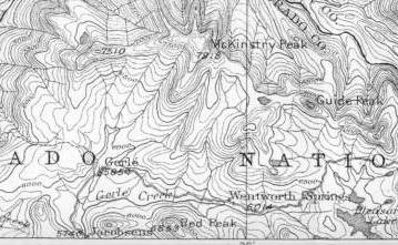
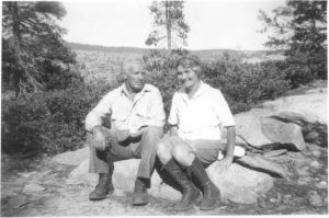
These historical pages are a continuing historical work on the place names, people, locations, maps, mountains, lakes, streams, resorts, companies, 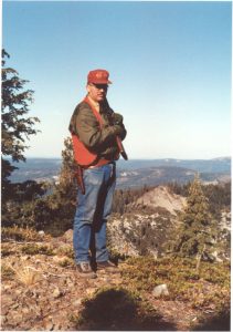 Dams, mills, ranches, roads, trails etc. in the larger area surrounding Gerle Creek in Eldorado National Forest on the Georgetown Divide in El Dorado County, California. Follow this page as I add to the historical information collected over the years from my library of maps, pictures, interviews, exploration, documents and research. Work in progress. Please do not hesitate to contact me with information to share or for just questions about Gerle Creek and the surrounding areas of Eldorado National Forest and El Dorado County, California…….. MG Brattland Author deer hunting McKinstry Peak, Fall 1991
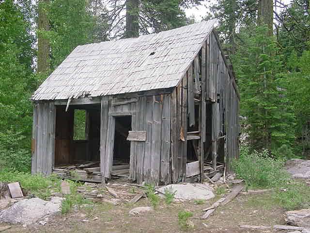
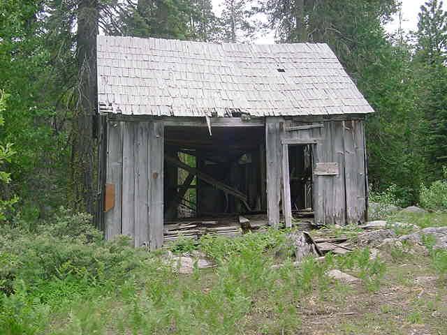
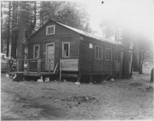
AE Brown Cabin-1875s,Long Meadow and Butler Meadow
A.E. Brown was in fact Albert E. Brown, born April 21, 1859, Cool, El Dorado County. His father was Provost D. Brown, early El Dorado County pioneer and cattle rancher of Cool and Pilot Hill. (Sioli, 1883)He built a cabin in Long Meadow as well as just West of the Old Ditch Tender’s road, halfway between Airport Flats/GCSHT and the California Water Company built diversion dam still visible at the head of the Gerle Creek Ditch at the Northern end of Gerle Lake, where the natural creek now enters the Northern end of the lake, which was built 1873/1874 to divert water to Hanna’s Camp for further diversion via ditches and creeks to Georgetown. AE Brown was another of the many valley ranchers and farmers who claimed meadow land up in the Sierras for use by their livestock in the Summer months. His ranch building on the road to Gerle Creek Ditch Diversion Dam is plainly located on the original Geological Survey Map. The pictures below are of AE Brown’s cabin still standing on the West end of Long Meadow.
Provost D. Brown, one of eight children of Abraham J. and Mary (Provost) Brown of Brownsville, Middlesex County, New Jersey. He was born September 1st, 1824. His early life was spent as a student and working on his families farm in New Jersey. With the news of gold discovered on the American River in Coloma, he needed a practical means to reach the gold fields, so invested his savings in a company of 38 persons who purchased a sailing ship. The company purchased rations and then sailed the ship with the company members aboard to San Francisco via the Southern tip of South American, arriving in June, 1849. They immediately sailed their ship up the Sacramento River to Sacramento City, where they sold off all the rations they brought including the ship to the highest bidder, keeping six month’s rations for themselves. Brown intended to get into the merchant business, but illness changed his plans, leading to opening a restaurant known as the Knickerbocker. Like so many businesses and early gold rush towns, it was lost to one of Sacramento’s early floods and the second attempt at a eating establishment was also lost to a fire. Not to be deterred, he got into the freight hauling business from Sacramento to the mines at Long Bar on the Yuba River. Once he had saved the requisite funds, he again purchased a restaurant and a interest in two mining claims. After major efforts expended digging ditches to support the mining work on his claims, the floods of `1852 removed their hard earned work including the many diversion dams and ditches, he and others had built. Still undeterred, he continued his mining efforts, eventually becoming quite successful, taking away $17,000, quite a sum of money for the mid 19th Century. As friends were in a habit of doing during this time, he loaned an associate money which was used to purchase a ranch called the Tennessee Ranch in El Dorado County. In the end, he assumed responsibility for this ranch to save his investment, renaming it the Knickerbocker Ranch, which remains today in the area South of Cool. After more work and money invested in the ranch, he lost it and returned to the mining support business, hauling materials to the mines. He eventually began to farm and acquired 320 acres of property between Cool and Pilot Hill which he obtained land patents from the General Land Office in 1881.(Sioli, 1883)
Provost D. Brown married in 1856, having two sons, Charles C. born June 31, 1857 and Albert E. born April 21, 1859. His first wife died. He remarried a second time only to have his second wife die as well. He married his third wife, Nellie S. Bancroft on December 7, 1878, who was from Clipper Gap. This union resulted in two more children born October 2, 1879, Phillip D. and Effie N., born February 19, 1882. (Sioli, 1883)
Provost Brown and his sons were successful farmers, who raised cattle as well as grain and fruit. (Sioli, 1883)
The Georgetown Gazette of April 16, 1880 reported “Mr. Brown (of Pilot Hill) is one of our most enterprising farmers and fruit growers, being located in a district composed of as fine agricultural land as exists in the foothill belt. Mr. Brown has planted 1500 choice fruit trees on his farm this season-embracing prunes, plums, peaches, apples, pears, walnuts, Japanese persimmons, etc. He also has a vineyard of 10,000 bearing grape vines, besides a few hundred bearing fruit trees. Mr. Brown came to this State thirty years ago, and is now in the vigor of manhood. He has unbounded faith in the foothills becoming the active scene of the greatest fruit and wine producing region in the world, and that too in the near future.” (Gernes; Deibert, 1999)
The Georgetown Gazette, February 5, 1891 reported that Provost’s sons, Chas. and Albert Brown owned the PD Brown Ranch in Pilot Hill and that they were continuing to plant fruit trees, including 2000 new ones which were mostly of the pear variety. the paper reported on February 26, 1891 that A.E. Brown had begun spraying the trees in his orchards to protect them from inspects. This type of activity was very new.(Gernes; Deibert, 1999)
AE Brown’s Cabin1, AE Brown’s Cabin2, AE Brown’s Cabin3
For additional reading on PD Brown and family by Joanne Burkett
Airport Camp or Camp Gerle, Gerle Creek Rest Camp, Airport Flats US Army Air Corps Rest Camp (R&R)-Gerle Creek, now Airport Flats US Forest Service Campground, Eldorado National Forest, El Dorado County, Ca
See Also John Holmes Chronology of Gerle Creek Summer Home Tract and Airport Flats-1938-1988
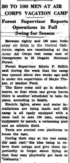
Here is a 1931 article from the “MOUNTAIN DEMOCRAT” which gives the basis for the “Rest Camp” built by the US Army Air Corps at Gerle Creek in 1931 which hereafter gained the name “Airport Flats” in later years locally, but was referred to as “Camp Gerle” by the US Army in the historical records of 20th Fighter Wing Association as shared by Arthur Sevigny, the association historian. This first article was contributed by Monte Hendericks, a volunteer historical researcher with the Eldorado National Forest, whose primary interest is military and civilian plane crash sites on the Eldorado National Forest. Have a look at this link for more information on aircraft mishap sites on Eldorado National Forest. Many thanks to Monte for sharing this essential record.

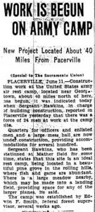
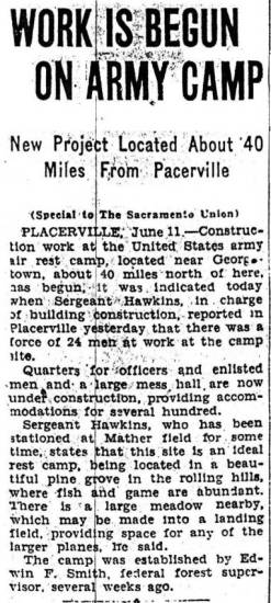
 The second clipping is a Sacramento Union article from June 12, 1931, reporting on the work and plans for the “Army Camp” at Gerle Creek, followed by a third clipping from the “MOUNTAIN DEMOCRAT” of July 31, 1931 on the Airport Camp at Gerle Creek……….Camp Gerle in US Army parlance.
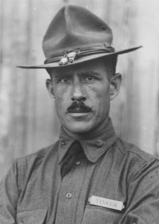
According to Arthur Sevigny of the 20th Fighter Wing Association, the historical records show that the 77th fighter Squadron (part of the 20th Pursuit Group at Mather Field and possibly the rest of the 20th, including the 55th Pursuit Squadron were at Camp Gerle , El Dorado, California from August 3 1932 till August 25th, 1932 . This would have been during the second summer of the existence of the Camp Gerle built at Airport Flats  on Gerle Creek by the US Army. As indicated in the articles below, Major Clarence L.Tinker was at the time, the commander of the 20th Pursuit Group at Mather Field, Sacramento, California. Major General Tinker was lost during the Battle of Midway Island while on a bombing mission on Wake Island. Tinker Air Force Base, Oklahoma would later be named for Major General Tinker.


The following two pictures of a cottage along with two tent platforms at Camp Gerle were from the collection of photos from the late Mrs. Tinker, which were shared with Dr. James L Crowder, author of a book on the Major General Tinker’s life during an oral history interview in August 1983.
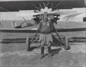 During this period, the 20th Pursuit Group at Mather Field flew P12B, pictured above. This photo of a un-identified pilot and his aircraft from the 55th Pursuit Squadron was taken in 1931 at Mather Field and kindly provided by the 20th Fighter Wing Association .
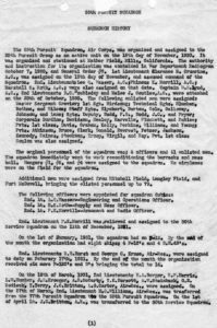
The following document is the 55th Pursuit Squadron official history for the period of 1930 till 1932, On page 2 of the history, the command devoted a paragraph to the background on the Gerle Creek Rest Camp and the squadron’s usage of it. This document was provided by the 20th Fighter Wing Association historian,

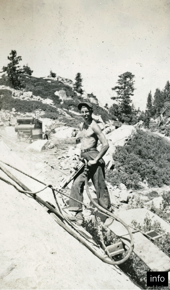
According to Les Clementsen of Stone Cellar (Clementsen,’04), by the mid 1930s, the Airport Camp or Camp Gerle at Gerle Creek was a Civilian Conservation Corps (CCC) Side Camp with a local man named Joe Flynn in charge of it. In his regular Mountain Democrat Column, Three Amigos from September 4, 1998, Joe Flynn indicates in the summer of 1940 he was in charge of the Airport CCC Side Camp with 30 to 40 men working for him. The following paragraph is quoted fromJoe Flynn’s own words from his 2004 oral history describing some of the details of his work at Airport Camp/Gerle Creek Side/Spike Camp for the CCC during the summer of 1940:
“In 1939 I was at Snowline(CCC Camp). In 1940 I ran the spike camp of 40 men at Gerle Creek, we called it the airport camp, and built the road from Schlein Ranger Station into Loon Lake. We didn’t finish it. Gerle Creek CCC Camp was interesting because I had to be the foreman during the day and be the camp manager at night. I had another foreman, Ray Ellis, who had the 10-man fire crew. I had to do the rationing. I had to feed those boys on 43 cents a day. The cook and I made out the menu. The cook was a 16-year-old boy from Mississippi. He was a good cook. He had hot biscuits every morning and nice yeast rolls every night. They would just melt in your mouth. He was pretty good on desserts. Most of my crew were Cajuns from south of New Orleans down the river. They had never seen a rock in their life and we were drilling in good hard granite. When I first went up to Gerle Creek, Ed Smith, the old Supervisor who was a Army mess sergeant in WWI said, “You’re not ever going to let those boys go hungry. The Army sometimes doesn’t always get food there in time and they give you pretty skimpy rations.” So we went down to the fire warehouse in Placerville and loaded a truck up with canned goods. Up by Schlein Ranger Station, which was two to three miles from the camp, they had an old powder house so I put this canned food and stuff in the powder house, along with the powder that was used for the road building. Whenever times got tough, 1’d sneak up there and get some canned food to supplement the Army diet.”
Joe Flynn was a local El Dorado County resident who went off to the Army Air Corps to fly during WWII, returning after the war to study at Oregon State and returning to work for the Forest Service eventually becoming the Forest Supervisor of Eldorado National Forest. After retiring from the Forest Service he would continue in active public life eventually being elected as a El Dorado County Supervisor. For more detailed history about  Joe Flynn, see the Joe Flynn USFS Retires Reunion Living History Project Feb 9 2001, Nordstrom Whited Interviewer oral history done through UCB. Below is a May 7, 1940 article from the Nevada State Journal, Reno, Nevada reporting on the planned June 1940 re-opening of the CCC Side Camp at Airport on Gerle Creek at what is now known as Airport Flats. A CCC Side Camp.
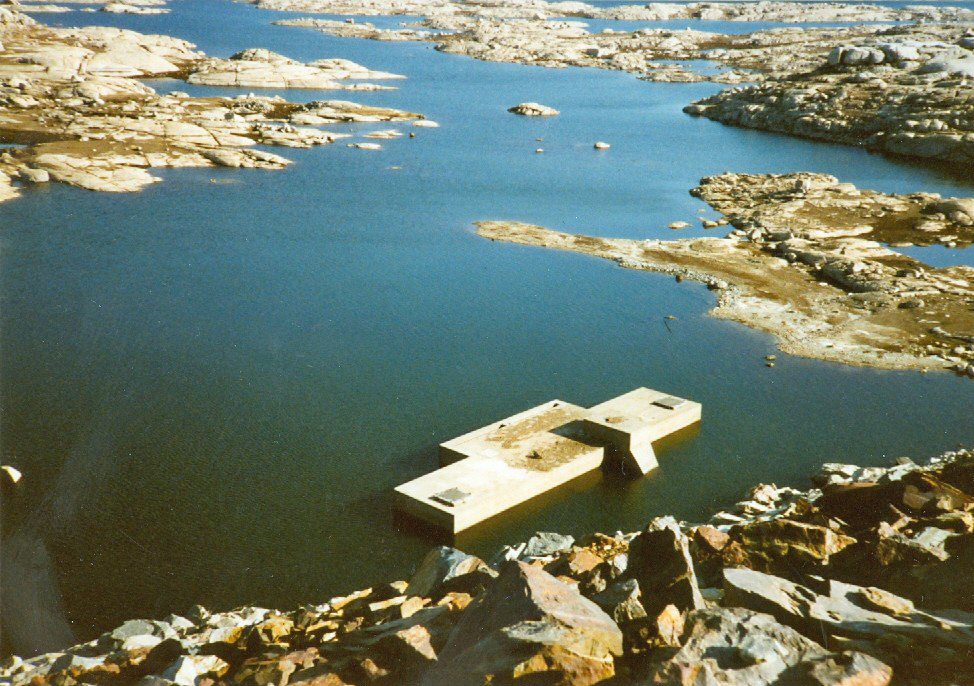
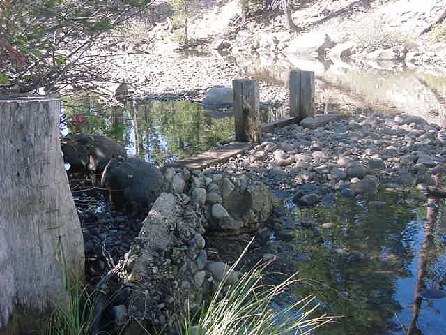
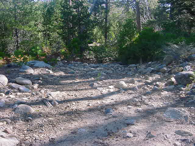
Prior to 1931, the Airport Flats area was a naturally open area in the trees at a natural fording point of Gerle Creek (picture of the McDowall Family Ford pickup sitting in front of the Ford on Airport Flats, 1962) on the Georgetown/Wentworth Springs road to Wentworth Springs. From 1873, it was the point where the ditch tender’s road branched off to the diversion dam ( Pic#2, Pic#3) at the head of the Gerle Creek Ditch ( 1873 Map )on Gerle Creek. Have a look at this dual picture kindly volunteered by Lint Brown using the 2001 photo of the Diversion Dam taken by myself alongside a very nice 1936 picture taken by friends of Linton A. Brown Senior showing Lint Brown Senior and a friend at the same dam 64 years earlier. In 1927, a log bridge
[This excellent picture was taken in 1959 by John Holmes, showing the collapsed Gerle Creek log bridge at Airport Flats. Those two boys swimming in Gerle Creek are Bill and Charlie Holmes. Of further significance is the flow of the water in this picture. The creek flowed much higher prior to the removal of the Old Loon Lake Dam in late 1962 and is evident by the fact that both of the Holmes boys are swimming in deep water as opposed to the flow today which is shallow at best. Many thanks to John Holmes for sharing this very historic picture of this special log bridge long ago gone……]
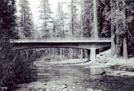
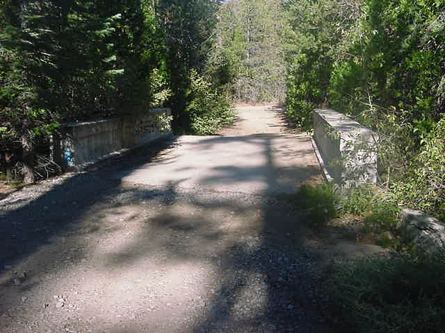
was built within about 20 feet of the present modern single lane concrete bridges at Gerle Creek, Airport Flats. The first lane of the concrete bridge was built in 1963 (Picture taken in 1962-63 by McDowall Family) and followed with the second lane in 1969. This log bridge with concrete foundations served well from 1927(Supernowicz, 1983) till the severe Winter of 1951/1952 when the log bridge was lost in the Spring runoff. There after till the concrete bridge was built in ’63, cross creek traffic returned to the natural ford South of both bridges about 100 feet. Here is a 1962 picture of the Airport Flat access to the ford across Gerle Creek (McDowal Family Photo)The primary reasons for this cross creek traffic of Gerle Creek was the road to Wentworth Springs went this way; access to the two barracks buildings built adjacent to the swimming hole off the flats on the Southside in the early 1930’s by the US Army Air Corps; access to the road from the flats to the Gerle Creek Ditch and Diversion Dam, a mile down Gerle Creek from the flats, as well as accessing AE Browns Ranch( early maps clearly list this name as “AE Brown” while some other sources suggest that his name was “AC Brown”) halfway down the ditch keepers road off the flats as well as the land used by Alex Forni after 1885.. This ditch and diversion dam were constructed during the summer seasons of 1873/74 and finished late in 1874 for the California Water Company diversion of Loon Lake water to Georgetown. The barracks buildings were used both by the US Army Air Corps till the end of World War II, when the custody of the two barracks buildings, the large water tank and a large garage building in the center of the flats were transferred to the Forest Service.
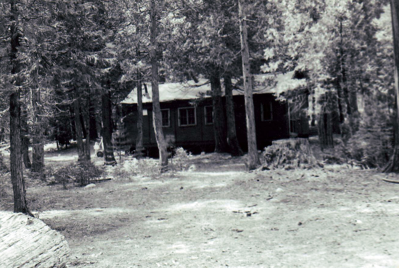
 Here are two historic pictures of two of the several buildings originally built by the Army in 1931 on Airport Flats and called by the US Army, “Camp Gerle.” The first picture is of one of the barracks buildings, which in later years was all that really remained at Airport Flats and was called the “Guard Cabin” or Airport Flats Ranger Station by the Forest Service. This picture was taken by W.Maule of the US Forest Service in 1959 as a means of documenting existing structures on the forest. This building was not torn down until the late 1960s. The Forest Service survey crew who surveyed the new road up in our area, lived in this barracks during the Summers of the 1967 and 1968. During the Summer of 1968, due to the general disrepair of the structure, the Forest Service brought in a trailer and parked it next to the barracks, which was used by the crews. Dave Orchard worked on this survey crew in both 1967 and 1968 while Jim Barnard, son of the Barnard family who had built a cabin on Lot 36 at GCSHT, worked on the same survey crew with Dave Orchard during the Summer of 1968, staying down on the Flats.
If you look close at the picture on the lower left, just sticking up above the Forest Service pickup truck bed, one can see what appears to be part of the pipe which comes out of the water tank which was over to the left and not in the picture. An additional barracks about the same size was also located between this building and the creek, very close to the ‘swimming hole” which has been a favorite spot of everyone who has ever used the Airport Flats area from day one. This barracks was already torn down in 1958, but remnants of it could be seen walking the short trail from the Water Tank down to the swimming hole. Another picture of the same building on the flats from a little different angle taken in 1962 by the McDowall Family
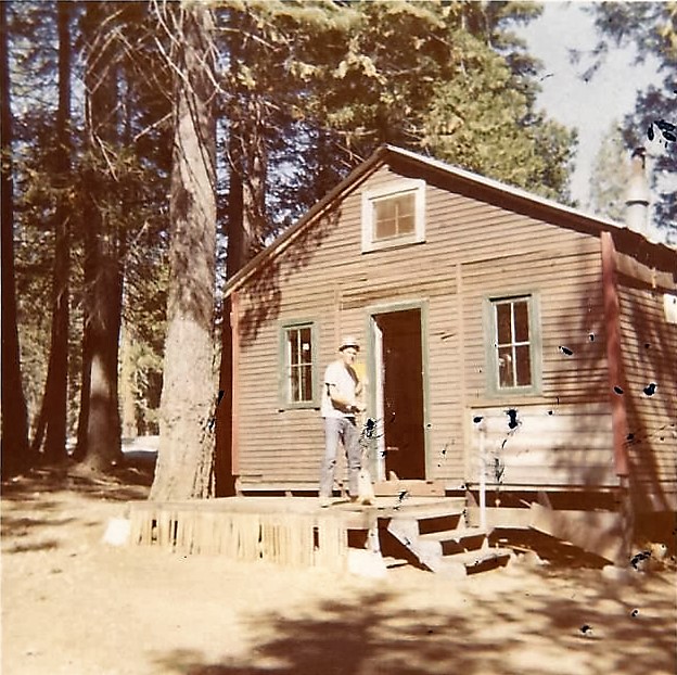
 This is a Summer of 1968 photo showing David Orchard of Carmichael, Ca, at the time, a current Stanford University student who worked the Summer of 68 and after as the head of a Forest Service survey crew based at Airport Camp during the Summer. He and his crew lived in the original Airport Camp building on Airport Flats. They were survying the new road all the way down into Rubicon River Canyon to the dam at Hell Hole. A member of the survey crew took this picture of Dave with his camera.
The third photo, also taken by by W. Maule of the Forest Service in 1959, shows the “Old Barn” as it was referred to by the Forest Service as well as one small out building. This Old Barn was located right next to the current large fire pit in the Motorhome camp site immediately on the left on entry into the Forest Service campground at Airport Flats. Whether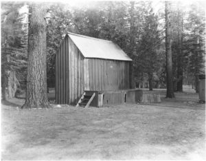 this building was one of the original constructed by the Army in 1931 or was later constructed, one cannot be certain, other than looking at the condition, it would appear to be of older age and reflecting nearly 30 years of age and use by the time this picture was taken. The Forest Service tore down this barn during 1961.
Both of these photos were made available from the US Forest Service archives at Pacific House Ranger Station by Krista Deal, Pacific District Archaeologist. Many thanks to Krista for this important contribution to the local history of our area.
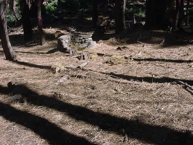
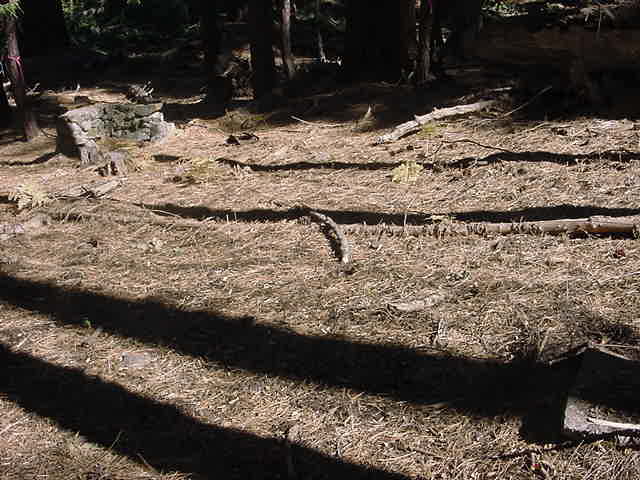
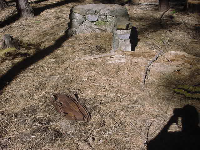
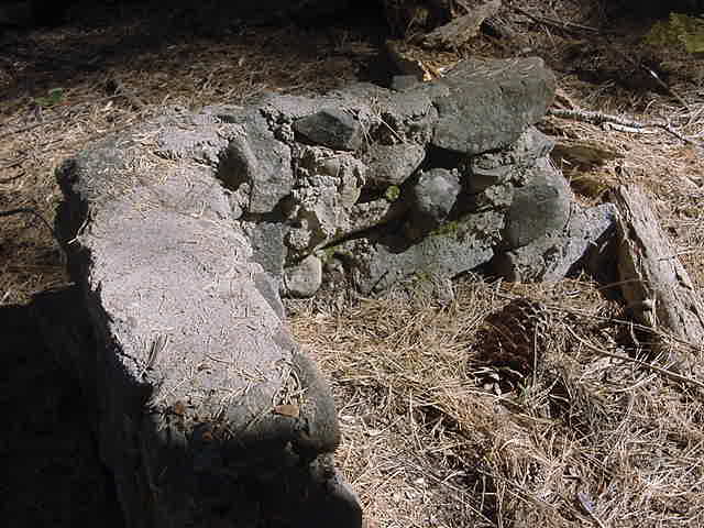
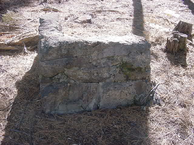
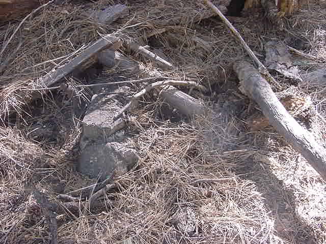
During the Fall of 2003 the Forest Service was doing a selective logging and a general cleanout of underbrush and small trees in the Gerle Creek area to make the area more fire safe. In the logged area almost directly across from the old lower road along the Southwest side of Gerle Creek which takes off from the Wentworth Springs road about 300 feet Southwest before the road goes across Gerle Creek at Airport Flats, about 75 feet into the forest, the Forest Service has flagged a general area with red ribbon about 600 square feet. Within this area are two old original concrete and granite stone foundation corners, plus remnants from the beginnings of a building, including an old metal bucket. I have taken the following photos of these foundations and the site.
Gerle Creek Foundation1a, Gerle Creek Foundations1b, Gerle Creek Foundations1c, Gerle Creek Foundations 1d, Gerle Creek Foundations 1e, Gerle Creek Foundations 1f, Gerle Creek Foundations 1g
After over 40 plus years, I have never ever heard anyone discuss these old foundations nor have I ever known about their existence. History wise at different times, I have heard that the summer home tract at Gerle Creek was in fact laid out in this area originally, but was eventually moved to its present location. I have also long heard over the years that the tract was originally laid out along the lower road along the Southwest side of Gerle Creek and was eventually moved to its present location due to the fact there was no interest in the tract at that time and for the fact that the mosquitoes were so much worse down along the creek. Is entirely possible that both of these old rumors were true and the layout of the tract included the area where the foundations are presently and along the road on the Southwest side of the creek.
My final thought about this foundation would be that it could very well be apart of the Commanding Officer’s cabin for Major Tinker which was to be built as part of the “Rest Camp” at Airport Flats as laid out in the above article, which was referred to by the US Army as Camp Gerle. Looking over the foundation remnants thoroughly, I found no markings or impressions. Knowing that people commonly put names or dates in the initial parts of buildings etc., I found nothing along this line. I would hope that the Forest Service has plans to more thoroughly investigate this site.
After World War II, the Forest Service barracks buildings at Airport Flats served a variety of purposes including housing fire fighting crews, El Dorado County prisoners during the summer months of 1951 or 1952 who were brought in and housed here while out cutting certain kinds of plants and vegetation. This did not work out and was only tried one Summer season. Later the Forest Service had custody, during the evenings, they would sometimes show movies outdoors using a large screen setup on the open area of the flats with rows of benches for people to sit. Carolyn Beam, owner of South Fork Mill (many thanks to Lint Brown for sharing his fathers photo) remembers this well as a child during the very early 50s at South Fork Mill when she and others were invited to attend these evening movies at Airport Flats. Carolyn many times was allowed to ride her horse from South Fok Mill to Airport Flats for the movies. Later in the mid 60s, it housed the Forest Service survey crews who surveyed the new paved road from Highway 50 to Loon Lake and Lawyers Cow Camp(Gurleys or Gerles). Of the two large barracks buildings, the one closest to the Gerle Creek swimming hole was gone by the late 1950s, leaving one large barracks building on the edge of the open flats area, the large water tank immediately next to it and a large tall garage building for storing equipment out in the center of the flats in what is now the motor home parking area of the Airport Flats Forest Service Campground. These were all gradually torn down by the early ’70s.
By 1937, El Dorado County constructed a new concrete bridge to cross Rocky Basin Creek right on the Southeastern edge of Francis Cow Camp and with it a short mile of new road which eliminated the existing road section on the Western side of Gerle Creek between Airport Flats and Francis Cow Camp and the need to ford Gerle Creek at Francis Cow Camp. So with the popularity of the automobile changes in the road were necessary that were not as big an issue when driving a wagon with a team of horses, which led the politicians and many users of the Wentworth Springs road to find a better way. This better way was to abandon the crossing at Airport Flats and Francis and build the road which today goes along the Eastern side of Gerle Creek and is the only one most people ever knew existed. It did require crossing at Rocky Basin Creek which must have been an easier under taking for the automobile than those two fords as the County only finally built the current concrete bridge over Rocky Basin in 1937……The old original section of the Wentworth Springs Road between Airport Flats and Francis Cow Camp continues to be used by the GCSHT folks to access their hydraulic ram pumps on the West side of Gerle Creek.
n the Georgetown Gazette as reported in the Mountain Democrat of September 5, 1914, “El Dorado County Supervisor Morgan had the boulders in the second crossing of Gerle Creek(Jacobsens) blasted out to make the creek passable for autos or light teams going to Wentworth Springs. Some improvements have been made on the road in the vicinity.” In 1914, the first crossing of Gerle Creek would be at Airport Flats, the second at Francis Cow Camp and the Third Crossing at Jacobsens, none of which had bridges then.
As early as 1914, the politicians were at work to resolve this issue which plagued all travelers to Wentworth Springs before the creeks returned to their normal Summer flow.
“Supervisor P. F. Morgan spent several days of last week at Gerle Creek laying out a new piece of road so as to eliminate the dangerous crossings of the creek at Francis Ranch. When the piece of road is complete, it will enable automobiles to go to Lake Tahoe via Georgetown, Wentworth and Rubican Springs without difficulty. At this season of the year the water is high in Gerle creek and automobiles are unable to ford the stream.” Georgetown Gazette July 8, 1915
[Have a look at this USGS map of 1895 where you can clearly see that the Georgetown-Wentworth Springs road cross Gerle Creek at what is now Airport Flats so that the ditch keeper road then turns off to the South to the diversion dam and halfway to the diversion dam the road makes a sharp right and dead ends at AE Browns ranch or house.]
This map also clearly shows how the road proceeds to Francis Cow Camp where it fords the creek just above Rocky Basin Creek and then continues on to Wentworth Springs via Jacobsens and Gerles.This revision and addition to the Wentworth Springs road reflected local ranchers and resort owners needs to access their properties in the early spring of each year. Gerle Creek could be a pretty ferocious flow of water to get across in the Spring and the new Rocky Basin Creek Bridge and new road on the Eastern side of Gerle Creek resolved this. The old ford at Gerle Creek at Francis Cow Camp and the original but unused lead in road to the ford is still visible and just a little bit North of the entry point of Rocky Basin Creek into Gerle. The original road [shown clearly on the 1916 Eldorado National Forest Map until 1937] crossed at the Airport Flats ford/the Log Bridge (after 1927) and then followed (on the Western side of Gerle Creek) what became the GCSHT road to the associations water ram pumps and past this location fording Gerle Creek directly across from Francis Cow Camp. From there the road remained the same as depicted today.
airportcamp1931b
airportcamp1931c

ccccampgerle1a
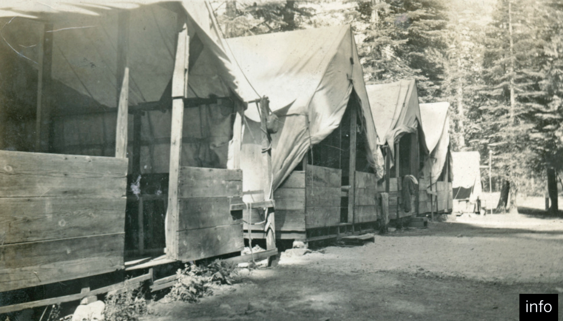
airportcamptentplatformscccmid1930s1a
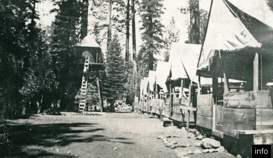
airportcamptentplatformscccmid1930s1b

CampGerleaug1932b

CampGerleaug1932a

CampGerleaug1932b

airportflatsbarracks1959
4[1]
airportcampbuildingsummer1968

airportflatsbarn1959
loonlakedamlate1930sairportcampccccrew1a
loonlakeroadchimunkblufflate1930sairportcampccccrew1a
TinkerMAJGCCNov30toOct32

CampGerleMajortinkerhouseaug1932b

restcampfoundation1003g
restcampfoundation1003f[1]

restcampfoundation1003e[1]

restcampfoundation1003d[1]

restcampfoundation1003d

restcampfoundation1003c[1]
restcampfoundation1003b[1]

restcampfoundation1003a[1]
Airport Camp Ford of Gerle Creek
 This is a Papenfus-Hart Family (GC Lot 39) photo of the Hart grandchildren playing and wading in Gerle Creek in the Ford of Gerle Creek on the Airport Camp side, discussed above. Late 1960s photo
Airport Camp Swimming Hole
 Just behind and on the Southside of the old Airport Camp Barracks building is the swimming hole which has been used by people frequenting this area since the beginning of time. It is a very natural swimming area and from the late 1940s, 1950s and into the early 1960s had a basic diving board made most probably during the Army Air Corps R&R Camp days of World War II or later during the Forest Service usage as a fire camp from the end of the WWII into the 1950s.
Mark Hart, Airport Camp/Flats Swimming Hole, Gerle Creek, down and behind the old Airport Barracks location. Diving board was a basic affair put together by old Airport Camp users from the Forrest Service or even earlier, from the US Army Air Corps and CCC. The carpet was installed on the diving board by Gordon Brattland Lot 24 so the children would not get splinters.
 I am clapping my hands to hurry Karen Brattland up on the diving board while our father, Gordon Brattland observes from the swimming hole. Brattland Family photo 1959
Airport Camp Rain Gauge 1946 to 1976
Jim Goodridge of the California Division of Water Resources kindly offered the background and history on the old rain gauge and tower which sat on a small mound in the center of the current Forest Service campground at Airport Flats in the early years. Looking for a picture of the old tower if anyone can help…….
“The US Weather Bureau, Substation History for California, 1958, lists Gerle Creek Camp or Gerle Creek Airport Camp. The gage was a 200 inch Sacramento type gage on a 15 feet tower. Located at 38°59’N, 120°23’W, Elevation 5500 Feet, 23 miles ENE of Georgetown. The record apparently started in 9/46/46 . The observer was listed as the US Forest Service. Their Forest and Range Field Station may be able to cone up with the early records or they may be in the Central Districts files, I do not recall but it may have been one of the gages we measured once a year. The records were no doubt published in Climatological Data or the older Hydrologic Bulletins.I recall preparing a summary of Storage Gage Data when I worked at the Central District many years ago. The old type rain gage was 8 inches on the top and cone shaped. I would hold the equivalent of 200 inches of precipitation in all but contained a few gallons of anti-freeze. We would weigh the water once a year. This was the only way we could calculate the water balance on mountain watersheds at that time. I noticed that the Gerlie Creek gage was listed in the 1975 index of Climatological Data but not in the 1976 index.” Jim Goodridge 2009
B-17C Crash Site Tell’s Peak
Bacchi Ranch
1931 Forest Service Map Showing Bacchi Ranch just East of Quintett on the Northside of the Georgetown Wentworth Springs Lake Tahoe Road
Barts Creek and Valley
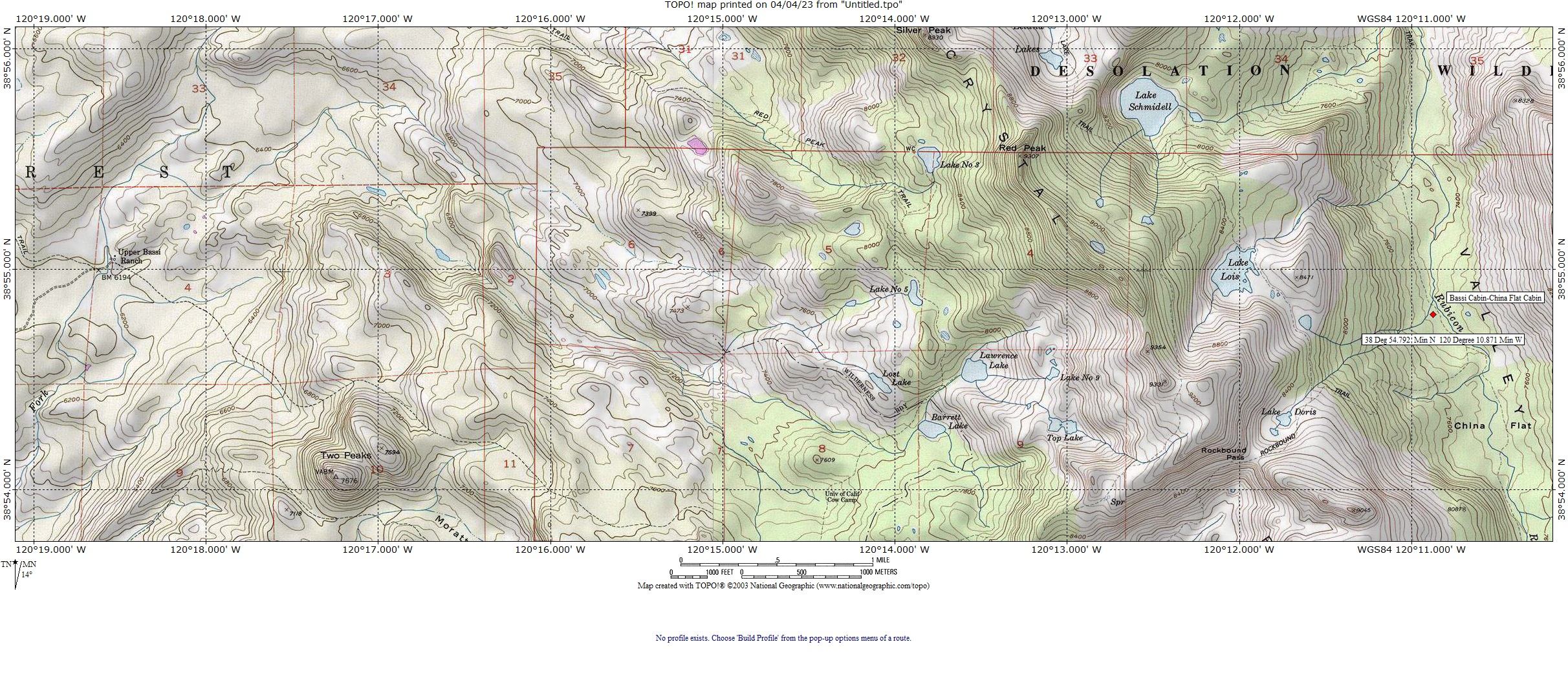
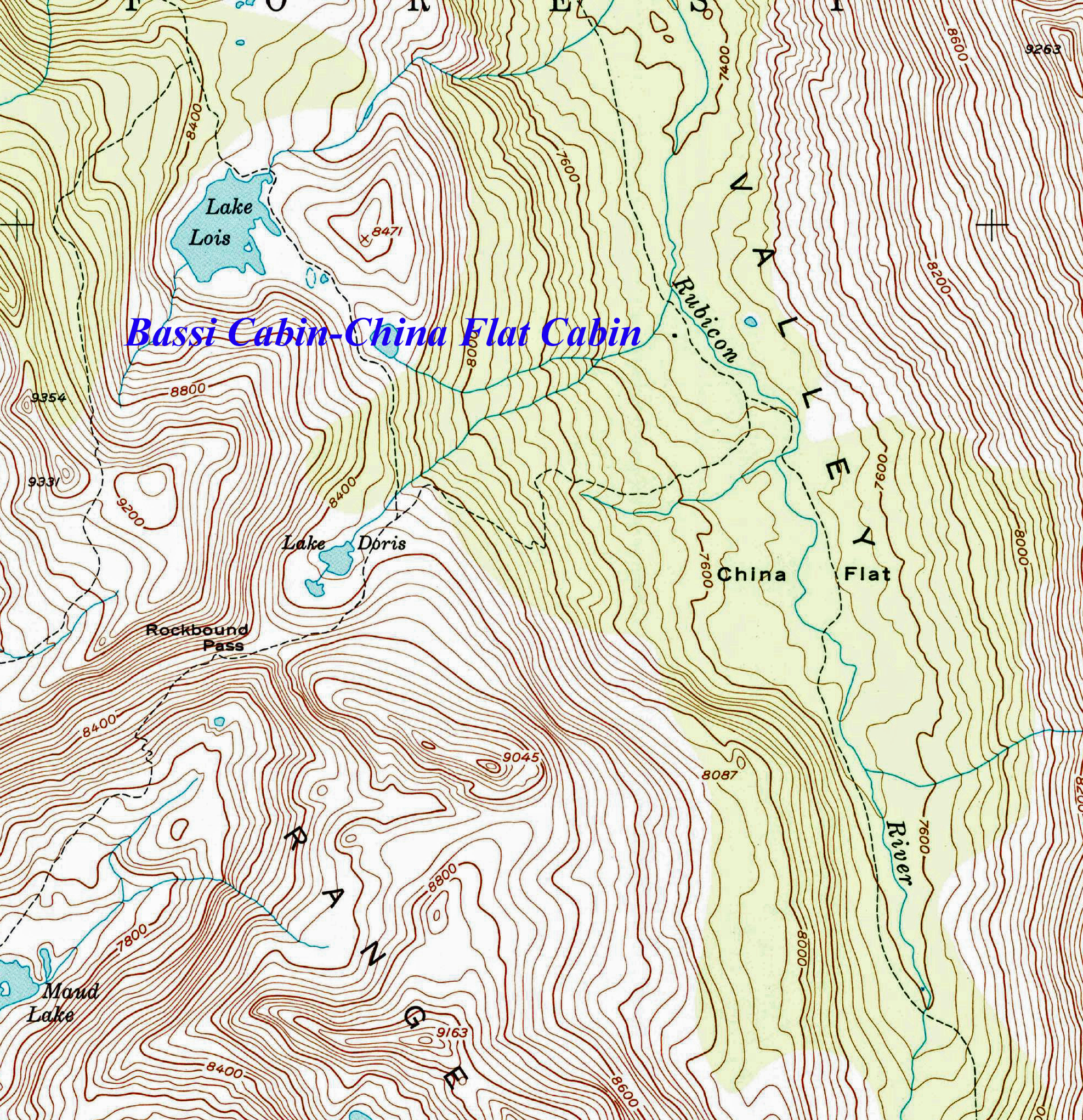
Bassi Cabin-China Flat Cabin, Rockbound Trail, Rubicon River, Desolation Valley
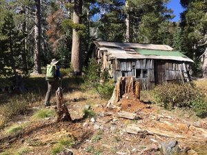 The Bassi Cabin or the China Flat Cabin as it
 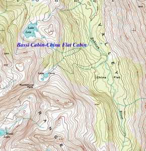 is referred to by the USFS, was “a very temporary cabin built by Bassi for residence while in the (Desolation) area.” Rood, 1992, Page 56. The temporary cabin or shack was built in the late 19th Century. Cabin Photo Credit NorCal Hiker, Rockbound Pass: Desolation’s Desolate Side, October 12, 2017
Eldorado National Forest calls this cabin the “China Flat Cabin.” so noted in Supernowicz, 1983, Eldorado National Forest Historic Sites Index.
Maps
Topo with cabin located with Lat Long Topo with black square for cabin
Bennet’s Range Bennet Lake-
 1875-1889 The farmers house on the road identified as road to Bennet’s Range from Gerle’s heading up to McKinstry or Bennet Lake.
Noted on the earliest of maps in the meadow area half mile West of McKinstry or Bennet Lake. Reading the Surveyor’s Field notes for the original survey for this Township completed in September, 1889, the survey wrote that the cabin or farmer’s house in McKinstry Meadow, below and slightly to the West of McKinstry or Bennet Lake which on the earlier survey belonged to Bennet, now belonged to Forni. The surveyor’s notes also spelled Bennett with two “Ts” versus one “T.” The Forni name is misspelled in the Surveyor’s original hand written field notes. As to who Bennet or Bennett was, it could have been MP Bennett of Placerville who was an attorney and became an elected judge in El Dorado County. We know that he had a particular interest in this part of the county as he wrote a detailed letter published in the newspapers supporting the investment of public monies to finish the road from Wentworth Springs to Lake Tahoe
Berts Lake
On Chipmunk Bluff above Schlein’s cabin off the road to Loon lake
Bisbee Lake or Horse Shoe Lake or Bixley Lake or Bigsby Lake
Bowman (1873) first mentions this lake calling it Horse Shoe Lake in his report to the California Water Company shareholders page 170, para 2. In the 1880 report to shareholders of the California Water Company, Guildersleeve (1880, Ashburner Appendix page 1A) refer to this lake as Bixley Lake. Sioli 1883 page 120 regurgitates this same general report information from both Bowman and Guildersleeve while identifying the lake as Bixley Lake which comes from the 1880 report exclusively. Obviously in the 7 years between the reports, this lake acquired a different name which has morphed over the years into several similar sounding names including Bixley, Bisbee and Bigsby Lake. The first surveying of this area which created the original Survey Plats, was finished by the late 1870s and used to publish maps from 1895, may have assigned the Bixley name to the lake but by 1931 it was displayed as Bisbee Lake on the 1931 and 1943 USFS Maps while the 1937 hand drawn map by Judge Johnson used by himself as a regular camper, hiker and fisherman to the Wentworth Springs area called the lake Bigsby Lake. These things change due to new information and are corrected over time. A review of the 1931, 1943 and 1949 USFS maps show in pretty clear form why someone would have originally called this lake Horse Shoe Lake due to it’s shape. The surveyor notes sometimes have clues in this regard but unfortunately the original survey plat for Loon Lake is bare as a map with just section lines and almost nothing else, not even the lake information and there are no surveyor notes which I have been able to obtain. This has been a problem in resolving some other historical location information in the Loon Lake area as well. I might add that Bowman and many others got a number of names different or spelled differently including Gurley versus the correct Gerle during their inspections on the Divide.
With the construction of the new Loon Lake Dam in 1962, Bisbee Lake became a part of Loon Lake with it’s original location along the face of what is now the Francis Fill above Francis Cow Camp on the most Western edge of Loon Lake. Thanks to Tim Green of Loon Lake for his interest in this project and to Lint Brown for his map graphics work from his book Sixteen Summers on the Ditch with a descriptive diagram of Loon Lake and it’s many lakes as against Loon Lake today.
Blair Brothers Saw Mill Pollack Pines, California
thanks to George Mihan
Bottle Hill Fire October, 1917
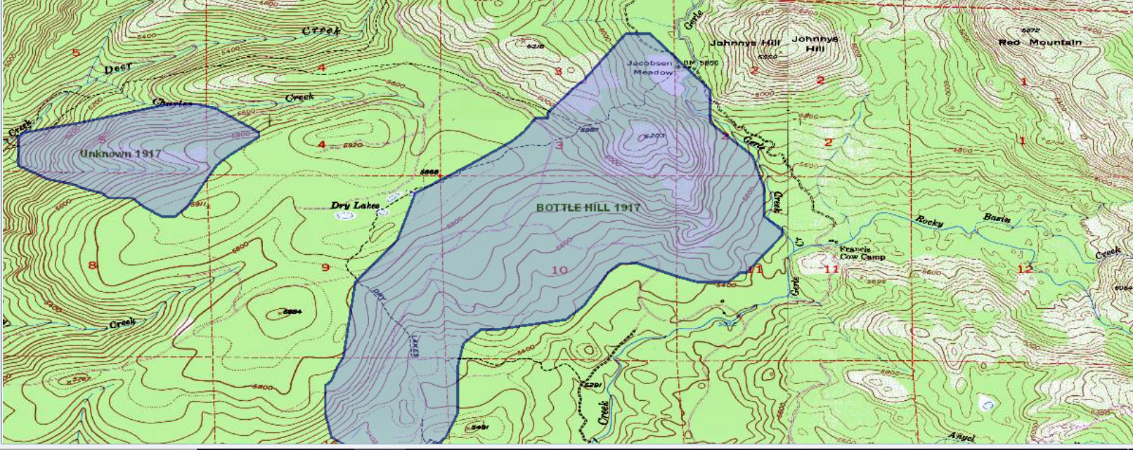 The northern half of the eventual Gerle Creek Summer Home Tract burned in the October, 1917 Bottle Hill Fire on the Georgetown Ranger District, Eldorado National Forest. The fire consumed 3000 acres, including areas of the King Fire in 2014 and the Fork Fire of 2020. The Forest Service most probably named this fire using a local description for the 6200ft hill up behind the Gerle Creek Summer Home Tract and what is Airport Flats today. Since Jacobsens Dairy and Francis Cow Camp were both very active dairies and ranches in the teens of the 20th Century, one guess is along the Dry Lakes Trail which starts at Jacobsens and proceeds to the West just on the North edge of the peak may have had a place where the ranchers disposed of old things including bottles which was coined in the late 19th and early 20th Century to describe this peak and become the basis for the name of the fire.
In walking some of the lots on the upper end of the summer home tract, most of the large trees all have substantial fire scars on them including an entirely burned huge cedar tree which was laying across Lot 24 covered by buck brush when the Brattland family signed their lease on that lot in 1958 and remains today. The lower tract road and most probably the middle tract road were just outside the southern perimeter of this fire, while the upper road and the rest of the tract to the North end of it were definitely inside the fire border including the area of the pump house. Looking at your oldest and largest trees especially the cedars will clearly show any burn scars from this fire if they were in it.
In Dana Supernowicz, “Historical Overview of the Eldorado National Forest,” his Masters Thesis in 1985, page 174 he discusses the lessons learned on the forest from the fires on this forest during 1917, including the Bottle Hill Fire. The records of this fire are in the historical archives of the Eldorado National Forest offices in Placerville.
Many thanks to Gene Rogers, retired US Forest Service Fire Analyst for finding the above historical map for me. I had personally read the fire records from the “teens” of the 20th Century in the EDNF archives in the early 1990s but had never seen the graphic presentation which is now apart of the fire history on our forest. A brief note in the “Engineering and Mining Journal, Volume 104, 1917” reported on the Bottle Hill Fire on Georgetown Ranger District indicating it was under control and had consumed 3000 acres.
From CHATAI:
The Bottle Hill Fire of 1917 was a devastating wildfire that occurred in the Eldorado National Forest in California, United States. The fire started on August 25, 1917, and burned for several weeks, consuming over 80,000 acres of forestland.
The cause of the fire was believed to be a lightning strike, and it quickly spread due to dry weather conditions and strong winds. The fire was first spotted near Bottle Hill, a prominent landmark in the region, and it quickly spread to neighboring areas.
At the time, firefighting techniques were not as advanced as they are today, and firefighters had limited resources to combat the flames. Despite the efforts of over 2,000 firefighters, the fire raged on for weeks, destroying much of the forest in its path.
In addition to the loss of forestland, the fire also claimed the lives of several firefighters and civilians. The exact number of casualties is unknown, but estimates range from 20 to 40 people.
The Bottle Hill Fire of 1917 was one of the most devastating wildfires in California’s history, and it played a significant role in shaping the state’s approach to wildfire management and prevention. Today, the Eldorado National Forest has a robust fire management program in place, which includes measures such as prescribed burns, fuel reduction, and early detection and response systems to prevent future catastrophic wildfires.
Buck Island Lake Wikander Cabin
 According to GeorgeWharton James, the lake was named by the Hunsaker Brothers of the famous Hunsaker Springs (Rubicon Springs). “The lake is very irregular in shape, about a third of a mile long, and a quarter of a mile wide in its widest part. Near one end is a small island. Hunsaker found the deer swam over to the island to rest and sleep during the heat of the day, hence the name.” James, 1915, pg 220.
 In the words of Judge Wilbur Johnson………..“Picture 6 Vic Wikander and his wife, Alice.
While honeymooning they visited Buck Island, over the hill from Rubicon to the west. Victor worked out a 99 year lease of the smaller island at Buck Island, I presume with the U S Dept. of the Interior.
In the 1920’s Rubicon Springs continued to be accessible by motor car and Victor began to take in the materials needed to improve the leased island. He carried everything over the hill to Buck Island by back pack, a little over a mile but up quite a grade. (NB: The last motor vehicle into Rubicon (until the Jeep) was a Cadillac touring car operated by an enterprising fellow from The Lake (Tahoe). On the way out the Caddy slid off the road at one of the switchbacks and was abandoned. This occurred around 1928-1930 and the vehicle remained, somewhat intact, for quite a few years. From this, the current name, “Cadillac Hill”, was coined.)
As time passed, Victor built a rowboat, first of all, and then 3 cabins. A main cabin and 2 smaller cabins as guest houses. He flew 3 flags; The Stars and Stripes at the main cabin and the flags of Finland and Ireland at the guest cabins.
He laid out paths cabin to cabin and other points of interest on the island. He gathered stones, 4 – 6 inches in diameter. and lined the paths. Using the rowboat, he gathered sand from the far west side of the lake and sanded the paths.
He also built a catch-all storage shed near the main cabin and a boat house with skids to house the rowboat over the winters. Sometime, during later years, he stopped using the boat house. He just pulled the boat out of the water and left it in the open. One time, I asked, “Why?” He said that, in the boat house, the boat dried and seeped leakage by the next season.
He spent all summer every year at the island. His wife joined him when school was out. He also went in regularly in winter. His wife never joined him on the winter trek. He put a door high in the gable of the main cabin to avoid digging snow down to the front door. Each summer season he would provision the cabin for the winter trek, food and fuel. One year he fell and broke a bone in the ankle area, possibly the lower end of the fibula. He crawled into the cabin and set the break as best as possible and bound it with strips of cloth. He spent the next few weeks holed up in the cabin waiting for the break to knit. What a guy!
His island was close to the north shore of Buck Island Lake, about 50 yards or so. The water there was shallow and in winter it froze enough for him to ski/snow shoe across. In the spring he could wade . At most, the water depth was about 5 feet at one point. Thus, he never really had to “swim” to the island.
He spent many idyllic years at the lake until the 1950’s when age began to take its toll. He passed away in Oakland, Alameda Co. CA, on August 7, 1958. His wife, Alice, survived another few years until the early 1960’s. End of an era! (no children).”
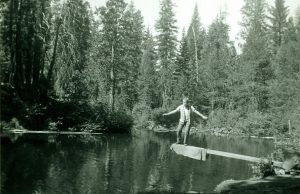
A Lint Brown and his father-1953 Fishing Trip to the Rubicon
“I finally got around to relooking at the photos from the July 1953 backpack trip with my father and Bob Neeley. We started at Wentworth Springs, hitching a ride with Joe Hacker in his Jeep, who carried us up somewhere around Spider Lake and dumped us out where the road got really bad-we started hiking, passing Buck Island Lake on the way to our first night’s camp at Rockbound Lake.
We continued the loop: past Rubicon Springs, over Barker Pass to Five Lakes Creek, and back down the Rubicon through Hell Hole and Hales Camp, photos of which you have already seen. (By the way, Joe Hacker and his wife Isabelle were both expert fly fishers, both of whom my father admired for their skill; they frequented the Crystal Basin in the 1950s.)
Attached are three photos you have not previously seen. (Lint Brown Sr Photos 1953 provided by Lint Brown)
The first is the one I hoped to find, a shot of Buck Island Lake, taken by my dad as we passed by on the way to our first night’s camp at Rockbound Lake. The second is a blowup of a portion of that first photo, which shows a cabin that is almost certainly Vic Wilander’s. This photo was taken on July 15, 1953, the first day of our 6-day trip. As you can see, we were not very close to the cabin–I am not even sure we noticed it at the time. The scanner sees things our eyes miss…
Third is a shot of a couple of trail signs, taken on July 16, 1953 along what is now known as the Rubicon Trail, between Buck Island Lake and Rubicon Springs. The top sign, a USFS model, pins down the location. But the real find here is the handmade lower sign: “To Buck Island Lake–Wikanders.” It’s easy to imagine that Vic himself crafted that rustic sign. But why? Who would have been coming to visit them from that direction?
Bugle Lake
Bugle Lake Headwaters for Ellis Creek which flows out of and down into the Northeast end of Loon Lake. In the days prior to the new Loon Lake Dam, the creek entered Pleasant Lake which is now a part of Loon Lake. The lake is directly above Wentworth Springs on the Northside of Jerrett Peak.
Bunker Hill
 Bunker Hill-1875-Eldorado National Forest, Placer County, Ca The mountain top which was acquired inorder to put a lookout on top, was purchased by the Forest Service May 5, 1936.
Early wood low to the ground lookout structure pictured in Supernowizc 1983 History of the Eldorado National Forest of the 1930’s was replaced by Joe Bauman who built the present day stone lookout tower and living quarters in the 1942 ( Forest Fire Lookout Association http://www.lookouts.us/Sorted_By/California.htm .)This is a Lint Brown photo from 1957.
Cabodi’s
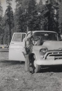 Cabodi cabin, since 1961, on 5 acres with a spring, located in south Placer county west of Murray Camp. Attached is a photo of Larry Cabodi in 1960 by his 1957 patrol truck next to Schleins station. He was the “Forest Guard”, as the position was labeled back then, for the one year there.
California Water Company-1874
The early details of the California Water Company and all their activities in this area are covered in great detail by Bowman, 1874; Gildersleeve, 1880 and finally summarized in Sioli’s history of El Dorado County in 1883.This company, originated and capitalized in San Francisco, was central to early development of resources in the Georgetown Divide area, building a Loon Lake log dam initially along with a ditch to connect Gerle Creek to Hanna’s Camp by 1874. This trial dam was followed by building the granite stone dam to replace the original nine foot high log dam at Loon Lake in 1881-1882 using Chinese labor which stood till removed in 1962 for the current earth filled dam built in 1963. The companies need to support their ditch and flume structures to bring the water from Loon Lake to Georgetown also necessitated their building the South Fork Mill,( between 1874 and 1880) a water powered saw mill at Hanna’s Camp, which still stands today.
The California Water Company of 1874, became the California Water and Mining Company 1880, Loon Lake Power and Water Company, 1904, merging with the California -Nevada Electric Power Company to become Truckee River General Electric Company in 1912.. The water company merged once again with the Sierra Pacific Power Company from Nevada in 1914. Between 1930 and 1935 the old water company became the Georgetown Divide Water Company. and in 1946 , the Georgetown Divide Utility District was formed as a result of local voters, whom later purchased the water system from the Georgetown Divide Water Company in 1952 and passing the utilities rights to water from the upper Catlepart of the system including Gerle Creek and Loon Lake to Sacramento Municipal Utility District (SMUD in 1961. The summary of the California Water Company timeline above and much more detailed discussion can be found in Lint Brown’s “Sixteen Summers on the Ditch”, Feb 2003 in the chapter on the “Georgetown Divide Water History,” pages 1 through
Cattleman’s Association
Charles Creek
Named for one of the Gerle Brothers, Charles W. Gerle (born 1823) or possibly the baby son Charles or Charlie Gerle of the other Gerle brother, Christoper Cyrus or C. Gerle, born December 1870 and died February 1,1871. The creek is just to the West of the Gerle Ranch in the meadow.
Clausenius Site, Slab Creek, Box Mill
Georgetown Gazette May 12, 1910
“The editor, J.C. Horn and son Hulbert, made a trip to Clausssenius’ place on Slab Creek, Saturday, returning Sunday. We found Mr. Clausenius and his help busy turning out box shook for which he has a ready sale at the mill. The fruit men of this and adjoining counties know that Mr. C. turns out excellent work, and many of them go up there for their box shook. In the box factory is an automatic sawing machine which makes at least 20 cuts to the minute, so one can imagine the number of boxes that can be produced in a day. The place is nicely located in tall pines at an elevation of 4400 feet near Headquarters, with an abundance of free, pure mountain water and good fishing and hunting. Some of the sugar pine trees in the place measure as much as eight and nine feet in diameter…They have named their place “The Park”, and it must be seen to be appreciated…”
The spellings of Clausenius above vary due to editor Horn’s own writing at the time in 1910. Claussenius Site is 2 miles South of Pino Grande on old Michigan Cal now Sierra Pacific property, about 10 air miles miles west of Union Valley Dam.
Dellar’s Cabin-1889-Eldorado National Forest, Placer County, Ca
According to the Surveyor’s field notes who completed the original survey plat on the Township including Dellar Meadow and Dellar’s cabin in September, 1889, he wrote that Deller’s first name was Louis…..Louis Dellar. In fact his full and complete name was Louis J. Deller, spelled with a “e” vice an “a,” who was born in California in 1854 according to the official 1910 US Census. In reviewing the records of the Deller family on the 1860, 1870, 1880, 1890, 1900, 1910, 1920 and 1930 census’ respectively, it would appear from the hand written census entries from 1860 that Deller was originally either Dellar, Doller, Daller, Duller or Deller. I believe over the years that Andrew Deller, Louis J Deller’s father elected to use the “Deller” spelling after 1870 as the census listing for 1870 lists the Deller family name as Deller. I think that in common use, so many people spoke the name as Deller, that the original spelling was changed by usage and family need to Americanize their name. The Surveyor spelled Deller’s last name both on the original plat and in his field notes as Dellar which could very well have been the correct, original family name when Andrew and Eva immigrated to the US around 1849 from Germany.. For this reason and through the years, the map makers have continued to use the original spelling, In Mountain Meadow, just above Dellar Meadow where L. Dellar cabin was depicted in the final surveyors work and original survey plat of the area in 1889, there are another set of ruins on the South edge of Mountain Meadow, identified by the Forest Service , right on the Dellar Trail or Stockmans Trail which went on around Bunker Hill down into the Rubicon Canyon and across to the other side. These ruins could possibly have been an earlier cabin belonging to the Deller family or some other early user of this very beautiful meadow. Krista Deal of the US Forest Service believes these cabin ruins date from approximately the 1850’s. The Georgetown Gazette got the Deller name spelled as the family was to prefer in their article of 1882 below.
A report from the June 23, 1882 edition of the Georgetown Gazette on the movement of livestock through Georgetown to the ranches in the Sierras……….“A great many droves of stock and dairy cattle, sheep and goats, have passed through Georgetown during the present month for their ranges above, and many more are yet to pass before the month ends. Among those who have already passed up with dairy stock are: Forni of Gold Hill, Sam Forni of this place(Georgetown), filippini & Co., Bacchi of Garden Valley, Schelari and Gerley(mispelled) of Uniontown, Deller and Son near this place (Georgetown) and others whose names we have not in mind. Besides this, no less than a dozen large bands of sheep and goats have passed through town. Much stock is also passing up by routes south of this place.” (Gernes; Deibert, 1999)
In the above article in the Georgetown Gazette, the editors when they referred to Deller and Son would be referring to Louis J Deller as the “Son” of Deller and Son, while the ” Deller” was Louis’ father, Andrew Deller. Andrew Deller was married to Eva, both born in Baden, Bavaria, Germany according to the US Census’ of 1860, 1870 and 1880. Andrew was born in 1812. Eva, his wife was born in 1830. They came to the US around 1849 as their oldest child, Emma, was born in Louisiana in 1849, while Louis J. was born in California in 1854 according to the 1860 census. The family arrived in California sometime after 1849. The oldest child Emma was not listed in the 1870 census which could mean she died or had been married off. Andrew and Eva Deller had two other children, Lenora born approximately 1860 and Adaline or Addie born in 1865. In the late 1890s Louis married Rose, born June 13, 1872 and had three children, Anna born in 1897, Andrew J. in 1899 and Aninita in 1904. When Louis’s parents, Andrew and Eva passed away in the 1880s, he took over the ranch in Greenwood township (Pilot Hill) in the 1880s. The Mountain Democrat in the Feb 10, 1912 edition of the paper reported the real estate transfer of the Deller Ranch in Greenwood to H.B. Stacy. This may have been only part of their property, as they were still running cattle per the following article in the Summer of 1912
“Andrew Deller and Wesley Lovejoy of Cool passed through town Monday with ninety head of cattle for their summer quarters in the higher mountains (Dellar Cabin & Meadow, below and on the east side of Bunker Hill). These youthful cowboys are aged 12 and 10 years respectively and were fitted with sombreros, chaps and all the equipment of the older cowboys. Louis Deller and Steve Lovejoy, fathers of the boys, went up later in the day with supplies.” June 27, 1912 Georgetown Gazette
Louis J. Deller was not listed in either the 1920 or 1930 census, while his wife Rose was. I believe he probably passed away by 1920. By 1930, Louis’ son Andrew J Dellar had married Florence and moved to Sacramento where he raised his family. Andrew and Rose had two children, Richard L. born in 1923 and Lorraine W. born in 1925. On the 1930 census, Andrew J. Deller was listed as a butcher in Sacramento, while his mother Rose was working in Sacramento as a servant. According to the 1930 census, the Deller family lived in the city of Sacramento. Rose Deller, Andrew’s mother, died in Sacramento on August 15, 1966.
Desolation Valley
“Indian Hatie told the Rupleys about trouble between the white men and the Indians when she was a little girl. One day her mother hid her in the woods and told her not move. She came back day and said the white men had driven off the Indians. the Indians started back for Carson Valley, but there was a storm….in the Spring they were found frozen to death. They say that is how Desolation Valley got its name.” (Yohalem, pg 214)
Dobbas Ranch
 Dobbas Ranch at the head of Pleasant Lake on Ellis Creek-1870s-middle of section 33 of Township 14/15-Chembino J. Dobbas or CJ Dobbas or Jim Dobbas of Greenwood was a butcher, rancher and owner of the City Market on Main Street, Georgetown. Chembino would eventually sell the City Market to one of his Gerle Creek neighbors, AA Francis of Georgetown and Francis Cow Camp, another of the many Georgetown merchants and butchers. Chembino Dobbas was born in Switzerland in 1841, immigrating to El Dorado County after 1860.
Chembino being a butcher was an early employee with the William Tell Butcher Company of Garden Valley and Georgetown along with John Petar, Joseph Sartor, Charles Petar and Joseph Dobbas. The company eventually split up January 11, 1864 when each of the above employees left William Tell and went into business for themselves when Ciprino Pedrini and Company sold the William Tell Butcher Company to John Petar. This change was announced in the local El Dorado County newspapers as well as the Sacramento Daily Union via legal notices.
Chembino married Amanda B Lovejoy of Greenwood on June 5, 1873 in El Dorado County. Amanda was born in Maine in 1854. Amanda’s family came to California from Maine and settled in Greenwood, El Dorado County where her father LH Lovejoy was a very prominent El Dorado County businessman who tried his hand in a number of pursuits such as lumberman, miner, farmer, toll road operator, blacksmith, before acquiring Doctor Thomas’ line of stage in 1869 from Georgetown to Sacramento by way of Pilot Hill and Salmon Falls in partnership with Page, one of his inlaws, who eventually moved into politics and leaving the stage company to Lovejoy (Sioli, 1883). He was born in Sidney, Kennebeck County, Maine on December 18, 1820 and arriving in California in 1853, moving to El Dorado County in 1854. Her mother Clara G (Page) Lovejoy was born in Maine in 1829, marrying LH Lovejoy in 1848. LH Lovejoy’s family came west and joined him in El Dorado County in 1862. Besides Amanda, they had four other children, including three boys, Thatcher, Fred, Stephen and one additional girl named Maud. Fred, Stephen and Mary, the three youngest of the five children were born in California, while Amanda and her older brother Thatcher were born in Maine.
Chembino and Amanda Dobbas had two sons, Herbert born in California in 1874 and Arthur born two years later in 1876, also in California.
From a October 1883 edition of the MOUNTAIN DEMOCRAT which reprinted a note from the GEORGETOWN GAZETTE
“Jim Dobbas and family passed through town (Georgetown) Tuesday on their way to Greenwood. They have been at Pleasant Lake, near Loon Lake during the summer, where Mr. D. has a stock ranch. Jim looks as seedy as a ’49er.”
Some clarification on the location of Dobba’s Ranch, from August 3, 1887 reprinted in whole in the paragraph below. This refers to declaring part of the Georgetown – Lake Tahoe Wagon Road (now mostly known as the Rubicon Trail) a public road. Thanks are due to Cindy Baker of PAR Environmental Services of Sacramento, California who found this interesting paragraph below from El Dorado County records as part of her research on the old El Dorado County Road from Wentworth Springs via Rubicon Springs to Lake Tahoe now called the Rubicon Trail and kindly shared it.
‘The petition of E. L. Crawford and 19 other citizens and taxpayers of Georgetown Township and taxable therein for road purposes, praying that the Board of Supervisors declare as a public highway that certain trail or highway in Georgetown and Lake Valley Townships described as follows: commencing at Wentworth Springs running up the Valley of Gurly Creek in S. S. E. course 1 ¼ miles to a point about ¾ mile north of Loon Lake, thence S.E. 1 mile to Ellis Canon about 1 mile north of Dobba’s Ranch at the head of Pleasant Lake, thence nearly the same course to the pass near old trail about 2 miles, then about 2 miles nearly S.E. to and leaving Spider Lake 1/4 mile south, crossing the Little Rubicon at the outlet of Buck Lake, thence nearly E. ¾ mile to a point about 1/3 mile north of Rock Bound Lake, thence Northerly to Potter’s ford on the Rubicon River about ¾ miles, thence down the westerly bank of the Rubicon River ¾ mile to Hunsuckers Spring connecting with the Hunsucker Grade, having been considered and it appearing that said trail or highway should be declared a public highway, and there being no objections made thereto, it is ordered that the said trail or road as herein before described be and the same hereby is declared to be a public highway and ordered to be recorded as such” (El Dorado County Board of Supervisors Minutes n.d.:300; County Road Book:210).
The Dobbas Ranch on the Northeast side of Loon Lake and at the head of Pleasant Lake where Ellis Creek comes into it. The ranch probably made use of the considerable low level open meadow and mountain marsh around Pleasant and Loon Lakes which was conducive for cattle use during the summer particularly before the California Water Company installed the temporary log dam on the outlet of Loon Laketo Gerle Creek as well as Pleasant Lake up stream from Loon Lake on Ellis Creek which fed Gerle Creek and Loon Lake in 1873 to see if they could develop more storage water and support their business needs for water throughout the summer dry season in Georgetown and the lower western half of El Dorado County. These log dams increased the size of Loon and Pleasant Lakes in the summers after 1873, thereby proving the California Water Company business model for increased water supplies which would have decreased Chembino’s grazing area. With the completion of the granite block dam at Loon Lake by 1883, the property which Chembino had been using was more restricted in the summer months due to the much larger Loon and Pleasant Lakes.
Chembino or Jim Dobbas was a member of the Masons in Pilot Hill and very active in their affairs. Amanda Dobbas was very active in the local Grange and was an officer in the local chapter. In the early 1890s, Chembino and his wife, the Greenwood Butcher, kindly donated a lot in Greenwood for the building of a new Catholic Church since local Catholics had been meeting in the Winkelman Hotel for church services since 1880. The church was finished and dedicated in 1891 (Gardner, 1993, 2002); Upton, 1940). Author Georgia Gardner made a slight error listing “Mr. And Mrs. Arthur Dobbas, the town butcher” as the parties who donated the lot, when Arthur was barely age 17 in 1891 and certainly not married. Chembino moved his family and business to Rocklin, California, becoming a partner with a distant cousin to his wife’s father, who was also a butcher, named Lovejoy, opening the Dobbas & Lovejoy Meat Market. 1893 was not a kind year for Chembino Dobbas as you will read. On April 20, 1893 the Georgetown Gazette reported Chembino was seen limping while walking on the streets of Georgetown due to a horse cart accident on a road near Pilot Hill. Unfortunately the business was lost in the terrific fire which burned almost the entire northern half of the town of Rocklin on May 25, 1893. Not long after this, Chembino died very unexpectedly during a Sunday evening walk of a heart attack on August 13, 1893 in Rocklin. His wife Amanda remarried in 1894, marrying Charles W. Lovejoy from Auburn, California.
Dobbas Cow Camp French Meadows
 During research I discovered that Dobbas family had a second ranch called Dobbas Cow Camp which was located under the lake near the dam at French Meadows in southern Tahoe National Forest, Placer County on the banks of the Middle Fork of the American River which existed until the construction of the French Meadows Dam in the mid 1960s. The ranch is clearly shown on early maps. I find it most interesting that both of the Dobbas Sierra cow camps/ranches were lost to new dam construction of the early 1960s. This location was more accessible for the Dobbas family especially with their butcher business moving to Rocklin in the later years of the 19th Century. Arthur Dobbas and family settled in Auburn which made their summer cattle operations in French Meadows quite accessible via Auburn and Foresthill. The power plant licensing proposal map (above link ) showing historical locations within the French Meadows lake and dam area uses the 1930 map of the area to outline the locations for this new power project.
According to an Oxnard PRESS-COURIER Newspaper article of August 30, 1963, Bernard Dobbas was the owner of Dobbas Cow Camp in French Meadows and had been holding up the building of the French Meadows Dam and Lake due to mitigation issues associated with items the contractors and the utility were to provide inorder to take his 1 1/2 acres in the Meadow along with the historic cow camp buildings the family had originally erected there. Bernard was the grandson of Chembino or Jim Dobbas and the son of Arthur Dobbas. Bernard was born in 1913 and was a star basket ball player at CalDavis besides being a life long cattleman like his father and grandfather. Bernard’s father Arthur was born in 1876. Although the article says he had been running cattle at the cow camp since 1939 which would be around the time he graduated from CalDavis, infact he, his father and grandfather had been cattlemen and butchers since the middle of the 19th Century in El Dorado and Placer Counties, making use of the area surrounding this meadow for summer grazing like his father before him and his grandfather and father did on Pleasant Lake.
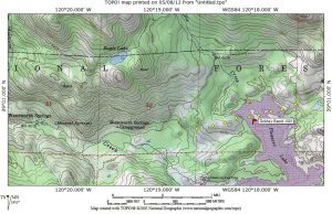
Doyles Ranch, Southeast of Loon and Pleasant Lakes-1873
 His ranch is identified on the Amos Bowman Map of the Georgetown Divide holdings of the California Water Company, published in 1873 as well as on the G. M. Wheeler Atlas Sheet 47 B, D, E Calif, Nev 1876/79 . The info on the Wheeler Atlas was kindly volunteered by Doug Walker of the El Dorado County Historical Society and El Dorado County Museum. The ranch was located on the trail between the southwest part of Loon Lake over to Tell’s Ranch right at the crossing of the South Fork of the Rubicon River, called “Little South Fork” on the map. The ranch location is but a 1/2 mile above present day Stone Cellar. Doyle’s Ranch is a long time research effort to learn more about who Doyle was. Doyle, whoever he was, most certainly had a lower ranch on the Georgetown Divide, but any information or identification of that location or background on Doyle, continues to elude me. The search for Doyle is ongoing and anyone with any information on who he might have been, please drop me a note. The 1873 map was obtained from the UC Berkeley Water Resources Library from their collection on the California Water Company. The California Water Company of San Francisco originally hired Amos Bowman, a
  Canadian engineer to do a full survey of the company holdings on the Georgetown Divide resulting in a formal report which included this map to the Board of Directors in 1874. His 1873 map is the definitive map of early El Dorado County, California and along with Sioli are the two major sources of early history in the county.
Ellis Creek
Ellis Creek Probably named for Jock Ellis, a Squaw Valley dairyman and sheep herder whose name is on Ellis Peak, Ellis Lake and Ellis Valley in Placer County above the Georgetown-Lake Tahoe road. See also G.M Wheeler Atlas 47B,D,E Sheet Calif, Nev 1876/79 for Ellis Peak. Jock Ellis had a dairy on the West side of Ellis Peak for many years before he gave it up to shift to raising sheep. Ellis would sell during the summer months all the butter, milk and cream he could generate to those passing on the Georgetown-Lake Tahoe road as well as the Lake Tahoe community. (James, 1915)This creek flows out of Bugle Lake into Loon Lake. In the days prior to the new Loon Lake Dam in 1962, the creek entered what was then Pleasant Lake. Pleasant Lake is now part of the new Loon Lake. Where Ellis Creek crosses the Georgetown-Wentworth Springs-Rubicon Springs-Lake Tahoe 4WD road is where the new (since the 1980s) Jeepers 4WD trail joins from Loon Lake Dam.
Francis Cow Camp-AA Francis-1872s,Eldorado National Forest, El Dorado County, Ca
In 1872, Allessandro A. Fransioli, one of several Swiss-Italians to establish ranches in the area, constructed a log bunkhouse at Francis Cow Camp. Born in Canton Tieno, Switzerland, May 29, 1817, Alessandro came to America with his father Joseph, arriving in California in 1852. Like many others before them, they became miners on the Georgetown Divide with some success. Allessandro’s father Joseph returned to Switzerland where he died at age 68, leaving his son alone in California. Allessandro continued to engage in mining, before leaving the Divide for San Francisco where he became a fruit and cigar merchant in 1857. In 1858, he returned to the Georgetown Divide, changing his focus and got into the butcher business. He eventually purchased the business from the firm he was working for, continuing in the business very successfully for another 25 years. Additionally, he owned a saloon and livery business in Georgetown. Alex Francis also owned a sheep ranch near Folsom. Georgetown Gazette Jan 14, 1881 He had 1500 sheep on this ranch as well, again reported in the Georgetown Gazette June 3, 1881(Gernes; Deibert, 1999). In a late 1880 edition of the Georgetown Gazette, a quarter page advertisement for the “Bonanza”, on Main Street, Georgetown was displayed. “Verbiage in the ad included the following recommendation from the proprietor, A. A. Francis….”Nothing but the finest brands of Liquors, Cigars and Tobacco kept. Best French Brandy “The Pete” Whisky, Gin, rum, bitters of all kinds, Mountain Brewery Lager for sale by the bottle or gallon. Club Room with Pool Table.” In a late 1890 advertisement in the Georgetown Gazette, AA Francis ran a near quarter page ad for his butcher business called “City Market, Main Street, Georgetown, A. A. Francis . The editors of the Gazette referred to Francis as Georgetown’s Butcher. Later in a editors note from the July 19, 1900 edition of the Georgetown Gazette, it was reported that…..”Alex Francis has decorated his place of business with a handsome new sign – Arcade Saloon – from the brush of Trask, the artist.”(Gernes, Deibert, 1999) In 1870, “Alex” Fransioli married Florina Forni, daughter of another local Swiss-Italian immigrant. They had seven children. He eventually retired in 1897. (Jerrett, 1963; Errington, 2000) However the retirement was due in part to the fire of 1897, whereupon, he soon reopened his butcher shop after finding it difficult to “remain idle” (Morgan;Rambeau; Wurm, 2003). Review of these early maps shows that AA Fransioli’s name was shortened or misspelled to read AA Francis, which may have been related to how he was commonly referred. For a picture of Alex Francis, see Rambeau, 1998, page 21 for a group photo of the I.O.O.F. lodge in Georgetown, 1889. There is a group picture showing members Alex Francis, Charles Forni, Dan Jerrett, Gus Orelli and Charles Wentworth, all significant men in the history of Gerle Creek.

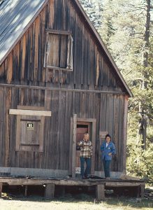
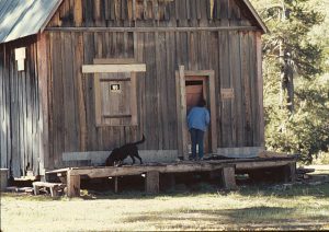
Here are some 1973 pictures of Francis Cow Camp, picturing my wife Pat, sister Karen looking over the historic cabin and the ranch site including the original cattle loading ramp made of logs…….Pic#1, Pic#2, Pic#3,
 I recently obtained a copy of the Georgetown Historical Walking Tour Brochure which includes a wonderful illustration of AA Francis’ Georgetown home 1880 which is on Church Street in Georgetown. Jacqueline Morgan did the drawing while Sheryl Rambeau was the historian and author, with Bonnie Wurm doing the layout in the original brochure, 2003
(Morgan; Rambeau; Wurm, 2003)
Recent Francis Cow Camp Ranch building pictures of the remains of the ranch buildings taken October, 2001. Pic#1, Pic#2, Pic#3 Francis CC after collapse winter of 90-91, July 91, Pic#4
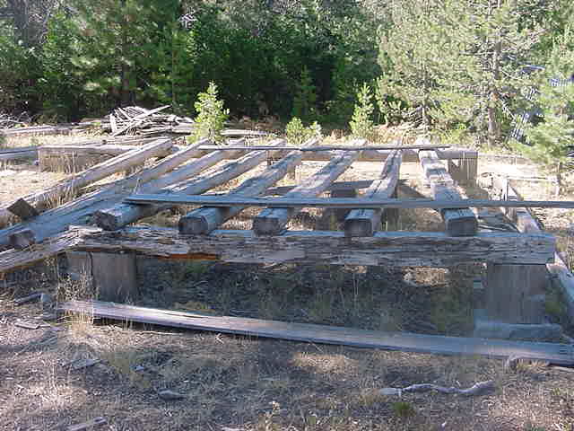
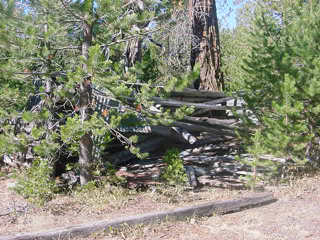
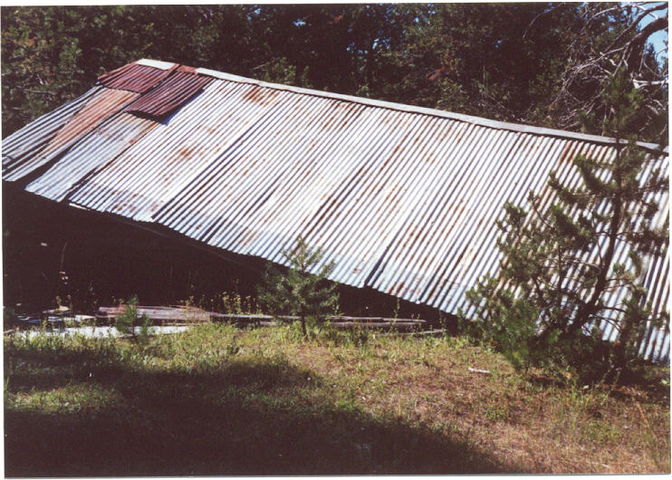
Francis Lake
Named for the Francis family Georgetown Gazette. Lake is about halfway between the old Mary’s Lake in the West end of Loon Lake (Francis Fill Dam) and Francis Cow Camp on Rocky Basin Creek where it drains into Gerle Creek. The actual picture of Francis Lake is from the Wikipedia note on Francis Lake.
GCSHT-1953/1957- Lot 24-GA Brattland Family Cabin-1958-Old and Current Pictures
Georgetown Gazette(GG)- Mountain Democrat(MD) Newspaper Reports on interesting events on the Georgetown Divide from 1860 to the Present…………..Gernes, Diebert, 1999
GG June 19, 1890 “Theodore Schlein, while engaged in building a new flume for the California Water Company at South Fork on Wednesday 11 inst., the flume , not being securely braced, went down precipitating Mr. Schlein upon the rocks, severely injuring his hip and side. He was brought down Saturday for treatment. He is under the care of the Odd Fellows.”
GG June 10, 1898 “Among the stockman who passed through our town the past two weeks for their alpine ranges were: Murphy Bors. of Weaver Creek, for their range at Mckinney’s(Lake Tahoe); G. Bassi for silver Creek: Sam and Amelio Forni, for Forni’s(Stone Celler, Butler Meadow, Fornis’s Ranch(Tell’s Ranch, Fillipinni’s eventual Van Vleck). Wm. Bachin and Son from Garden Valley; McCollough from near Folsom, for South Fork; Rodoni Bros: Butler from near Folsom, with sheep: Jake Drairer from Cool.”
Georgetown Wentworth Springs Rubicon Springs Lake Tahoe Road
This road was described by James in 1915 as a “stern road, that would make the “rocky road to Dublin” look like a “flowery bed of ease. The Georgetown Road is an important and historic feature of the Tahoe Region, for it connects Georgetown with Virginia City, and it was the former place so many Tahoe pioneers came.” James, 1915, pg 220,347.
In a short informational note in the Tahoe Tattler in the Fall of 1881, the current owner of Rubicon Springs reports on plans for the road……..”Hunsucker Bros’ proprietors of the Rubicon Springs, say they will have a road open to Georgetown next year, to give visitors a better chance to see the wonders of that wonderful place and to expedite the ways and means of getting out the famous soda water. Up to date the demand has been much greater than the supply.”(Gernes; Deibert, 1999)
Later in the Georgetown Gazette edition of July 1st, 1885, the editors offer their thanks to to Mr. Hunsucker for this personal effort in getting the road from the Rubicon Springs to Lake Tahoe in serviceable condition…………..”Good! the new road from Rubicon Springs to Lake Tahoe is in splendid order, and Mr. Hunsucker deserves much credit for the good job in its construction. Johnny Poor, who is running the stage on that road now sends a four-in-hand down the road as though it was level ground. At the Springs the thermometer during July 5, 6, and 7th stood during the warmest part of the day at 85 degrees. Since the 4th the health and pleasure seekers are coming in more freely. There remains only a short piece of road to be made between the Rubicon and Wentworth’s to complete the wagon road from Georgetown to Lake Tahoe.”(Gernes; Deibert, 1999)
Even with the best efforts of the Hunsuckers and Wentworths, the road remained unfinished in 1887 when the editor summarized the history and need for the road to be finished by the county in the July 16, 1887 edition of the Georgetown Gazette……………”During the past twenty years there has been expended, by the citizens of the Georgetown Divide in opening a wagon road to Tahoe, no less than $10,000. It is now completed to Wentworth Springs, 42 miles from Georgetown, and from Lake Tahoe to Hunsucker’s Springs (Rubicon Springs) about 10 miles. leaving about 10 miles between those points to be opened. the road has always been free to anyone who desired to travel it, and no person ever received back any of the money expended. To complete the road will cost at least $3000. To raise that amount by private subscription has been found impossible; yet a portion could be raised, and if some assistance had been rendered by the County, the road could have been opened this year.”(Gernes; Deibert, 1999)
In a further very short note or tidbit in the July 12, 1888 edition of the Georgetown Gazette, the editors reported……..”Arrangements have been made for completion of the Georgetown and Tahoe wagon road.”(Gernes, Deibert, 1999)
During the Summer of 1888, the Gazette reported on the progress of the Lake Tahoe road completion in the August 2, 1888 edition as follows……….”The wagon road now being completed from Georgetown to Lake Tahoe will make this the most direct and best route for people coming from the lower Counties who have not visited this great lake. Georgetown being a central point is a very convenient place for procuring supplies for a mountain trip, and we believe that goods can be brought at as low figures here as in any mountain town.” (Gernes, Deibert, 1999)
Finally, in the late Fall of 1888, the final part to the Georgetown to Tahoe wagon road was completed and reported upon in the October 4, 1888 paper………..”The wagon road is now completed through to Lake Tahoe from Georgetown, so that loaded teams can pass over to the lake. With tow daily stage lines plying between Placerville and Auburn, making Georgetown an important junction, it is believed that by next Spring business will justify a daily line between Georgetown and Lake Tahoe.” (Gernes; Deibert, 1999)
The continuing condition of the Georgetown to Lake Tahoe Road via Wentworth Springs and Rubicon Springs was in yearly need of work to keep it in passable condition. the attraction of Lake Tahoe and its resorts as well as Wentworth and Rubicon Springs made it necessary to keep the pressure on the county supervisors for road maintenance. The following letter was, I am sure, a sincere request for support for the county infrastructure but it should also be noted that Judge Bennett was running for re-election at the time of this letter. This letter may have also been a means of reminding the citizens of Georgetown of his name and his obvious civic interest in the county. He was subsequently re-elected shortly here after. In a letter to the editor of the Georgetown Gazette of September 14, 1896 by Judge M.P. Bennett of Georgetown, he wrote……”Most residents of the county are familiar with the natural advantages of the Placerville road, the liberal hospitality of the Inns along the way, and the climax of scenic grandure, when from the western summit of the Sierras, Lake Tahoe, fifteen hundred feet below, breaks into view….there has been for many years a road from Georgetown to Wentworth Springs and despite some pretty steep hills, it is a good mountain road. I first traveled it in the summer of 1877 and it was a most delightful renewal of my early impression through the mighty timber….Wentworth Springs….owned by Nathan Wentworth whose well built hotel is in a beautiful valley, in which a number of sparkling, health-giving springs are an attraction that annually bring thither numerous tourists from this county as well as Sacramento and Placer counties. Many stop here and venture no further because the wonderful beyond, like all the fabled wonders of antiquity, is approachable through only the most perilous way. From Wentworth Springs to the Rubicon Springs, is not exceeding ten miles, measured in feet and inches, but a mile of good road is a mile, and how far a mile of this is, I do not dare to state. Some portions of it are called “Sluicebox” and one of our party designated it “Devil’s Sluice Box” to go with “Hell Hole”, not far off. To make this road passable, from three to five hundred dollars should be spent on it and the investment would be a most judicious business proposition for El Dorado county…..As McKinney’s stands for progress on the western shore, so does Tallac with its beautiful new hotel building, at the south end of the Lake, but there is woeful want of land communication between the two places. A good road is constructed from Tahoe City to McKinney’s, and from Tallac to Brigham’s, and a wagon has been through from McKinney’s to Mr. Frost’s Rubican Park, but from that place to Dr. Brigham’s, a distance , I think, of probably five or six miles, there is no wagon road….We have in Lake Tahoe one of the greatest natural wonders and beauties of the world….does not fairness to the North Divide…demand that the approach to the Lake over the Georgetown road be made safe and comfortable?….(signed) M.P. Bennett”(Gernes, Deibert, 1999)
I recently came across this local Georgetown-Placerville Liddicoat Family history showing their early involvement with using Jeeps on the road from Georgetown to Lake Tahoe via Wentworth Springs and Rubicon Springs with wonderful pictures of Wentworth Springs in 1946 along with detailed pictures of their Jeep travel on the road including historic pictures of Rubicon Springs and the bridge before the steel bridge and after……….This website is a must review for a look back 60 years plus at Rubicon Springs and road to Lake Tahoe.
Gerle Creek(Gurley)
The creek was named for early El Dorado County settler, Christopher C. or Cyrus Gerle, a Swedish immigrant who arrived before 1860(Gudde)but in later records(Mason) it indicates he arrived in California in 1854. The youngest of two Gerle brothers who came to California in 1850’s,Christopher Cyrus Gerle was born in Sweden in 1833, marrying his wife, Mary Clausen in Coloma, El Dorado County in 1865. Christoper C. Gerle became a naturalized US Citizen on August 19, 1861 at the El Dorado County Courthouse in Placerville, California.
Mary was daughter to Peter (also called Paul) and Mary Clausen, who emigrated from Heliogoland in 1853, was born in Heliogoland in 1849. The Clausen’s had three daughters with the oldest Anna marrying Jasper P. Jurgen’s in their native Heliogoland on October 3, 1852. The newlyweds decided to leave for California making the trip their honeymoon. Eight other members of the immediate family decided to head to California with the newlyweds, including Anna’s parents, Peter and Mary Clausen, their sons, Numel and Paul, their other daughters Margareta and Mary and Numel’s wife. The other two making the trip were Chris and John Jacobsen who were distant relatives of the family. The Jacobsen’s other brother, Alex Jacobsen, came the next year to California and later married Margareta Clausen in Coloma. Jasper P Jurgens and his wife Anna Clausen Jurgens settled in Pinchem on Weber Creek, El Dorado County(Baldwin, 1975).
The ship voyage from Hamburg Germany to San Francisco around the horn of South America took six months. Once in San Francisco, the group took a river steamer to Sacramento and eventually on to Mississippi Bar, which is now Fair Oaks, California, staying there until 1854 and then continuing their journey to Weber Creek and Pinchem in El Dorado County (Baldwin, 1975).
Peter Clausen was born in England 1806 and his wife Mary was born in Heliogoland in 1815. While our US Census records show the Peter Clausen indicated he was from England, this may be due to the British capturing Heliogoland in 1807 during the Napoleonic Wars, with Heliogoland remaining a possession till England returned the island to Germany in 1890. It could also mean he was in fact born in England and moved to Heliogoland as well.
Peter Clausen was a boot maker and cobbler by trade. He and his wife setup a cobbler shop in Coloma where he worked for years before retiring and moving back to Weber Creek, where he passed away in 1884, with his wife Mary Clausen passing away 4 years later in 1888 (Baldwin, 1975).
Christopher C. Gerle and his wife, Mary initially had two boys, Peter C. Gerle, born Wednesday December 22, 1869 and dying Wednesday, February 1,1871 and a second boy, Charles (Charlie) Gerle, born Wednesday December 14, 1870 and dying Wednesday February 1,1871, on the same day as his brother.
Their deaths were reported in the SACRAMENTO DAILY UNION in the death notice section, “At Coloma, Feb. 1st, Peter C, son of Mary and Chris Gerle 2 years, 1 month and 11 day. At Coloma, Feb. 1st, Charlie, infant son of Mary and Chris Gerle, aged 7 weeks.”
Both are buried in the Pioneer Cemetery in Coloma with their uncle, Charles W. or William Gerle. Christopher C. Gerle and his wife Mary later moved to Plymouth, in Amador County, California, in 1877 (Mason) having a third son George and three girls, Mary, Charlotte and Maggie. The 1880 census indicates Christopher was working as a laborer in Plymouth. By 1881, Christopher was working as a Mason in the Empire Mine in Plymouth (Mason) . The Empire Mine in Plymouth is not to be confused with the Empire Mine of Grass Valley. The Empire Mine became the Pacific Mine in the early 1880s with new ownership. Christopher C. Gerle died in Plymouth, Amador County February 26, 1885 at age 51 as reported in a death notice in the March 9, 1885 issue of the SACRANTO DAILY UNION. Charles W. Gerle was the oldest brother, born in Sweden in July, 1823 and dying March 4, 1907, Charles W. or CW Gerle became a naturalized US Citizen on March 9, 1858 at the El Dorado County Courthouse in Placerville, California. Charles W. Gerle arrived in Coloma in 1851 according to the 1860 census while his younger brother, Christopher C. Gerle arrived three years later in 1854. Both were living together as bachelors in 1860 and identified themselves as miners in 1860 census. Eventually Charles W. Gerle lived in Coloma with Minnie Johnson, who was previously married to an Englishman and had two boys Juan Johnson and Charles W. Johnson in Sweden, with a third child George Marian. Johnson, born in Coloma in 1878. Later George and the other children took Charles Gerle’s name, inheriting the ranch property of Uniontown Coloma Pilot Hill. The Georgetown Gazette would always refer in later years to George M Gerle of Pilot Hill.
“C.W. Gerle (Charles William Gerle of Uniontown/Gerlees Ranch on Gerle Creek) was plaintiff and David Croft et al. was defendants in an action to recover Gerle’s mining claim and $100 damages July 1, 1861. The jury determined that Gerle owned the claim, but did not award the $100 damages”
From Justice Court Records of Coloma, stored in the California State Library California History Room’s Collections between 1859 to 1888 compiled by Paul Nesbitt, PhD…published in the April 22, 1988 issue of the MOUNTAIN DEMOCRAT Newspaper page A-8
According to original Land Patent records, Charles W. Gerle filed on 4 pieces of property within MD 11N, 09E, sections 10 & 3, of which 3 pieces were in 10 and 1 piece in 3 in Uniontown, El Dorado County, Ca.. The attached map outlines these sections which are basically Northwest or down the South Fork of the American River from Coloma and Uniontown. Their ranch was most certainly on the 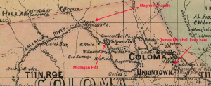 North side associated with the land along the section line between 3 and 10. The land is flat and was close or on the river directly. The Gerle Brothers needed that water for their livestock. When they drove their cattle to their cabin (Gerles) on Gerle Creek, they drove it Northeast up to Georgetown and then on the road to Gerles on Gerle Creek each Summer. These land patents were issued in 1874, 1879 and 1892 to Charles W. Gerle by the General Land Office. Thanks to Trey & Monica Pitsengberger’s History Blog on the Georgetown Divide for this 1868 Township and county map image from their blog.
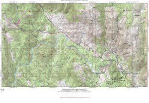 The Gerle brothers ranch in Uniontown Coloma outlined above is now contained within the Cronan Ranch Regional Trails Park in Pilot Hill California now administered by the BLM. Currently one of the walking and biking trail loops within this very large park along the Northside of the South Fork of the American River is referred to as the “Gerle Loop” reflecting the three Gerle brothers original settlement there in the 1850s. Anyone with information on the Gerle brothers who would like to share should contact James Barnes, the BLM Archeologist in charge of the current research in this area.
According to the Mountain Democrat of Sept 30, 1916, the Gerle Brothers bought their ranch property (Gerles/ Wagner Brothers/Lawyers Cow Camp) on Gerle Creek from the Indians in the early sixties(1860s). By 1877, Christopher Cyrus Gerle and his family had moved to Plymouth in Amador County. Gerle Family sources indicate that Christopher may have lost his portion of the Gerle Ranch in Uniontown and on Gerle Creek in a poker game in Carson City to his own brother Charles W. Gerle, which would account for his move with family to Plymouth. Another possible reason for this move is it came shortly after Christopher and Mary lost their two infant sons which may have also convinced them to move as well to make a fresh start. In 1889, the California Water and Mining Company purchased the Charles W. Gerle’s interest in the property and had the land surveyed. The survey reported that the property was swampland and overflow lands which made it the property of the State of California. In 1895, CM Fitzgerald, the superintendent of the California Water and Mining company, was granted a patent to the 440 acres of property in section 36 of T.14N, R. 14E.. He then deeded it to his company and who in turn deeded to each of the other companies who have taken ownership since.
The remaining part of Gerle’s Ranch on Gerle Creek….the eastern part was still owned by Charles W Gerle and remained in his family, being passed to his wife Minnie and son George M Gerle after Charles death in 1907. Later after the death of George M Gerle in 1917, George’s wife Aileen became the owner of Gerle’s Ranch property on Gerle Creek, eventually deeding the ranch property in 1935 to George’s two younger brothers, Thomas H Gerle and Grant G. Gerle(Chris Hankins, 2010) Thomas passed away in 1949 while Grant Gerle died in 1956. In 1964, Bruce Wadsworth of Georgetown bought the eastern part of the Gerle Ranch , 330 acres, on Gerle Creek and held it until it sold in late 2008/early 2010 to the Sacramento Municpal Utility District or SMUD.
The Georgetown Gazette reported in their August 20, 1880 edition about Charles Gerle’s trial in justice court……….”The trial of Chas. Gurley (misspelled), for drawing a rifle on James Smith, took place in Justice McLains court last Saturday. Dist Attorney Ingram represented the prosecution, with Jas. Smith and Chas. Harris as witnesses for the complaint, while Gurley testified for himself. The weight of the testimony told against Gurley, but the matter was compromised by Gurley pleading guilty to simple assault and paying a fine of $50.00.”Gernes; Deibert, 1999
A report from the June 23, 1882 edition of the Georgetown Gazette on the movement of livestock through Georgetown to the ranches in the Sierras……….”A great many droves of stock and dairy cattle, sheep and goats, have passed through Georgetown during the present month for their ranges above, and many more are yet to pass before the month ends. Among those who have already passed up with dairy stock are: Forni of Gold Hill, Sam Forni of this place (Georgetown), Filippini & Co., Bacchi of Garden Valley, Schelari and Gerley(mispelled) of Uniontown, Deller and Son near this place (Georgetown) and others whose names we have not in mind. Besides this, no less than a dozen large bands of sheep and goats have passed through town. Much stock is also passing up by routes south of this place.” (Gernes; Deibert, 1999)
The Gerle Brothers used their Sierra ranch on Gerle Creek (Gurley; Lawyer’s Cow Camp; & Wagner Bros.) from the early 1860s to raise hogs and cattle during the Summer months, hauling the pork products over the Sierra’s on the Georgetown/Wentworth Springs/Rubicon Springs/Lake Tahoe Road to sell in Virginia City, Nevada. The earliest maps including Bowman’s 1874 Map of the whole Georgetown Divide show their ranch and the creek identified with Gerle misspelled and written as it sounded; “Gurley.” Gerle’s Ranch dates from the early 1860s and became a very important way stop on the road to Lake Tahoe from Georgetown, remaining so well into the 20th Century after the ranch property was sold off in 1889.
Gerle Meadow/Neck Meadow
The Old Bruce Wadsworth cabin at the back of the very southern section of Gerle/Neck Meadow up against the base of Johnny’s Hill, on the south side of Gerle Creek serviced by two wood and steel bridges. The main wood bridge across the meadow and the old flatcar bridge recovered from Jacobson’s Crossing of Gerle Creek, one 1/8 mile up Gerle creek from the main bridge. Gerle Meadow/Neck Meadow is the Eastern part of the Section which originally belonged to the Gerle Brothers and now belongs to SMUD, purchased in 2009 from Bruce Wadsworth of Georgetown. Bruce owned the property from 1964 and built the cabin and the barn structure using a chainsaw saw mill using timber in the meadow. The cabin uses water from a spring off the lower North side of Johnny’s Hill. This area is one of the most beautiful and serene areas on Gerle Creek. Walking this area will immediately tell you why the Gerle Brothers attached themselves to this area. The original Gerle Brother’s cabin before the main one ( Gurleys, Gerlees, Wagner Bros, Lawyers Cow Camp ) to the west on the meadow was built was in Neck Meadow on the original survey plat from the 1870s.
Gerle Creek Summer Home Tract(GCSHT), US Forest Service Summer Home Tract, first established/located on Southwest side of Gerle Creek opposite from Swimming Hole on logging spur by the the Forest Service. See also John Holmes Chronology from 1938-1988. A November 5, 1953 article in the MOUNTAIN DEMOCRAT entitled “Plan New Recreation, Homes on Wentworth Springs Road,”
“A new summer home and recreational area is being planned by Eldorado National Forest for Gerle Creek, on the Wentworth Springs Road approximately 40 miles East of Georgetown. The site selected embraces an area large enough for 50 to 60 summer homes, one public camp area and two organizational areas. Fishing, swimming and hiking will be the principal attractions. The area is only eight miles west of Desolation Wilderness area. Work on the proposal is being carried out under direction of County Supervisor Gene Chappie and Ranger George Ramstad.”
This original plan and layout of the summer home tract lots along the Southside of the creek did not work out. Interest in the lots was basically lacking and some of the old stories indicated due to the location directly on the creek, the mosquitos made it difficult. In any case, with no interest in the original location, the Forest Service went back to the drawing boards and re-laid out the summer home tract in the present location on the North side away from the creek and up on the hillside above the Airport Flats area as laid out in the map below. Have a look at this original US Forest Service Map of the GCSHT, a compass and tape survey, dated Feb 1953. By the time the FS offered lots at Gerle Creek, they had eliminated the lots on the Southside of the creek in favor of the current position up the hill on the Northside of the flats.
For a number of reasons not clear, there were no takers for the summer home tract between the original offering in 1953 and when they began again to create interest in the summer home tract. In a January 31, 1957 article entitled “SPRING OPENING OF SUMMER HOME TRACT ON GERLE CREEK PLANNED,” published in the MOUNTAIN DEMOCRAT,
“Plans were announced this week by Ranger Kenneth St. John of Georgetown Ranger station for the opening of a summer home tract along Gerle Creek. The forest service will offer 40 lots for lease this spring or early summer, said St. John. The tract, about three and a one-half miles north of South Fork on Gerle Creek., will be reached either from the Georgetown-Wentworth Springs road or by the Icehouse road from Highway 50. The area is 39 miles northeast of Georgetown on the Georgetown-Wentworth Springs road and 28 miles north of Riverton on the Icehouse road. The lots, each of one-quarter to one-third acre in size, will be leased on a standard forest service permit, reissued annually, according to St. John. This is the first summer home development area opened along Gerle creek.”
As originally envisioned, it was laid out for lots 1 through 47, but later lots 1 through , 8,9 and 16 were removed from this original plan. The exact position of the Summer Home tract center is 38 Degrees, 59.205 Minutes North; 120 Degrees, 23.010 Minutes West.
Later in the Summer of 1957, the MOUNTAIN DEMOCRAT reported in a July 11, 1957 article entitled “FIVE SUMMER HOME SITE APPLICANTS AWARDED LOTS AT GERLE CREEK,”
“Summer home sites along Gerle Creek above Georgetown have been awarded to five applicants in the first allotment of 42 sites in the Forest Service development it was announced this week by Georgetown Ranger Kenny St. John. Lots were awarded to Steven R. Camber, Oakland; D.C. Young, Orinda; Albert H. Somner, Garden Valley; John Holmes, Sacramento; and Harry Heckenliable, Stockton. The five were among a list of applicants which has been building up since 1952, it was explained and many who had previously applied apparently were no longer interested, accounting for the small number of applicants appearing to select sites. Later applicants now on file will be notified of a date to be announced later when further selections may be made.”
I believe that due to the rather remote location, the unfamiliarity of people in general with this area on the forest and real difficulty in reaching this area in the early 50s, that interest was lacking for few interested folks who were willing to trek to Gerle Creek. The roads to Gerle Creek then were little more than two tire tracks whether coming from Riverton or Georgetown. The narrow old log roads took considerable time and navigational skill to make your way to places like Gerle Creek. The initial offering of summer home sites in 1953 was coming at a period of time when the country was just 8 years past a major World War and currently was involved in the Korean War. Recreation opportunities for people were not high on the scale when balanced against the need to reestablish their basic needs including housing and work. Among the other difficulties of Gerle Creek was the fact that the original log bridge crossing Gerle Creek at Airport Flats in 1927 had been washed out in the Winter of 1951/52. So besides the isolation presented by the summer home tract at Gerle Creek was the fact you had to ford the creek every time you came or went to the summer home tract. In the days before the new Loon Lake Dam, this was no small feat and nearly impossible during the early Spring and Summer, due to the snow runoff. All tract residents as well as other users of Airport Flats barracks buildings, including the South Fork Mill ditch keeper had to ford the creek till 1963 when the first lane of the new concrete bridge was completed.
By 1957, 1958 people were ready to take up the opportunities presented by the Forest Service offering of summer home tracts. My parents, Gordon and Joy Brattland found out about Gerle Creek as a result of applying to the Forest Service for a summer home lot at Wright’s Lake. Our family camped regularly at Wrights Lake from the mid 50s and fell in love with the isolated setting and the cabins around the lake. The Forest Service advised that they had no more lots at Wright’s Lake, but they had a summer home tract at Gerle Creek and plenty of available lots. My parents then visited the tract in the early Summer of 1958 via Georgetown with my sister and I in tow and selected lot 34 next to the Holmes on Lot 33. After completing the paperwork and being awarded the lot, the Carey Brothers, who had also wanted Lot 34, had begun to build on the lot. When we showed up after being awarded lot 34 by the Forest Service, the Carey family indicated they had earlier actually selected lot 34 and that one of the three Carey Brothers was supposed to go to Georgetown and sign the required paperwork with the Forest Service, but had failed to do so. They were so intent on this lot that my father and mother decided to pick another lot, selecting instead Lot 24. They reported the problem to the Forest Service, who corrected both lease documents, awarding Lot 24 to the Brattland family, while allowing the Carey family to retain Lot 34.
Gerle Creek Summer Home Tract Association
Originally proposed by the Eldorado National Forest Supervisor W. W. Spinney USFS as “Airport Summer Home Tract” on December 10, 1953 with 50 lots, the Georgetown Ranger District finally finished laying out the lots and constructing the tract roads so it could be made available for leasing in the Summer of 1957. It began with 42 lots with one of them being removed by the forest service in the early years.
Original Association Hydraulic Ram Pumps for the water system picture 1 Here is a later picture with my friend Dave Orchard standing in front of the hydraulic ram pump house built over the ram pumps, picture 2.
Lot 24 History Brattland Family Cabin
Lot 41 History McDowall Family Cabin
Gerle Creek Reservoir-Eldorado National Forest, El Dorado County, Ca
In 1885, Alex F. Forni applied for a patent on 560 acres near what is now Gerle Reservoir in the Butler Meadows area, where he operated a ranch (Errington 2000). Review of the earliest map of the area, shows AE Browns ranch house and fence in this area, but no mention of Forni. Butler Meadows is more than likely named for the Samuel Butler and his pioneer family who were early cattle ranchers, arriving in about 1860. This same area was also an area frequented by Indians, most likely Southern Maidu, making use of several areas around the juncture of Angel Creek and Gerle Creek, “during the Summer months, hunting, fishing and gathering seeds, fruits, and bulbs” underneath the current reservoir, according to Wilson and Dyson(1962)
Gerle Lake Drone You tube Video
For a picture of Charles Forni, see Rambeau, 1998, page 21 for a group photo of the I.O.O.F. lodge in Georgetown, 1889. There is a group picture showing members Alex Francis, Charles Forni, Dan Jerrett, Gus Orelli and Charles Wentworth, all significant men in the history of Gerle Creek
Gerle Creek Reservoir Dam
Gerle Creek Reservoir Dam was completed in 1962 and is on the East side of Butler Meadows. As an interesting piece of background on this eventual site for this storage reservoir for SMUD, in 1916, hearings were held on the water rights of the Truckee River General Electric Company to water from Gerle Creek. These rights had been assumed when they acquired them from the California Water and Mining Company (California Water Company). The company wanted to build a dam and reservoir to produce electricity. This claim was disputed and became part of rather complicated and extended federal hearing. The most interesting part of the proposal, was the intention to build this dam on Gerle Creek at Jacobsens, creating water storage lake in the meadow adjacent to Jacobsens extending back into Gerles Ranch or Lawyers Cow Camp. The hearings were reported on extensively, including the names of witnesses who testified, including Jacob Jacobsen (Mt Democrat Sept 30, 1916). In the April 17th issue of the Mt Democrat in 1917, it was reported the federal government found in favor of the Truckee River General Electric Company and confirmed their rights to the water for use of Gerle Meadow for a dam and reservoir. By 1924, these rights had been passed along to the Georgetown Divide Water Company (Mt Democrat, March 8, 1924). All real action to actually create a dam and reservoir were put off till the early 1950s when El Dorado County in the push to resolve their increasing need for water with the post WWII boom revisited creating a a number of dams and reservoirs in the county for electricity generation. From early 1951 till at least 1955, the planning of the SMUD Upper American River Project on the divide included the Gerle Creek Dam and reservoir in Gerle Meadows next to Jacobsens. The Mountain Democrat carried a very extensive and detailed article including a map showing 68 proposed dam sites in the June 23, 1955 newspaper, including the actual proposed reservoir site at Gerles Meadow, next to Jacobsens and not in its present location. As the proposed SMUD Upper American River Project progressed after 1955, the Gerles Meadow site was dropped in favor of the eventual and current site in Butler Meadow.
Georgetown and Carson Valley Road-Georgetown Cutoff-Georgetown Junction
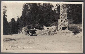
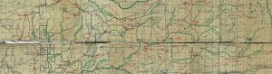
Very popular road from Georgetown down across Union Valley to the Wilson Ranch near Wright’s Lake connecting with the Placerville Road to Lake Tahoe (Highway 50) just East of Fred’s Place at the Georgetown Junction (Toll House). This road dates from the mid 19th Century up through the late 1950s when the construction of the Upper American River Project of dams and lakes, many of the old roads or parts of the old road went away.
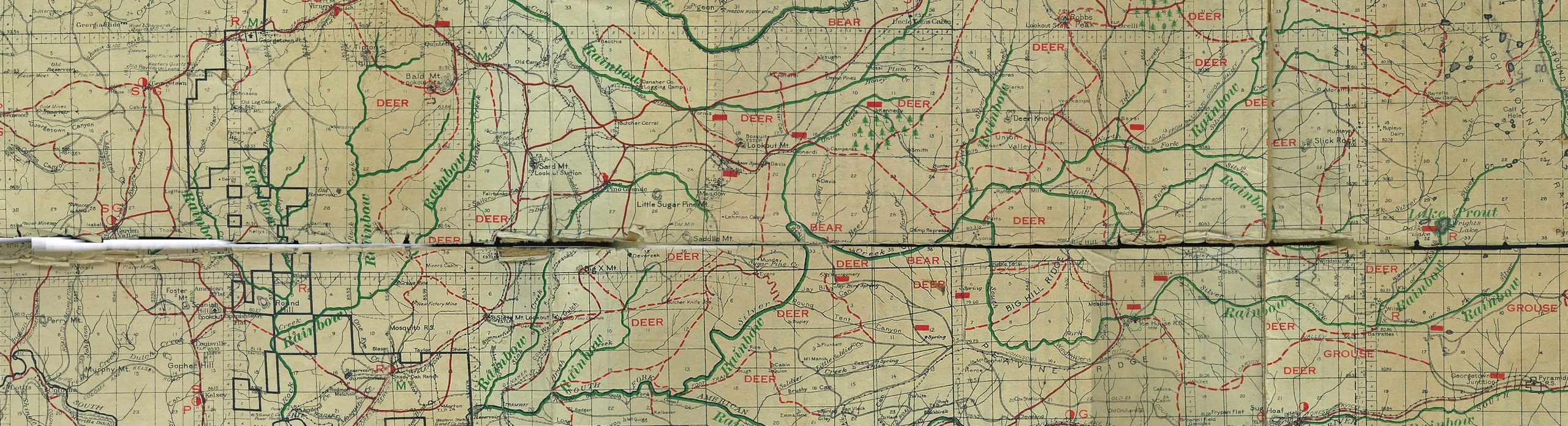
Georgetown Junction, “THE WRIGHT’S LAKE STORY,” Wright’s Lake Association, 1962/1994, page 13 “This junction had been moved further west several times, but in 1927 there were still the remains of a large chimney at the old junction. In early times, the Georgetown Junction Toll House was located here. The reason for the name “Georgetown Junction” was that the original Johnson’s Cut-off road to Placerville had a branch here that took off up the mountain to the North to a point near the Wilson ranch. Here it crossed Silver Creek, the outlet of Wright’s Lake, and then ran in a northwesterly direction between the south and middle Forks of Silver Creek on to Georgetown, which is about twenty miles east of Auburn.” The Georgetown Cutoff Road stands out wonderfully in this 1902 El Dorado County Mining Claims Map. Another excellent map showing the majority of the Georgetown Cutoff is the Pacific Ranger district Map of 1950. the map shows clearly the Georgetown Cutoff from Wilson’s Ranch, West to Puley, Jones, Big Silver and then to the Northwest by Deer Knob to Georgetown through Union Valley.
Granlees Ranch (Forshoda) Diversion Dam and Ditch
John (Jack) D . Granlees owned this summer ranch on Big Silver Creek, Union Valley, as well as his main ranch near Slough House along the Cosumnes River. The Granlees Ranch property near Slough House was sold in the early 1960s to form the basis for the new community Rancho Murieta . The Granlees built a stone diversion dam and ditch to divert water from Big Silver Creek to supply water for their ranch and cattle in the meadows of Union Valley, located above Granlee’s Ranch on Big Silver Creek. The ranch was removed with the construction of Union Valley Dam and Reservoir in the early 1960s. According to the markings in the top of the rock diversion dam, it was most recently rebuilt and repaired in October of 1947. My original thought was the diversion dam was built to support Millionaire Camp, but according to Krista Deal of the Forest Service at Pacific House, the old diversion dam was built to support Granlees Ranch in Union Valley. The remnants of the original ditch are still there in places down to the lake.
For a more comprehensive review of the Granlees/Macklin/Driscoll Family history see Naida West’s article in the El Grove Citizen On Line February 8, 2008 entitled, ” Granddaughter of Early RM pioneers dies at 96″ written on the passing of Mary Anita Granlees Macklin.
Additional pictures…………pic 3, pic 4, pic 5, pic 7, pic 8
Gurley’s Ranch(Gerle)
Lawyers Cow Camp, Wagners Cow Camp Early 1860s,Gerle Brothers-Natives of Sweden-Hog Farmers-Eldorado National Forest, El Dorado County, Ca
Summer range location for the Gerle Brothers, early emigrants and farmers on Gerle Creek, 2 miles West of Wentworth Springs (USGS Map of 1895) on the Georgetown/Wentworth Springs/Rubicon Springs/Lake Tahoe road, next to Gerle Creek. Their ranch property butted up against the Jacobson Ranch property on the West side of the section, also on Gerle Creek. One of two Gerle brothers who came to California in 1851,Christopher C. or Cyrus Gerle was born in Sweden in 1833, marrying his wife, Mary Clausen in El Dorado County in 1865. Mary was daughter to Paul and Mary Clausen, both emigrating from England to Coloma. Her father Paul was born in 1806 while her mother was born in 1815, both in England. Her father Paul was a boot maker. Christopher C. Gerle and his wife, Mary initially had two boys, Peter C. Gerle, born Wednesday December 22, 1869 and dying Wednesday, February 1,1871 and a second boy, Charles (Charlie) Gerle, born Wednesday December 14, 1870 and dying Wednesday February 1,1871, on the same day as his brother. Their deaths were reported in the SACRAMENTO DAILY UNION in the death notice section, “At Coloma, Feb. 1st, Peter C, son of Mary and Chris Gerle 2 years, 1 month and 11 day. At Coloma, Feb. 1st, Charlie, infant son of Mary and Chris Gerle, aged 7 weeks.” Both are buried in the Pioneer Cemetery in Coloma with their uncle, Charles W. or William Gerle.
Christopher C. Gerle and his wife Mary later moved to Plymouth, in Amador County, California, in 1877 (Mason) having a third son George and three girls, Mary, Charlotte and Maggie. The 1880 census indicates Christopher was working as a laborer in Plymouth. By 1881, Christopher was working as a Mason in the Empire Mine in Plymouth (Mason) . The Empire Mine in Plymouth is not to be confused with the Empire Mine of Grass Valley. The Empire Mine became the Pacific Mine in the early 1880s with new ownership. Christopher C. Gerle died in Plymouth, Amador County February 26, 1885 at age 51 as reported in a death notice in the March 9, 1885 issue of the SACRANTO DAILY UNION. Charles W. Gerle was the oldest brother, born in Sweden in July, 1823 and dying March 4, 1907. Charles W. or CW Gerle lived in Coloma with Minnie Johnson, who was previously married to an Englishman and had two boys Juan Johnson and Charles W. Johnson in Sweden, with a third child George M. Johnson, born in Coloma in 1878. The Gerle Brothers used their Sierra ranch on Gerle Creek (Gurley; Lawyer’s Cow Camp; & Wagner Bros.) to raise hogs and cattle during the Summer months, hauling the pork products over the Sierra’s on the Georgetown/Wentworth Springs/Rubicon Springs/Lake Tahoe Road to sell in Virginia City, Nevada. The Gerle Brothers and the Wagner Bros were long time neighbors in the Sierras during the Summers with Murray Camp folks just a mile North of their ranch on the way to Bennett’s Ranch in the McKinstry Lake area, as well as the Jacobsons, Francis, Wentworths, Dellars and Jerretts. By 1877, Christopher C. Gerle and his family had moved on to Plymouth in Amador County. Gerle family sources indicate that he may have lost his share of the Gerle properties in El Dorado County in a poker game to his brother, Charles W. Gerle in Carson City. According to the Georgetown Gazette, reprinted in the Mountain Democrat of Sept 16, 1916, the Gerle Brothers bought their ranch property (Gerles/ Wagner Brothers/Lawyers Cow Camp) on Gerle Creek from the Indians in the early sixties(1860s). In 1889, the California Water and Mining Company purchased the Charles W. Gerle’s interest in the property and had the land surveyed. The survey reported that the property was swampland and overflow lands which made it the property of the State of California. In 1895, CM Fitzgerald, the superintendent of the California Water and Mining company, was granted a patent to the 440 acres of property in section 36 of T.14N, R. 14E.. He then deeded it to his company and who in turn deeded to each of the other companies who have taken ownership since. The earliest maps including Bowman’s 1874 Map of the whole Georgetown Divide show their ranch and the creek identified with Gerle misspelled and written as it sounded; “Gurley.”
Gerle’s Ranch became a very important way stop on the road to Lake Tahoe from Georgetown in the “Sixties”, remaining so well into the 20th Century after the ranch property was sold off in 1889 to the California Water Company. The Wagner Brothers eventually purchased this property and have retained ownership among their family, Wagner and Veer Kamp, of the majority of Gerle Meadow around the old ranch house to this day.
In the early part of the 20th Century, Archie and Irma Lawyer leased Gurley’s Ranch from the Wagner’s about the same time they actually purchased Uncle Tom’s Cabin, at which point it became known as “Lawyer’s Cow Camp” after 1920(Errington 2000). Reviewing the original Eldorado National Forest Map of 1916 shows this old ranch still listed as “Gerles.” Later, the historic ranch was returned to the Wagners, who referred to it as Wagner Bros., Wagners and or Wagner’s Cow Camp. The 1950 Forest Service map clearly shows the ranch listed as Wagner’s but in later years returned the name to Lawyers when in fact the ranch was never owned by Lawyers and long since not leased anymore.
The US Forest Service acquired 80 acres of section 34 of Township 14N, R14E, of the original Gerle Ranch property May 3, 1920.
The Gerle Brothers lived on their ranch in Uniontown -Coloma during the rest of the year when not using their high sierra ranch on Gerle Creek.
Gurley’s Ranch1, Gurley’s Ranch2, Gurley’s Ranch3, Gurley’s Well, Gurley’s Ranch 4,
See Gerle Creek.
Gerle’s Meadow-Eastern half of Gerle’s or Lawyer’s Cow Camp–
Now owned by SMUD-Slide video made up for the sale of the property by Wadsworth family in 2010.
Hales Camp Cabin
 Hales Camp Cabin on the North side of the Rubicon River, near Hales Crossing, 4 miles down the Rubicon River from Hell Hole Dam. Hales Crossing is located at the Western point of the Charles Creek Trail which began at Jacobsens on Gerle Creek and wound its way West and down into the Rubicon Canyon. Lent Brown photo
Hanna’s Camp-South Fork Mill-California Water Company
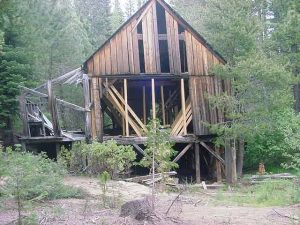 Water Operated Saw Mill, 1874-1880, South Fork of Rubicon River, Eldorado National Forest, El Dorado County, Ca .
Hartless Mountain
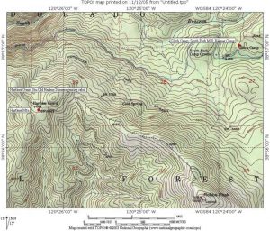 Hartless Mountain is named for Benjamin W. Hartless, a Garden Valley dairyman and farmer. Hartless received formal land patents from the General Land Office in 1892 on land immediately around Hartless Mountain and Uncle Tom’s Cabin which he used for Summer grazing of his livestock. The Hartless Guard Station, on Hartless Mountain was the original Hartless Summer grazing cabin. Originally born in Rutherford County, Tennessee, Feb 15, 1828, he moved with his widowed mother to Carroll County Missouri, living there for 6 years, before heading to California. As so many new arrivals to California, Hartless took up mining initially in Nevada City before eventually migrating to the American River as well as Dry Creek , near Georgetown. By 1858, he gave up mining and began farming and running dairy cattle at Garden Valley. Hartless married a widow, Mrs Wakefield with six children on April 23rd, 1871. The children’s names were Claudis B., William B., Jefferson D., Frank, Thomas and John. Mrs Hartless was a native of Saratoga County, upstate New York, who arrived in California in 1853. She first made her home in Sacramento County at Brighton before moving on to Negro Bar and then to Garden Valley. Benjamin Hartless owned 160 acres in Garden Valley in 1883.(Sioli, 1883)
Ice House Ranger Station 1910
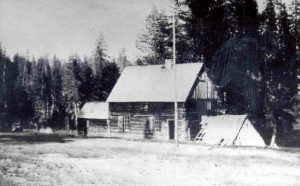 This building burned and was lost in the 1959 Ice House fire.
The history surrounding Ice House and this original building which eventually evolved into a ranger station in the early 20th Century is directly related to the Old Soda Works building in Placerville owned and built originally by John McFarland Pearson, the Ice Merchant in Placerville and is laid out at http://malakoff.com/goldcountry/mcplacsw.htm .
Jacobsen’s Ranch/Dairy- Eldorado National Forest, El Dorado County, Ca
 Johnny Jacobsen (USGS 1895 Map) applied for a patent on 80 acres of land in 1891, on the West side of Gerle’s Ranch, where he operated a diary in the meadow now bearing his name, adjacent to one of the crossings of Gerle Creek (Baldwin 1975). Johnny Jacobsen, or Jacob Jacobsen, (Picture published in Baldwin, 1975) or “Jake” as his friends and ranching neighbors called him in later years (Hill 1929), born in 1860 in California, was one of three children (Sophia, Peter and Jacob) of Alexander and Margareta Clausen Jacobsen. Alex was born in the province of Schweswig, Germany on May 30, 1830, arriving in California in 1854, who married Margareta Clausen of Coloma in 1858 (Sioli, 1883; Baldwin 1975). Alex’s parents were born in Denmark, where his two brothers John and Chris were born. The Jacobsen’s migrated to Heliogoland where they became friends with the Peter Clausen family before returning to Germany. Alex became a sailor early on signing on to a Dutch ship serving 3 years off the west coast of South America (Sioli 1883; Baldwin 1975).
Baldwin tells an interesting story about Alex falling in love with an unknown young girl during his trip to America aboard ship in 1853, whose parents did not approve of her relationship with Alex. They wanted her to marry a rich merchant and pressed her to break off the friendship. The quarreling and demands from her parents to stop the relationship caused the young lady to jump overboard, drowning herself, to never be found. This was very difficult on the young man Alex Jacobsen. After his arrival in Weber Creek and Pinchem, Alex fell in love with Margareta Clausen but the Clausens did not approve of the match either, which was probably due to the stormy relationship Alex went through on the ship and the tragic death of this young girl. Alex was very disappointed, but perseverance was the answer which led to the marriage in 1858 in Coloma (Baldwin, 1975).
Margareta was daughter to Peter (also called Paul) and Mary Clausen, who emigrated from Heliogoland in 1853, was born in Heliogoland. The Clausen’s had three daughters with the oldest Anna marrying Jasper P. Jurgen’s in their native Heliogoland on October 3, 1852. The newlyweds decided to leave for California making the trip their honeymoon. Eight other members of the immediate family decided to head to California with the newlyweds, including Anna’s parents, Peter and Mary Clausen, their sons, Numel and Paul, their other daughters Margareta and Mary and Numel’s wife. The other two making the trip were Chris and John Jacobsen who were distant relatives of the family. Jasper P Jurgens and his wife Anna Clausen Jurgens settled in Pinchem on Weber Creek, El Dorado County(Baldwin, 1975).
The ship voyage from Hamburg Germany to San Francisco around the horn of South America took six months. Once in San Francisco, the group took a river steamer to Sacramento and eventually on to Mississippi Bar, which is now Fair Oaks, California, staying there until 1854 and then continuing their journey to Weber Creek and Pinchem in El Dorado County (Baldwin, 1975).
Peter Clausen was born in England 1806 and his wife Mary was born in Heliogoland in 1815. While our US Census records show the Peter Clausen indicated he was from England, this may be due to the British capturing Heliogoland in 1807 during the Napoleonic Wars, with Heliogoland remaining a possession till England returned the island to Germany in 1890. It could also mean he was in fact born in England and moved to Heliogoland as well.
Peter Clausen was a boot maker and cobbler by trade. He and his wife setup a cobbler shop in Coloma where he worked for years before retiring and moving back to Weber Creek, where he passed away in 1884, with his wife Mary Clausen passing away 4 years later in 1888 (Baldwin, 1975).
Alex died in Sept 1906 followed by his wife, one month later (Baldwin, 1975). The Jacobsen’s settled on Weber Creek, where they conducted a dairy farming business (Sioli, 1883, Baldwin, 1975).
Lilla Hill, “Our Traveling Correspondent” from the Mountain Democrat wrote a series of articles about her summer of 1929 where she rode her horse Hightower from Lake Tahoe to the Hill Ranch in Kelsey via Desolation Valley, Rock Bound and Buck Island Lakes, down the Lake Tahoe to Gerogetown road past Wentworth Springs, Gerlee’s where she spent a night at Jacobsend’s, Mr Jacobsens or Jakes Dairy at Gerle Creek. Since Jake was not there, she used the corral for her horse and slept on the ground next to the corral for the night, reporting it to be cold and damp, before heading out the following day and arriving at Kelsey after 2 long days in the saddle with her only protection being a 32 caliber pistol she carried when riding. She described the corral as “fair sized with pasture grass in it.” Lilla Hill’s description of the Lake Tahoe to Georgetown Road was “primitive.” (Hill 1929)
Johnny “Jake” Jacobsen died in 1944 and was buried in Coloma.
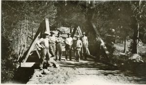 This is a 1929 picture (also picture directly below) of the log bridge built and finished in 1929 crossing Gerle Creek at Jacobsen’s meadow and dairy. this bridge was reported completed in the MOUNTAIN DEMOCRAT of September 27, 1929. It reported that by a civilian crew headed up by Mr. Lawrence. This bridge remained in place many years but was lost like a lot of the bridges on Gerle Creek. With the loss of this bridge, travelers to all parts of forest East of Jacobsen’s Dairy were required to ford once again.
After a number of years without a bridge at Jacobsen’s Dairy, El Dorado County Board of Supervisors in Sept of 1944 approved an appropriation (not to exceed $2000) to build a concrete bridge over Gerle Creek at Jacobsen’s (Mt Democrat, Sept 7, 1944). The concrete bridge at “Jacobsen’s” as this creek crossing is and has been referred to for years, was eventually lost during  the Winter of 1963/1964’s. The Mayor of Placerville tried to ford Jacobsen’s in late May, 1964 on the way to check the road to Wentworth Springs and Lake Tahoe for the upcoming Jeeper”s Jamboree only to get stuck in the middle of the creek due to the depth and flow of the water from the Spring runoff and SMUD’s need to let extra water flow out of the new Loon Lake Dam. John Holmes from Gerle Creek came to the rescue and pulled the Mayor and his jeep out of Gerle Creek. (Mountain Democrat June, 1964)
El Dorado County would later construct a new bridge which used an old railroad flat car which would last till about 1980 when it was washed away during the Winter. El Dorado County at this point, with the new paved road in and a means for people to go around the old Wentworth Springs road, abandoned any further replacement of this bridge leaving it to become the ford it is today and was originally before 1944. The railroad flat car bridge was left abandoned after being a casualty of the Gerle Creek Spring runoff (Sandy Hart Papenfus GC Lot 39 family photo). Bruce Wadsworth, the owner of the Neck Meadow, below Wentworth Springs, which includes the eastern half of the old Gerle’s Ranch asked the county if they were going to use the bridge and they indicated they were not. So Bruce had an obliging logger with a Cat tractor drag the bridge up the old Wentworth Springs road to his property where they installed it in Neck Meadow over Gerle Creek, which then allowed Bruce Wadsworth to reach his cabin at the back of the property. Previously, he had some log bridges which had taken a beating over the years from the Spring Runoff and a Winter on Gerle Creek with no dam in place during the construction of the new Loon Lake Dam.
Considering that Johnny Jacobson owned the dairy and meadow at the foot of what is annotated on area maps as “Johnny’s Hill,” Johnny’s Hill takes its name from Johnny Jacobsen.
Mountain Democrat June 1964
 Named for Johnny “Jake” Jacobsen, Jacobsen’s Meadow and old Dairy Ranch on Gerle Creek.
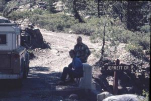 Jerrett Peak and Creek were named for the Jerrett family, early El Dorado County pioneers. The Wentworths and the Winslows eventually sold Wentworth Springs to Robert S. Jerrett of Georgetown, Ca, son of Daniel Jerrett, a Georgetown Grocer and 49er.Robert’s brother, Herman Daniel Jerrett, wrote two books….”California’s El Dorado, Yesterday and Today,” 1915 and a later book entitled “Hills of Gold,” 1963. For a picture of Dan Jerrett, see Rambeau, 1998, page 21 for a group photo of the I.O.O.F. lodge in Georgetown, 1889. There is a group picture showing members Alex Francis, Charles Forni, Dan Jerrett, Gus Orelli and Charles Wentworth, all significant men in the history of Gerle Creek. Jerrett Creek flows out of the West side of McKinstry Lake and down crossing the Wentworth Springs Road below the springs into Gerle Creek.
 More than likely named for the famous early Eldorado National Forest Ranger, Joe Bauman who was principal to the establishment and surveying of the Gerle Creek Summer Home Tract as well as current massive, beautiful hand built stone lookout station at Bunker Hill. Here is an actual photo of Joe’s Spring in 1990 with my mother Joy Brattland enjoying a drink of the very good water which is a product of the spring on Bunker Hill.
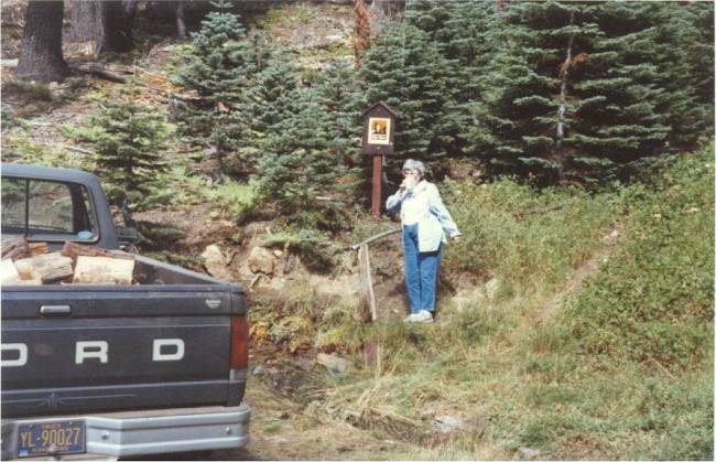
Jones Silver
 Named for Fleming and Florence Jones who Summered in the Silver Creek area, running dairy cattle.(Yohalem) Jones Silver cabins, pictures 1, 2, 3, 4, 5. 6. and 7.
Leonardis Ranch This is a Jonni Hill photograph of the ranch contributed to help with the history of important places and people in El Dorado National Forest and County, which was used as a basis for one of her original paintings. Jonni Hill is a noted artist of people and early places in El Dorado County. Many of her works are displayed in Robb’s Resort. Our family personally owns one of her wonderful Native American paintings. You can find out more about her art work at High Country Sketches.
Loon Lake and Dam-1873/1881/1962,Eldorado National Forest, El Dorado County, Ca
Loon Lake Dam and surrounding area-January 1, 2021 Tim Green
Identified early on by The California Water Company as a means to deliver a constant supply of water to Georgetown and the many mines and farms during the dry months of the Summer. the California Water Company tested this idea by building a temporary dam of logs, nine feet high (Bowman, 1874) to determine whether sufficient water could be retained through the Summer such that it could be selectively released to overcome the shortage of water in the lean summer months. This idea required the building of the 4 mile long South Fork Ditch connecting Gerle Creek with to Hanna’s Camp on the South Fork of the Rubicon River in order to further divert this Loon Lake water via a series of creek beds, ditches and flumes to Georgetown. This initial log dam was completed along with the South Fork Ditch by the Fall of 1874.This original log dam was then replaced by a second higher log dam, about 20 feet in height which remained till replaced in 1882 by the granite stone dam. In addition to the higher log dam on Loon Lake, separate log dams were built on Pleasant Lake and Bixby lakes behind Loon Lake which enabled each to collect more water which flowed from them into Loon Lake. Complete details of each of these log dams as well as the log dam on Loon Lake was covered in the 1880 California Water Company report to the Board of Directors. In this report, the recommendation was to build a larger, taller dam at Loon Lake to increase the total storage of water to allow the company to sell more water for farming, mining and agriculture. By building the larger dam, it would also replace the smaller additional log dams on Pleasant and Bixby Lakes. Bixby Lake is currently the part of Loon Lake behind the Francis Fill Dam.
July 30, 1881, MT DEMOCRAT, “Dam at Loon Lake-the Georgetown Gazette says: The California Water and Mining Company has commenced the erection of a substantial stone dam at Loon Lake. The wall to be entirely built of granite, which is found in inexhaustible quantities, and of the best quality, right on the ground. We understand that that portion of the dam which it is intended to complete before Winter, include about 450 feet in length and 20 feet high at the trunk or highest point. A force of experienced quarrymen have been engaged, a number of whom have already gone forward. All the tools and appliances necessary for the rapid and economical prosecution of the work, such as derricks, tackle, wire guys, car for transporting rock from the quarry to the dam, cement, supplies for the men, etc; are either on the ground or on the way there.”
Further reporting on the progress of granite dam construction at Loon lake from the September 2, 1881 edition of the Georgetown Gazette………..”The dam being constructed by the Cal. W.&M. at Loon Lkae are composed of Granite and the works are of the character to do service for ages….the winter following the present Company’s purchase of the promising property was one of the severest ever experienced by ditch owners owners in the Mountains of California, and the Manager, Mr. Findley in common with the leading men of the County, has determined that such a disaster sjall never visit their property again, and further they are building dams of such dimensions as to increase the water reserve sufficient for all future wants of the divide and the city of Sacramento, besides, which the County many have the opportunity of supplying in the near future. The object of these immense reservoirs located at an altitude of more than 6000 ft. above the sea, is to store an abundance of water from the vast accumulation of snow, as a reserve for the dryer seasons, when the supply from other streams begins to fail.”(Genres; Deibert, 1999)
The California Water Company in their official company report to their board of directors of 1880 said much the same thing regarding supplying Georgetown and the City of Sacramento, actually including San Francisco in their proposal for water from their Loon Lake water.
The Georgetown Gazette kept track of the Loon Lake dam building again reporting on the work progress in the short new report of October 21, 1881……….”There are some forty men engaged on the work of the Cal. W.&M.Co. at Loon Lake. C.H. Jones, the Superintendant of construction says that a more faithful and better lot of men he never saw anywhere, and to the credit of Mr. Jones, we have heard it remarked by several of the men, that a better Boss they never worked under. When the spring opens a much larger force will be employed, and the works completed during the season. The dam will be 664 feet in length on top, and forty feet in height along the widest base.”(Gernes, Deibert, 1999)
It would appear that the Mt Democrat and Georgetown Gazette were talking and getting reports from two different people regards the actual size of the dam being constructed at Loon Lake.
In a short note in the June 23, 1882 edition of the Georgetown Gazette……..”We noticed yesterday 1200 feet of 1 inch wire cable in front of the Cal. Water Co.’s office which goes to Loon Lake for guys to support a large derrick used in moving ponderous blocks of granite from the quarry for the everlasting dam which the enterprising management of the Company is constructing at that point.” (Gernes; Deibert, 1999)
July 22, 1882, Mt Democrat, reported “Superintendent Wolf of the California Water Co’s works at Loon Lake was down on a hurried visit this week. He reports that work on the dam is progressing rapidly; the force increased, a new derrick being put up, making the fourth derrick, and that he believes the dam will be completed this season.”
Early winter weather caused some confusion and delay in finishing the dam early in October, 1882 as reported in the Georgetown Gazette of October 7………………..”A portion of the quarry men employed at Loon Lake dam came down this week on account of the storm and signalized their intention of quitting for the season, as they believed winter had set in. There being a couple gaps in the dam yet to be closed, and the managing Director Findley being satisfied that there would yet be plenty of good weather in which to complete the work, tried to persuade the men to return, but they refused. Yesterday, Mr. Findley stated for the Lake to utilize the force already there to see that the two gaps are filled and you may depend on it.”(Gernes, Deibert, 1999)
As a post script to the personnel situation which Managing Director Findley was facing when some of his quarry men quit with the initial October winter storm, the Gazette reported the following snippet in their October 14, 1882 edition of the paper on Findley’s character……………”The Loon Lake boys tell us that Tom Findley, who was with them the past two weeks, threw his coat and went to work with a vim. Findley is the man to meet an emergency every time.”(Gernes, Deibert, 1999)
In mid May, 1883 the California Water Company had to dispatch a crew of men to Loon Lake Dam to make some repairs on the just completed granite dam in the Fall of 1882 as reported in the May 26, 1883 edition of the Georgetown Gazette…………”A party of laborers departed for Loon Lake on Thursday to repair a portion of the surface of the new dam washed out, owing, it is said, to the waste-way being too small for the discharge of surplus water.”(Gernes, Deibert, 1999)
Later in 1881(Sioli,1883), the California Water Company build a permanent replacement granite stone dam finishing it in late 1882 which stood [(This historic photo was taken on June 24, 1940 by Linton A. Brown(1901-1966), father of Linton Brown of Red Bluff, Ca, who has kindly provided these historic photos from his collection on the South Fork Mill, the ditch system and Loon Lake Dam.. His father was a friend of Art Rasor, the ditch tender for the Georgetown Divide Water Company] till removed by SMUD’s contractors in Fall(Sept/Oct) 1962 (another great historic photo provided by Lint Brown and taken by Eugene Poe on Oct 30, 1962)and replaced by the present Loon Lake Dam in 1963.
Here is Loon Lake empty in 1962 during the construction of the new and present modern dam, looking from the area of the Loon Lake Boy Scout Camp area (to be) the dam area in the first picture and up to the tunnel at the very Eastern end of the new Loon Lake where the road goes over the top of the tunnel over the mountain in this picture to the Rubicon Reservoir and Buck Island Lake. This road was constructed entirely for the construction of the dam at Buck Island Lake as well as the tunnel under the mountain carved from solid granite which brings the water from Rubicon Reservoir down into Loon Lake. The tunnel opening at the loon lake end is quite large but is about 8 ft in diameter. These pictures show the extensive work done by SMUD’s contractors to make the new lake area ready for the completion of the New Loon Lake Dam by 1963.
The hand cut granite blocks removed from the considerable granite rock surfaces surrounding the dam area on the North side of the present day Dam, can now be found spread out along the top of the current dam structure as well as the Francis Fill on Loon Lake. A walking tour of this area and close inspection reveals where all the original granite was hand cut by Chinese Labor. Chinese Labor were also principal to the construction of the South Fork Ditch with rates for their pay specifically outlined in the Amos Bowman Report to the company directors. For a very good, recent 2001 Mountain Democrat article on the modern dam and the various powerhouses and underground interconnections, try www.mtdemocrat.com/archives/index.inn?loc=detail&doc=/2001/August/16-563-R0815_N.txt . For a very good picture and descriptive tour of the under Loon Lake Power House, check out this web site……the author took the tour and offers a great set of pictures….just fabulous….
For the most recent research on this area of the Eldorado National Forest, refer to Brown, Linton A., “Memories of South Fork and Gerle Creek Ditches and Old Loon Lake Dam, El Dorado County, California,” Linton A. Brown, Red Bluff, Ca, 2003. Lint goes into greater detail on the whole original history of the dam, lake and ditch system, as well as most of the local Georgetown Gazette discussion of the work on the dam.
Loon Lake Dam...historic July 3, 1953 photo of the dam kindly provided by Lint Brown…..from archives of California Department of Water Resources, Division of Safety and Dams and originally taken by Eugene V. Poe as several photos in sequence to get the entire dam….this Jpeg was the result of Lint Brown’s efforts to enhance and make all of the photos into one Jpeg….a very, very nice photo………
Here is a gallery of Loon Lake Dam pictures collected by Lint Brown from Ca State Archives which offer a wonderfully historic look at the California Water Company built dam of 1882 at Loon Lake….

picture109
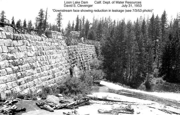
picture155
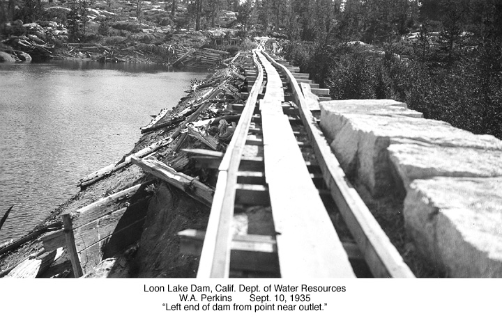
picture156
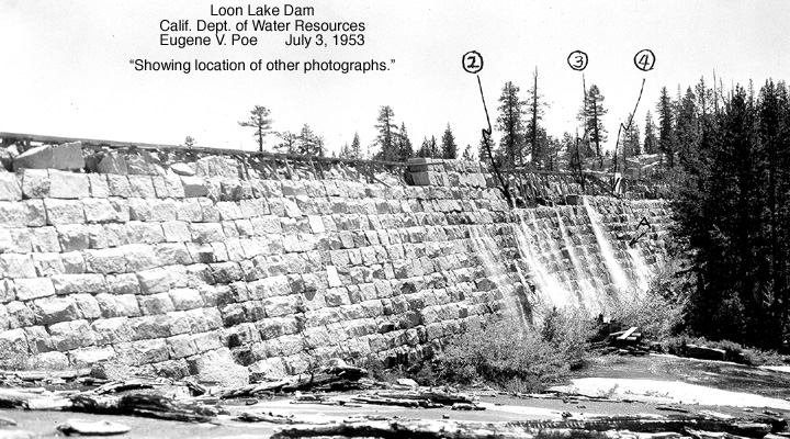
picture135
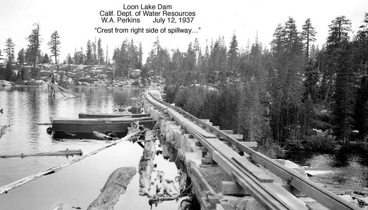
picture150
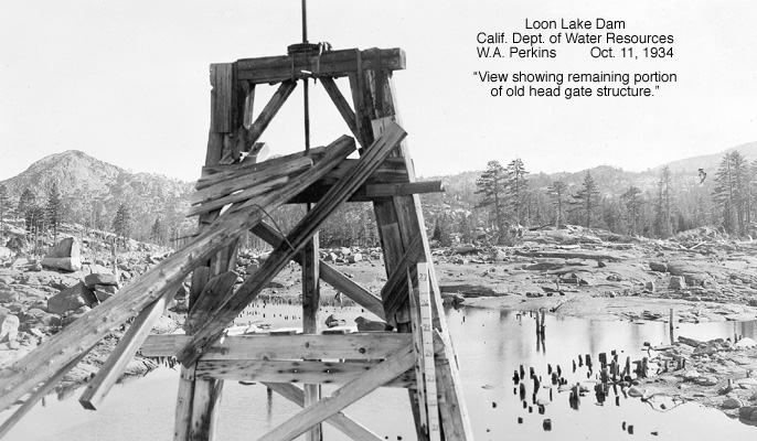
picture145
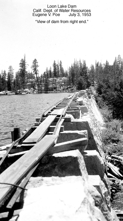
picture149
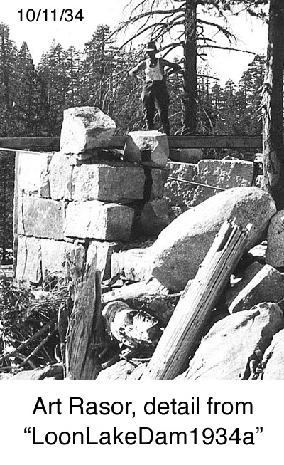
picture153
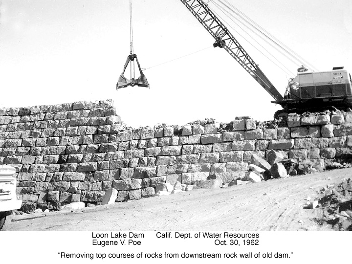
picture154
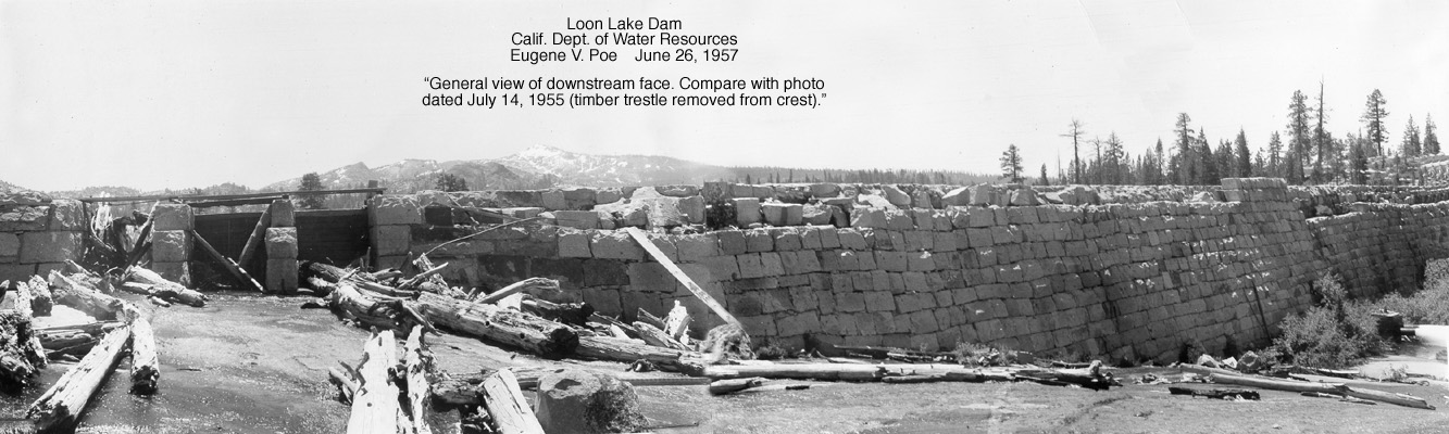
picture144
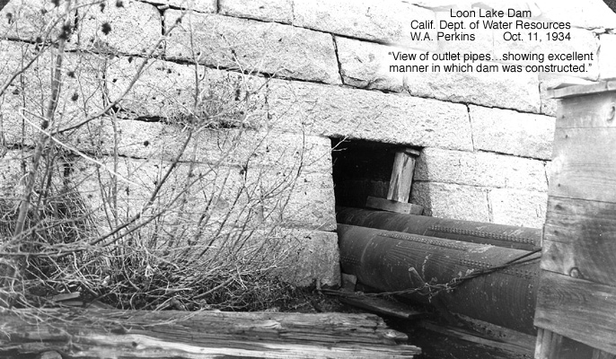
picture148
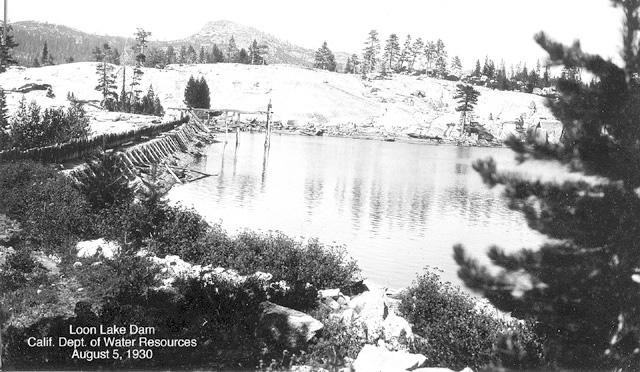
picture131
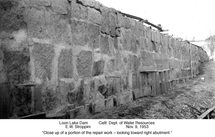
picture151
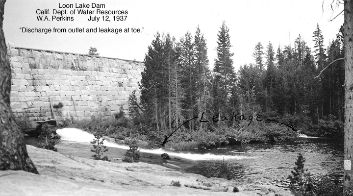
picture142
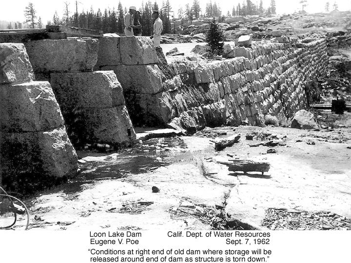
picture139
picture140
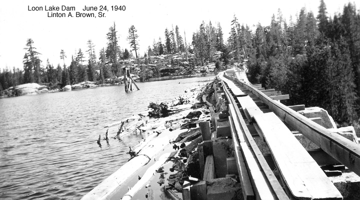
picture146
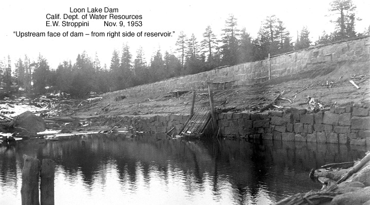
picture143
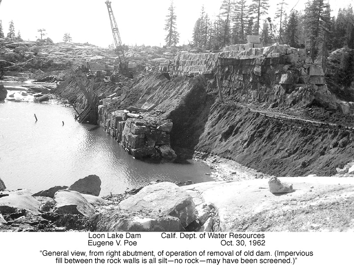
picture136
picture137
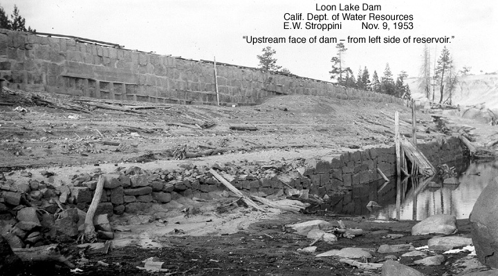
picture138
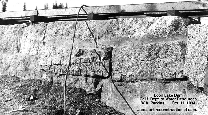
picture152

picture147

picture141
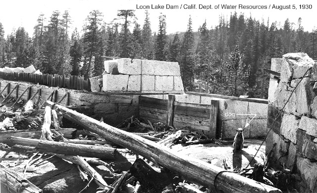
picture127
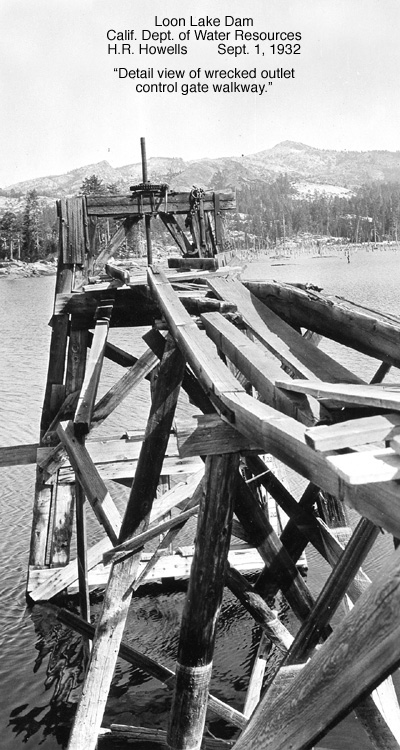
picture125
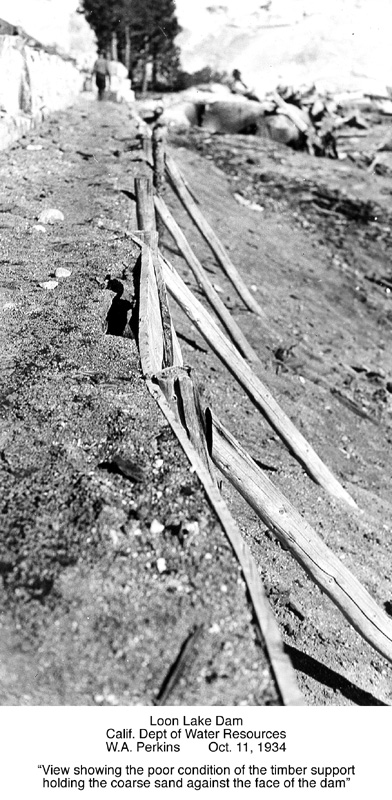
picture130
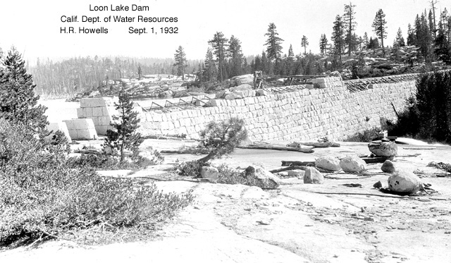
picture129
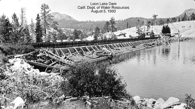
picture122
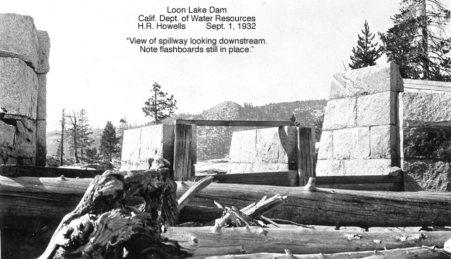
picture132
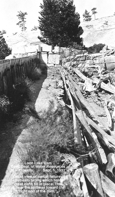
picture126
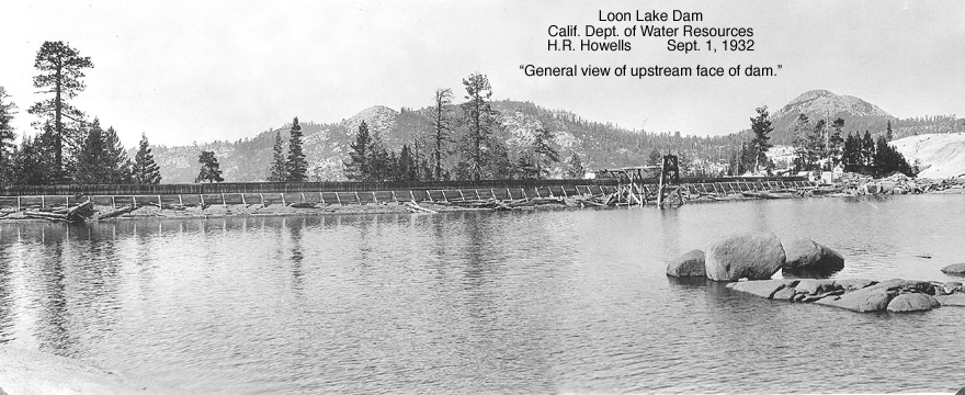
picture128
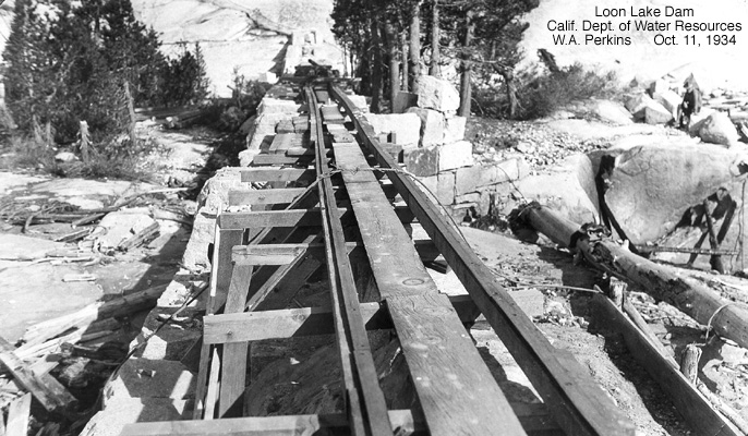
picture134
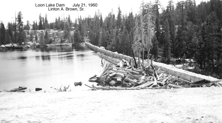
picture133
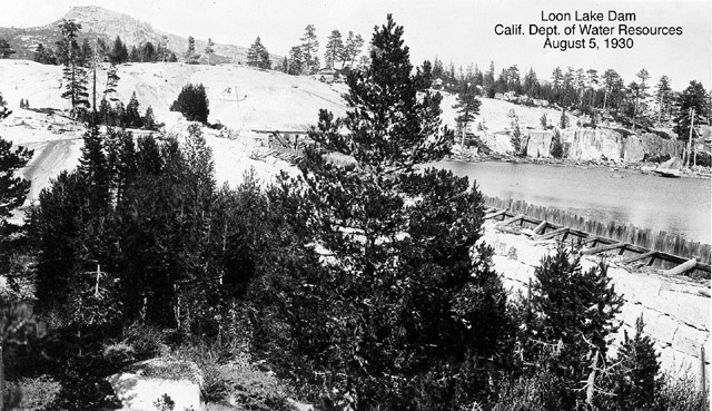
picture124
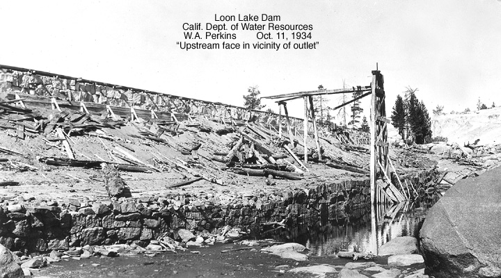
picture123
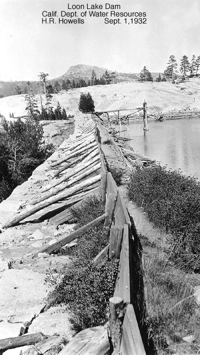
picture121
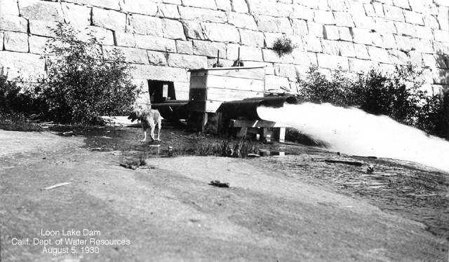
picture120

picture119
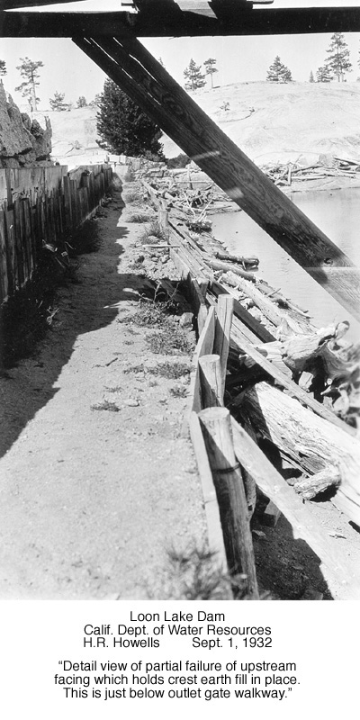
picture118
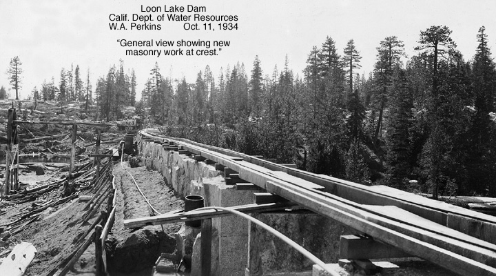
picture117
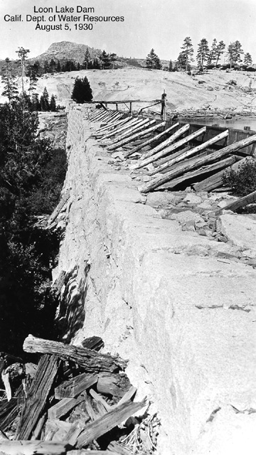
picture116
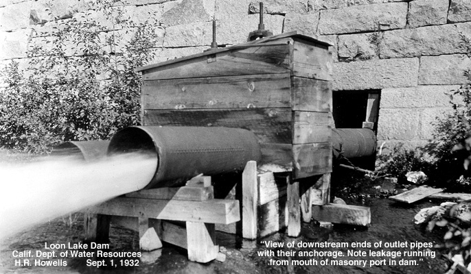
picture115
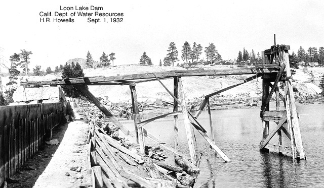
picture114
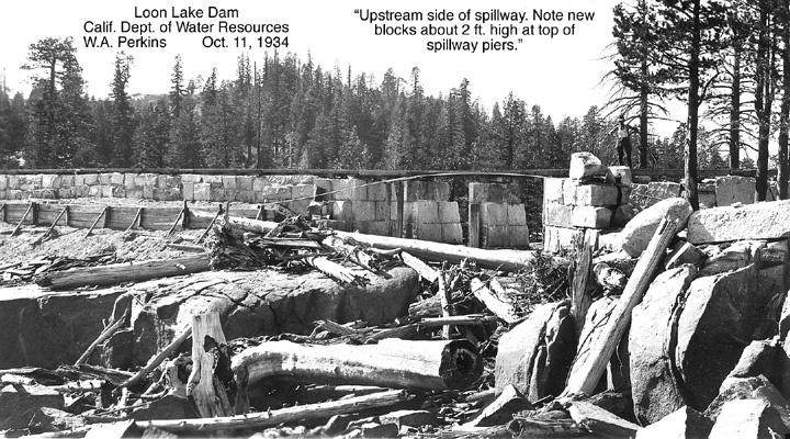
picture113
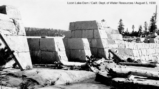
picture112

picture111

picture110
The following photo gallery includes copies of official State of California Water Department inspection documents
written as a result of various inspections and additional work on the Loon Lake Dam between September of 1934 till mid year 1953, Georgetown Divide Water District documents, including a couple old newspaper articles on the raising of the dam’s height and cracks in the dam due to atomic bomb tests in the early 1950s. These documents were also collected by Lint Brown during his research work in 2002 on the Ditch Camp at South Fork and shared with me. I have put them up here so that others with a historic interest in our area of the forest might enjoy them as I do…..a very interesting read as well….enjoy and many thanks to Lint Brown……..

picture107[1]
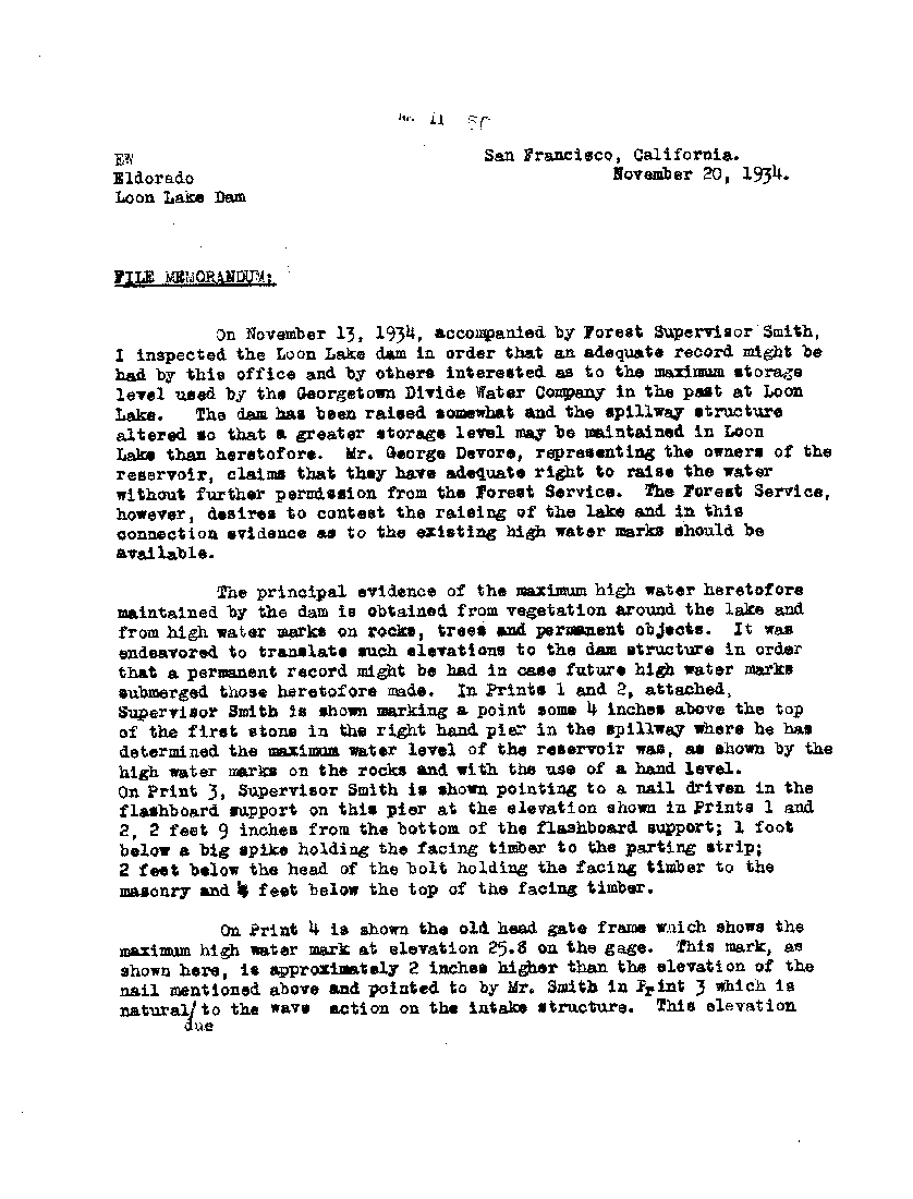
picture107
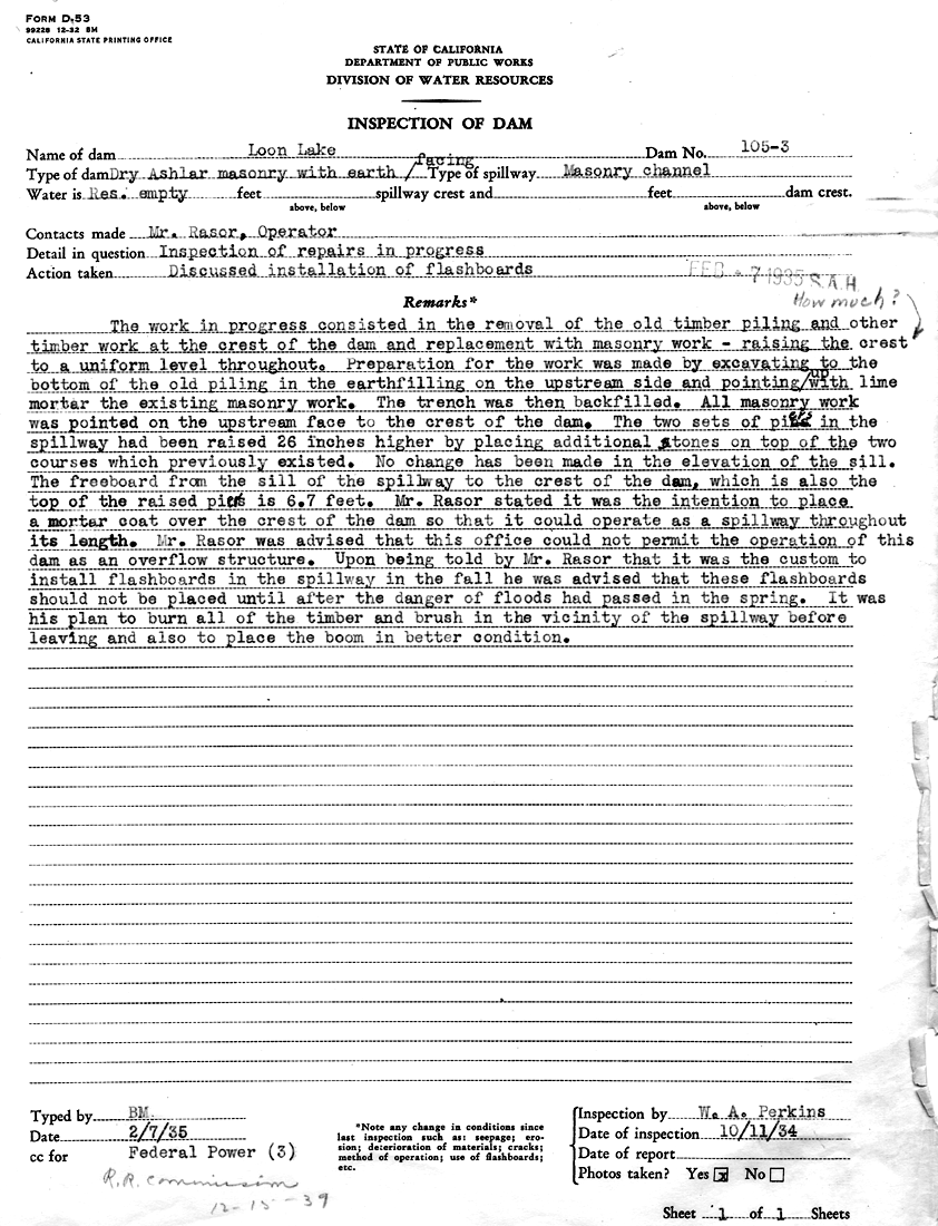
picture106[1]

picture106
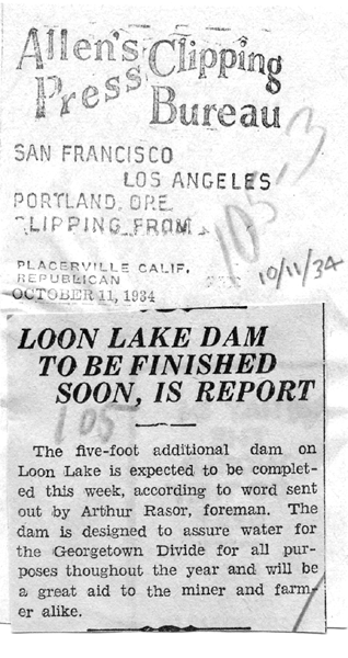
picture105[1]

picture105
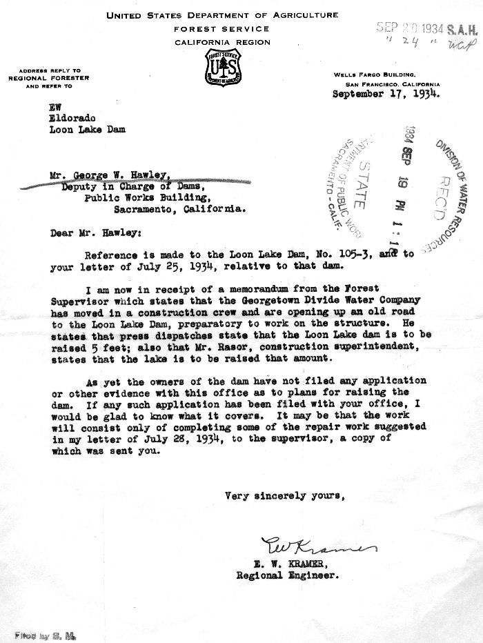
picture104[1]

picture104

picture103[1]
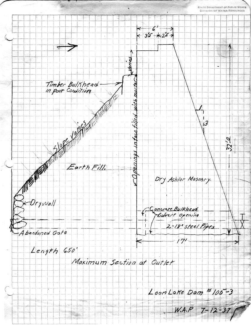
picture103
picture102[1]

picture102

picture101[1]
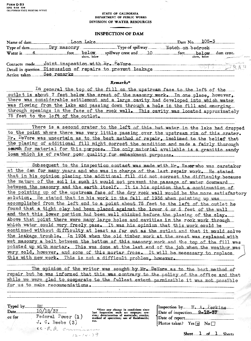
picture101

picture100[1]
picture100

picture099[1]
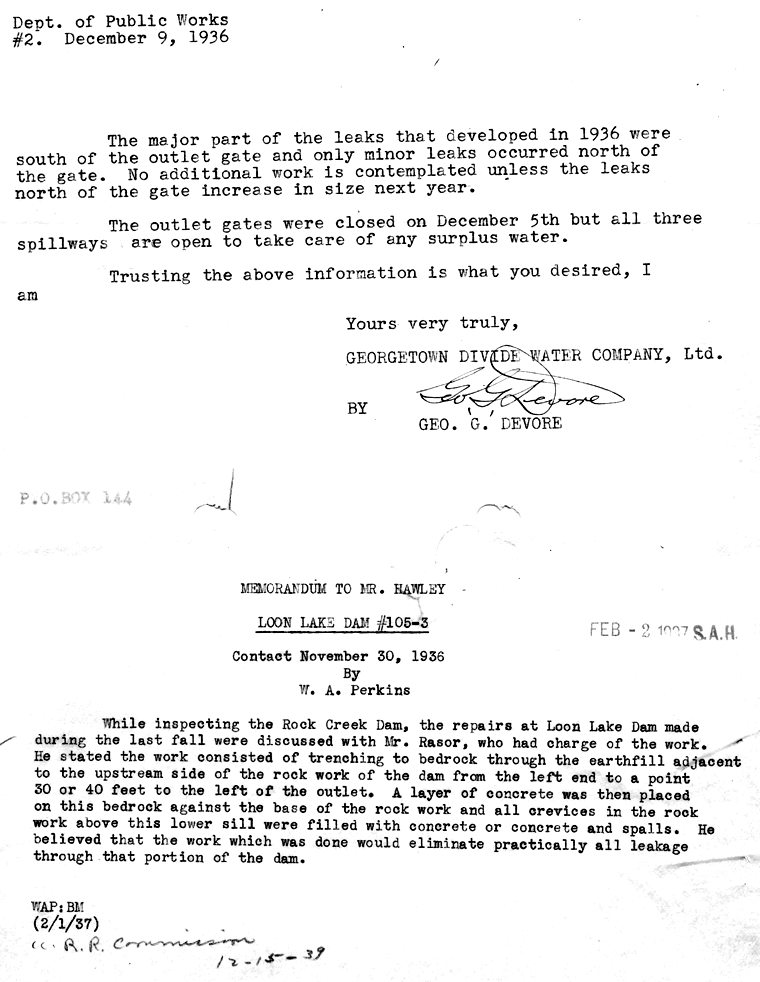
picture099
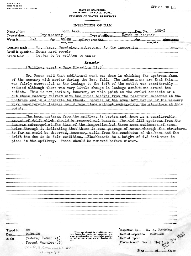
picture098[1]

picture098
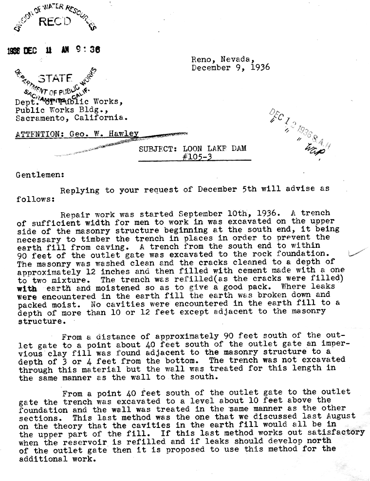
picture097[1]

picture097

picture096[1]
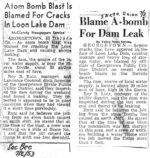
picture096
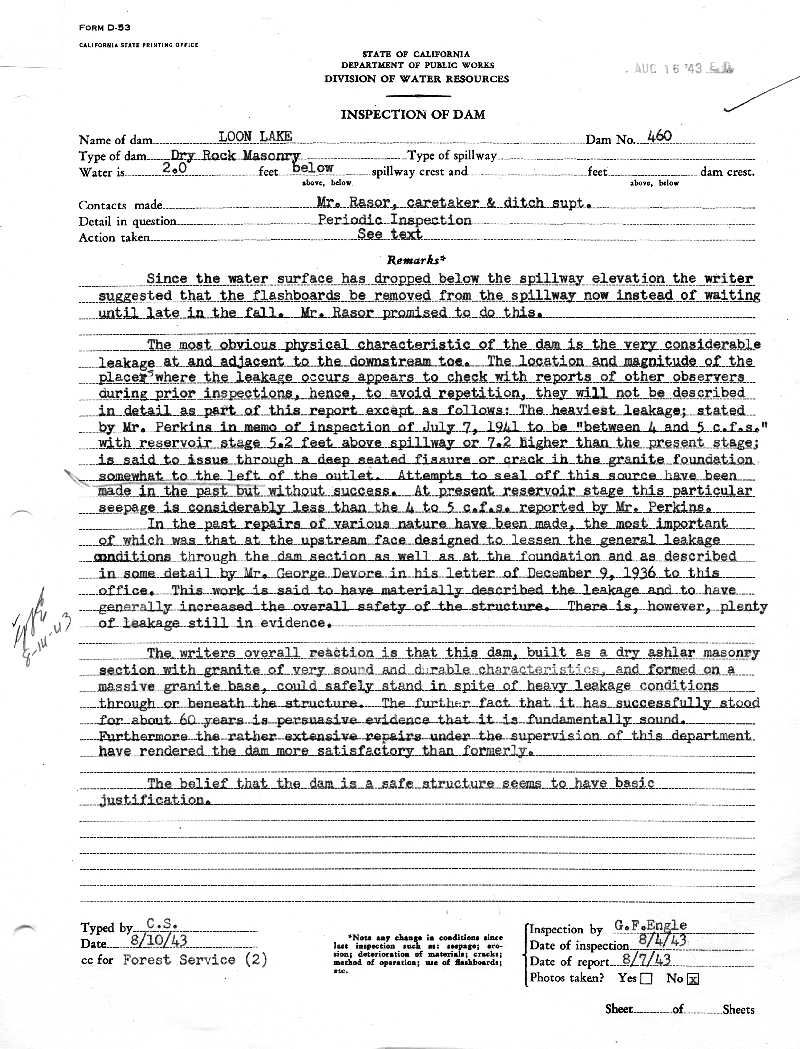
picture095[1]

picture095

picture094[1]
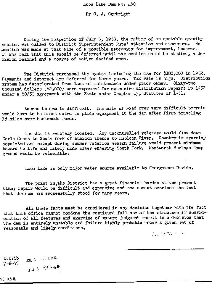
picture094
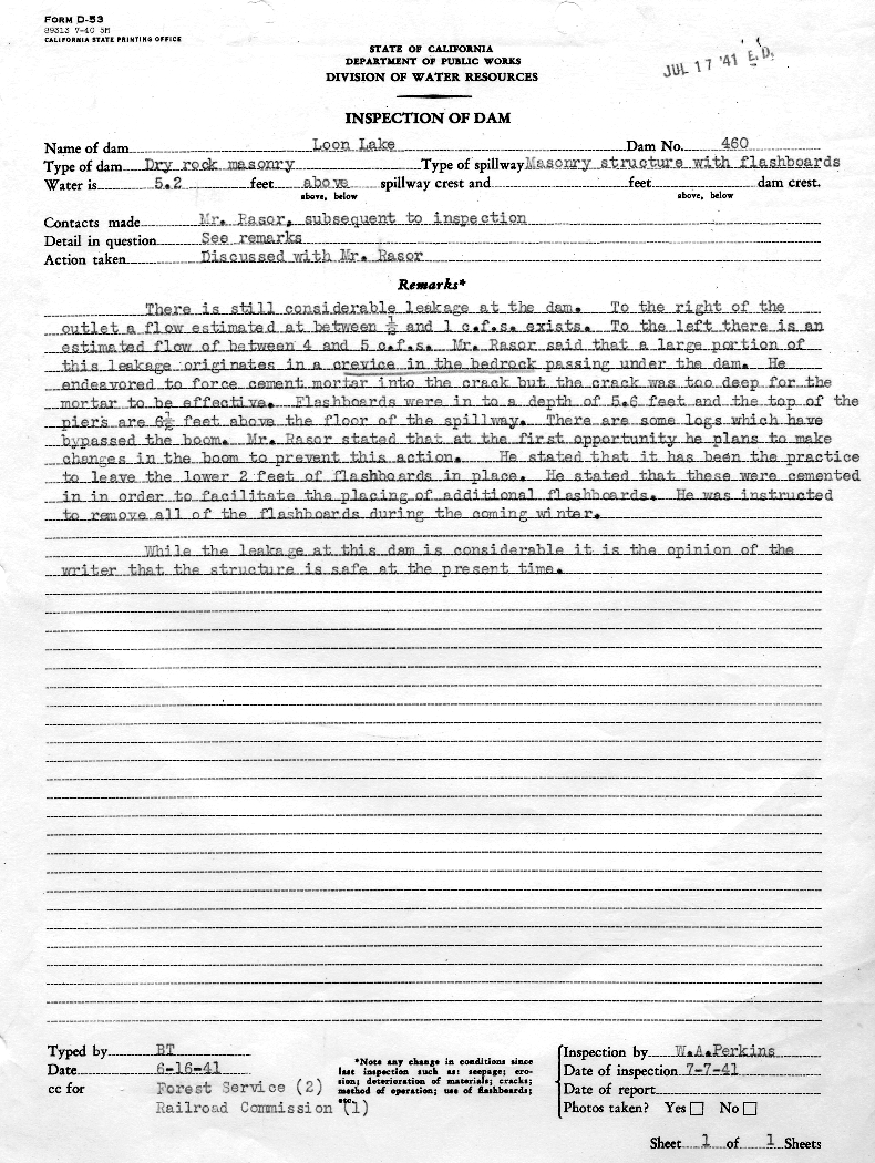
picture093[1]

picture093

picture092[1]
picture092
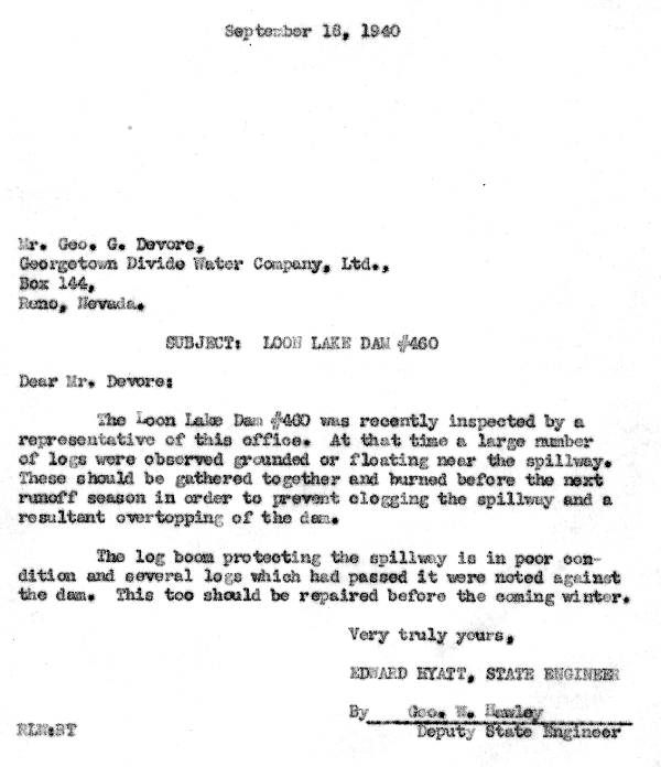
picture091[1]

picture091

picture090[1]
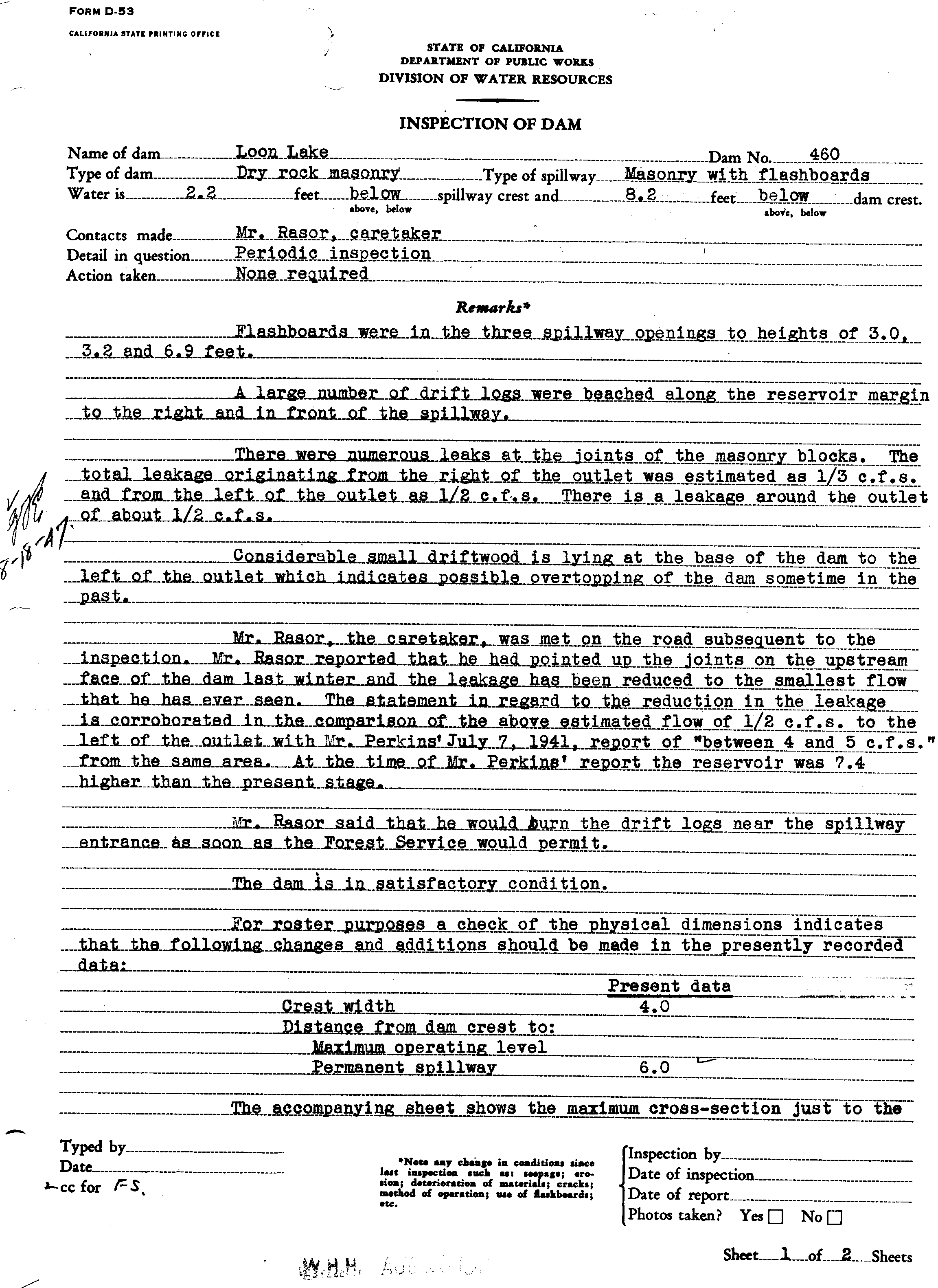
picture090

picture089[1]

picture089
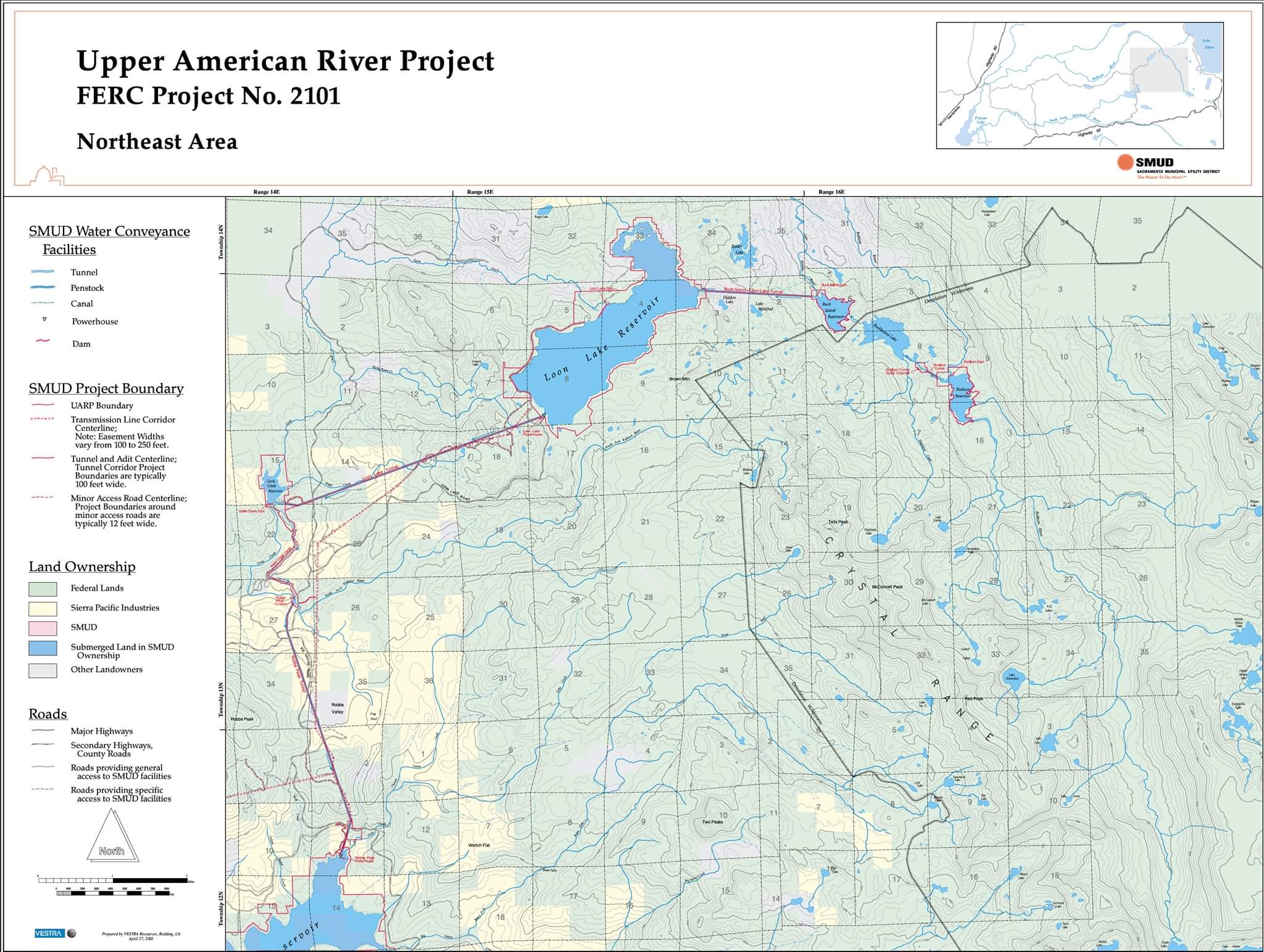
Leonardis Ranch
 This is a Jonni Hill photograph of the ranch contributed to help with the history of important places and people in El Dorado National Forest and County, which was used as a basis for one of her original paintings. Jonni Hill is a noted artist of people and early places in El Dorado County. Many of her works are displayed in Robb’s Resort. Our family personally owns one of her wonderful Native American paintings. You can find out more about her art work at High Country Sketches.
Loon Lake Aircraft Crashes /Mishaps
Georgetown Gazette July 6, 1922
“An airplane belonging to a man named Hunt of Sacramento, and occupied by himself and a friend, in making a forced landing, skidded into the north end of Loon Lake Sunday afternoon, and into the rocks at the edge of the lake. The machine was badly damaged but the men escaped unhurt, and walked to McKinneys(Lake Tahoe), twenty miles away, from there they went to Reno, their destination. Engine trouble was the cause of this accident.
This photo of the Irwin Hunt airplane crash on the North side of Loon Lake Dam on Sunday afternoon, July 9, 1922, was kindly shared by Chris Baird of Arizona Wrecks. arizonawrecks@cox.net
Hunt Crash Photo 1 Hunt Crash Photo 2 Hunt Crash Photo 3 Wikander of Buck Island Lake Lint Brown Loon Lake Airplane Crash Location
This airplane crash was covered quite well at the time in newspapers with articles written in the Woodland Democrat, Woodland, Ca, the Georgetown Gazette, Oakland Tribune and the Reno papers. It was most probably written about in the Sacramento Union and Bee as well. The most interesting aspect of this mishap is that it was witnessed first hand by Vic Wikander of Buck Island Lake. He and a friend who had been out hiking were at the time sitting on the shore of Loon Lake, enjoying their lunch, when this flying machine come down, circled the lake and then made the landing on the lake which ended up in the rocks on the north shore. This whole story is included in the above Wikander article published in 1950 in the Reno paper. Though the article says this event happened in the Summer of 1925, this oversight was due to the time passed since the event and Vic’s memory of so many years in the past It is quite a read and the whole article is available above via the highlighted link. The pilot, Irwin Hunt, was a famous young dare devil pilot who lived in Woodland and barnstormed around the country. Accompanying Hunt was a Warren Gould of Reno. The airplane with both men aboard was en route to Reno to began a series of flying exhibitions in Reno and around the country. The airplane suffered some sort of engine difficulty causing Hunt to make a forced landing reported in some of the papers as landing on the lake and skipping across and coming to rest up in the rocks and granite on the north edge of the lake very close to the original granite block dam. The Woodland Democrat reported in the article that they intended to make repairs on the aircraft, estimated to cost $3500 at the scene of the accident and actually fly this airplane out of the crash position on the north edge of the lake and dam.
Reviewing various sources, we have not be able to tell whether Irwin Hunt and his associates ever rebuilt this airplane onsite and flew it away, although it was removed in some manner, yet to be determined.
As a final note about the photographs, we are curious about who the people were that took these photos and who might have provided the horses to visit the site. I think it highly unlikely that these visitors trucked their own horses in but rather made arrangements with any number of the many ranches which surrounded this area, from the Wagner Brothers at Gerles Ranch, Jerretts of Wentworth Springs, Jacobsen’s of Jacobsen’s Meadow, Francis Cow Camp, the Devore’s at South Fork Mill, Forni’s of what is now VanVlecks, Orelli’s of Robbs Valley, Bassi…or even the US Forest Service Ranger at Wentworth Ranger Station, a mile east of Wentworth Springs, and just barely a mile down Gerle Creek from the dam. In those days this ranger station actually had a FS telephone for communication purposes. The list goes on. My sister, Karen Brattland points out, that these horses “appear to be “ground tied” which is an old cowboy thing. You train your horse to stop and stay in one spot by dropping your reins on the ground–he’s suppose to understand that he is tied to something solid and un moveable. Very useful out where there is nothing solid to tie a horse to.” This suggests the horses indeed came from one of our local ranches. The people in these photos could very well be some of our locals to this overall area of the Eldorado National Forest and not associated with the airplane ownership. Lastly, many of our forest service people still got around the forest during this period on horseback, so they could be from the Forest Service
Credit for the research on this interesting event in the past history of Loon Lake and it’s historic dam includes Monte Hendericks, Eldorado National Forest expert on airplane crashes and crash sites here in the Sierra Nevada, Chris Baird of Arizona Wrecks, Lint Brown, author of “SIXTEEN SUMMERS ON THE DITCH, Memories of South Fork and Gerle Creek Ditches and Old Loon Lake Dam, El Dorado County, California,” Linton A. Brown, Red Bluff, Ca, February, 2003, the late Judge Wil Johnson and myself. Earlier in the Summer of 2008, I came across the old article from the Georgetown Gazzette which peaked all of our interests as we had been following up on reports of another airplane crash below Loon Lake Dam in 1931-1932 which Judge Johnson remembers visiting and seeing from about 1932. Later in 1946 as a young person, Lint Brown was shown the remains of an airplane crash down below the dam by the late Art Razor of the Georgetown Divide Water District in 1946. Lint Brown created a very nice graphic map of Loon lake identifying the location below the dam where he remembers being shown the crashed airplane remains. Les Clementsen of Stone Cellar, has also reported seeing the same crashed aircraft below the dam in his lifetime of working and living in our area. Wikander in the 1950 Reno newspaper article also talks about the bits and pieces remaining from a airplane crash. Well, in early 2009, Chris Baird, an aircraft crash site historian in Arizona purchased several very old airplane crash photos (photos 1, 2 and 3 above) including the above photo plus several others off E-Bay. The photos came out of an old personal album which had the pictures described as Greimes Airplane Crash. Greimes was another aerial daredevil who during the 1920 to 1923 period lived in California and performed with various dare devil pilots of the day as a wing walker. It was not until 1925 that he moved to San Antonio and learned to fly at Brooks Field. Chris published these photos on a aircraft crash site blog asking if anyone might have any information on this mishap and where it might be. Monte Hendericks reads the same blog, saw the photos and immediately recognized the location as Loon Lake from the above photograph which has our Guide Peak next to McKinstry Lake, Eldorado National Forest in the picture. Knowing about the Georgetown Gazette article on the 1922 airplane crash he shared the photos with myself. I could immediately see the same location as Monte, as did Lint Brown and Krista Deal of Pacific Ranger District. Chris Baird, Monte Hendericks and Lint Brown have all done exceptional jobs of digging up further documentary information on Irwin Hunt which gives us more knowledge about the pilot. During this period, he was in a partnership with William Moffett who later died in a Navy airship crash as a Rear Admiral. Naval Air Station Moffett Field, in Mountain View, California was named for him. Unfortunately for Irwin Hunt, in 1925 he had a fatal crash during one of his barn storming events where he was giving paid rides to the public, killing himself and his passenger.
As a footnote, we are continuing in our research on this crash and would like to hear if anyone can provide any documentation on how this demolished airplane as the newspapers described it was removed from the location. I think it was extremely unlikely that if it could be rebuilt on site, that it could have been flown out.
This is a August 2009 Lint Brown photo matched with the 1922 crash site photo. he has recently returned from a search of the crash site at Loon Lake for old debris.
Snow Survey Helicopter from Rogers Helicopters Stranded at Loon Lake February 1, 1960 due to Snow Storm
Here is the Mountain Democrat Article of the day discussing this event up at Loon Lake. Thanks to Lint Brown, author of “SIXTEEN SUMMERS ON THE DITCH, Memories of South Fork and Gerle Creek Ditches and Old Loon Lake Dam, El Dorado County, California,” and the retired Director of the California Division of Water Resources for Northern California, who did all the sleuthing on this article when I shared it with him. He had worked with both of the two Division of Water Resources employees involved and contacted Jack Hannaford about the event. Rather than a simple e-mail response, Jack wrote a nice article about the event which is linked below. Jack makes it clear on what really happened and where they stayed since the article suggested they stayed at a cabin at Loon Lake which in the pre 1962-63 enlarged Loon Lake Dam days, there never was any buildings there at the lake since the early 1880s when there was some sort of large barracks building to accommodate the many workman who lived at the lake and worked on the original granite block dam. This building survived till about 1890 or so when the Winter snow crushed it. He offers some background on what the survey does and the conditions of the snowpack and water content for the Winter of 1959 to 1960. This event happened well before the new road and in the days when it could take 3 hours from Highway 50 or Georgetown to get to Gerle Creek on the roads of the day, let alone Loon Lake which needed 4wd for the last two miles passing Schlein Ranger Station for the crawl over Chipmunk Bluff and down to the South end of the lake during the Summer. In the Winter, this was a completely isolated area period…..and very unfriendly to anyone not prepared which was not the case here. As a final note about this event, Harry Rogers of Rogers Helicopters, Fresno, California, went from a very small commercial helicopter service in 1960 to one of the biggest commercial helicopter operators in the State of California today. His aircraft work around the state and country for civilian and government customers………..Enjoy the “Rest of the Story”………
The Golden Empire Council of the Boy Scouts of America in Sacramento, Ca acquired about 5 acres of shorefront property directly East across from Loon Lake Dam, where they constructed a Boy Scout Camp beginning early Summer, 1964. Due to the
location of the new camp, all materials had to be transported by water to the camp as there was no roads and only a trail along the East side of the lake from the Campground to the Boy Scout Camp. Two full summers, 1964 and 1965 were required to construct the present main lodge building on the site, and build the septic system. The camp was envisioned as a base camp where the scouts would then begin their main camping experience from by hiking into the Desolation Valley Wilderness area. I was one of the two dozen scouts and the oldest(only Scout with a drivers license) who worked full time the entire Summer of 1964 and 1965 helping to build the camp, living at the camp from June till August of both years. I drove the tractor, the camp Ford dually flatbed truck and boats and barges (A picture of the 16 year old author on the camp John Deere Tractor awaiting another barge load, Summer of 1964, taken by my late father, Gordon A. Brattland) used to haul all the building materials from the campground to the camp via the water. The main lodge has special glue lamb beams custom made for this unusual shaped lodged, hauled up by truck to the campground and then hauled intact via barge to the camp where they were raised using a large Gin Pole by the US Navy Seabees from the Sacramento unit who spent two weeks active duty at the camp for this purpose. Loon Lake BSA pics 1, 2, 3, 4, 5, 6, Here are some later photos taken during a visit by my father Gordon and myself during the mid 70s via our fishing boat to the camp which very nicely show the main lodge which was the end result of all the work of the Summers of 1964 and 1965…..Pic#1, Pic#2, Pic#3, Pic#4 The summer of 1964 and 65 were the two best summers of my early life.
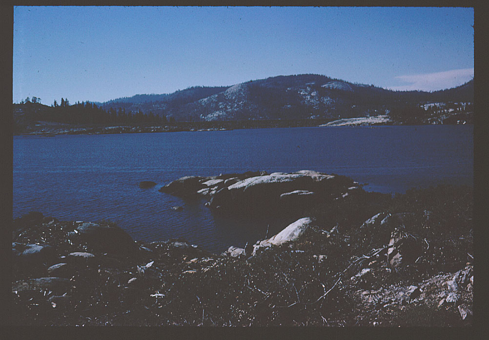
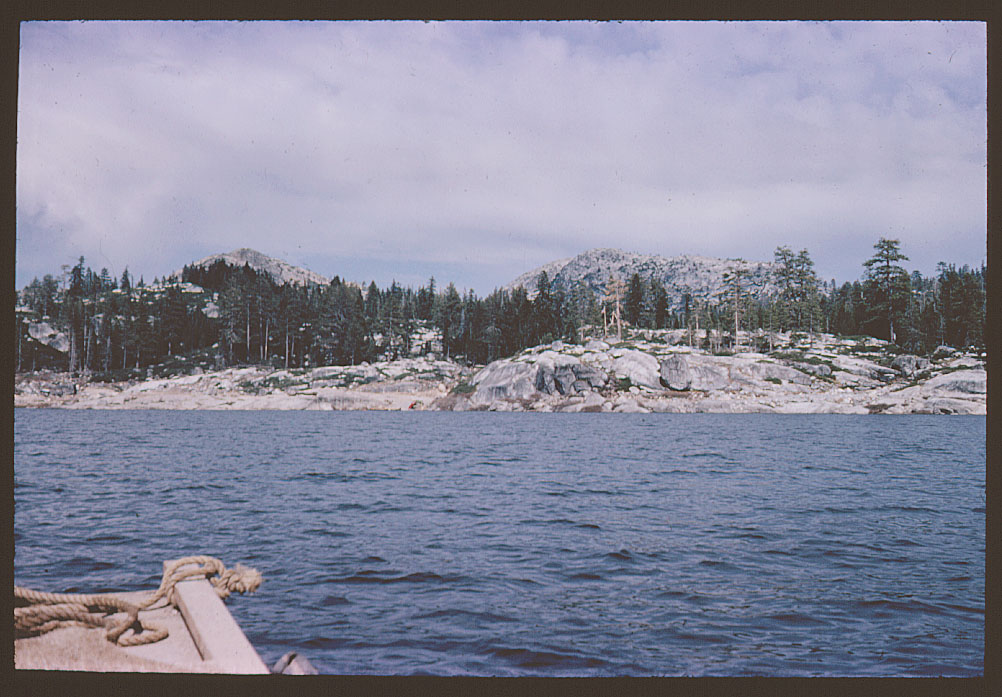
This original Boy Scout built camp is now Deer Crossing Camp and has been now since 1983 a private summer camp which offers the same types of activities originally envisioned by the Golden Empire Boy Council of the Boy Scouts of America in Sacramento when this camp was built on the lake.
For the official history of the Golden Empire Council’s Loon Lake Boy Scout Camp, try this abbreviated part of the overall History of the Golden Empire Council itself. If you look at the Loon Lake Staff Photo on page 80 of the abbreviated Loon Lake Camp history, you will see me as a 17 year old in the top row middle of the official BSA photo.
Loon Lake Road -Click on the maps for more details-According to Les Clementsen of Stone Cellar (Clementsen,’04), by the mid 1930s, the Airport Camp or Camp Gerle at Gerle Creek was a Civilian Conservation Corps (CCC) Side Camp with a local man named Joe Flynn in charge of it. In his regular Mountain Democrat Column, Three Amigos from September 4, 1998, Joe Flynn indicates in the summer of 1940 he was in charge of the Airport CCC Side Camp with 30 men working for him. Among the projects they worked on that summer was making the road from Schlein’s to Loon Lake a better road. Joe Flynn was a local El Dorado County resident who went off to the Army Air Corps to fly during WWII, returning after the war to study at Oregon State and returning to work for the Forest Service eventually becoming the Forest Supervisor of Eldorado National Forest. After retiring from the Forest Service he would continue in active public life eventually being elected as a El Dorado County Supervisor. For more detailed history about Joe Flynn, see the Joe Flynn USFS Retires Reunion Living History Project Feb 9 2001, Nordstrom Whited Interviewer oral history done through UCB.
Loon Lake Road 1943
Loon Lake Road 1950
Lower Bassi Ranch, Union Valley -1860s- Lower Bassi Ranch in Union Valley was removed during the construction of Union Valley Dam and the reservoir. The Pacific Ranger District Map of 1950 shows the ranch in the upper north east section of Union Valley very near the power house. The first picture is from the 1940s-50s while the final two are probably just before the reservoir area was cleared for the dam around 1960. The pictures below were provided from the Swift Family collection of photos by Michael Kuhl of Swift Ranch, Union Valley, Ca. Click on the map to view the original 1875 Survey Plat showing Lower Bassi Ranch in 1875. See also Upper Bassi and Swift Ranches.
1st picture to the left-This is the barn and corrals, which were west of the cabin. Picture was probably taken in late 1940s, early 1950s. Unable to identify the individual standing next to the loading chute. 2nd picture to the right This photo looks east towards the cabin. Much later, possibly right before they started clearing the area for the lake. Notice that the corral with the feeding troughs and tree in the previous photo are gone.
This was taking at the same time that the previous photo, this time looking west towards the barn. I believe the fellow is my grandfather Rufus Swift- Photo comments by Michale Kuhl Swift Ranch.
Loon Lake Power House Tour-Video-SMUD
Thanks to Tim Green from Loon Lake Dam for sharing this interesting video and the SMUD Map image and pdf.
Loon Lake identified in Amos Bowman’s 1874 Report and Map prepared for the directors of the California Water Company and probably so named due to the presence of Loon’s, a type of bird (Gudde, 1969) and is also the headwaters of Gerle Creek.
The following is a report from the Mt Democrat on the fine lakes in the area of Wentworth Springs from the September 23, 1882 issue of the newspaper. “Our Lake Region-Within a radius of one and one half miles of Wentworth’s Springs are five beautiful little lakes, varying from 15 to 80 acres in size. The altitude of the Springs is about 6,200 feet, or about the same as Lake Tahoe, and those little lakes are from 300 to 500 feet higher than the Springs. Groves of Tamarack surround these lakes, and a beautiful little meadow usually found adjoining. We learn that one of these lakes has been stocked with trout, and that Mr. Wentworth intends to stock the others next Spring. Loon Lake, two miles Southeast, and nearly 200 feet higher than Lake Tahoe, is a natural body of pure fresh water of some 1300 acres of surface, and in places 40 to 60 feet in depth; but since the construction of the dam, its size has been greatly increased, and will, when the monster granite dam now being built by the California W. & M. Co. is completed, embrace an area of about 7 square miles. Strange to say, until of late years this lake contained no fish. A few years ago some trout were put in, but until recently, it was supposed the fish did not live; now it is known that they have done well, and with the new supply added, it is believed that Loon Lake will become a favorite fishing resort in the near future-Georgetown Gazette”
Loon Lake Boy Scout Camp-Deer Crossing Camp
Loon Lake Boy Scout Camp-Deer Crossing Camp. For the official history of the Golden Empire Council’s Loon Lake Boy Scout Camp, try this abbreviated part of the overall History of the Golden Empire Council itself. If you look at the Loon Lake Staff Photo on page 80 of the abbreviated Loon Lake Camp history, you will see me as a 17 year old in the top row middle of the official BSA photo.
Loon Lake Road
Click on the maps for more details-According to Les Clementsen of Stone Cellar (Clementsen,’04), by the mid 1930s, the Airport Camp or Camp Gerle at Gerle Creek was a Civilian Conservation Corps (CCC) Side Camp with a local man named Joe Flynn in charge of it. In his regular Mountain Democrat Column, Three Amigos from September 4, 1998, Joe Flynn indicates in the summer of 1940 he was in charge of the Airport CCC Side Camp with 30 men working for him. Among the projects they worked on that summer was making the road from Schlein’s to Loon Lake a better road. Joe Flynn was a local El Dorado County resident who went off to the Army Air Corps to fly during WWII, returning after the war to study at Oregon State and returning to work for the Forest Service eventually becoming the Forest Supervisor of Eldorado National Forest. After retiring from the Forest Service he would continue in active public life eventually being elected as a El Dorado County Supervisor. For more detailed history about Joe Flynn, see the Joe Flynn USFS Retires Reunion Living History Project Feb 9 2001, Nordstrom Whited Interviewer oral history done through UCB.
Loon Lake Road 1943
Loon Lake Road 1950
Lower Bassi Ranch, Union Valley
Lower Bassi Ranch, Union Valley-1860s– Lower Bassi Ranch in Union Valley was removed during the construction of Union Valley Dam and the reservoir. The Pacific Ranger District Map of 1950 shows the ranch in the upper northeast section of Union Valley very near the powerhouse.
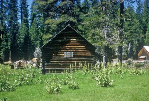
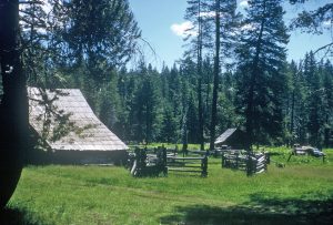
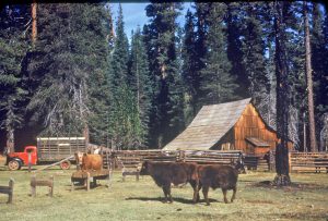
Marys Lake Named most probably for Mary E Wentworth. Nathan Wentworth discovered the Wentworth mineral springs while deer hunting in 1879. (Sheryle Rambeau, 2010)According to the 1880 Census, Nathan was married to Mary E. Wentworth and had three children, Lillie. N. Wentworth, Frank Wentworth and Guy E. Wentworth. Mary’s Lake one of the original separate little lakes which made up the original Loon Lake before the Loon Lake Dam of 1882 was most probably named for Mary Wentworth.
McKinstry or Bennet Lake, McKinstry Peak and McKinstry Meadow This map is a copy of the original survey plat of the area around McKinstry, originally done beginning in 1875 by J.R. Glover, another part of the survey done by L.D Bond in 1877 and the last part of this Township 14, Range 15 East completed by C. F. Putnam in July of 1882. As this is the authoritative original survey of this area by the US Geological Survey, they did not name McKinstry or Bennet Lake, the peak or meadow on this map. See also G.M Wheeler Atlas 47B,D,E Sheet Calif, Nev 1876/79 . This was more than likely the result of not having or knowing this common name for the area which Amos Bowman knew about when he did his authoritative survey of the Georgetown Divide resources owned by the California Water Company in 1873/1874, who may have had the benefit of dealing with people who were more familiar with this area due to their work and employment in this area, associated with the California Water Company. McKinstry Lake or Bennet Lake is noted as “lake” on the map in section 19, just West of the peak noted as “High Peak” on the map in section 20. The peak noted as “High Peak’ is not McKinstry, but rather what we call Guide Peak. The surveyors managed to draw it slightly more to the West than it was. McKinstry peak was not highlighted by these original surveyors as it would be on the bottom line of section 18 or the top line of section 19. The larger lake noted as “lake” on the section 29 section 32 line is what is now known as Bugle Lake, above Wentworth Springs. The “farmers house” to the West of McKinstry or Bennet Lake and not named is in fact “Bennet’s Range” so named on the township map immediately to the West of the this sectional. However in the surveyor’s notes for this particular section of township 14N 14E, it indicates at the time this particular section was surveyed, the “farmers house” annotated on the original survey plat was now owned by the Fornis. The surveyor’s notes also spelled Bennett with two T’s” versus one “T.”
 These two pictures, one taken by the Johnson family in 1936 while the other was taken later, most probably late 1940s by the family of Stanley Mueller, Sr, show the US Forest Service sign first up in the tree and later attached to a post on the lake’s edge, identifying McKinstry Lake as McKinstry or Bennet Lake.
Wil Johnson Family photo of McKinstry or Bennet Lake, 1936, showing Mrs Johnson sitting with her son, the late Judge Wil Johnson beside the lake.
Photo taken by the late Stanley Mueller, Sr. of Alameda, CA in the late 1940s provided by his granddaughter, Erica Boivin. As you can see, the original porcelain US Forest Service naming sign of the lake is in both photos. The Mueller picture of the 1940’s shows the bullet hole in the bottom of the sign which by the time of this photo, had been removed from the tree and attached to a post.
The following description is provided by Erwin Gudde…………”The mountain is labeled Mckinstry’s Mountains on Bowman’s map(1873), and M’kinstry peak on sheet 47-D of Wheeler’s atlas. It has been suggested that the name may commemorate George McKinstry, Jr., who was one of the best known of Sutter’s men and the first sheriff of the northern district(1846-1847); it seems more likely, however, that the places were named for Elliott McKinstry, a miner at Oregon Bar in 1866, or Lee McKinstry, a miner in Georgetown township in 1867(Gudde, 1969)”.
 Very nice photo of Joy Brattland sitting next to beautiful McKinstry or Bennet Lake in 1990.
Millionaire Camp was a small cabin on the original road to Upper Bassi Ranch from Union Valley, located on Big Silver Creek, 1/4 mile southwest of the fork of Big Silver Creek and Bassi Creek. The cabin is long gone. The name “Millionaire” evolved from what the original owner 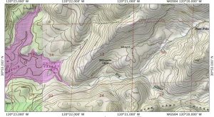 would say regarding his cabin. As the story goes, the owner said he felt like a “Millionaire” every time he stayed at the cabin which stuck as a name. None of the early Eldorado National Forest maps from 1916 through the 1940s showed this cabin and place name, including the original survey plat from the early 1880s but it does appear on the larger geological survey map of this whole section published in 1953 as well as on later forest service maps. This area has morphed into a very popular camping area from the middle 1960s with the construction of the new road from Riverton to Wentworth Springs/Loon Lake due to the
 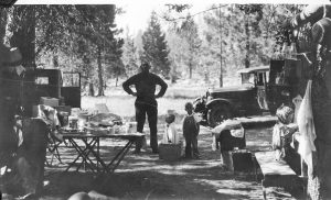 creation of Union Valley Dam and Reservoir. Prior to the creation of the Union Valley Dam and Lake, it was more of a challenge to get to this area either via the road from Riverton to Wentworth Springs through Union Valley and South Fork or via the old Georgetown and Carson Valley Road which cut across through Union Valley, and on to the Georgetown Junction East of Fred’s Place on Highway 50. Richard Cooper has very kindly donated a family photograph of his family camping in the Millionaire Camp area in the 1930s. His family also camped on the South Fork of the Silver Creek at Ice House besides at Millionaire Camp during those early days before acquiring a cabin in the Tahoe area. The picture shows his family in camp at Millionaire Camp with the family car, a 1932 Chrysler Imperial sedan.
Mountain Meadow Spring House Foundation
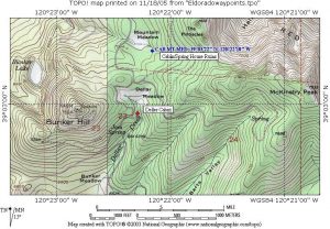 This historic foundation made of stacked granite stones was located by the Forest Service in 1989 during a survey in this area prior to some thinning activities. The rock foundation was the only remains of what was most probably a spring house or small cabin. It is on the edge of Mountain Meadow, about a 1/4 mile North of Deller’s Cabin in Deller Meadow. I believe this spring house or cabin was most probably built by the Deller family. The rock foundation is immediately next to the original trail which went up from Deller’s cabin in Deller meadow around the backside of Bunker Hill down into the Rubicon Canyon and crossed up to the other side. Robert Jerrett of Georgetown and later the owner of Wentworth Springs owned cattle grazing property directly across the canyon from this site. This foundation site is a sensitive area and should not be
 disturbed. It is marked accordingly and unless you know what you are looking for it is all but impossible to find. This rock foundation is about 3 to 4 layers high and has two large red fir growing up within the center of the cabin ruins. The black and white photo is a 1989 photo provided by Krista Deal of the Forest Service showing the ruins as they were uncovered. Many thanks to Krista for sharing this photo. It took me two Summers and about 4 visits with help to finally find these ruins, even knowing in general where they are since there is now dead fall on top and one actually has to be looking right at them to see them. These ruins at one time were right on the regular trail, but this is no longer the case as the alder and forest have taken over. My color photos were taken in October 2005.
Additional pictures Pic 3, Pic 10, Pic 11, Pic 14, Pic 18
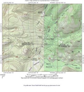 In 1898, William H. Murray filed on 160 acres14N 14E Section 26 Mount Diablo on what is now called “Murry’s Camp or correctly, Murray’s Camp,” just inside the Placer County line on the road to Bunker Hill, just a mile North of Gerle’s or Wagner Bros Cow Camp (Lawyer’s Cow Camp). Title transfer of the land was issued August 15, 1901.
William H. Murray was the son of William H. Murray born in New York State in 1838. His mother was Lucy H. Murray born in 1848. William H. Murray, the son was born in California in 1869. The Murray family lived in Township #1 in Placer County which is Roseville, Ca . William H. Murray was married to Kate Murray born 1878. They had 8 children, Roy, Bill, Kathleen, Carl F., Mallie, Carl, Harrel and James. Both of the Murray families lived in Roseville till the senior Murray and family moved to Pacific Grove, in Monterey County early in the 1900s, showing up on the 1910 census living there. Murray Camp or Murray’s Camp was used exclusively for deer hunting. Murray built a single clapboard sided cabin on the property sometime before 1916, exact date unknown. This cabin is still standing but was moved from it’s original location on the camp to it’s current location. On the US Forest Service  Map of Eldorado National Forest in 1916, Murray’s Camp was formally identified as “Murry Camp,” while the 1931 Forest Service map simply showed the camp identified as “Camp.” However, the 1943 Eldorado National Forest Map identified the camp as “Murray Camp.” The 1950 Forest Service Map returned to the “Murry Camp” identity. The Gerle’s, specifically Charles and later the Wagner Bros were very close neighbors of Murry Camp, eventually leading to the Wagner/Veerkamp family owning most of the original 160 acres which William H. Murray originally filed on in 1898.
Besides being the main trail to Bunker Hill, it was the trail to McKinstry Lake and Bennet’s Ranch in the meadows near McKinsty Lake. This trail was actually formally identified on the earliest maps as the “Road to Bennet’s Range.” There are five cabins at Murry Camp situated on Bart’s Creek. The following pictures of the original log cabins built during the 1900s were taken during a visit Memorial Day, 2004. According to Don Bishop, the new or current log barn was built in 1946, which replaced an older structure. Don Bishop also shared the following about their cabin: The Old Thomas, Now Bishop Cabin was built in either 1934 or 1936 as the information inscribed or etched into the foundation to the left of the front door is partially covered leaving the following for all to view, “F. H. Thomas and Family 19…” Before the Thomas family built their cabin at Murray Camp, they setup a large summer camp for several years in the area of Stumpy Meadows according to Don Bishop. Albert Ninas Cabin 1920s, Blair Bros Cabin Murry Camp Barn at Murry Camp, Old Thomas Now Bishop Cabin Murry Camp Murray Camp5, Murray Camp6, and Murray Family Cabin Now Serpia Family Cabin Murry Camp
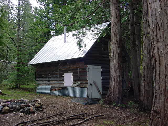
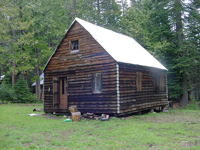
According to John Baughman, the Albert Ninas Cabin was built in the mid 1920s by Albert Ninas. Albert was John and Alvin Baughman’s great uncle. Albert died in 1939 in Auburn, California. John’s brother Alvin Baughman and he own this cabin now.
Orelli’s Ranch was located on the Eastern slopes of Robb’s Peak in the natural meadow of Robbs Valley and is first shown on the  Bowman Map 1873 and G.M Wheeler Atlas 47B,D,E Sheet Calif, Nev 1876/79. The ranch building is now only ruins. The following map shows exactly where the ranch building ruins are as shown in the picture below:
Oreli Ranch ruins Robbs Valley, October 2006
Palmer House-Union Valley
Pino Grande-Michigan California Lumber Company, Saw Mill , Logging Railroad & Mill Town-1892-1951
 Pino Grande Mill Town-About 1902
There has been considerable material written about the lumber mill at Pino Grande which was the hub of the logging, narrow gauge railroad of the Michigan California Lumber Company. For starters read R.S. Polkinghorn’s “PINO GRANDE, Logging Railroads of the Michigan-California Lumber Company”, Howell-North Books, Berkeley, California, 1966/Revised/Enlarged Edition Trans -Anglo Books, Glendale, California 1984.Professor Polkinghorn’s books are the authoritative documents for lumbering on the central Georgetown Divide-Eldorado National Forest areas during the late 19th Century through the middle of the 20th Century.
Pino Grande Michigan California Lumber Railroad Video 1939-1941…Thanks to George Mihal
For a quick read on Pino Grande try the El Dorado County Historical listing
or try this slide show on early photos of the Pino Grande Mill and Michigan California Lumber Railroad
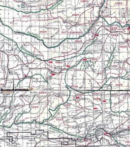 Pino Grande 1916
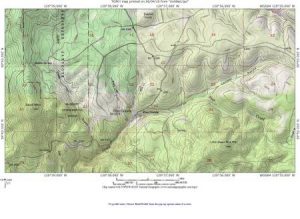 Pino Grande Site-El Dorado County, Eldorado National Forest
Riverton Hotel, Riverton, California-Riverton or River Side Hotel-Known originally as Moore’s Station,  named for the owner, John M. Moore, an early California toll road owner and operator. Moore’s toll road ran between Sacramento and Virginia City, Nevada. Moore was from San Francisco where he was a former member of the San Francisco Vigilance Committee (Gudde 1969). Moore’s Station was also known in early years as River Side or the River Side Hotel, was also a stage and Pony Express Stop from the 1850s. River Side Hotel or Moore’s Station was described in the personal journal of Jesus Maria Estudillio regarding his travel from San Leandro to Lake Tahoe on September 3, 1864, quoted in full by Cross(1954):
“About half past six we reached River Side (Riverton) (Hotel). Here we stopped for the night. No better name could have been given to this place for part of the house is built on the very river and
swishing waters pass below, making a terrific noise. There is but one house and this is in the one we stopped. If the supper was not of the best kind, I can say that we had better beds than at Placerville.”
 In about 1895 when Moore’s Station was to become a post office, since there already was a post office called Moore’s Station in Butte County in Northern California, an alternative name for Moore’s Station or River Side Hotel was necessary. Hereafter, Moore’s Station or the River Ride Hotel became Riverton and a official post office from 1895 (Gudde 1969). The Riverton Hotel remained an important way point for travelers on the Placerville Carson Valley Road, the Placerville Road, Emigrant Ravine Road, the Lake Tahoe Wagon Road , or simply “Johnson” Cut-Off”in the very early days which eventually was known as California State Highway 50.
Riverton was the jumping off point for driving into the Crystal Basin including Ice House, Union Valley, South Fork, all the many ranches, Airport Camp, Gerle Creek, Wentworth Springs and Loon Lake. The original Riverton Hotel was lost in a fire on November 2, 1928, but the owner and proprietor at the time, Albert M. Martin vowed to rebuild immediately which he did. (Mountain Democrat Nov 2, 1928) Later in the very early 1960s, the Riverton Hotel burned down for the final time and was not replaced, but the name remains to this day along with the historical monuments to this important stopping location on the Placerville Road to Lake Tahoe or Highway 50.
 The Riverton Hotel was a special place to visit and stay. Lint Brown’s parents chose it as their honeymoon location in 1934. Here is a photo of Lint Brown’s mother, Daisy Brown standing in front of the Riverton Hotel and one of the cottages during her honeymoon stay , August 30, 1934, the day after they were married.
For additional historic pictures of the Riverton Hotel, see “THE WIRGHTS LAKE STORY,” The Historical Committee of the Wright’s Lake Summer Home Association, 1962/1994, pages 63 and 64 for three early 1920’s pictures of the hotel, including some of its riverfront cottages along with a picture of the stone highway bridge across the South Fork of the American River.
Robbs Peak Gudde indicates it was named after an early cattle ranchman named Hamilton D. Robb, but that US Forest Service Records suggest it was named after a US Army Lieutenant with the last name of Robb who during a investigation of the area with his detachment, climbed the peak and left a metal can or “tin cylinder” on the peak (Gudde). See the Wheeler Atlas link. The Robb’s Peak property, 5.54acres, was acquired by the US Forest Service November 26, 1913.
Robbs Lookout...Lint Brown photo of Robbs Lookout on Robbs Peak A B. As reported in the Mountain Democrat of July 9, 1936, CCC members from the CCC Spike Camp at Airport Camp on Gerle Creek, will build a new lookout house on Robbs Peak.
Robb’s Valley Resort
It sits on the property immediately next to the old ranch location. The Orelli’s, Charles and Catherina, came to California in the 1850’s from Switzerland. Catherina, a native of Osasco, Switzerland, arrived in California in 1857 and married Charles in Placerville in 1858 (Mountain Democrat, Oct 14, 1911). They were from an area very near the border with France called Canton Ticino (Baldwin, 1975). Their cattle ranch was located in the area between Lotus and Rescue in the foothills, where they raised “beef and milch cattle” according to Anna Baldwin. In the early Summer, they herded their cattle up to the range property in Robb’s Valley. The cattle remained till herded back down to their ranch Lotus/Rescue in the Fall. This property at Robbs Valley was “obtained by government permit” according to Anna Baldwin. The Orelli’s made salami, cheeses and other dairy products which they sold to various merchants. The Orelli cabin or ranch in Robb’s Valley was noted on the Amos Bowman 1874 Map of the Georgetown Divide for the California Water Company of San Francisco, California as “Orelly.”
According to the Georgetown Gazette of October 9, 1885, “Charles Orelli brought down a ton of cheese from his mountain dairy a few days ago, which is pronounced to be of excellent quality, it being made from pure un-skimmed milk. This lot of cheese is in store at Gus Orelli’s and is being sold at 16 cents per pound, by whole cheese.” (Gernes, Deibert, 1999)
For a picture of Gus Orelli, see Rambeau, 1998, page 21 for a group photo of the I.O.O.F. lodge in Georgetown, 1889. There is a group picture showing members Alex Francis, Charles Forni, Dan Jerrett, Gus Orelli and Charles Wentworth, all significant men in the history of Gerle Creek.
Catherina suffered from heart trouble throughout her life, which eventually led to her death October 10, 1911, at home near Lotus. She was also related to the Bassi, Forni, Francis and Leonardi families and the Orellis of Georgetown. Her funeral was held at the Odd Fellows Hall in Georgetown with interment in the Georgetown Cemetery( Mountain Democ rat, Oct 14, 1911)..
Rubicon Springs-1869 Hunsucker Springs Rubicon Trail See Rick Morris’ excellent book, “Rubicon Springs and The Rubicon Trail: a history,” 2011. Soda Springs shows on the G.M Wheeler Atlas 47B,D,E Calif, Nev, 1976/79
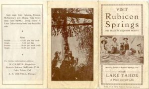 Originally discovered and established by the Hunsucker Brothers. In 1869, they filed and located themselves on 160 acres here building a log house which was to become a way station for travelers from Georgetown to McKinney’s at Lake Tahoe. They were great friends with John McKinney who owned McKinney’s on Lake Tahoe. This relationship helped bring people to the springs via the side wheeled steamer from Glenbrook on Lake Tahoe to McKinneys, where they were then brought in over the pack trail to Hunsuckers. Once the Hunsuckers became too old to run their way station, they sold it to Mrs Vade Clark in 1886, who renamed it the Rubicon Mineral Springs Hotel. She built a more substantial structure, finishing her work in 1889(Presba, 1992) and operated what became a sixteen room hotel for the next 15 years marketing the mineral water which she said was “better than whisky.” Dr Winslow Anderson felt much the same way describing the Rubicon
  Springs in his 1889 prize essay as “an excellent mineral soda springs, romantically situated in the beautiful Garden Valley, on the Rubicon River. The owner of this beautiful mountainous resort is erecting commodious accommodations for guests and visitors. As for the mineral springs, the doctor described them as belonging to the Alkalo-Carbonated class of waters, so valuable in the treatment of the many diseases” (Anderson, 1889). Vade Clark eventually sold her hotel back to Daniel Abbot in 1898, but leased back to Vade Clark, who continued to operate it till it eventually sold to Ralph Cowell in the 1908. (James, 1915; Presba, 1992).
Here are two images of a modern reproduction copy of a original Rubicon Springs advertising brochure in pamphlet form. The pamphlet indicates that R Colwell is the owner, which means it was published sometime from 1908. My thanks to Alan Vella from Gerle Creek Summer Home Tract for loaning this historic document so that it could be imaged and shared via this historical website.
 These days the property and the mineral springs are owned by the Jeepers Jamboree in Georgetown, now home to the famous yearly trek (Jeepers Jamboree) of 4 wheel drive Jeeps from Georgetown to Lake Tahoe via Rubicon Springs. Originally when the Jamboree first begin in 1952, the Jamboree found its way to Rubicon Springs and Lake Tahoe via Wentworth Springs, but by the late 1980s, the trek was modified go to Rubicon Springs via Loon Lake Dam, trekking the North side of Loon Lake and re-entering the trail to Rubicon Springs at Ellis Creek.
Here are four historic pictures of Rubicon Springs from July 16, 1953, taken by Linton A. Brown, the late father of Lint Brown. They show the old hotel partially collapsed as a result of the record breaking Winter of 1951/52 where the Sierras had one of the biggest snow falls on record, which led to considerable extra runoff and the damage seen in these nearly 50 year old photos. One of the photos shows what was left of the famous piano in the old hotel; another is a nice shot of the collapsed hotel; another a shot of a small barn or shed on the edge of the meadow and the final shot, shows Lint Brown and his friend, Robert P. Neeley standing proudly next to an interesting piece of old equipment, with their fishing and hiking equipment displayed. Here are two more historic photos of the SPRR Cabin in Lower Hell Hole taken by Lint Brown Sr in 1951, which was removed with the construction of Hell Hole Dam and Lake in the 1960’s. 029, 030
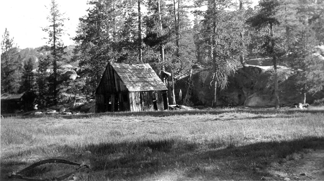
I recently came across this local Georgetown-Placerville Liddicoat Family history showing their early involvement with using Jeeps on the road from Georgetown to Lake Tahoe via Wentworth Springs and Rubicon Springs with wonderful pictures of Wentworth Springs in 1946 along with detailed pictures of their Jeep travel on the road including historic pictures of Rubicon Springs and the bridge before the steel bridge and after……….This website is a must review for a look back 60 years plus at Rubicon Springs and road to Lake Tahoe.
Rubicon Springs/River Bridge
Rubicon Trail History Page.…….a very nice historical time line on related history, names and places along the Rubicon Trail to Lake Tahoe. For even more detail and a wonderful timeline on the history of Rubicon Springs, along with some new and very interesting photographs of the Springs, their vehicles, the people and owners, try www.rubiconspringshistory.org . This is a new website and is very comprehensive………
Schlein’s Cabin
Schlein’s Cabin-Eldorado National Forest, El Dorado County, Ca US Forest received this property December 26, 1944. The original Schlein cabin was built by Theodore Schlein (family records say his full name was George Henry Charles Theodore Schlein) and his son, Ernest W. Schlein of Georgetown, but no longer exists on the property. According to the Mountain Democrat of July 9, 1936, CCC members from the CCC Spike Camp at Airport Camp on Gerle Creek will build a new ranger station on the old Schlein place on the road to Loon Lake. Theodore Schlein married his wife Anna R. Schlein in 1866. Earnest was born in California in 1867. His father, Theodore Schlein, born 1836 in Hanover, Germany. His mother, Anna R. Schlein was born in Pennyslvania in 1849. Her husband Theodore and his older brother William came to America from Germany prior to 1841. A third brother George Ernest Schlein came to America in 1841 at the urging of his older bothers. (Yohalem, 1977; KDeal 2005; Census Records; Georgetown Gazette; GernesDeibert 1999)They remained in the East for many years before heading West to the gold fields. By the 1880 census, the entire extended family(all three brothers and their families) were living in Georgetown. Theodore Schlein’s listed occupation in 1880 was as Ditch Agent. From newspaper records it was determined he was a ditch agent for the California Water Company. Theodore’s other two brothers, William and George Ernest, listed themselves as miners. Theodore Schlein and Anna Schlein’s younger daughter, Evalina, born in Georgetown in 1875, would eventually marry Robbert S. Jerrett of Georgetown and become the mistress of Wentworth Springs during the first half of the 20th Century during their tenure as owners of that venerable mineral spring and hotel resort. Taken from the THE MOUNTAIN DEMOCRAT, April 5, 1890, “Theodore Schlein and Al Toland visited Loon Lake last Friday. They found snow 16 feet in depth, and judge it had been about 24 feet prior to settling. The Loon Lake boarding house has been crushed in as also the South Fork saw mill; in fact very few buildings from Forni’s to the summit escaped. The roof of Sam Forni’s building is caved in and Uncle Tom’s Cabin (is) injured more than reported. The snow is 10 feet deep at Bill Vaughn’s. As Wentworth’s was not visited, nothing is known.”

 Bill Vaughn’s place was infact 12 Mile House to the East of Georgetown and belonged to the California Water Company. Bill Vaughn, like Theodore Schlein, was a ditch agent for the California Water Company. By In 1906, Ernest W. Schlein was issued land patents for the property which Schlein’s Ranger Station sits on as well as the meadow. The property and the Schein family built cabin and outbuildings , remained in the Schlein family till it was received by the Forest Service in 1944 via a land swap This property was used by the CCC as well during the late 1930s and 1940s.Here are several pictures of Schleins taken in 1964, picture 1, 2., and 3.
Theodore Schlein’s Wagon, purchased in Stockton in 1890…owned now by Dave Souza of Souza Ranch on Bear Creek in Garden Valley. Dave purchased this wagon from Leigh Hurley who was married into the Schlein Family….Picture and historical background, Dave Souza 2009
Lawrence Cabodi worked for the Forestry Service for many years and was a patrolmen on the Pacific District in the late 50s early 60’s. He stayed at Schliens station during a summer. He also helped with tearing down the last storage building at Airport Flat. Attached is a photo Larry Cabodi in 1960 by his 1957 patrol truck next to Schleins station. He was the “Forest Guard”, as the position was labeled back then, for the one year there. Joe Bowmen was the guard the previous year. Pretty cool photo showing the bag radio and even a side arm. Thanks to the Cabodi Family and Marco Cabodi for sharing this photo of his father. The Cabodi family have their own cabin in the Murray Camp area.
Spider Lake
Spider Lake is on the Georgetown to Lake Tahoe Road just past Wentworth Springs and a long time isolated fishing destination. One must hike or use a 4 wheel drive vehicle to get there. In a wonderful article on the front page of the Sacramento Bee, June 3, 1931, it describes the challenging trip by motorcar during Memorial Day time frame of 1931 for several Sacramento people who wanted to catch a few trout……..“SPICKARD FIRST TO SPIDER LAKE, Dealer Pilots Car over Granite Boulders to Reach Fishing Paradise……Driving through mud holes, around fallen trees and over granite boulders in the sluice box region of the headwaters of the Rubicon River, C. R. Spickard of the local automobile firm of Spickard & Loughland, and Ray Weatherwax, service superintendent for the firm, were the first to reach Spider Lake this season. They made the tri[ over the Memorial Day weekend, driving there via Georgetown, Uncle Toms and Wentworth Springs in five hours Friday afternoon and returning in the same time Sunday night. Road Good for a ways. Spickard said the road up the Georgetown Divide was very good to Wentworth Springs, forty-six miles east of Georgetown and 103 miles from Sacramento. From Wentworth Springs on ten miles to Spider Lake the going was bad and much difficulty was experienced. However, by persistent effort, the two auto men worked their car to within a few yards of the lake and pitched camp. Rewarded By Trout. After they had broken the trail, two or three other cars followed, but stopped further from the lake. They were rewarded for their effort by fine catches of large trout in Spider and other nearby lakes. There is a road that runs from Spider Lake on through the granite sluice boxes and down to Lake Tahoe at McKinneys, but it is in such poor condition that but a handful of cars have gotten through to the lake by this route in the past several years.”
Spider Lake has a very small hand built dam on it, which according to Larry Cabodi, former USFS Ranger on Pacific District of Eldorado National Forest and cabin owner on the North side of Murray Camp “I believe Frank Merrill built the dam for Cal F&G for fish survival back in the 50’s. He did that on a number of high country lakes.” October 2024
Stone Cellar
Land patents were issued to Amelio Fornifor Township 13N 14 E section 24 in 1888 followed by section 23 of the same township in 1894. The 1895 Geological Survey map clearly is annotate with Forni’s name on Stone Celler as well as a number of other properties in the Gerle Creek area. Les Clementsen owns Stone Cellar and has for many, many years. Like Robb’s Resort, Les built a large camp at Stone Cellar with several large buildings which cater to private groups as a summer retreat throughout the season every year.
Tells Creek/Peak
Gudde indicates it was named for a early Swiss “homesteader” named Tell. His cabin is shown on the early maps to the West of Tell’s Peak on Tells Creek around 1875. However other sources in Gudde’s research suggest it was named for “Ciperano Pedrini”, commonly known as “Bill Tell,” who was a merchant in Garden Valley (Gudde) James, 1915, pg 160 wrote “Tell was an old Switzer who used to keep a dairy ranch on the slopes of the mountain bearing his name.” In fact it was named for Ciperano Pedrini or William Pedrini as he was called after arrival in America of Garden Valley who owned a store there called Tell’s Store and Tell’s Ranch below Tell’s Peak. Later in 1875, his store and ranch holdings were taken over by his nephew, Renaldo Filippini along with his partners, Massino and Clemente Pedrini, thereafter known as Rinaldo Filippini and Company. Filippini arrived in 1859 and worked for his uncle in the store at Green Valley(Gernes,1982)
Uncle Tom’s Cabin 1864-Georgetown-Wentworth Springs Road, Eldorado National Forest, El Dorado County, Ca
Uncle Toms1, Uncle Toms2, Uncle Toms3,
 Originally built by Tom Markham in 1864(Presba, 1992). Archie and Irma Lawyer, married in 1912, owned Uncle Tom’s from about1921, living there every Spring till the first snow of the Fall till the mid 1970s.According to Irma Lawyer, it was named after a black man who lived there, mining and trapping in the early mining days. No one ever knew his real name, although he was referred to as Tom. However, other sources indicate that Tom Markham was in fact a Caucasian from Missouri. He later left the county in the late ’70s for Tulare County (Gardner, 1993). White fur trappers who moved into the area would seek help from Tom with trapping and actually getting their hides out. After many years, the name “Uncle Toms Cabin stuck and continues to this day (Yohaler, 1977). Here is an undated picture of Ray and Irma Lawyer standing in front of Uncle Tom’s Cabin shared on Facebook by Bill Purier. Ray would be Archie and Irma Lawyer’s son.
After Tom Markham left for Tulare County, John Brock and John Saucerman, hunters and trappers, made it their headquarters before it was passed along to William Vaughn and B.W. “Dick” Hartless turned it into a store and beer bar (Gardner,1993) According to Gardner, Dick Hartless actually inherited the name “Uncle Tom” among his friends, which followed him to the end of his life.. By the late 1880s, the the property was acquired by the Swiss Timber and Land Company who built a substantial building there. Uncle Toms was then operated by B. Scholari and then Charles Schultz of Coloma. After the Swiss Timber Company sold the property, Uncle Toms burned down, but the new timber company owner rebuilt it immediately (Gardner, 1993). The Lawyers once they took it over from this timber company, operated it as a roadhouse which catered to the Spring and Fall cattle drives of the valley ranchers moving their cattle into the many sierra meadows which were homesteaded by early California pioneers
Union Valley
 Named in Spring of 1851 by a party of men, including James W. Summerfield, formed to find Lake Tahoe. Summerfield was a late arrival to the goldfields in the Summer of 1849, arriving from Union, Virginia (now West Virginia) where he was born. He spent the remainder of 1849 and 1850 mining in Kelsey before returning to Hangtown in 1851. He and several other miners heard the story of a “certain mountain lake” which had a stream flowing into it, where one could see “innumerable pieces of gold, some of which were fully as large as a small-sized walnut.” (Upton, 1906)The story went on to describe the lake which the stream flowed into, as so clear that pieces of gold could be seen in it as well. James Summerfield was one of several men who formed several companies referred by Upton as the Gold Lake Party who left Hangtown to find Lake Tahoe, using the directions written down by the three men who gave them the story of gold. The party, which included Summerfield, made their way up into what is now called Union Valley, searching for this clear lake and stream of gold. Union Valley received it’s name from this party of men as “they communed and held services—when they became puzzled and were unable to follow the line of procedure as described in the paper of directions.” For this reason, hereafter, it was named Union Valley. (Upton 1906)
Union Valley Dam
 Here are several in construction pictures of the dam taken by my father with myself standing on the dam during construction Pictures 1. and 2.
Upper Bassi Ranch
 Upper Bassi Ranch and ranch buildings, 1860s. Located Northeast of Union Valley on Bassi Creek, between Fillipinni/Forni/Van Vleck Ranch and Tells Peak. Both pictures were taken in the early 1960’s by John Holmes, Lot 33 Gerle Creek Summer Home Tract……Pictures 1. and 2. The following information comes from G Bassi’s own comments to P.Sioli during the preparations and writing of the “The History of El Dorado County, California, 1882-83.
- Bassi was born in Valle, Switzerland May 18, 1840, the son of Antonio and Osula Bassi. He spent his early years herding cattle but by age 18 was ready to seek his fortune in America, setting out for California and the opportunities there.
- Bassi arrived 10 years into the Rush to California in January of 1859 spending his early years in El Dorado County working on dairy ranches and as a miner saving his money. In 1864 ,he went to Nevada looking for opportunity but returned in the Fall of 1864 and bought an interest in a dairy ranch at Rock Bridge.(Sioli, 1883). Later by 1870 , G. Bassi was able to buy the dairy ranch in full which was situated on the banks of the South Fork of the American River and included summer ranches and ranges on the banks of Silver Creek (Later years, called Big Silver Creek) in Union Valley and a second ranch on a fork to Big Silver Creek, later called Bassi Creek. (Sioli, 1883) In the early years the lower ranch on Big Silver Creek was referred to and marked on maps as “Bassi,” while the ranch on Bassi Creek which is a fork of Big Silver Creek, was referred to as Upper Bassi and so marked on early maps. With the construction of Union Valley Dam in the early 1960s, Bassi Ranch on Big Silver Creek was removed from within the area of the new lake.
G Bassi later married Virginia Forni, daughter of Sam Forni of Georgetown January 6, 1878. Their children included Daniel M Bassi born January 20 1879; Josphine V. Bassi born August 19, 1880 and Kitty Angelina Bassi born March 9, 1882.(Sioli, 1883)
“Among the stockmen who passed through our town the past two weeks for their alpine ranges were: Murphy Bros of Weaver Creek, for their range at McKinney’s ; G. Bassi for Silver Creek; Sam and Amelio Forni, for Forni’s; Wm. Bacchi and Son from Garden Valley; McCollough from near Folsom, for South Fork; Rodoni Bros; Butler from near Folsom, with sheep; Jake Drairer from Cool.” Georgetown Gazette June 10, 1898
Download Judy Rood Maste’s Thesis, The Upper Bassi Site-1992
B-17C Crash Site Tell’s Peak Upper Bassi Ranch
B-17C Crash October 31, 1941 B17C Pilot Located B17C Crash Site Map B17C Crash Site Link
 L-R John Watt, Pete Cowper and Bill Dillon during our hike to the site October 2008 Photo
Van Vleck Ranch
Van Vleck Ranch 1870s One of the original ranches built for summer range East of Robbs Valley for grazing cattle…identified as “Tell’s Ranch” on Amos Bowman’s 1874 Map of the Georgetown Divide for the California Water Company of San Francisco, California…Originally belonged to the Ceperano Pedrini or William Pedrini….(William Pedrini was commonly called .”William Tell”, with his store in Garden Valley called Tell’s Store and his ranch on the slopes of Tell’s Peak, Tell’s Ranch ) till 1875 when the ranch and store was passed to his nephew, Rinado Filippini of Rinaldo Filippini and Company. Renaldo arrived in 1859 to work for his uncle Ceperano Pedrini in the store and on the ranch. (Gernes, 1982) Fillippini owed the ranch till the late 1890s before being passed to the Forni Family (The 1895 USGeo and 1916 US Forest Service Map shows Forni’s name on the ranch) an then to the Van Vlecks…four pictures of the Brattland family visiting this historic ranch in July 1991…the next year the ranch burned down from a chimney fire. Pictures show the original ranch building along with the beautiful near natural meadow which made this such a perfect place for a summer ranch when first located by early settlers. Some of the timbers of this original mid 19th Century ranch house most probably came from the Southfork Mill at Hanna’s Camp when it was originally built during the Summer of 1885. Pic#1 Pic#2, Pic#3, Pic#4
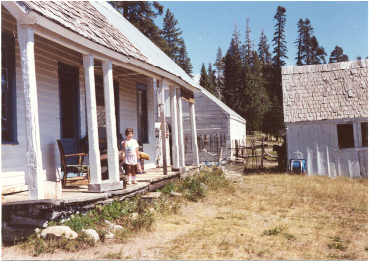
A report from the October 28, 1881 edition of the Georgetown Gazette on the Filippini “Dairy”……..”A profitable Dairy – Filippini and Company of Garden Valley, have a dairy of about 200 cows which they keep during the summer months in the higher altitude above Georgetown. They brought their stock down last week and reported the following as the result of the seasons operation. they made something over four tons of cheese, at which business, being native sons of Switzerland and trained to it from childhood, they are adept, and for their cheese they have an active demand. They are shipping this cheese to Eureka, Nevada, and other points. They also put up something over three tons of butter of remarkable fine quality , equal to the best we have ever tasted.”(Gernes; Deibert, 1999)
A report from the June 23, 1882 edition of the Georgetown Gazette on the movement of livestock through Georgetown to the ranches in the Sierras……….”A great many droves of stock and dairy cattle, sheep and goats, have passed through Georgetown during the present month for their ranges above, and many more are yet to pass before the month ends. Among those who have already passed up with dairy stock are: Forni of Gold Hill, Sam Forni of this place(Georgetown), Filippini & Co., Bacchi of Garden Valley, Schelari and Gerley(mispelled) of Uniontown, Deller and Son near this place (Georgetown) and others whose names we have not in mind. Besides this, no less than a dozen large bands of sheep and goats have passed through town. Much stock is also passing up by routes south of this place.” (Gernes; Deibert, 1999)
A report from the October 23, 1885 edition of the Georgetown Gazette on the Filippini Mountain Ranch building…….”Fred Smeder has just returned from R. Filippini and Co,’s Mountain ranch, some 40 miles east of Georgetown, where he has been engaged for the last eight weeks in building a fine large dwelling house for that enterprising Company. this and John Flora’s new swelling, going up near Volcanoville, are the finest buildings on the upper divide>” (Gernes; Deibert, 1999)
Wentworth Springs-1880,Eldorado National Forest, El Dorado County, Ca
Wikander Cabin Buck Island Lake California
Bibliography
Anderson M.D., Winslow, “Mineral Springs and Health Resorts of California,” The Bancroft Company, San Francisco, Ca, 1890.
Baldwin, Anna Luneman, “Joys and Tears of Yesteryears”, Anna Luneman Baldwin, 1975…source material for the Orelli, Jacobsen and Leonardi Families
Bowman, Amos, “Report on the Properties and Domain of the California Water Company, situated on Georgetown Divide: Resources of the Country, Between the South and Middle forks of the American River, In El Dorado County, California,” A. L. Bancroft and company, San Francisco, Ca,1874. See the link to learn more about Amos Bowman
Bowman, Amos, “Map of Georgetown Divide, El Dorado County, Showing also Portions of Placerville and Forest Hill Divide, with Ditches, Mines and other Properties of the California Water Company,” Amos Bowman, San Francisco, Ca, 1873 See the link to learn more about Amos Bowman
Brown, Linton A., Long time South Fork Mill, Old Ditch Camp, Georgetown Divide recreational user, growing up and spending considerable time during his youth living, hiking, fishing and working in these areas, with his late father Linton Brown Sr…huge collection of historic photos covering all areas of the Georgetown divide, including the old ditch Camp, Loon Lake, Rubicon Springs, Wentworth Springs, and the California Water Company holdings…most taken by his father Lint Brown Sr.. Lint is working on written history of this area, which will include many of the historical photos which he has loaned to me to include in the Gerle Creek history. Lint is a retired Engineer for California Department of Water Resources and lives in Redding, California.
Clemenstsen, Les, life long El Dorado County resident, former Army Air Corps Pilot in WWII and life long cattle rancher on the Eldorado National Forest, original owner and builder of Robb’s Resort as well as the builder and owner of the summer camp at Stone Cellar. Personal interview and historical discussion, Gerle Creek Lot 43 Dinner, October 12, 2004
Cross, Ralph Herbert, “THE EARLY INNS OF CALIFORNIA 1844-1869,” Ralph Herbert Cross, Cross & Brandt, San Francisco, 1954
Crowder, James L., “OSAGE GENERAL: MAOR GENERAL CLARENCE L. TINKER,” Office of Hisotry, Oklahoma City Air Logistics Center, Tinker Air Force Base, Oklahoma, 1987
Errington, Don; Deal, Krista, “Airport Forest Health Project, Draft Environmental Impact Statement,” USDA, US Forest Service, Pacific Southwest Region, Eldorado National Forest, Pacific Ranger District, Pollack Pines, Ca., July 2000
Gardner, Georgia; Edited by Leonard M. Davis, “Along the Georgetown Divide, A collection of Stories and Reminiscences About the Famed Georgetown Divide,” 1993, Roseville Historical Society, Roseville, Ca 2002
Gernes, Phyllis, Editor, “Daily Journal 1852-1860 of Stephen Wing,” Physllis Gernes, Garden Valley, Ca 1982
Gernes, Phyllis L., “Hidden in the Chaparral,” Phyllis L. Gernes, Garden Valley, Ca, 1979
Gernes, Phyllis & Deibert, Kenneth, “On & Beyond The Georgetown Divide,” Phyllis Gernes and Kenneth Deibert (530) 622-7590 (530) 333-4402, 1999 ( web master’s note….just an excellent book….The authors have taken the time to read all of the Georgetown Gazette newspapers between 1880 and 1900, plus several other smaller relevant papers, pulling out significant quoted parts which cover significant events, people, businesses etc. covered by the Georgetown Gazette….. a great help to anyone without access to the Georgetown papers which are only available in the El Dorado County library or the State Library…..if one has any kind of interest in the Georgetown Divide, it’s people, events, places of interest, etc., , one needs to own their own copy of this book, as do I……….mgb)
Gudde, Erwin G. “California Place Names, The Origin and Etymology of Current Geographical Names,” University of California Press, Berkeley, Ca, 1949,1960,1969.
Gildersleeve, David H., “California Water and Mining Company Report to the Stockholders,” New York, 1880.
Hill, Jonni Artist, Early Eldorado National Forest and County historic ranches and pioneers, Several of her photographs used with her permission High Country Sketches
Hill, Lilla, “Our Traveling Correspondent” Newspaper Column, Mountain Democrat Newspaper, Summer of 1929. Articles reprinted in September to November period of 1977 in the Mountain Democrat Newspaper.
James, George Wharton, “The Lake of the Sky-Lake Tahoe,” George Wharton James, Pasadena, Ca 1915.
Jerrett, Herman Daniel, “California’s El Dorado—Yesterday and Today,” Press of Jo Anderson, Sacramento, Ca, 1915.
Jerrett, Herman Daniel, “Hills of Gold,” Cal-Central Press, Sacramento, Ca, 1963
Johnson, Wilbur S., Superior Court Judge Retired, Redwood City, Ca…. Unpublished early historical information, e-mail, including early photographs, maps, etc., on Wentworth Springs and its surroundings, Robert S. Jerrett and family for Georgetown and Wentworth Springs, Ca, the Wikanders of Buck Island Lake from 1932, May/June 2003
Mason, J. D. “History of Amador County California” Thompson & West, Oakland, California, 1881
Mathis, George; Moser, Halmar Forrest, “El Dorado Sketches,” Friday House, Columa, Ca, 1973
Morgan, Jacqueline; Rambeau, Sheryl; Wurm, Bonnie, “Georgetown Historical Walking Tour” Brochure, Georgetown, Ca, Minuteman Press/USDA/Forest Service, 2003
Morris, Rick, “Rubicon Springs and The Rubicon Trail: a history,” Rubicon Historical Group, Rubicon Soda Springs, Ca, 2011
Nicosia, Francesco M., “Italian Pioneers Of California,” Italian-American Chamber of Commerce of the Pacific Coast, San Francisco, Ca, 1960.
Parker, Marilyn, “The Pollock Pines Epic,” Placerville press, Placerville, Ca, 1988
Polkinghorn, R.S., “Pino Grande, Logging Railroads of the Michigan-California Lumber Company,” Howell-North Books, Berkeley, Ca, 1966
Polkinghorn, R.S., “Pino Grander, Logging Railroads of the Michigan-California Lumber Company,” Howell-North Books, Berkeley, Ca,1984 (Revised&Enlarged Edition)
Presba, Peg, “Jeepers Jamboree, Book II, The First 40 Years,” Jeepers Jamboree and Jeep Jamboree, Inc., Georgetown, Ca, 1992
Rambeau, Sheryl; Moser-Flynn, Halmar, “Georgetown and The Divide, Volume II of El Dorado County Historic Places of Interest Myths & Legends,” The Heritage Association of El Dorado County, Georgetown, Ca, 1998
Rambeau, Sheryl, “Georgetown” Arcadia Publishing, San Francisco, CA, 2010
Roth, Major General Marshall S., “Letter from Maj Gen Roth to Dr. James L. Crowder on Camp Gerle and why Major Tinker established the encampment,” August 28, 198527
Sault, Dean Scott, “The Power of Water: A History of the Sacramento Municipal Utility District’s Upper American River Project, ” Master of Arts (MA), California State University, Sacramento, 12/04/2015 Download
Scott, Edward B., “The Saga of Lake Tahoe, Volumes I&II,” Sierra-Tahoe Publishing Company, Lake Tahoe, Ca 1955/1973.
Sevigny, Arthur, Historian, 20th fighter Wing Association source for background on Camp Gerle, Eldorado National Forest, 1932, Major Tinker US Army and 20th Pursuit Group.
Sioli, Paolo, “History of El Dorado County, California,” Oakland, California, 1883.
Starke, Peter, National Museum of Forest History-Maps-2022
Starns, Jean E., ‘Wealth From Gold Rush Waters,” Jean E. Starns, Publisher, in association with Word Dancer Press, Sanger, Ca, 2004
Supernowicz, Dana Edward, “Historical Overview of the Eldorado National Forest,” Masters Thesis, Sacramento State University, Sacramento, California, Spring 1983.
Upton, Charles Elmer, “Pioneers Of El Dorado,” Charles Elmer Upton Publisher, Placerville, Ca, 1906.
Upton, Will O., “Churches of El Dorado County California, Their History Covering a Period of Ninety Years From 1850 to 1940,” Old Hangtown Press, Placerville, Ca, 1940
Wilson, Norman L., Dyson, Jack R., “Archeological Survey in Gerle Creek Diversion Dam Area, El Dorado County, California,” State of California, The Resources Agency, Dept of Parks and Recreation, division of Beaches and Parks, Sacramento, Ca, 1962.
Wrights Lake Summer Home Association, “The Wrights Lake Story,” Cal Central Press, Sacramento, Ca, 1962/1994(Revised Edition)
Yohalem, Betty, “I Remember”….Stories and Pictures of El Dorado County Pioneer Families,” El Dorado County Chamber of Commerce, Placerville, Ca 1977
HISTORICAL LINKS FOR GERLE CREEK
www.visit-eldorado.com/stories.html
http://www.lookouts.us/Sorted_By/California.htm
www.co.el-dorado.ca.us/museum/other_museums.html

picture028
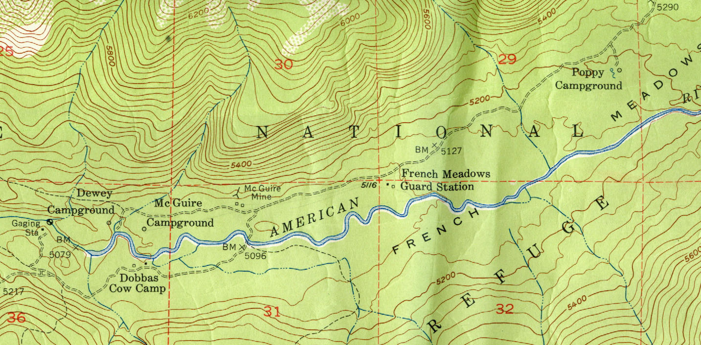
dobbascowcampfrenchmeadows
dobbasranch1885
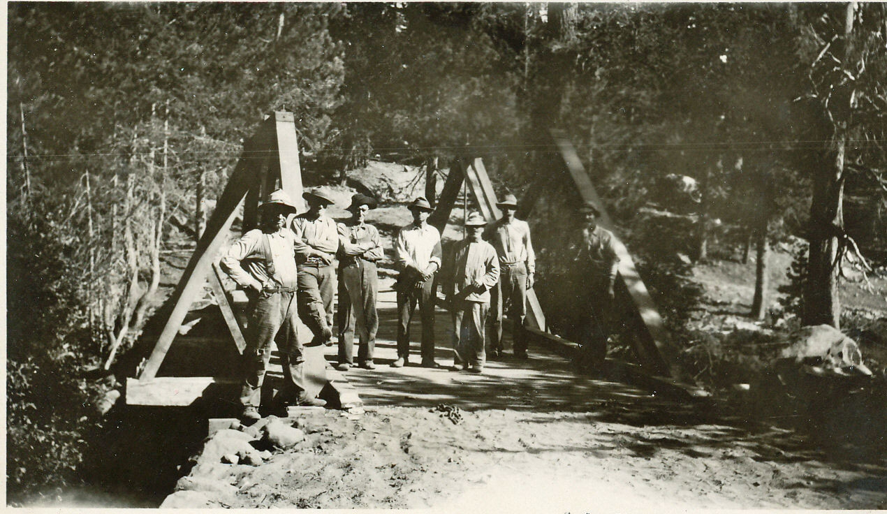
gerlecreekbridgejacobsens1929

hannascamp1

bunkerhilllo1957b
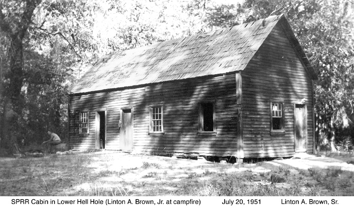
picture030
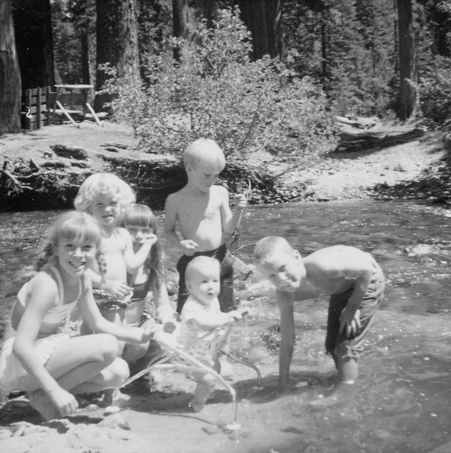
10HartsgrandchildrenatGerleCrkford
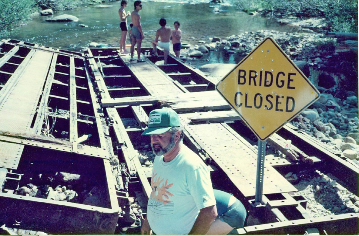
jacobsengerlerailroadbridge1980s
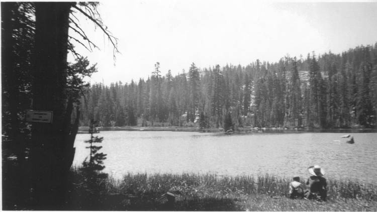
mckinstryorbennetlake1936

doylesranch1873

jacobsens1895

55thhist19311932page1
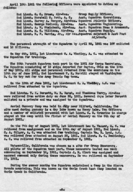
55thhist19311932page2
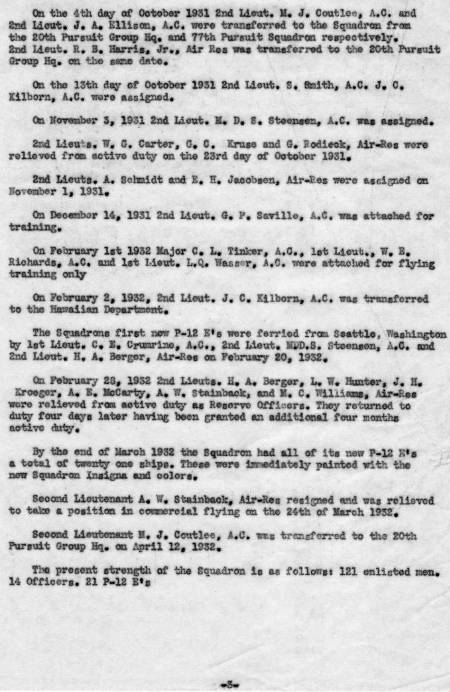
55thhist19311932page3
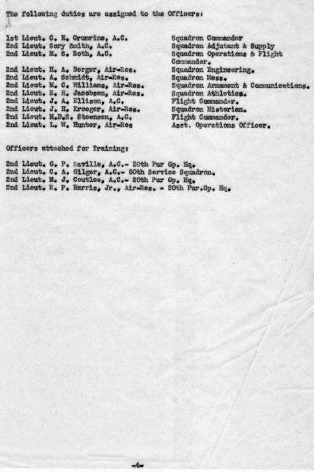
55thhist19311932page4

aafranciscabin1[1]

aafranciscabin2[1]

aafranciscabin3[1]
aafrancishouse2
airportflatsbarn1959

ccccampgerle1a
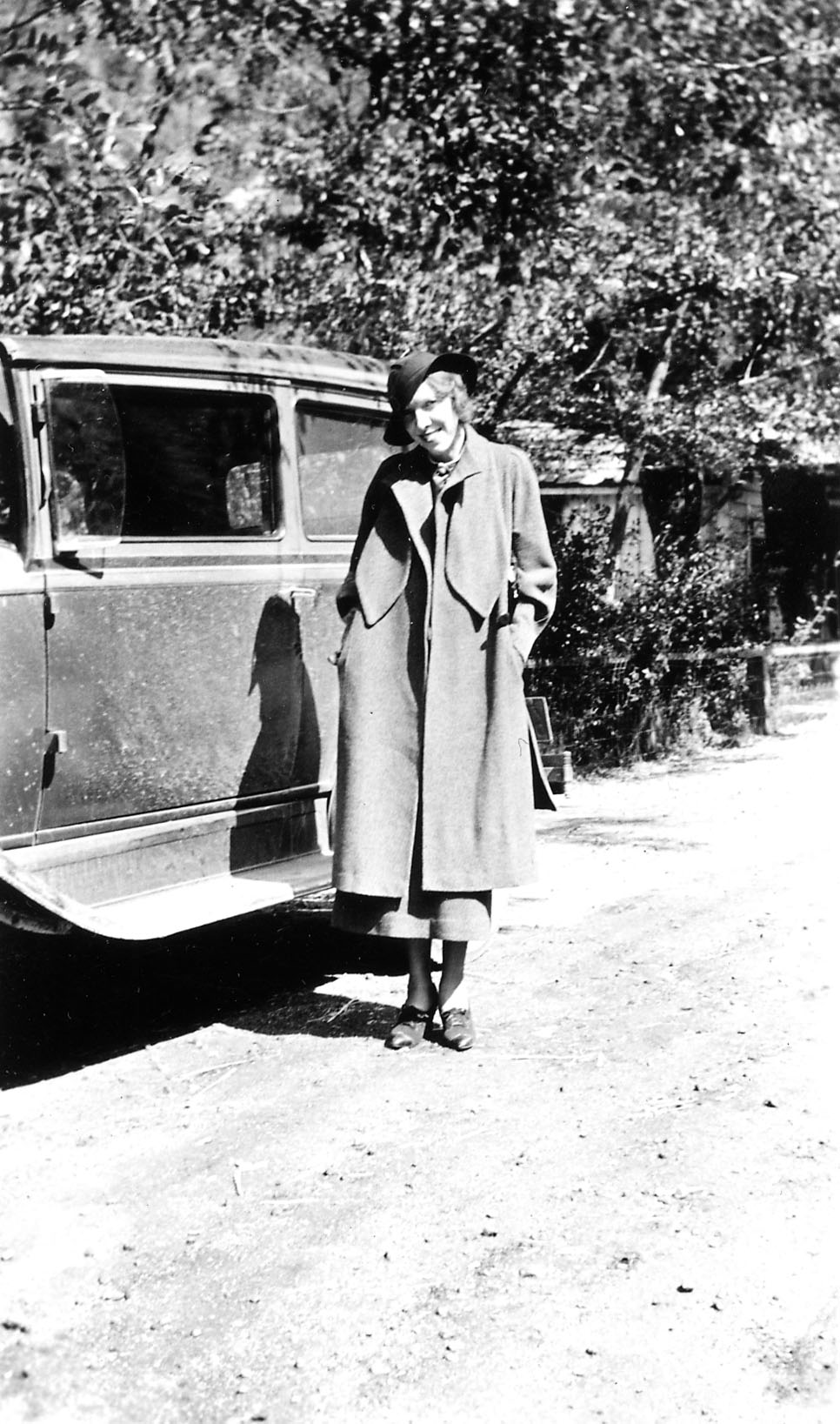
DaisyBrownRiverton083034
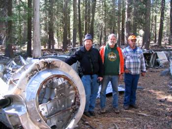
GerleCreekOct2008 049
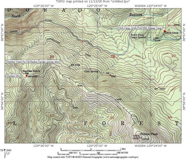
hartlessmountaincabinmap
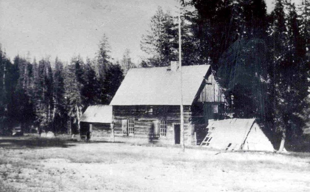
Icehouse Ranger Station circa 1910
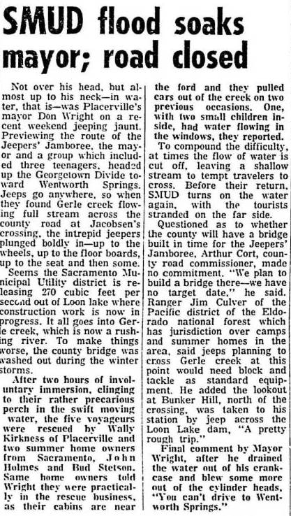
jacobsencrossbridgejune1964
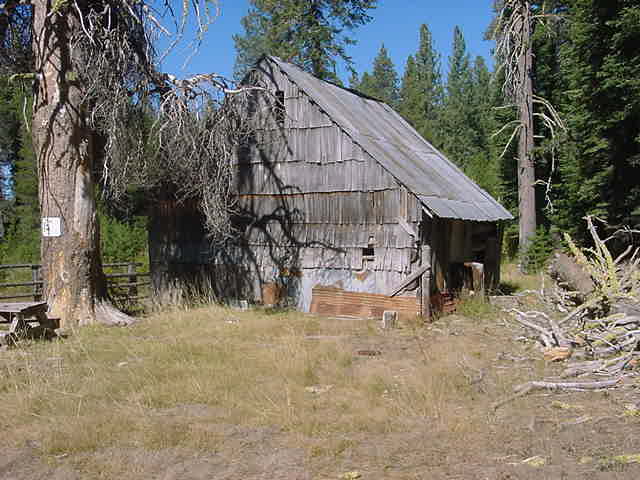
jonessilver03b

mckinstryorbennetlake1936
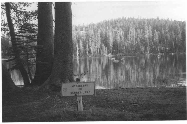
McKinstryorBennetLake1940s
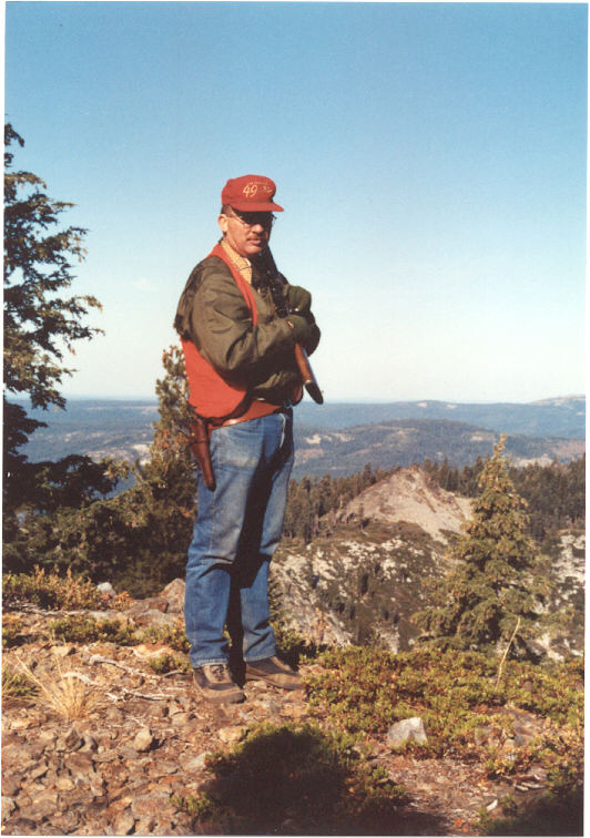
mgbmckinstry91
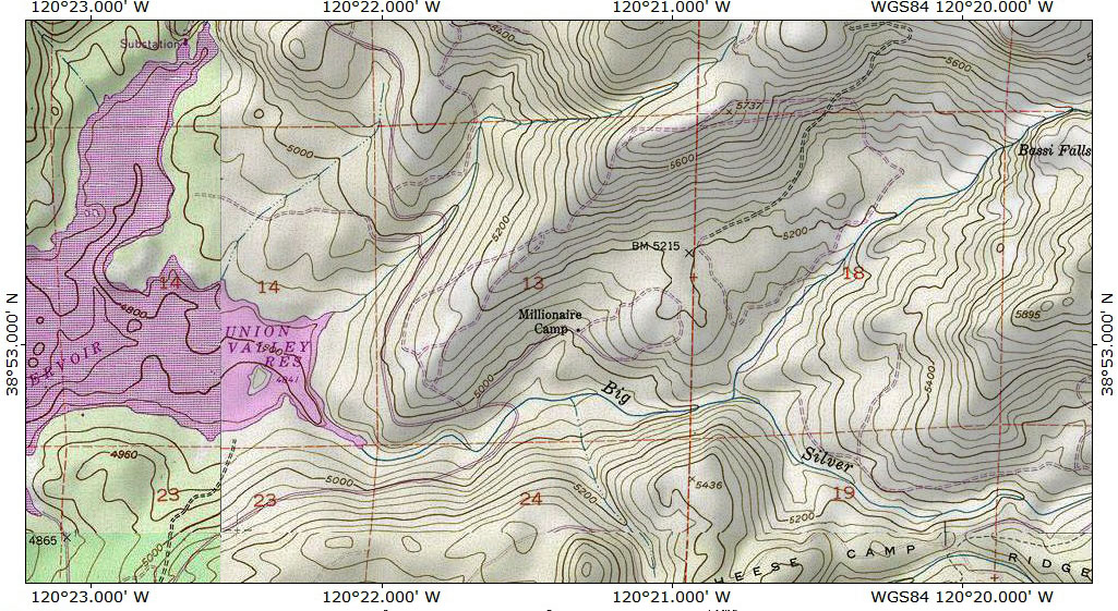
millionairecampbigsilvercreekeldoradonf
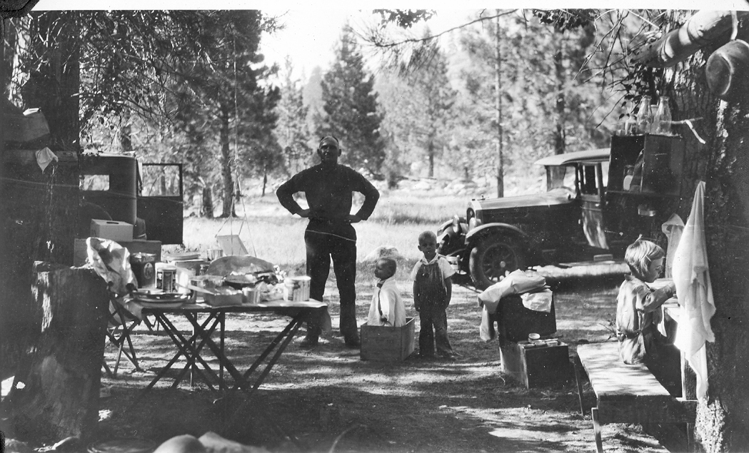
millionairecampeldoradonationalforest1930
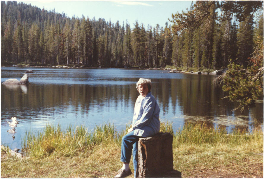
mommckinstry90[1]

mountainmeadowcabinruinsoct62005014[1]
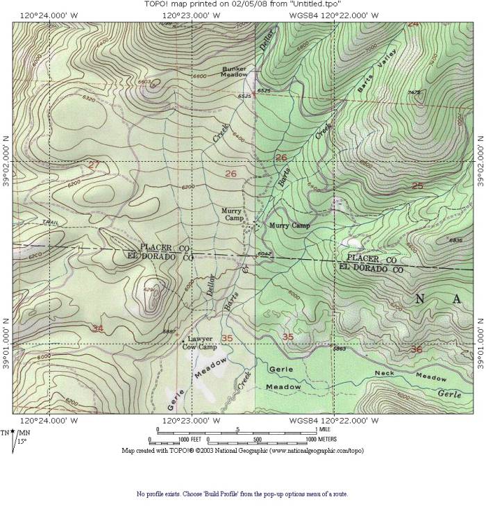
MurryCamp
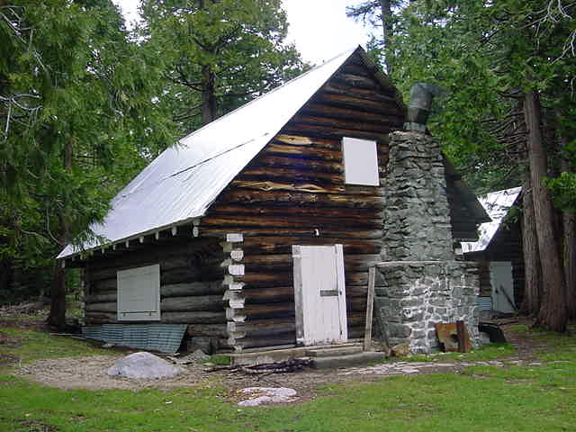
murrycamp0504d
orelisranchoctober102006 007

pic49
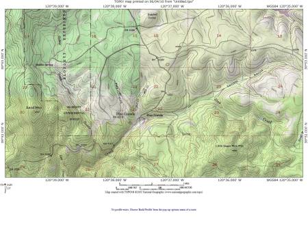
pinogrande
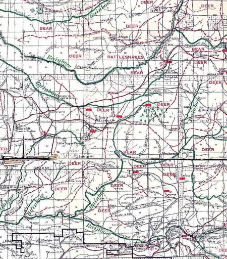
pinogrande1916
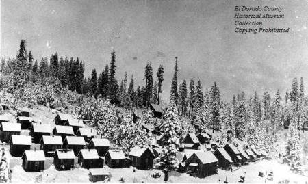
pinograndemilltownsmall

rivertonhotel

rubiconspgs1
rubsprsbrochure1a
rubsprsbrochure1b
schleinwagondavesouza2009asmall
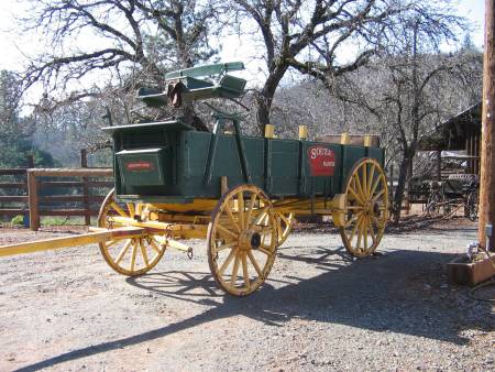
schleinwagondavesouza2009small
uncletomscabin3[1]

unionvalleydam1
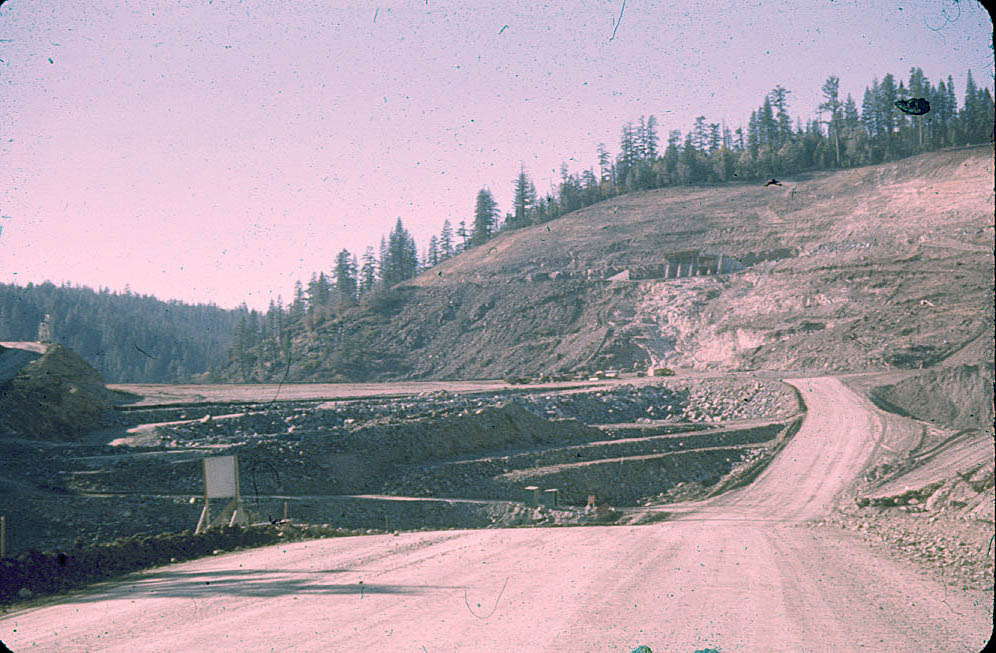
unionvalleydam2

upperbassi1[1]

mapofaebrownscabins
airportcamp1931b
airportcamp1931c
ccccampgerle1a
TinkerMAJGCCNov30toOct32

ednfmap1943b

ednfmap1943a
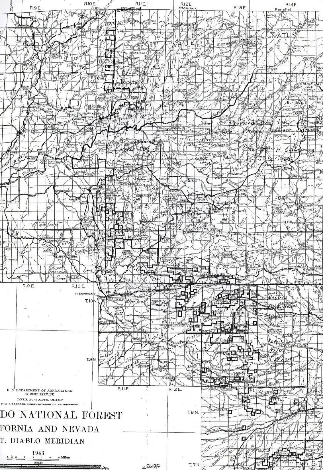
ednfmap1943b

ednfmap1943a
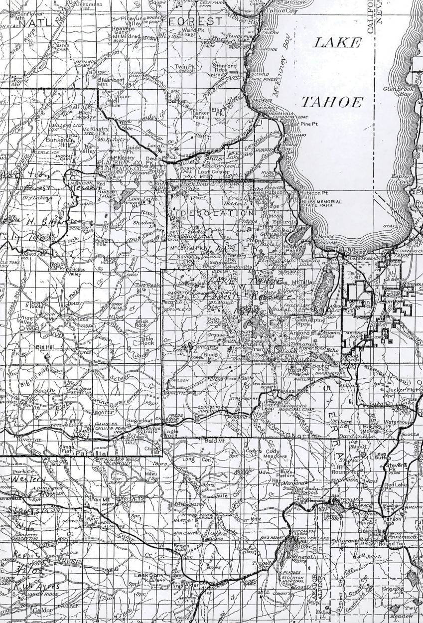
ednfmap1943a
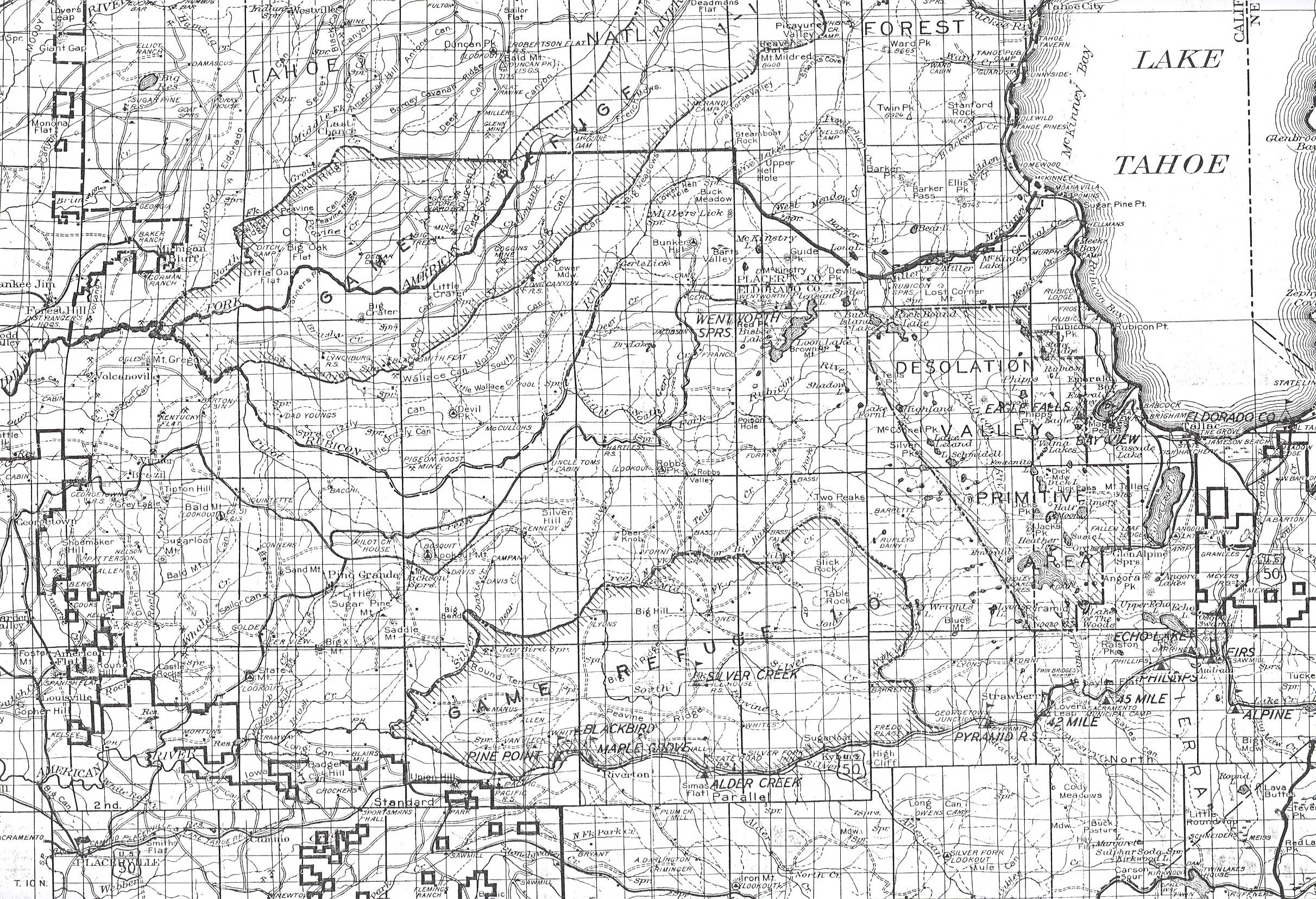
eldoradonf1931map

southforkmill1880

southforkmill1p

southforkmill1n
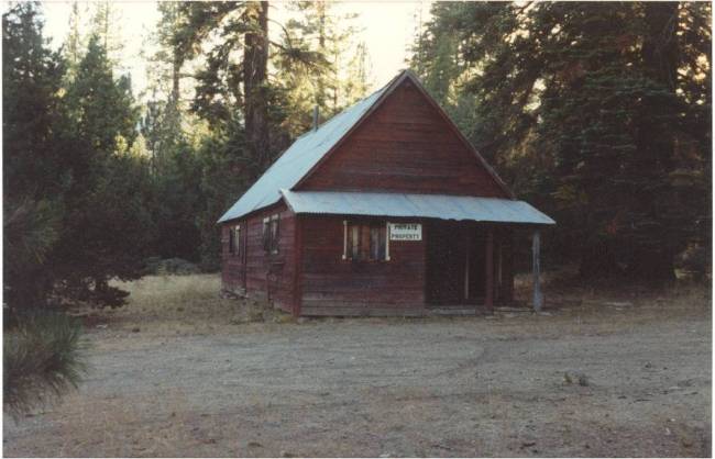
southforkmill1m
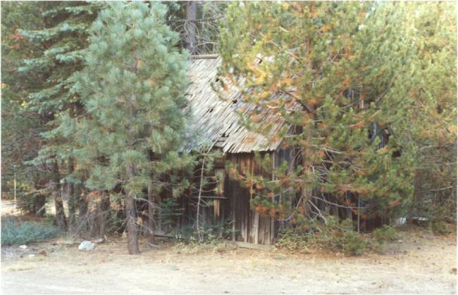
southforkmill1k
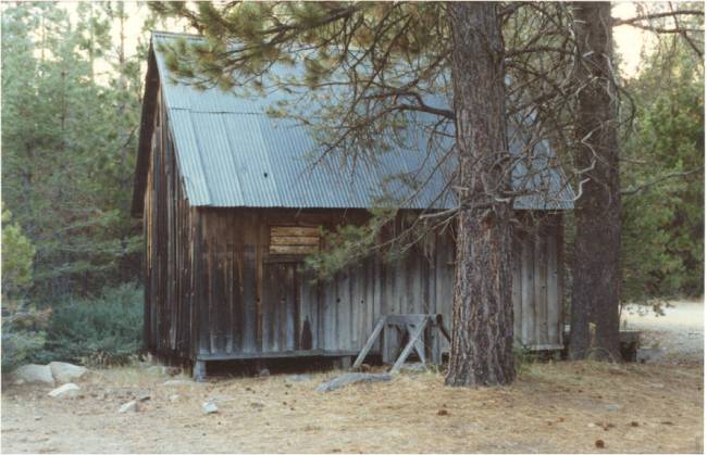
southforkmill1j

southforkmill1h
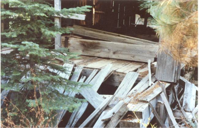
southforkmill1g

southforkmill1f

southforkmill1e

southforkmill1d
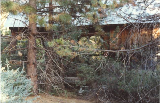
southforkmill1c
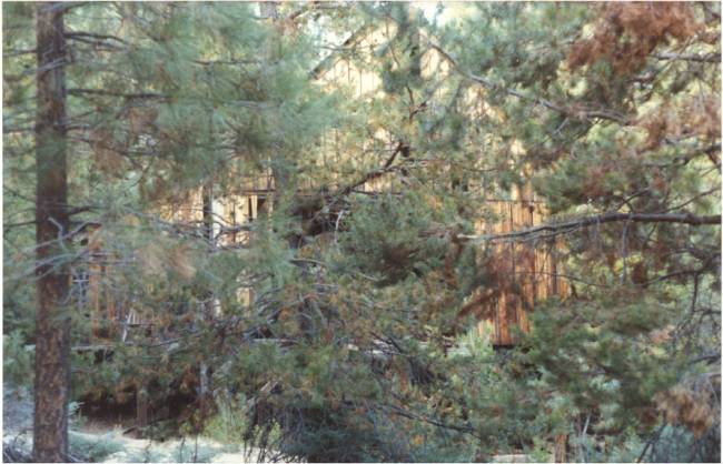
southforkmill1b
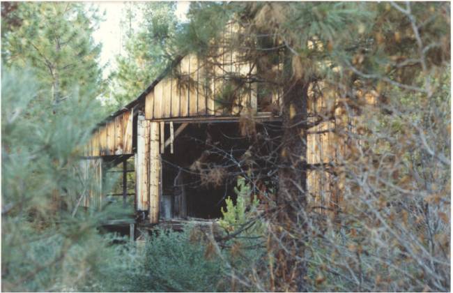
southforkmill1a
southforkmill1880
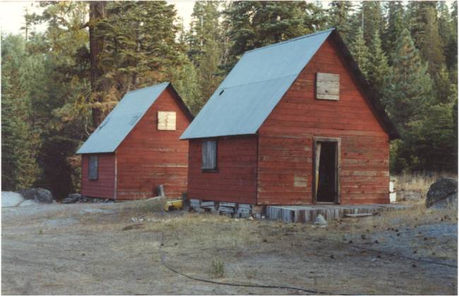
southforkmill1p
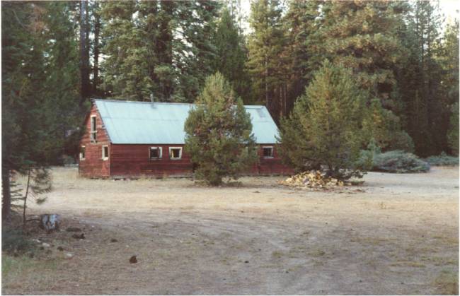
southforkmill1n

southforkmill1m

southforkmill1k

southforkmill1j
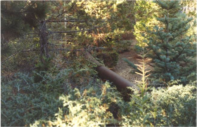
southforkmill1h

southforkmill1g
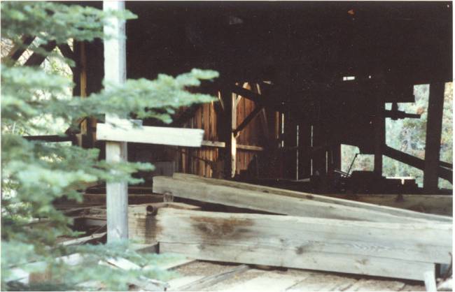
southforkmill1f
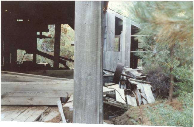
southforkmill1e
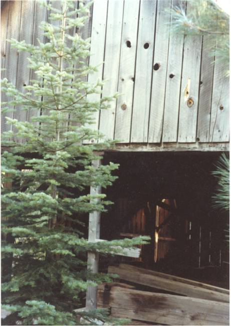
southforkmill1d

southforkmill1c

southforkmill1b

southforkmill1a
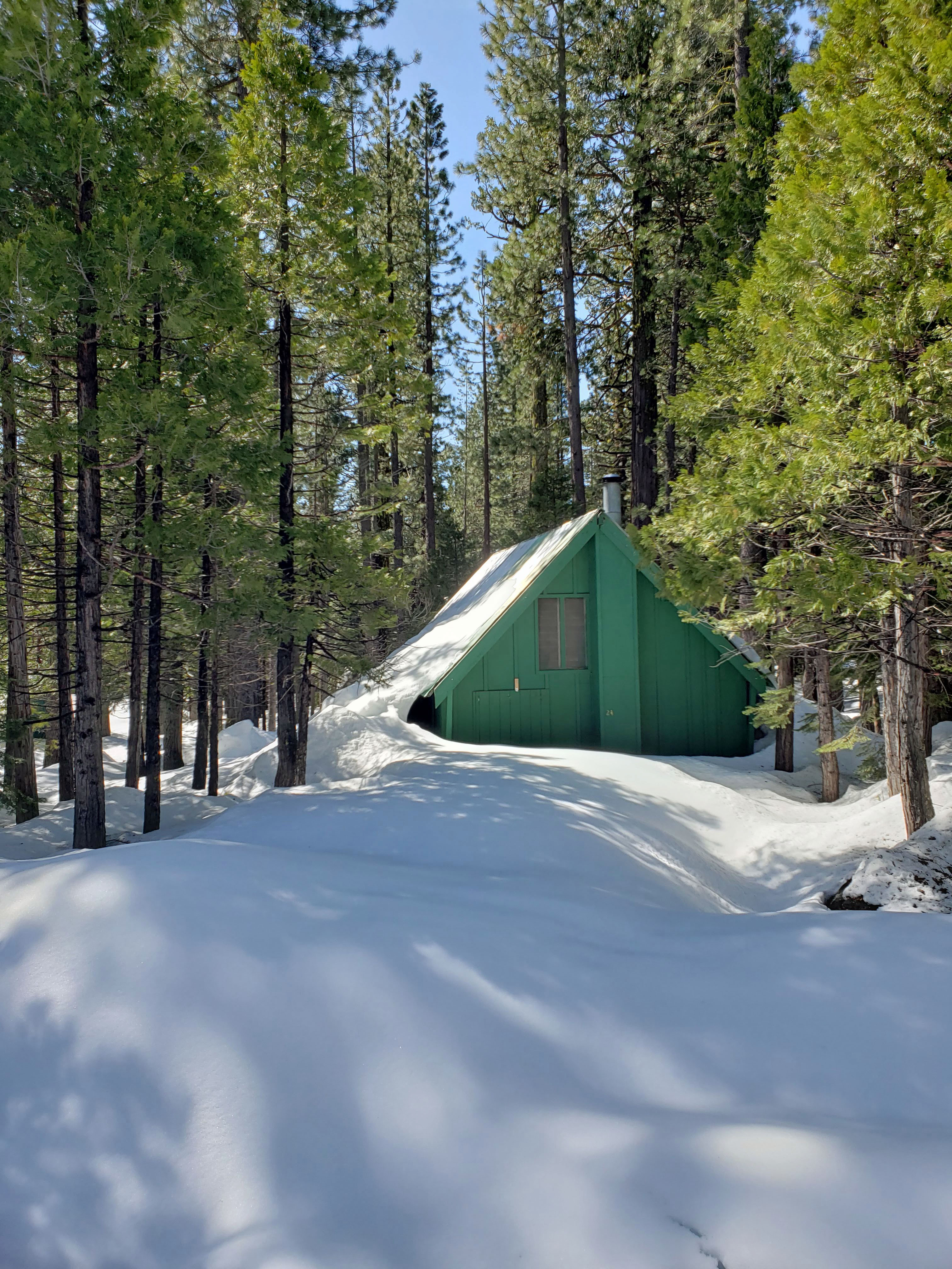
brattland cabin lot 24 march 23 2019
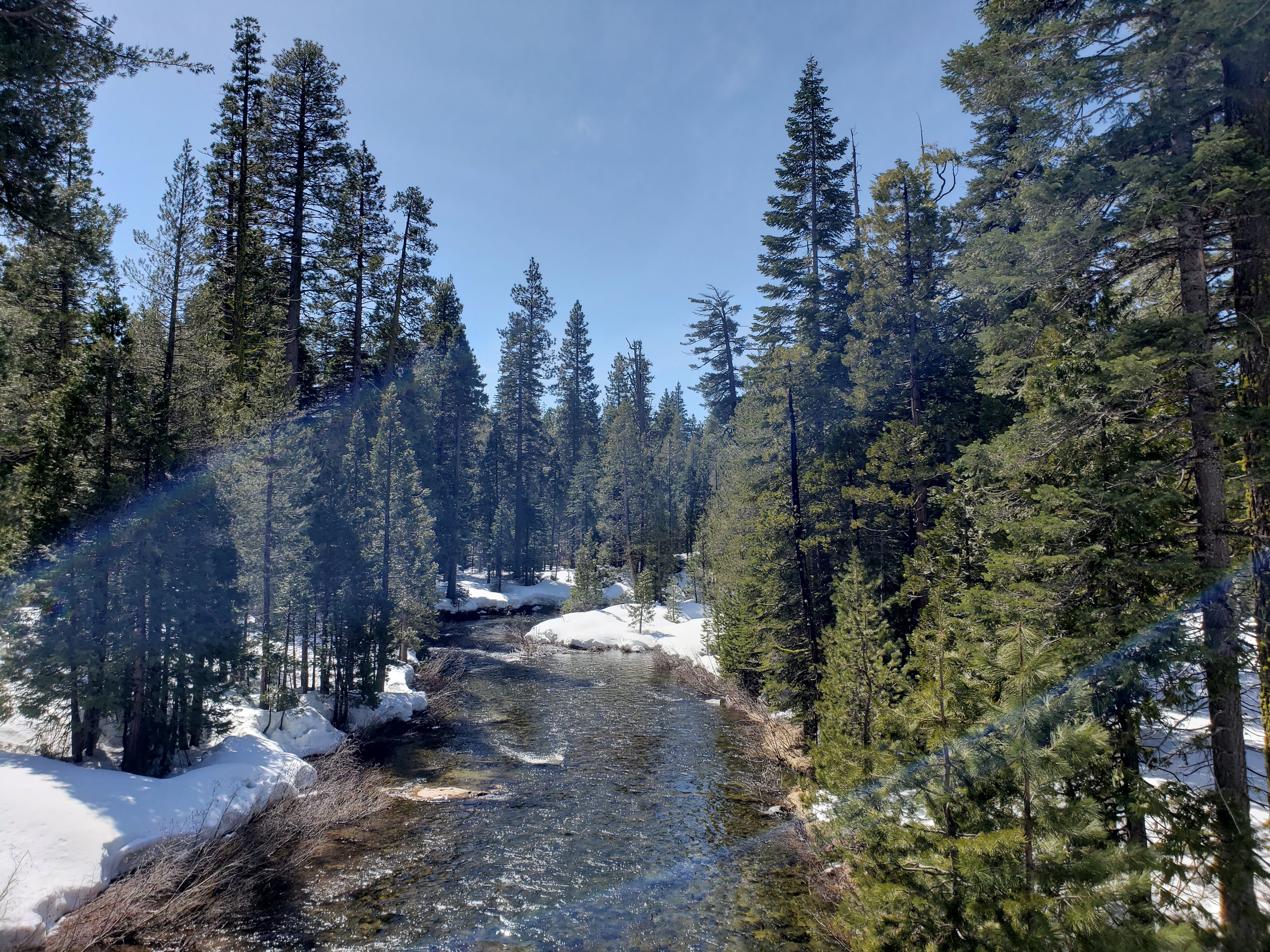
20190331_132615
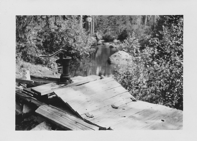
Wentworth Springs 1941

Picture 203
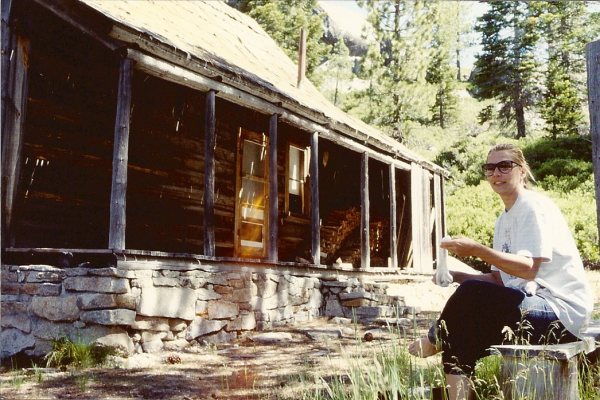
scan0001

leonardi
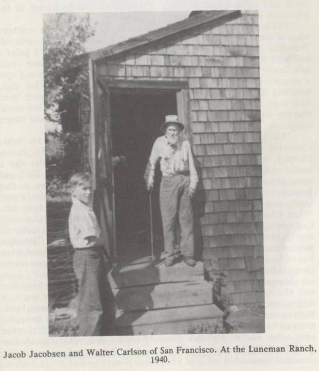
johnnyjacobsen
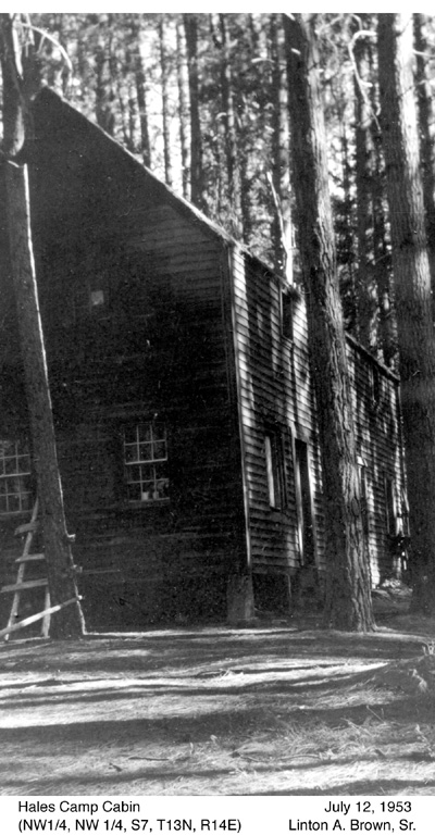
picture028
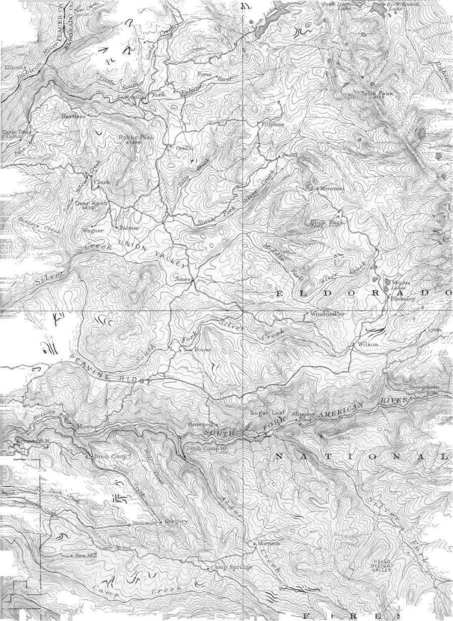
usgsmap1895a

Picture 392
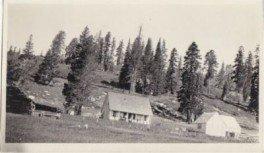
ForniRanch1920
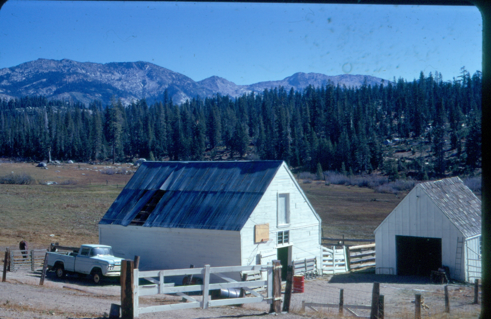
scan20170021
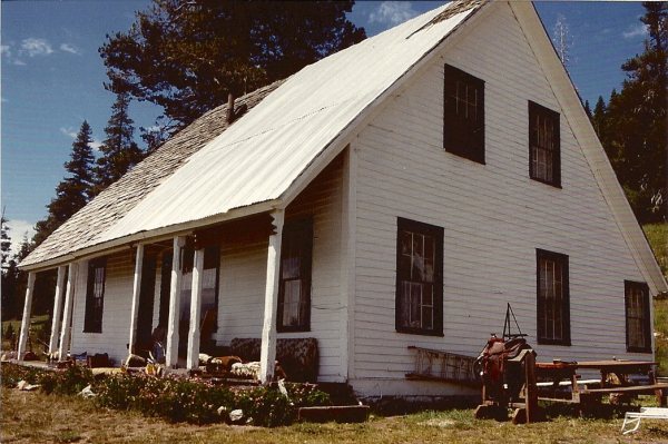
scan0057
usfsmap1982

granleediversiondam
bigsilverdiversiondamoct122005001
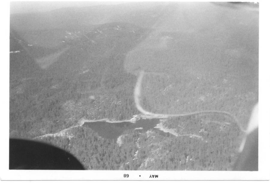
gerlecreekresaerial1968
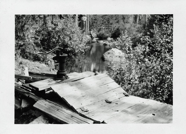
Wentworth Springs July 1941 Holmes Picture
Gerle Brothers Ranch Uniontown

aafrancishouse2
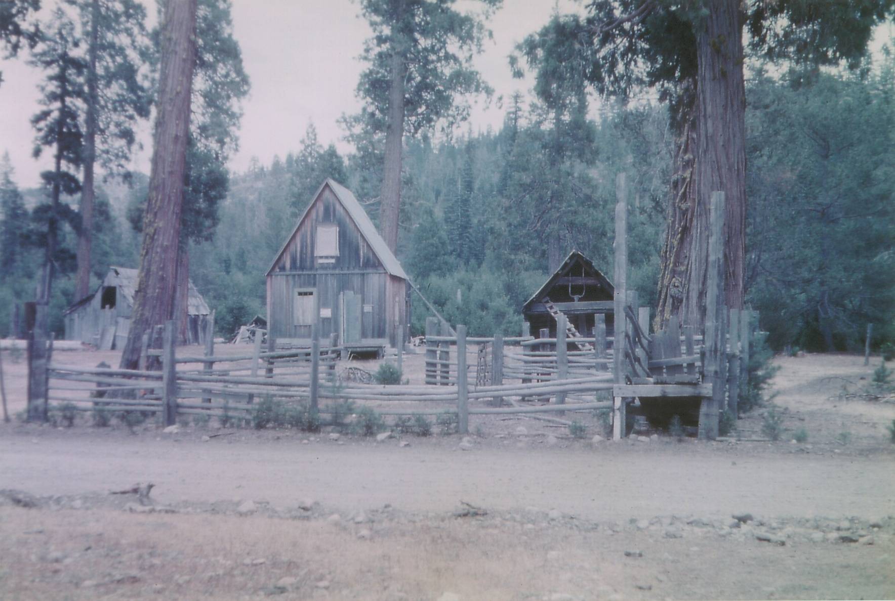
aafranciscowcamp
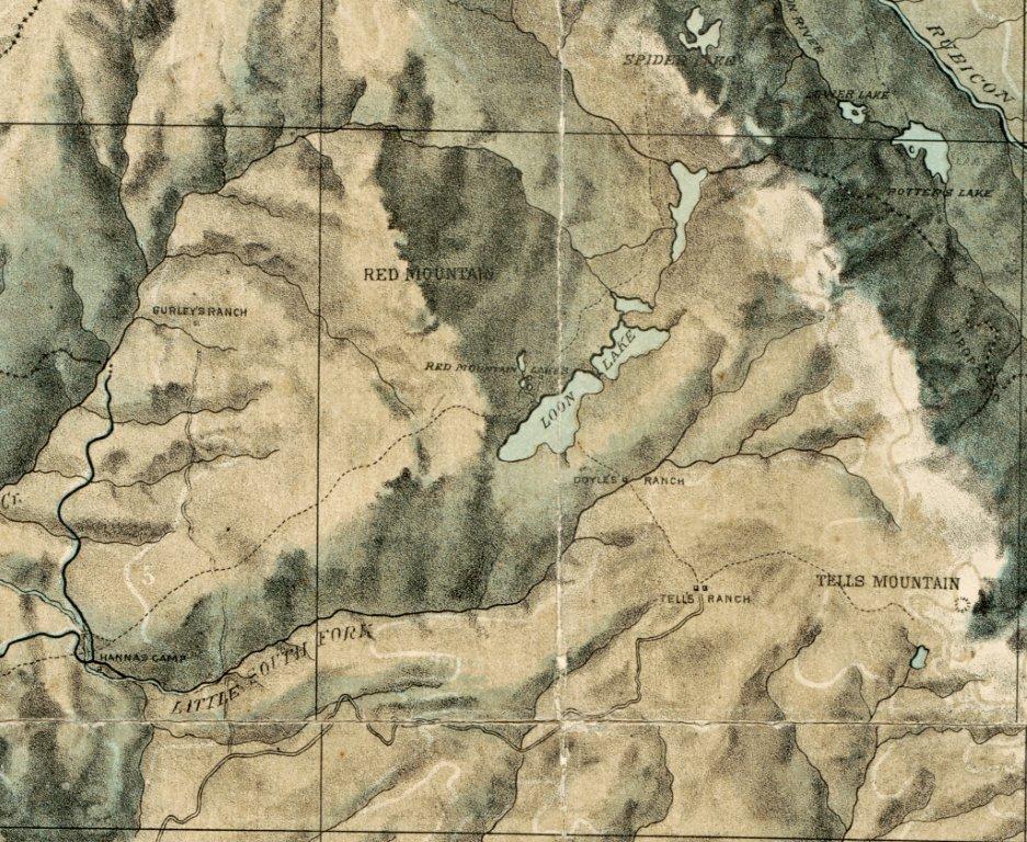
bowmanmap1873DoylesRanch_edited-1

doylesranch1873

dobbascowcampfrenchmeadows

dobbasranch1885

mountainmeadowmapoct62005

WikanderSign1953

BuckIsland1953detail

BuckIsland1953

picture71936
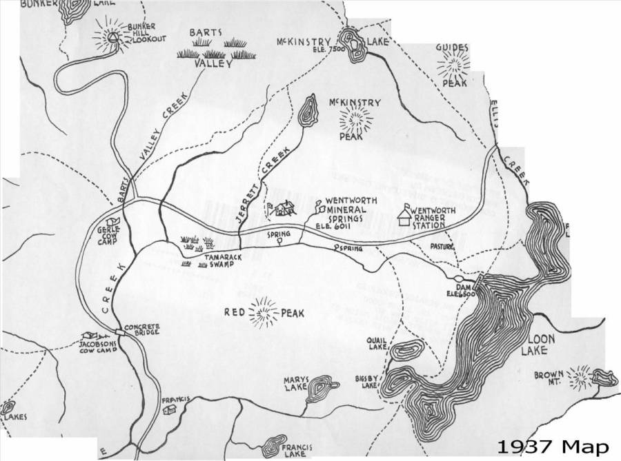
map1937a
wentworthpicture7
wentworthpicture6

loonlakeroad1943
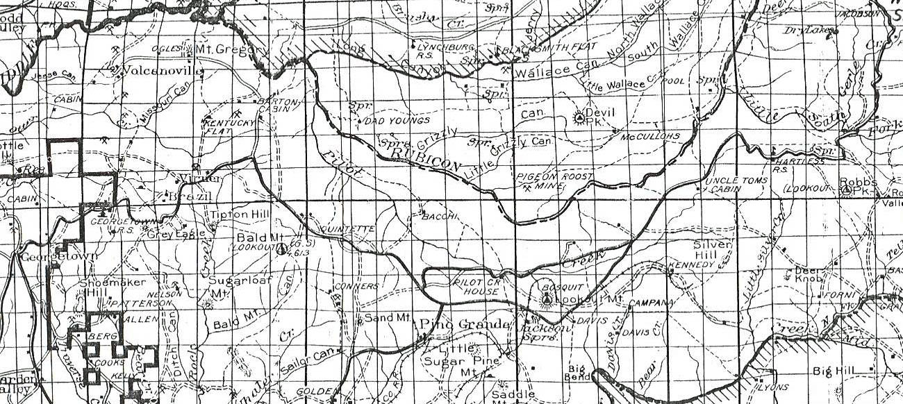
bacchirancheldoradonf1931map

oldcabinpictures0019
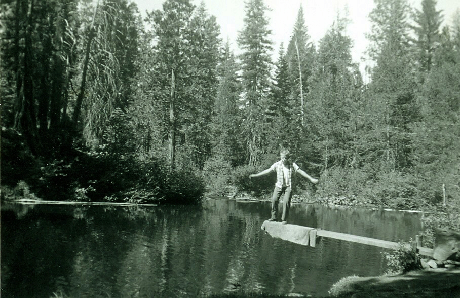
04markhartswimminghole

10HartsgrandchildrenatGerleCrkford

airportflatsbarn1959

airportcampbuildingsummer1968

ccccampgerle1a
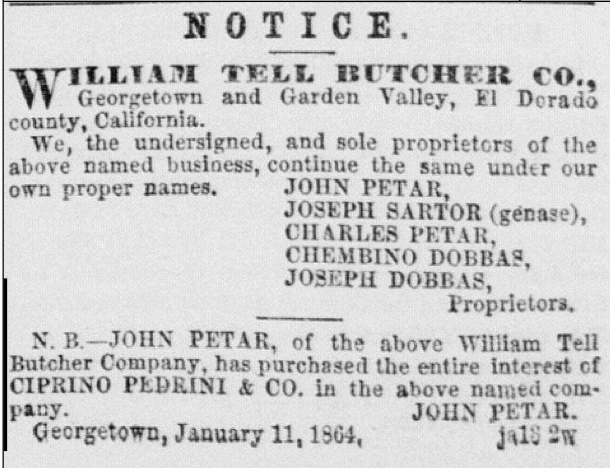
http://cdnc.ucr.edu/cdnc/cgi-bin/cdnc?a=d&cl=search&d=SDU186401
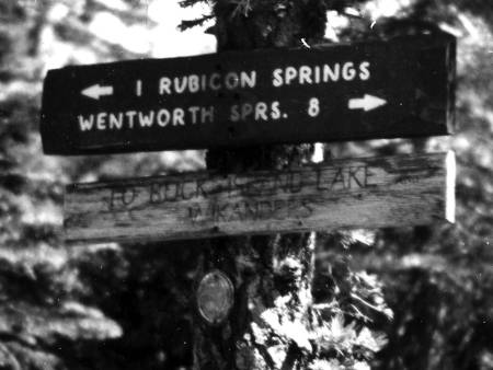
WikanderSign1953
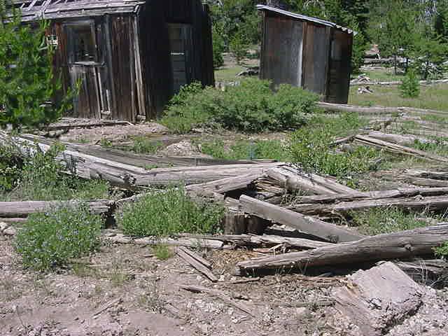
wentworthspringsremains2
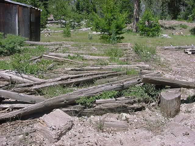
wentworthspringsremains
wentworthspringshotelpaintingcatherninewentworthpeterson2011
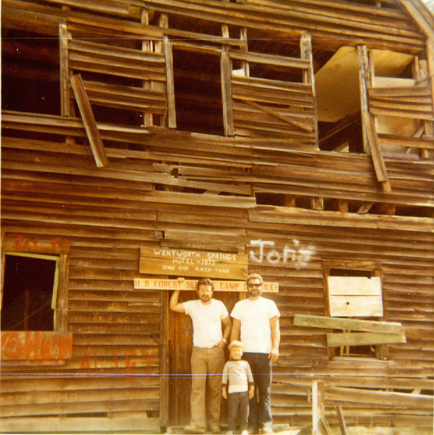
wentworthspringshotelearly70shartsb
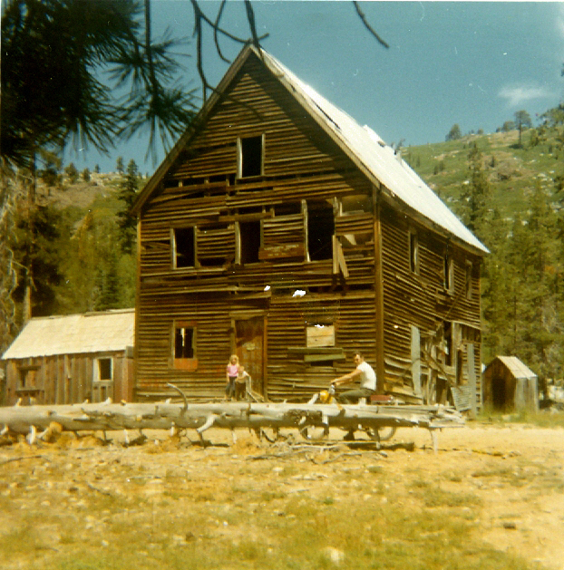
wentworthspringshotelearly70sharts
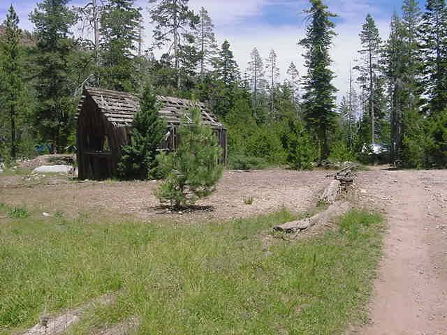
wentworthspringscabins2
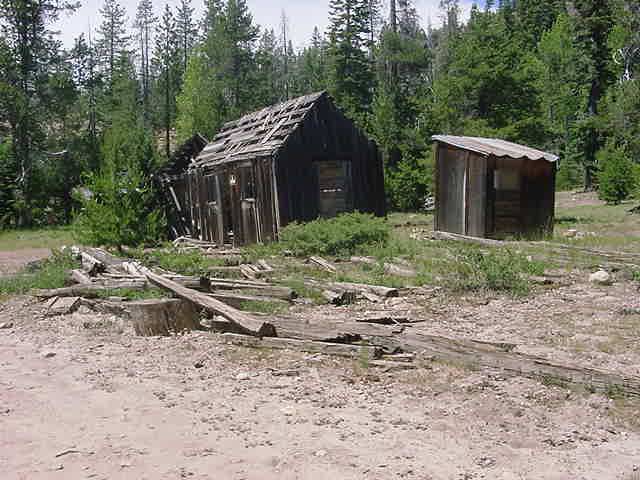
wentworthspringscabins1
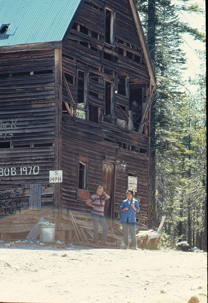
wentworthsprings1973
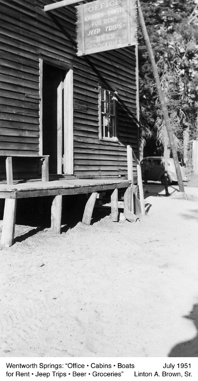
wentworthspgs1951a

wentmcken[1]
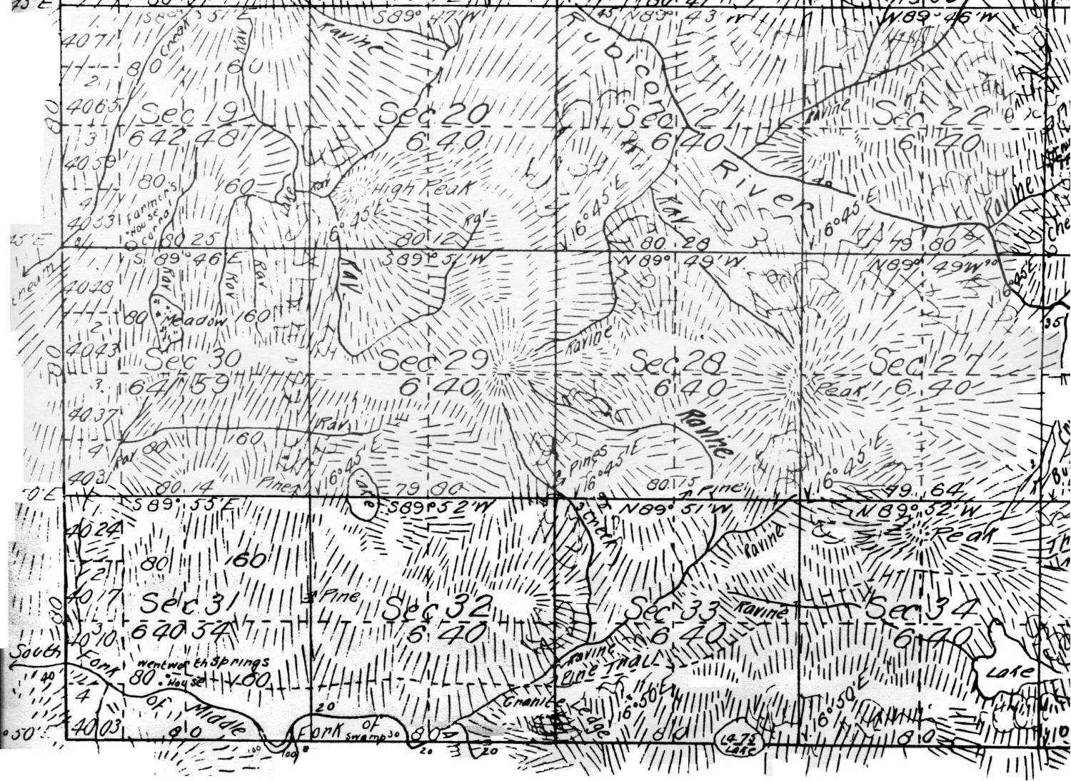
wentmcken
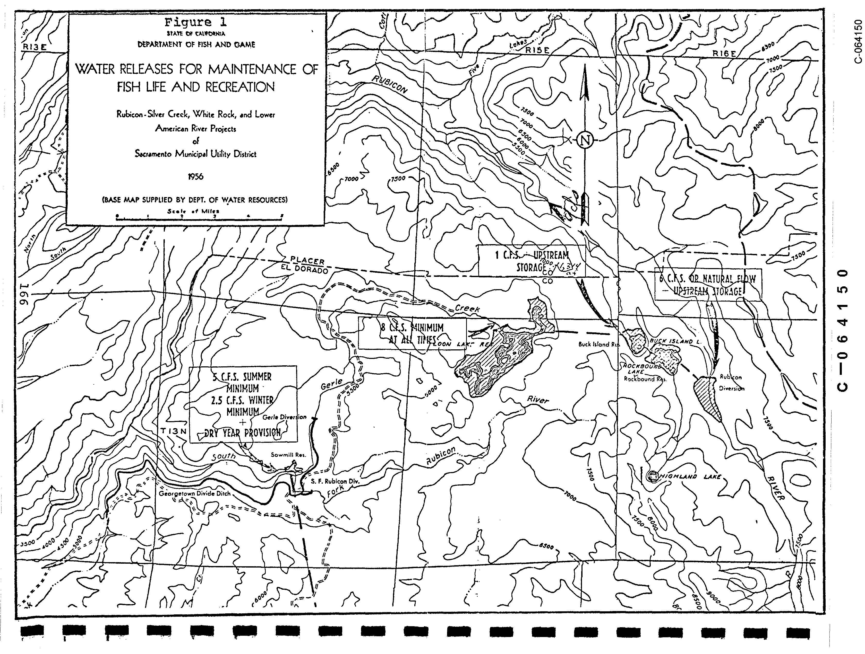
waterreleasesforfishlifegerlecreekloonlake1956
WAGONERCOWCAMP
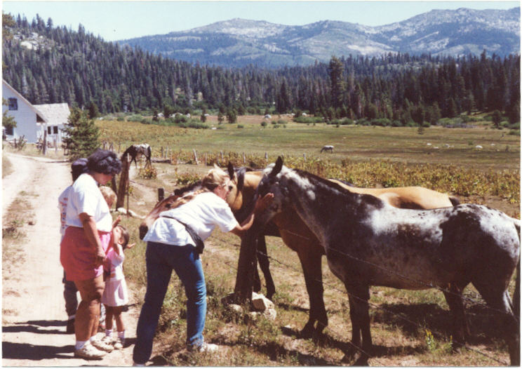
vanvleck91d[1]

vanvleck91d
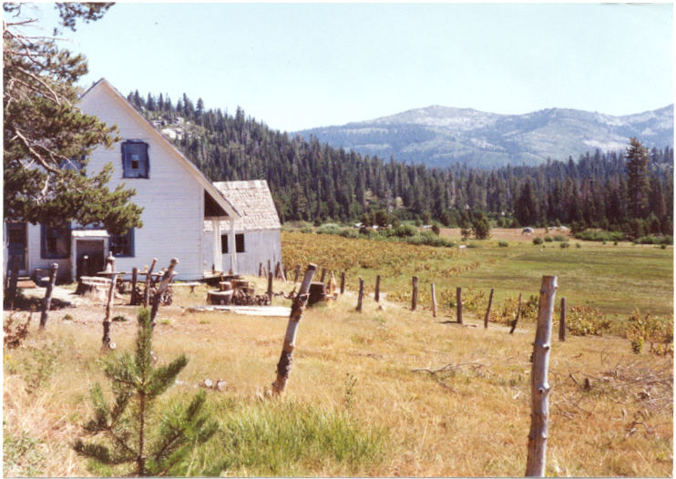
vanvleck91c[1]

vanvleck91c
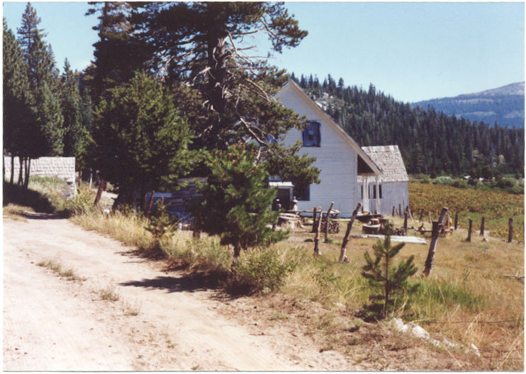
vanvleck91b[1]

vanvleck91b

vanvleck91a[1]

vanvleck91a

usfsmap1916
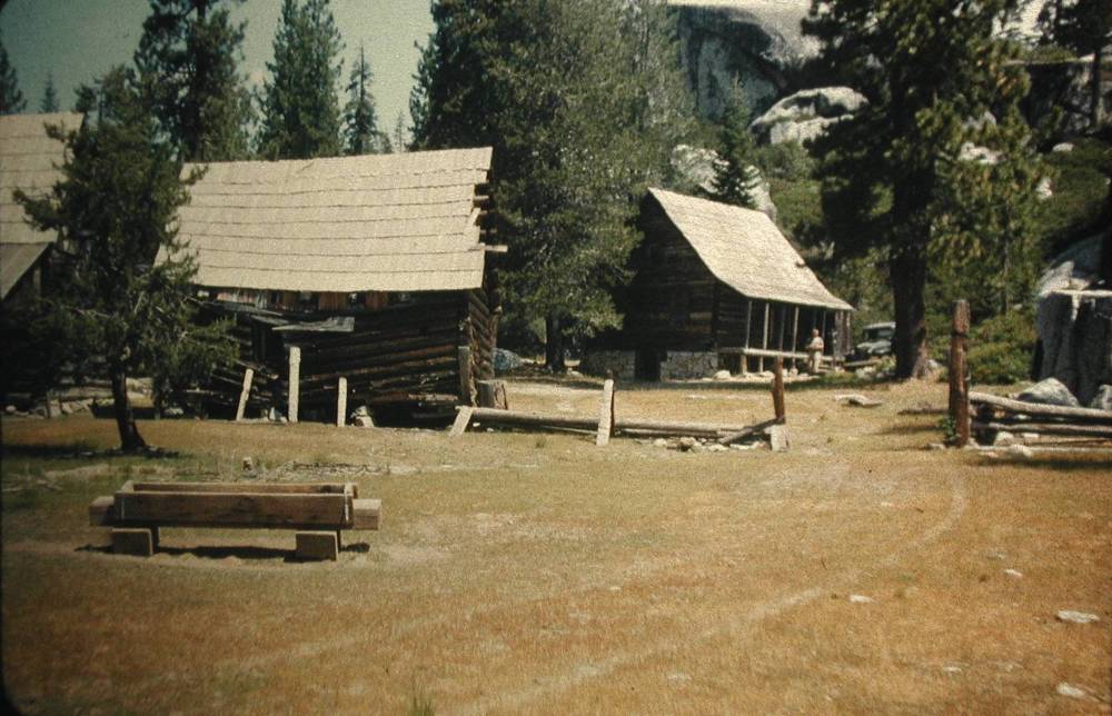
upperbassi2[1]

upperbassi2
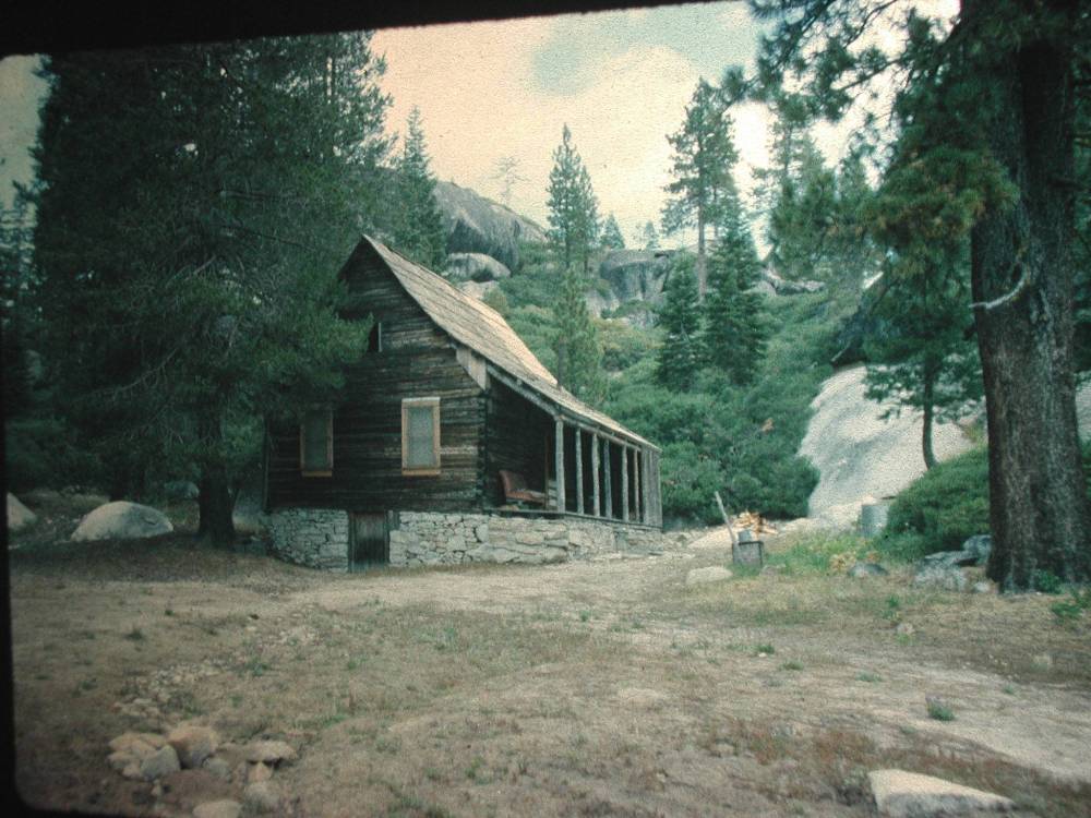
upperbassi1

uncletomscabin3

uncletomscabin2[1]

uncletomscabin2
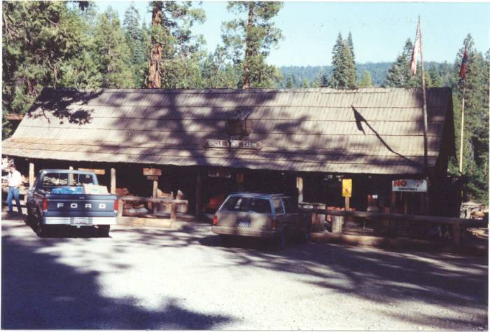
uncletomscabin1[1]

uncletomscabin1

TinkerMAJGCCNov30toOct32
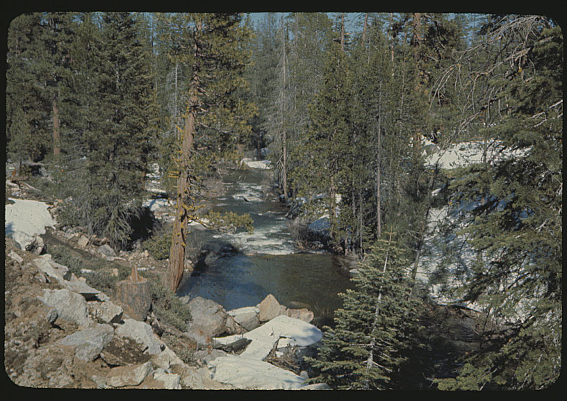
southforkrubicon64

schleinstation1964[1]
schleinstation1964
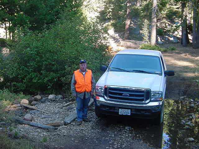
rupley03b
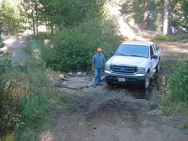
rupley03a
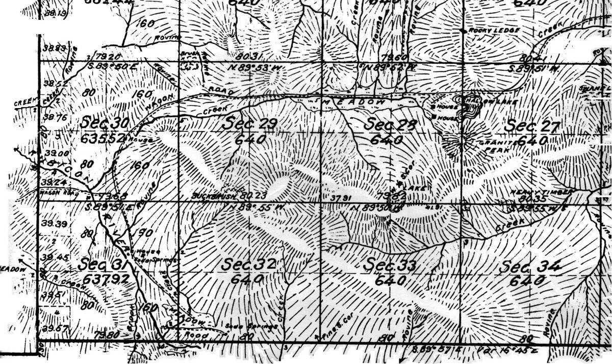
rubiconsprings

rubiconspgs4[1]
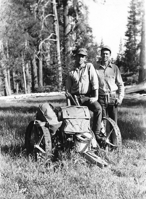
rubiconspgs4
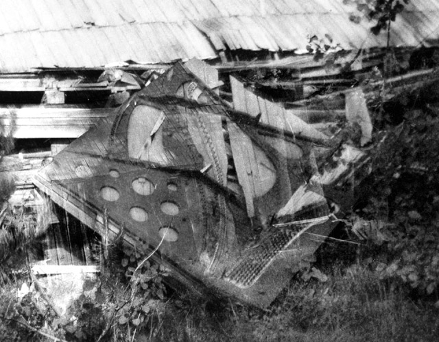
rubiconspgs3[1]

rubiconspgs2[1]

rubiconspgs1[1]
rogershelicoptersloonlakefeb1960a

restcampfoundation1003g[1]
restcampfoundation1003f[1]
restcampfoundation1003e[1]
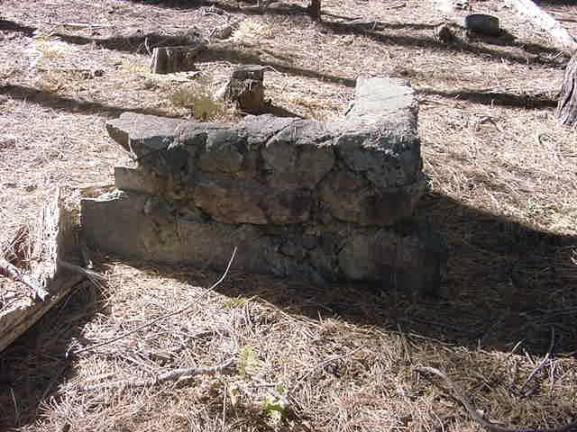
restcampfoundation1003e
restcampfoundation1003d[1]
restcampfoundation1003c[1]
restcampfoundation1003b[1]

restcampfoundation1003b

restcampfoundation1003a
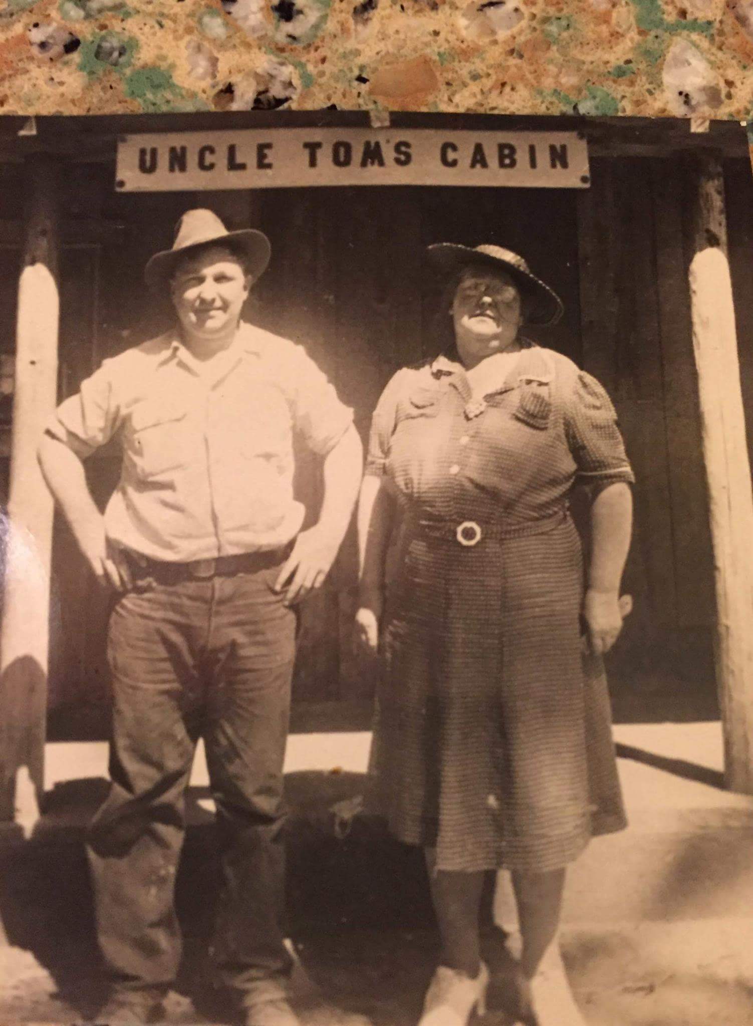
RayandIrmaLawyerUncleTomsCabin
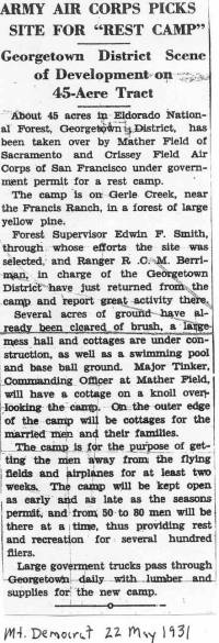
R&R Camp at Gerle2a
R&R Camp at Gerle
pumps[1]

pinograndemilltown
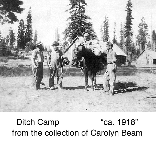
picture066[1]
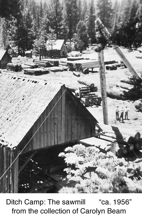
picture050[1]
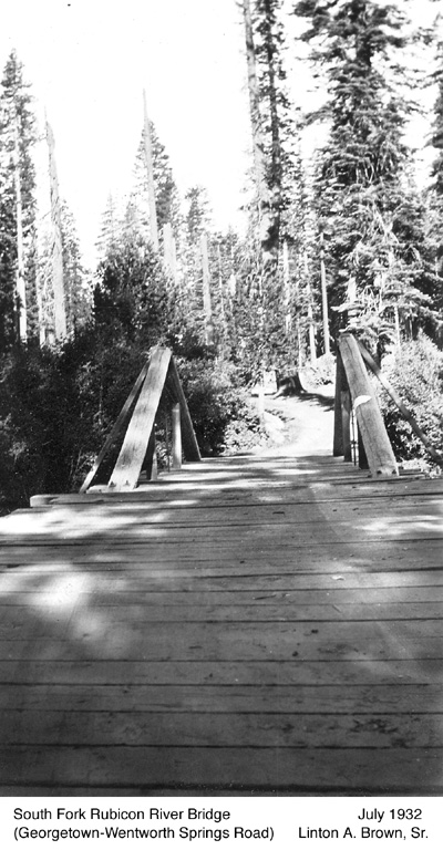
picture043[1]
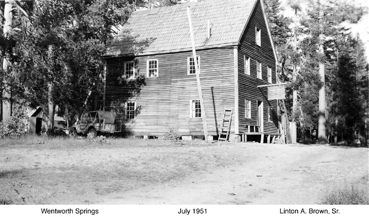
picture037
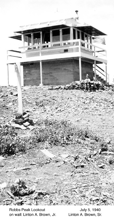
picture032[1]
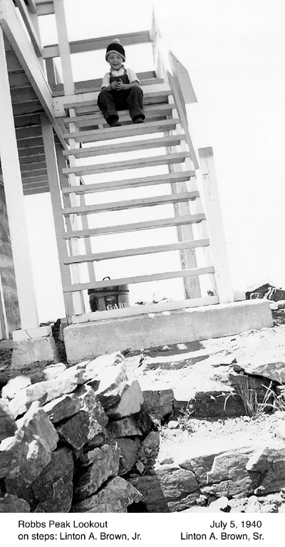
picture031[1]

picture030[1]

picture029[1]

picture028[1]
pic41[1]
pic38[1]
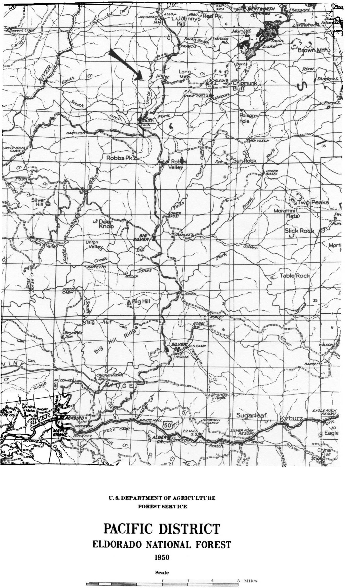
pacificdistrictmap1950[1]
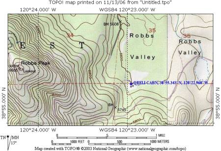
oreliranchrobbsvalley
oreli1915

oldroadfrancis[1]
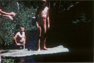
oldcabinpictures0019

murrycamp0504g[1]
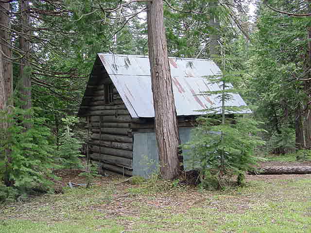
murrycamp0504f[1]

murrycamp0504e[1]

murrycamp0504d[1]

murrycamp0504c[1]
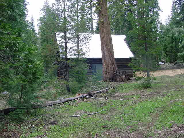
murrycamp0504c

murrycamp0504b[1]
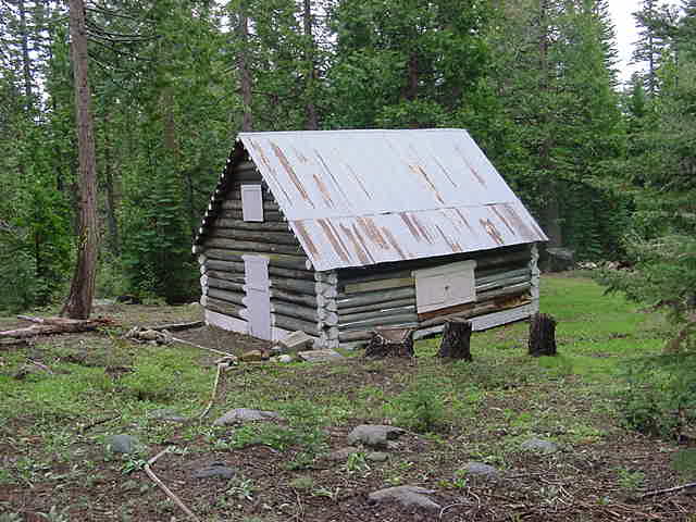
murrycamp0504a[1]
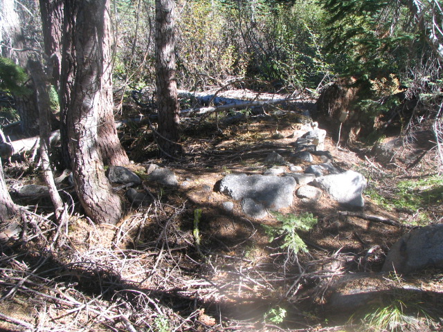
moutainmeadowcabinruinsoct62005001
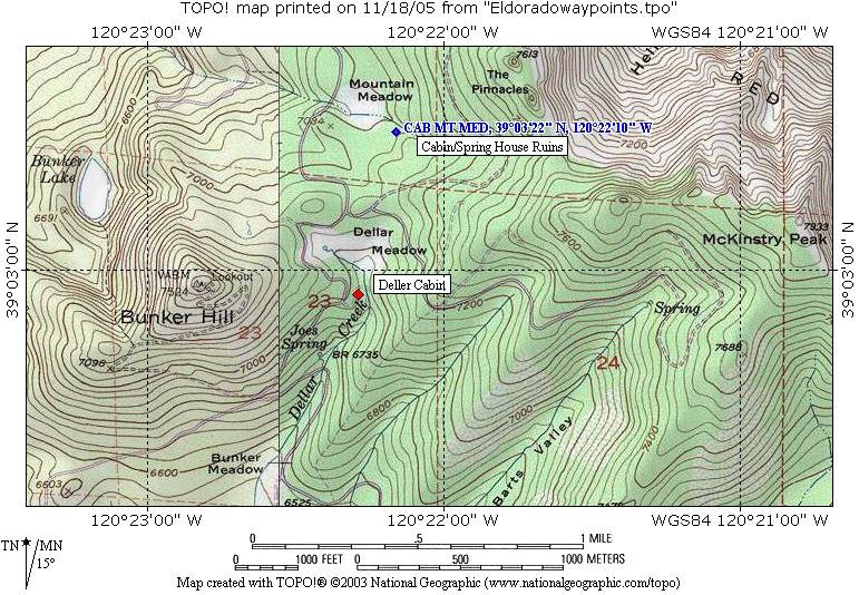
mountainmeadowmapoct62005

mountainmeadowcabinruinsoct62005018[1]

mountainmeadowcabinruinsoct62005017
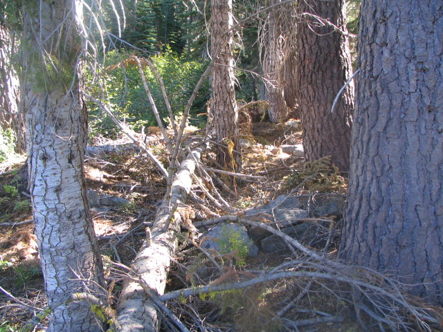
mountainmeadowcabinruinsoct62005015
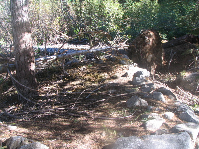
mountainmeadowcabinruinsoct62005014
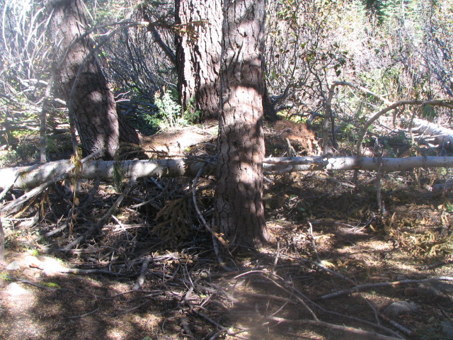
mountainmeadowcabinruinsoct62005013
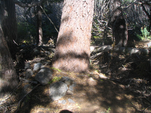
mountainmeadowcabinruinsoct62005012
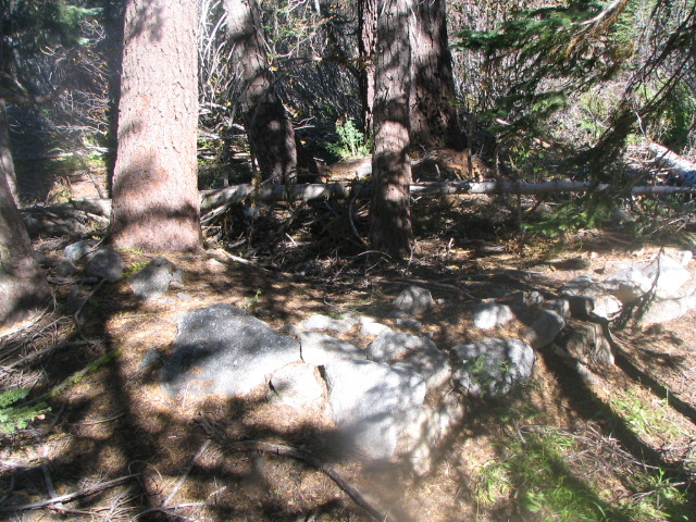
mountainmeadowcabinruinsoct62005011[1]
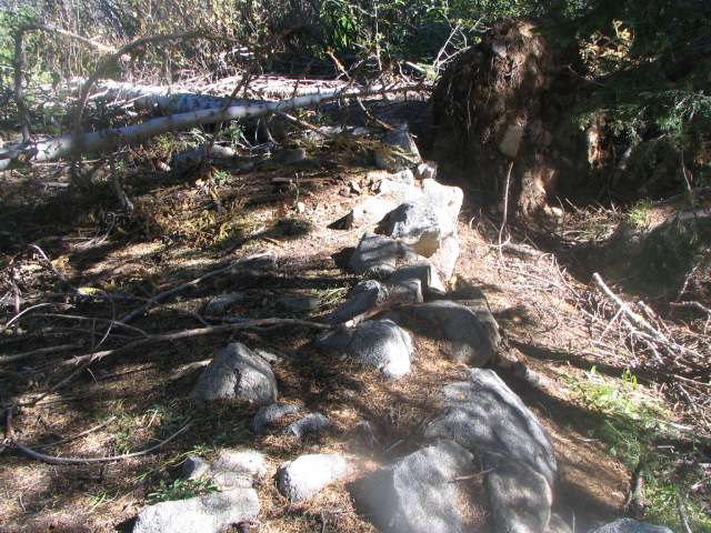
mountainmeadowcabinruinsoct62005010[1]

mountainmeadowcabinruinsoct62005010
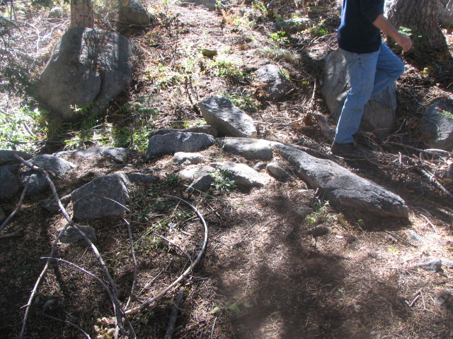
mountainmeadowcabinruinsoct62005009
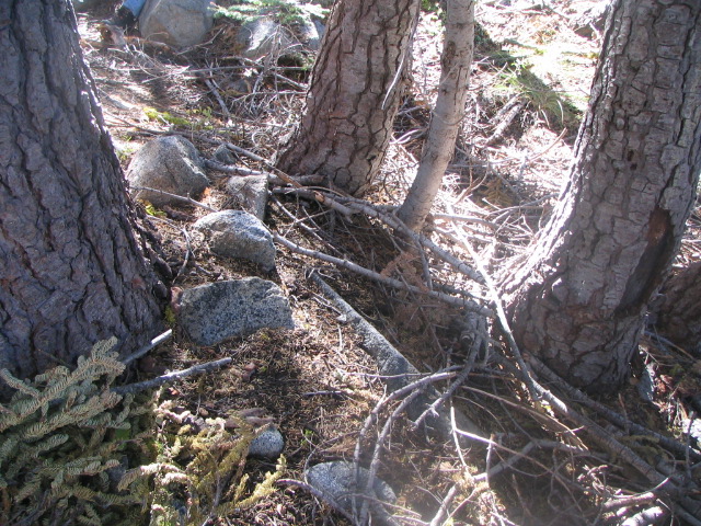
mountainmeadowcabinruinsoct62005008
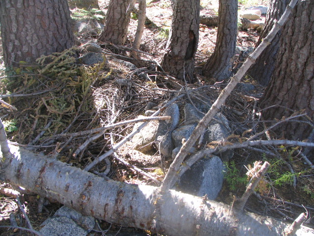
mountainmeadowcabinruinsoct62005007
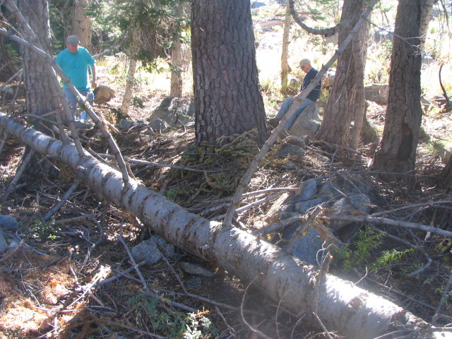
mountainmeadowcabinruinsoct62005006
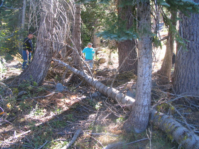
mountainmeadowcabinruinsoct62005005
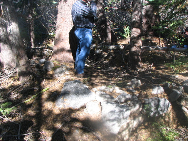
mountainmeadowcabinruinsoct62005004
mountainmeadowcabinruinsoct62005003[1]

mountainmeadowcabinruinsoct62005003
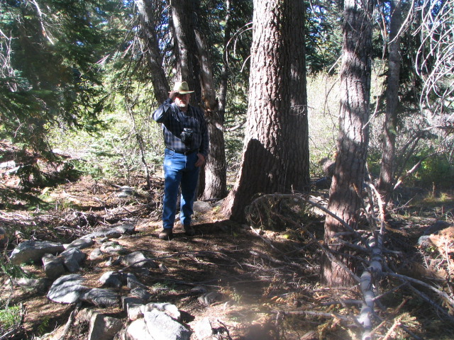
mountainmeadowcabinruinsoct62005002

mountainmeadowcabinruinsoct62005001
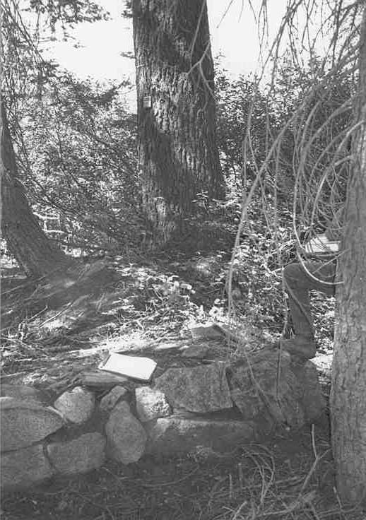
mountainmeadow1d
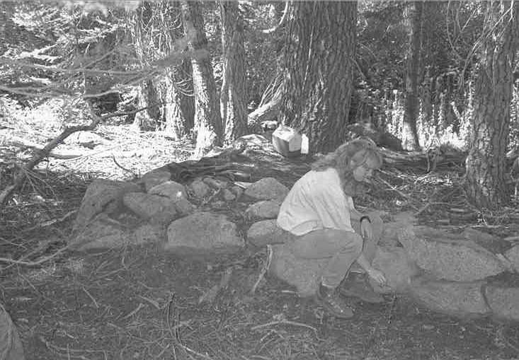
mountainmeadow1c
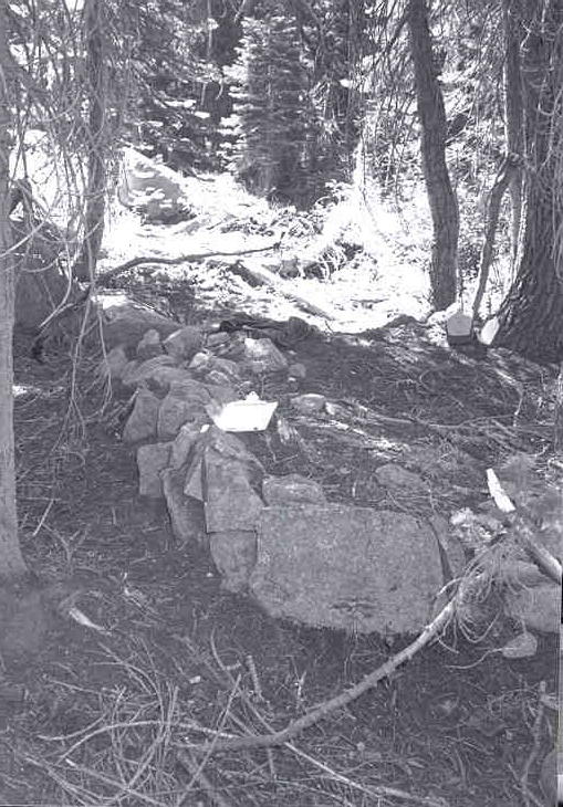
mountainmeadow1b
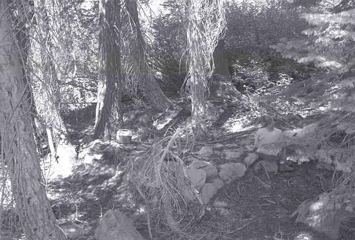
mountainmeadow1a

mommckinstry90
mdsept301916[1]

mapofaebrownscabins
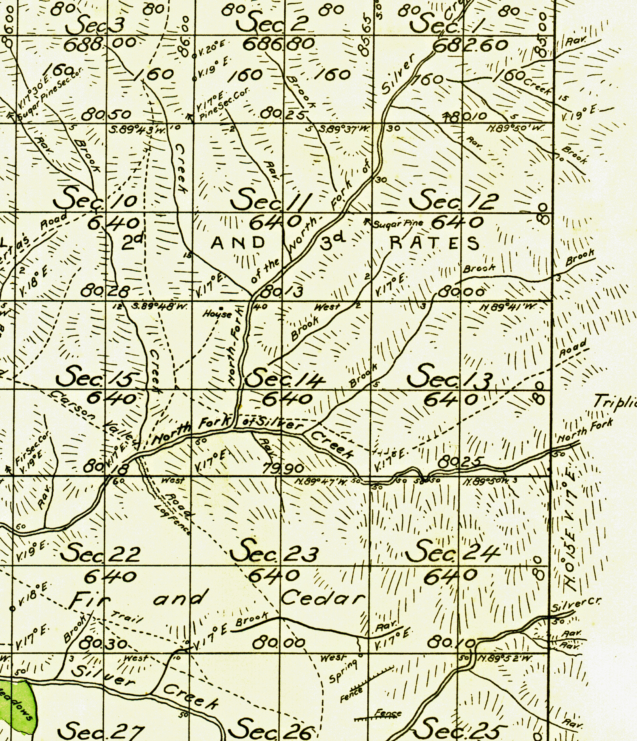
lowerbassiranchsurveyplatmap1874
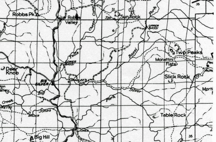
lowerbassiranchmaptmap1950

lowerbassiranch1c
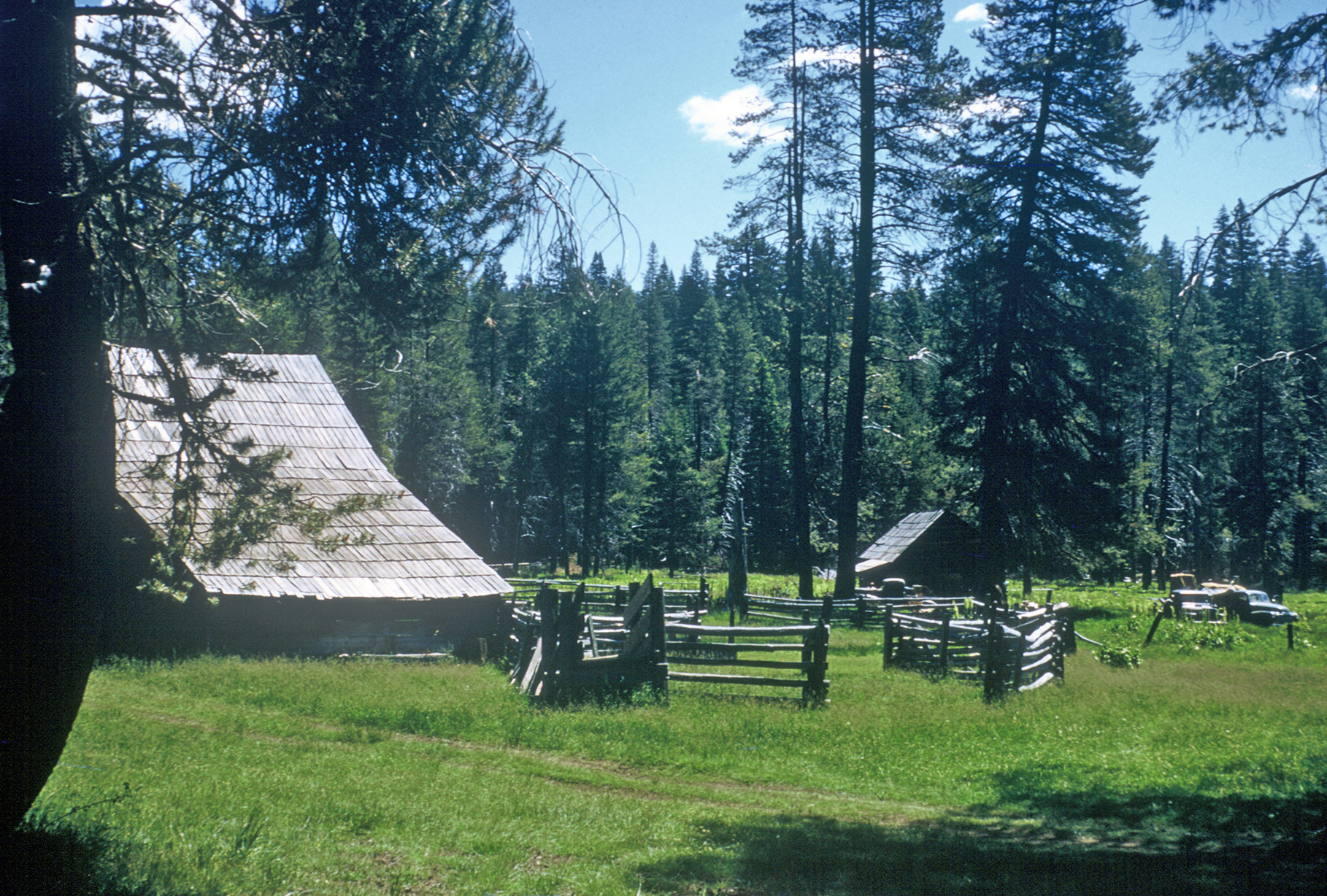
lowerbassiranch1b

lowerbassiranch1a
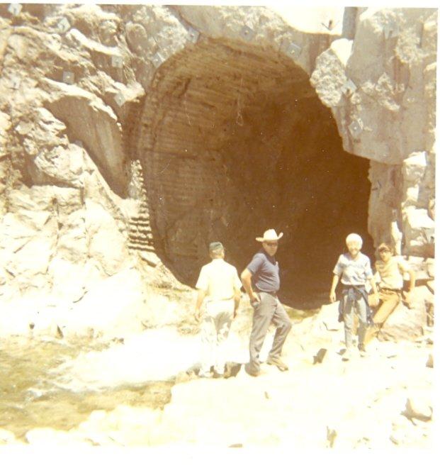
loonlaketunnelearly1970s
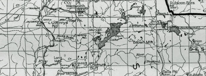
loonlakeroad1950
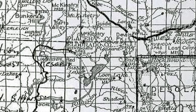
loonlakeroad1943

loonlakedamearly1990b

loonlakedamearly1990a
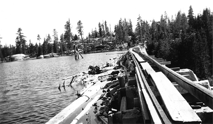
loonlakedam1940[1]

loonlakedam1940
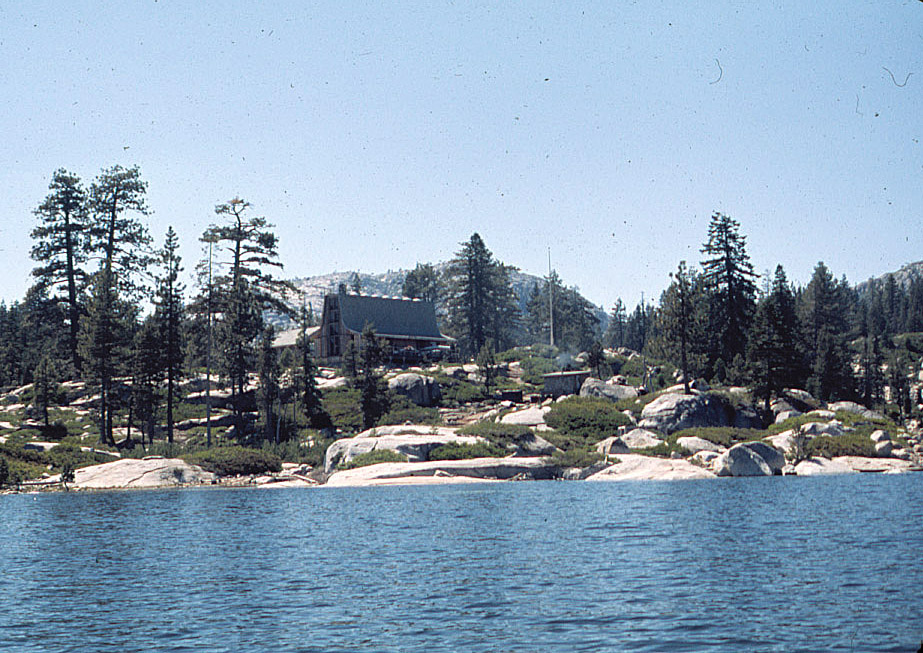
loonlakebsalodge4[1]
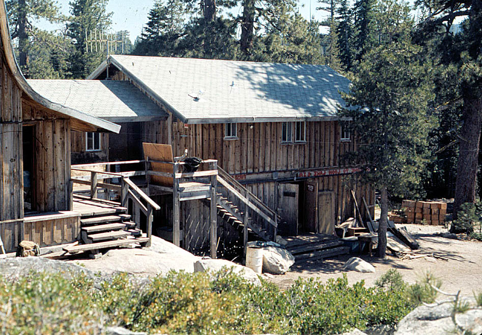
loonlakebsalodge3[1]
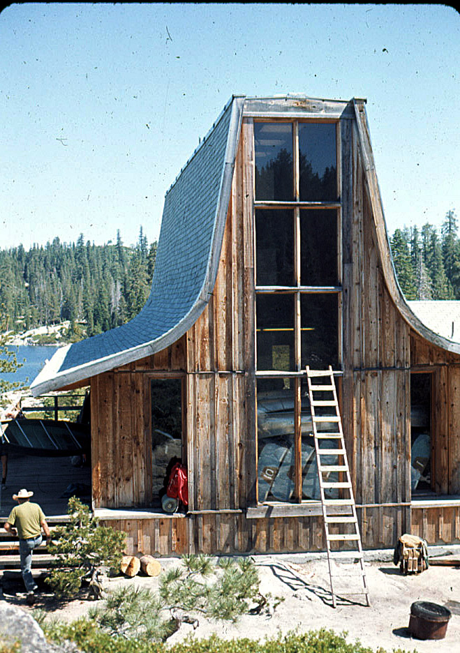
loonlakebsalodge2[1]
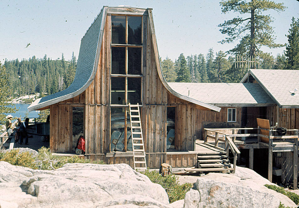
loonlakebsalodge1[1]
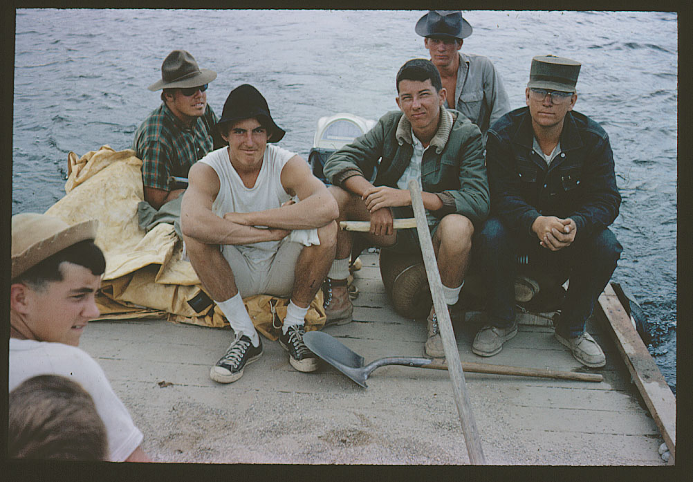
loonlakebsa64f[1]
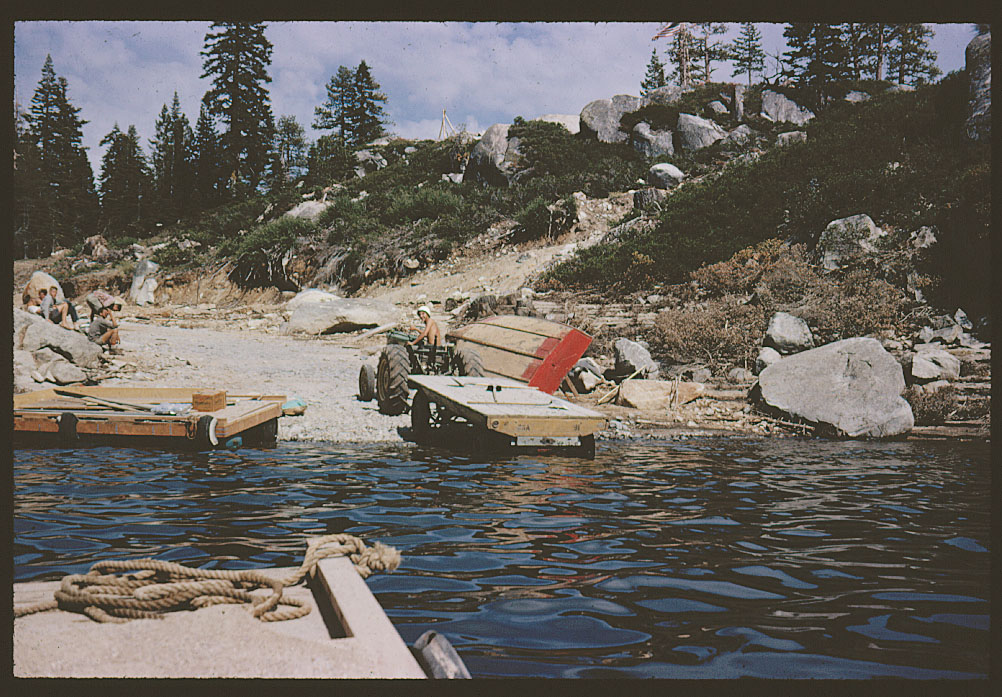
loonlakebsa64e[1]
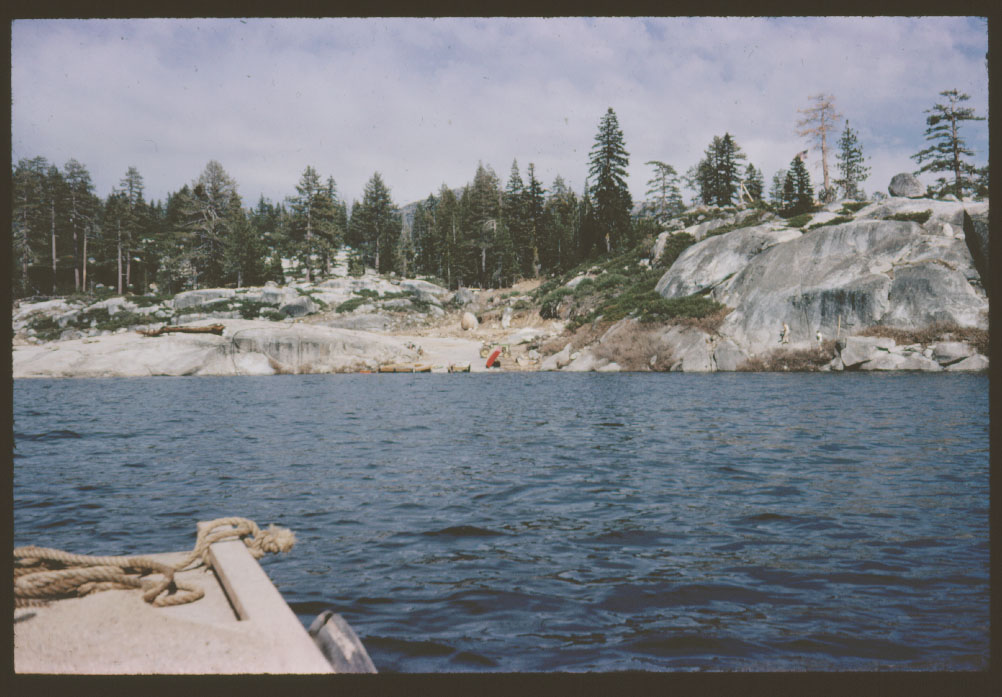
loonlakebsa64d[1]

loonlakebsa64c[1]

loonlakebsa64b[1]
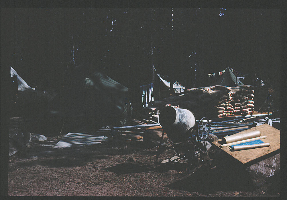
loonlakebsa64a[1]
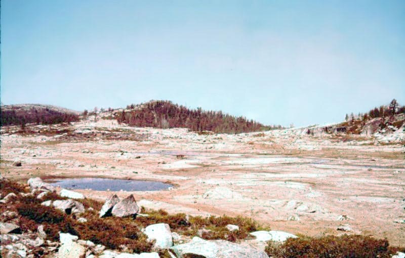
loonlake1962c
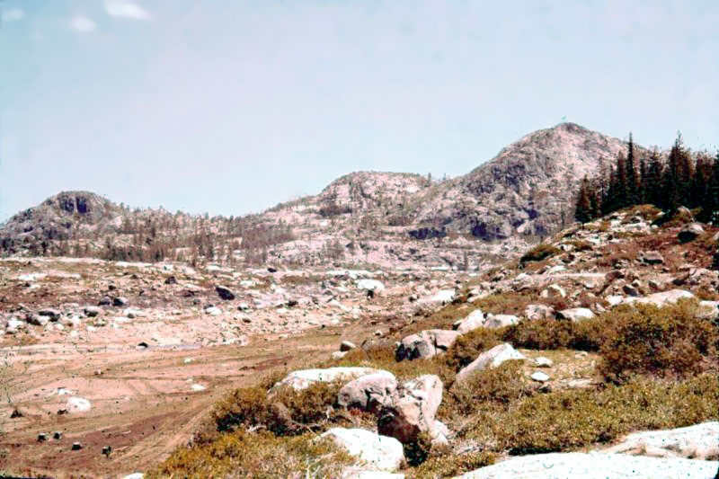
loonlake1962a
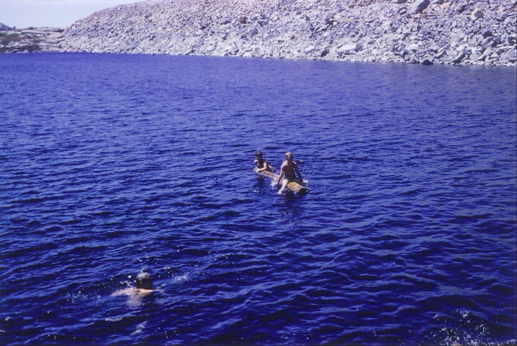
loonlake1
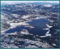
loonlake
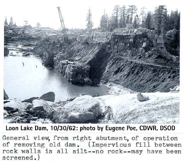
loon103062b[1]
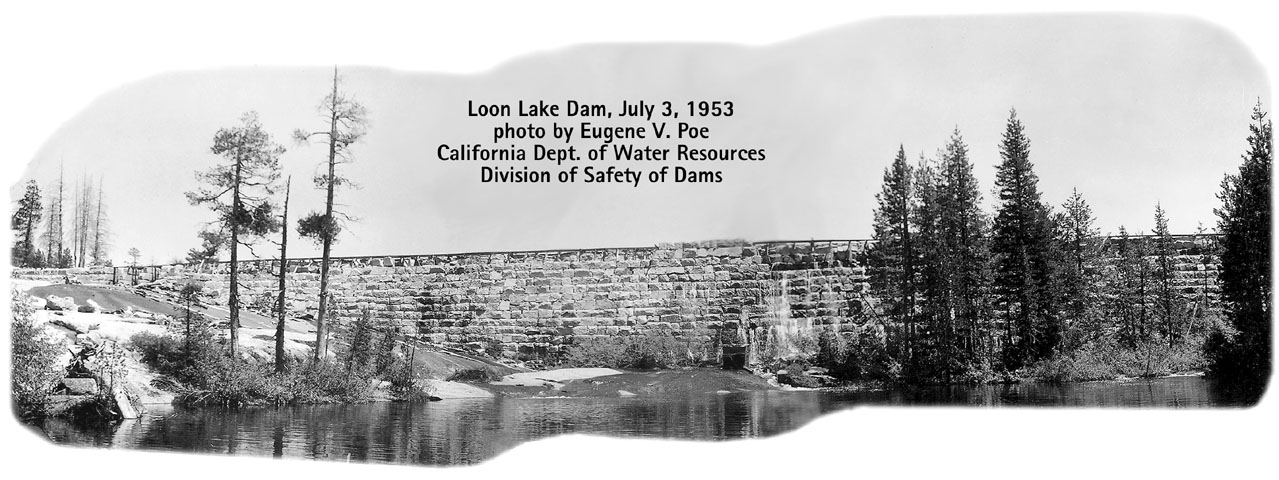
loon070353[1]
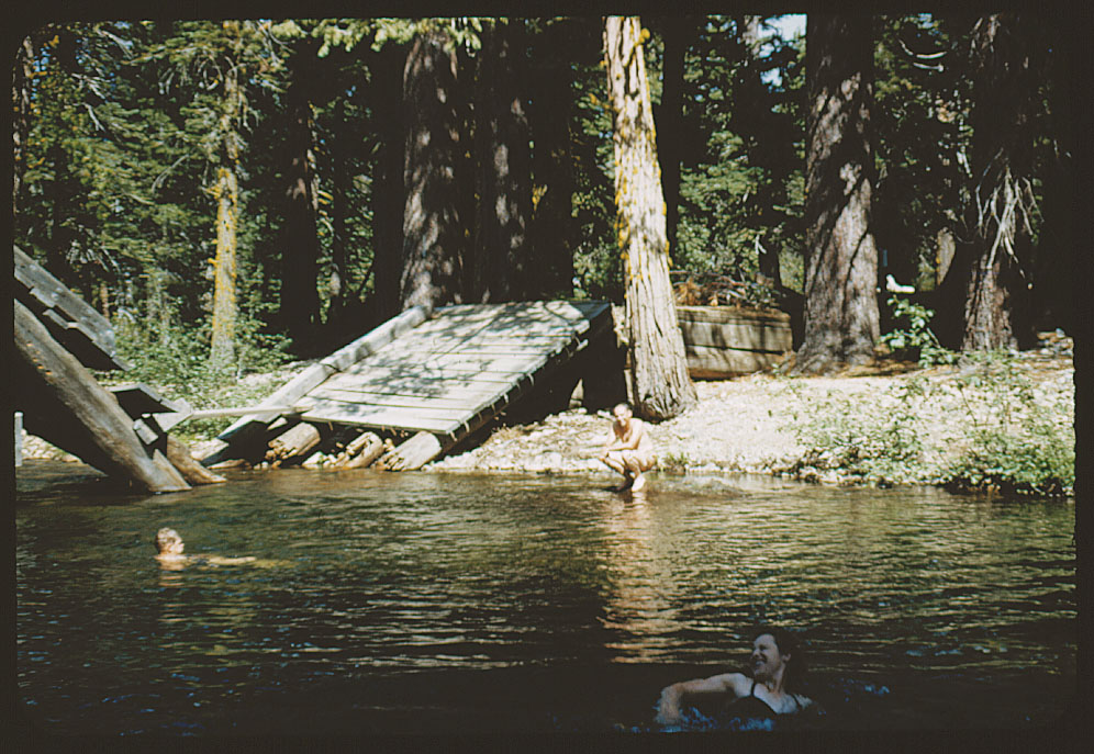
loggerlecreekbridge
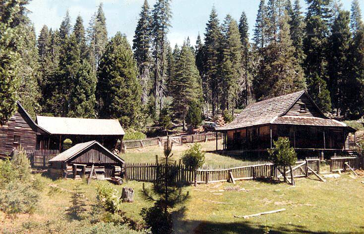
leonardi[1]
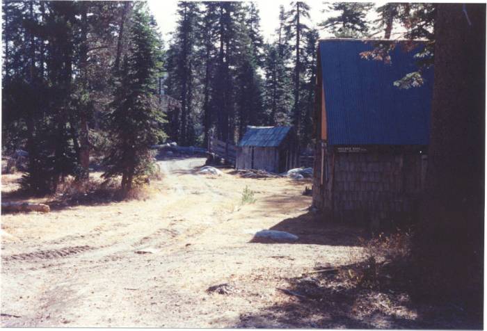
lawyerscowcamp3[1]

lawyerscowcamp2[1]
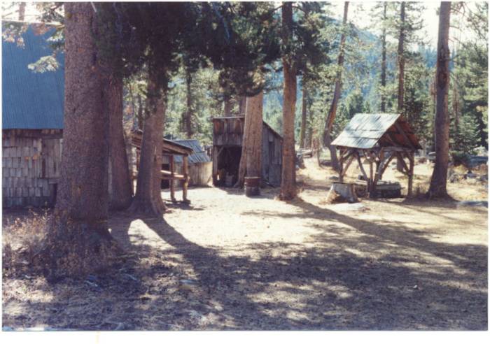
lawyerscowcamp2
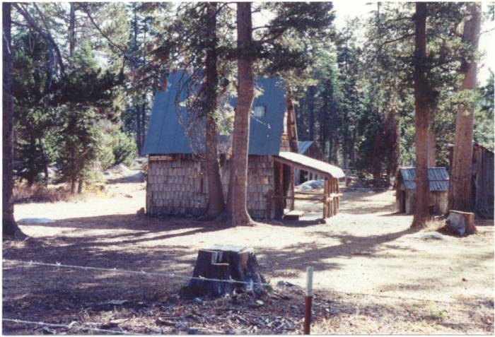
lawyerscowcamp1[1]
laketahoemap1915[1]
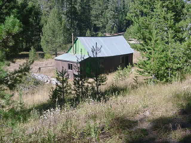
jonesssilver03e
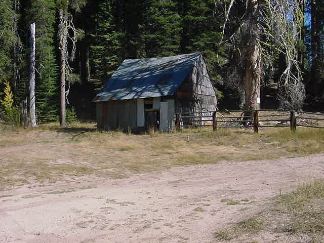
jonessilver03g
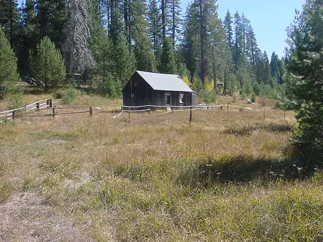
jonessilver03f
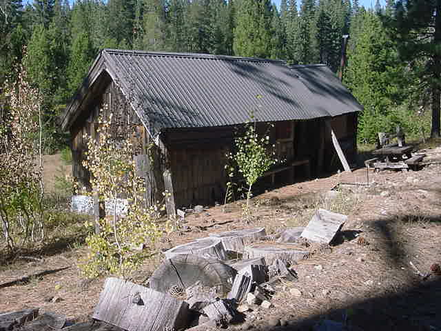
jonessilver03d
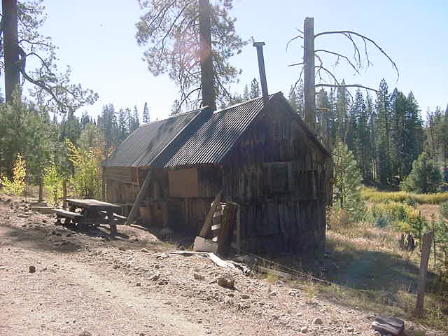
jonessilver03c
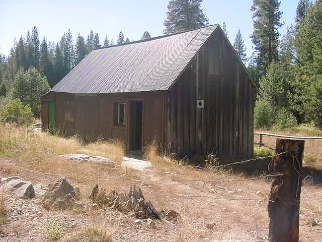
jonessilver03a

joespring[1]

jacobsongerlecreekbridge1922b

jacobsens1895[1]

jacobsengerlerailroadbridge1980s
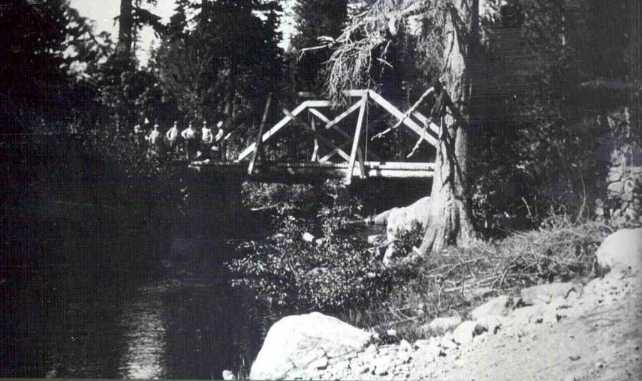
Jacobsen gerle bridge 1922
icehousedamnb
icehousedam
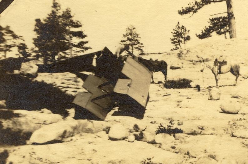
huntairplanecrashloonlake19221c[1]
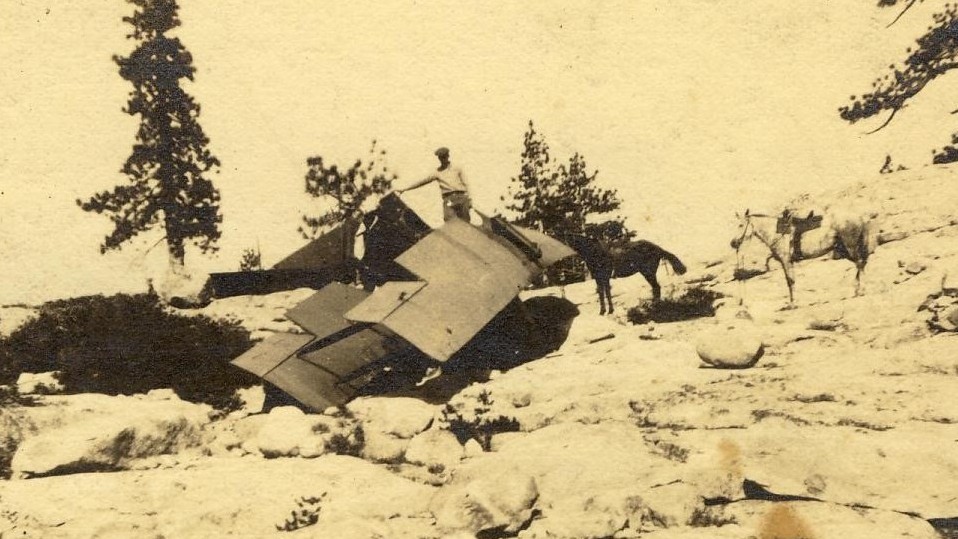
huntairplanecrashloonlake19221b[1]
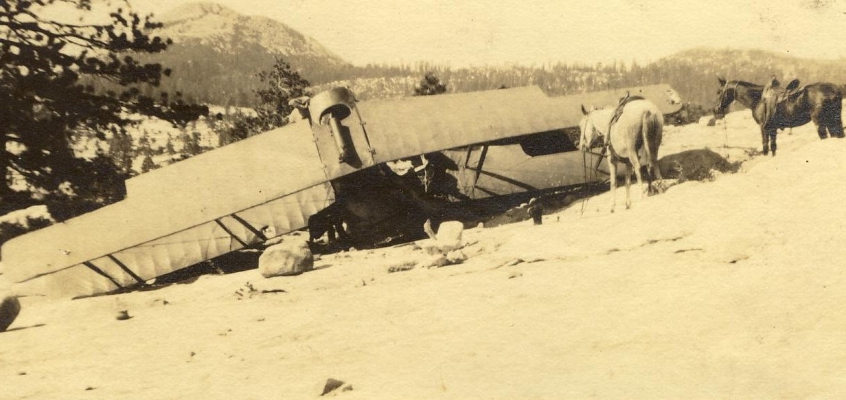
huntairplanecrashloonlake19221a[2]
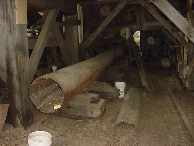
hannascamp3[1]
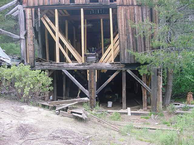
hannascamp2[1]
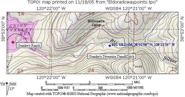
granleediversiondam
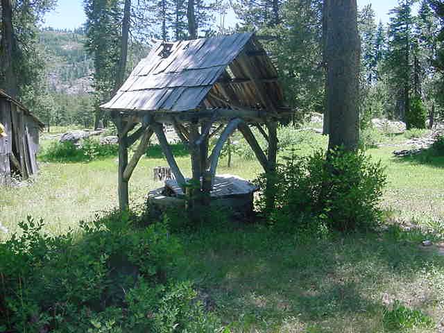
gerlesranchwell[1]
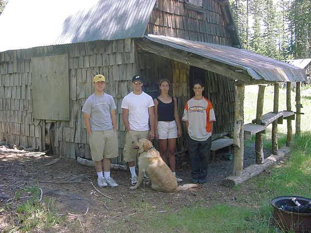
gerlesranchhouse[1]
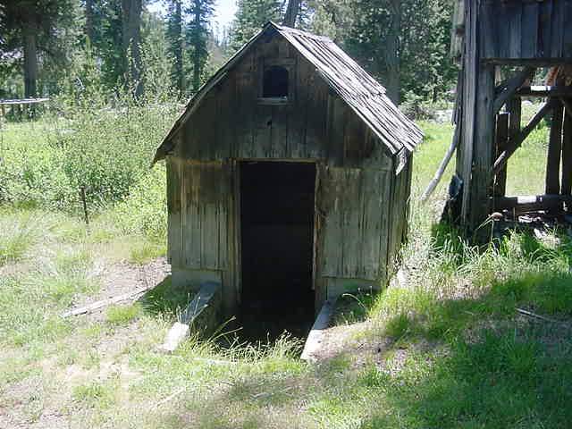
gerlesranch1
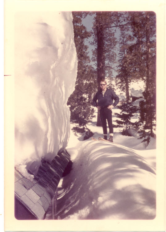
gerlesnowload69
gerlemay03c
gerlelakejan12-03a
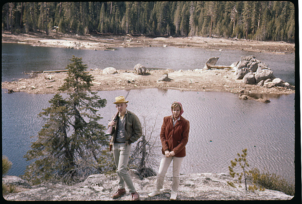
gerlelake64a
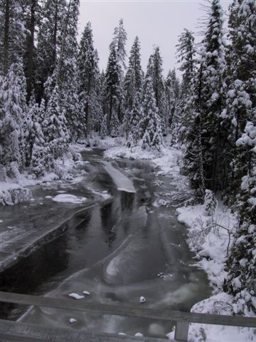
gerlejan12-03b
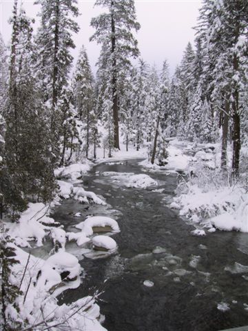
gerlejan12-03a
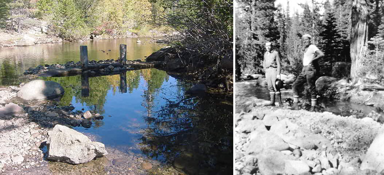
gerledivdam1936[1]
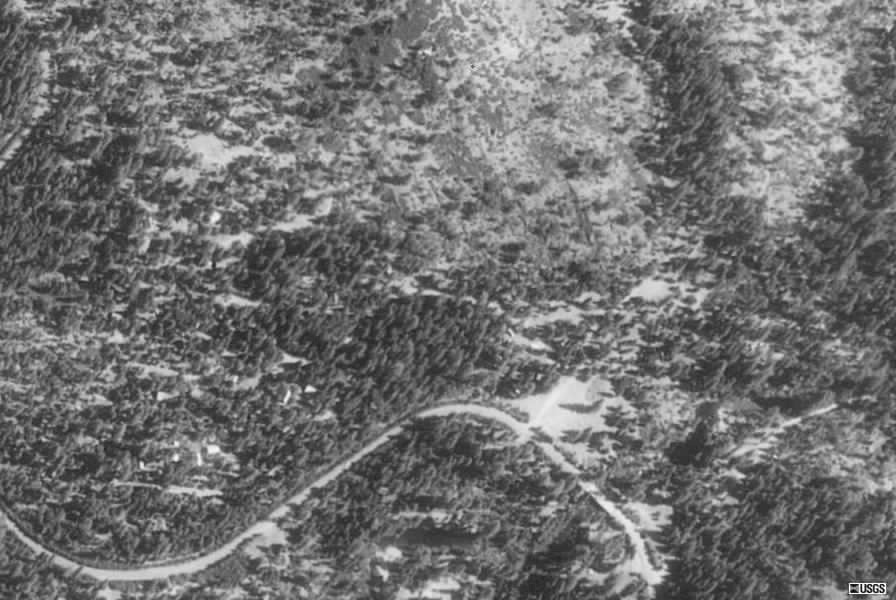
gerlecreekshtract

gerlecreekresaerial1968
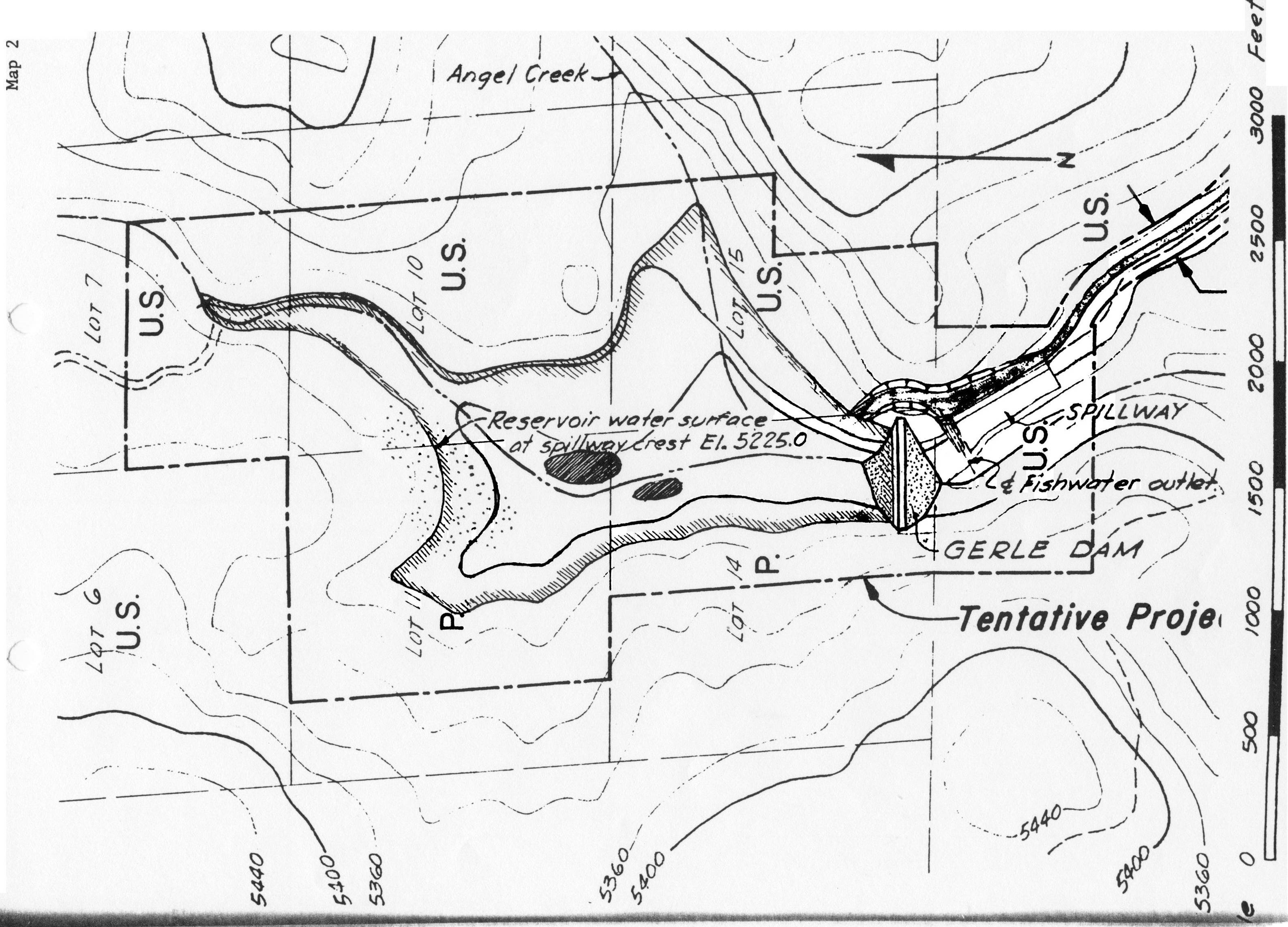
gerlecreekplan[1]
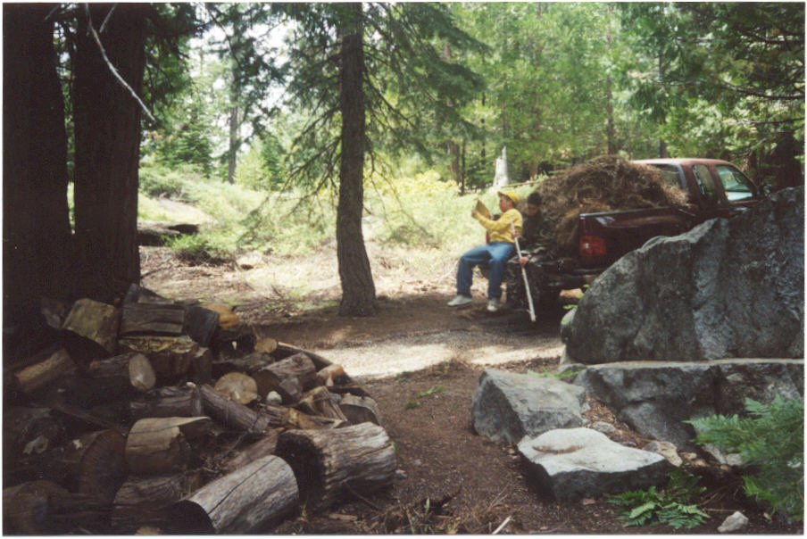
gerlecreekneedles
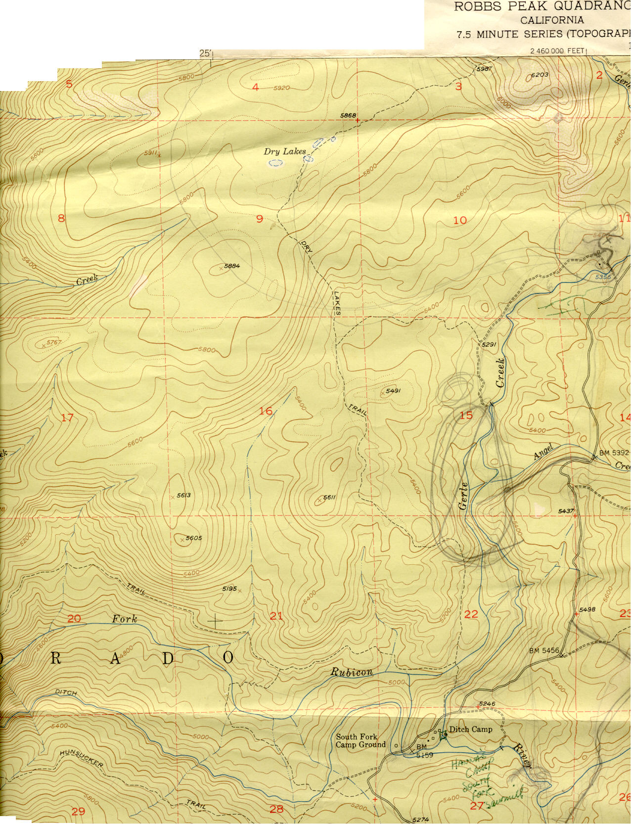
gerlecreekmap1950[1]
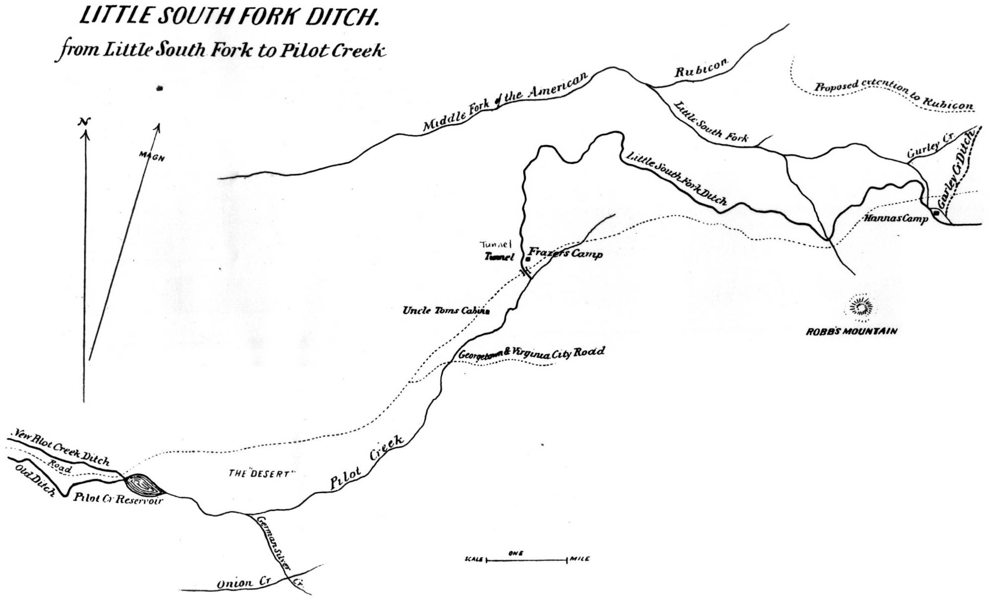
gerlecreekditch[1]
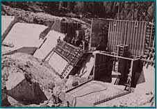
gerlecreekdam[1]
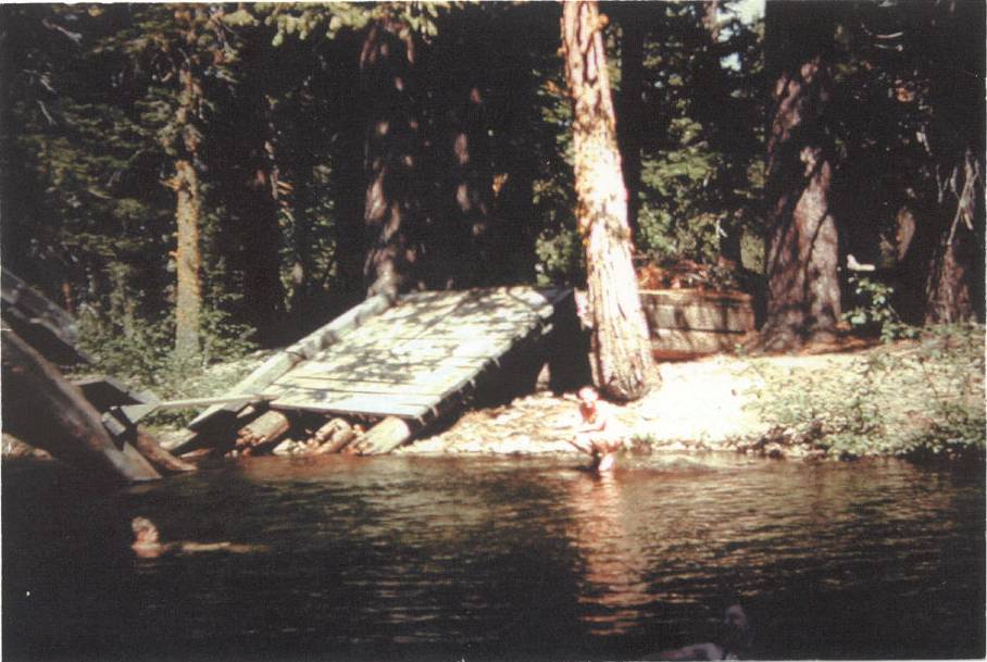
gerlecreekbridge
gerlecreekaerial
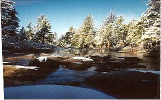
gerlecreek7
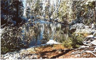
gerlecreek6
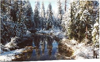
gerlecreek5
gerlecreek4
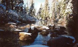
gerlecreek1

gerlecreek[1]
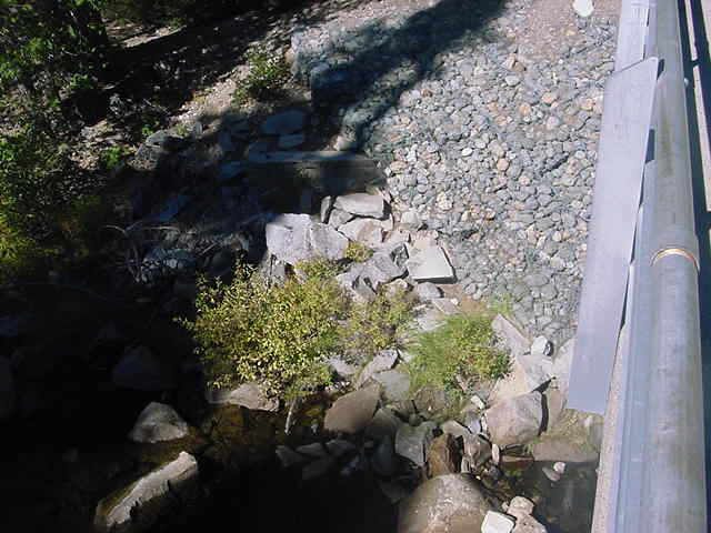
gerlecklogbridge[1]
gerleckford[1]

gerleckdivdamditch[1]
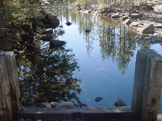
gerleckdivdam3[1]
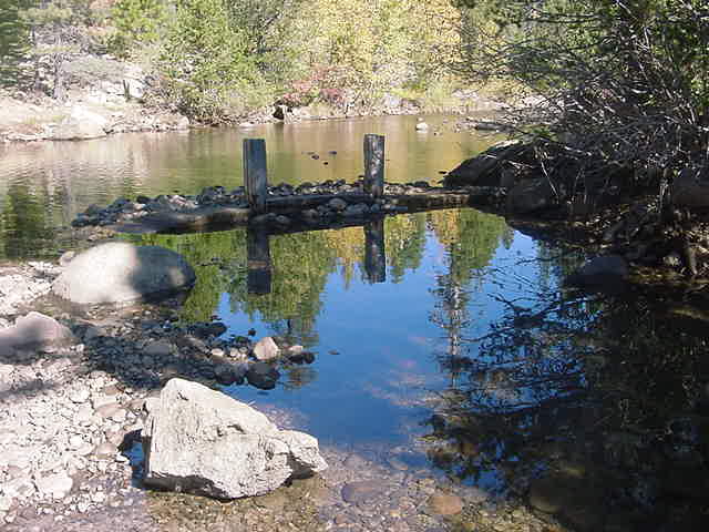
gerleckdivdam2[1]

gerleckdivdam[1]

Gerle Brothers Ranch Uniontown
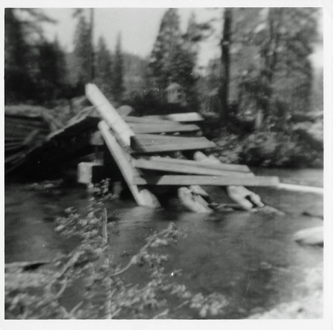
Gerle Bridge 1957 2
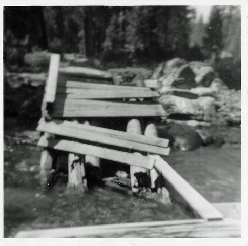
Gerle Bridge 1957 1
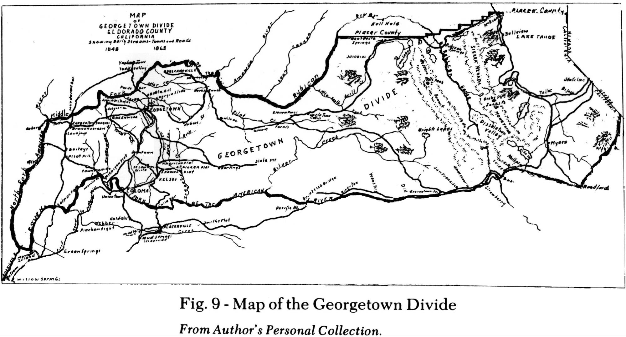
georgetowndividemap1915[1]
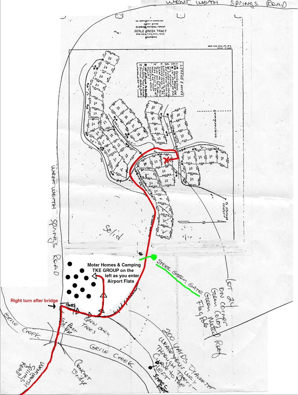
gctractmapteke
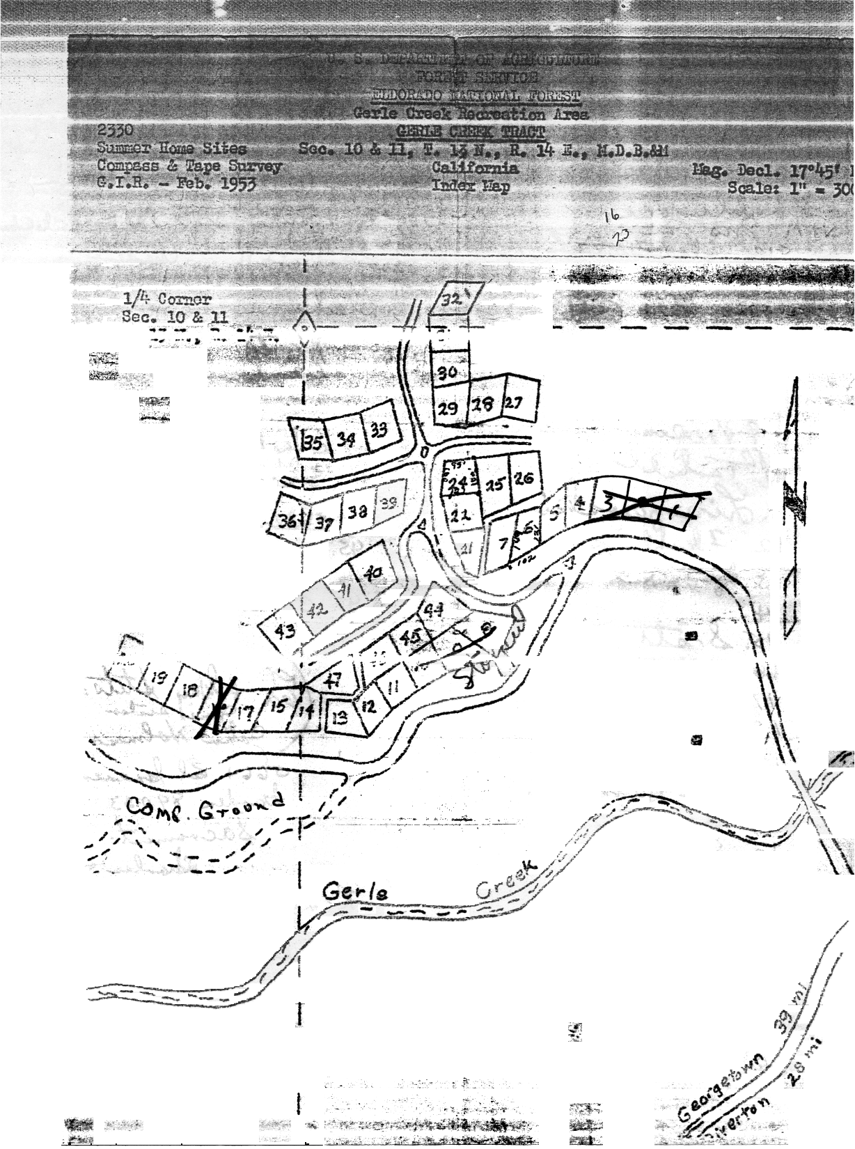
gcshtmap1953[1]
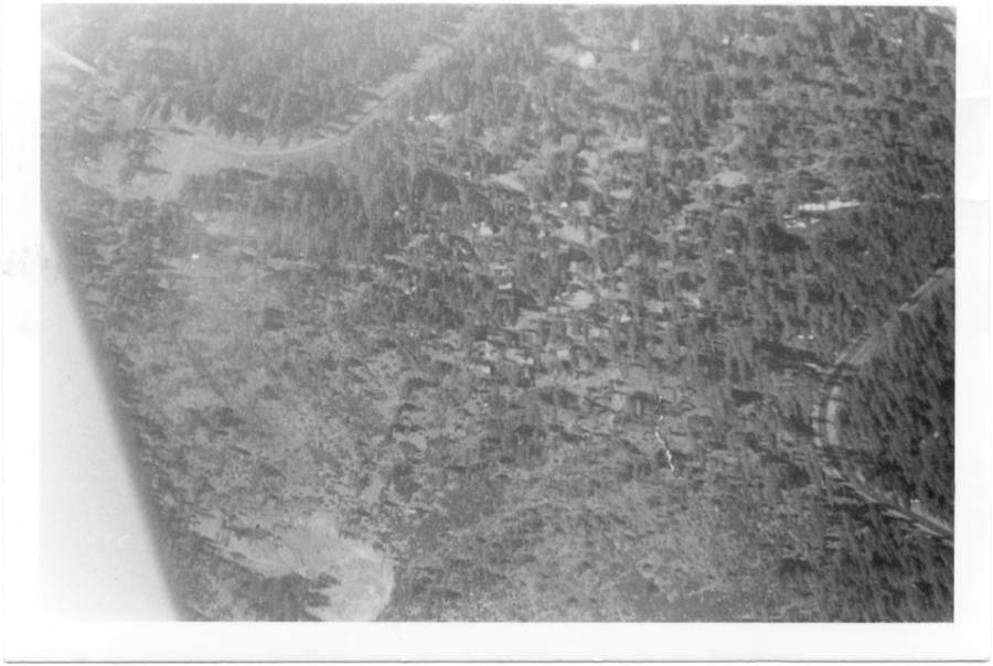
gcshtaerialshot1968[1]
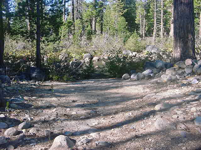
francisccford[1]

franciscc91[1]

franciscc3[1]
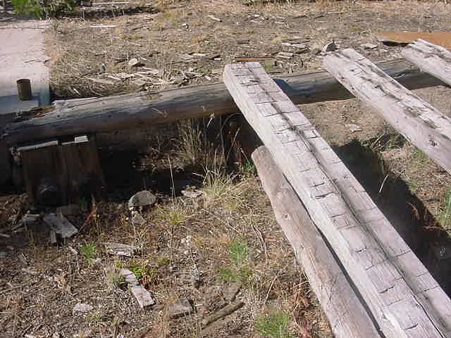
franciscc2[1]

franciscc[1]
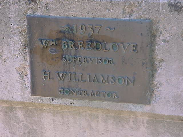
francisbridge2[1]

francisbridge[1]
Francis_Lake
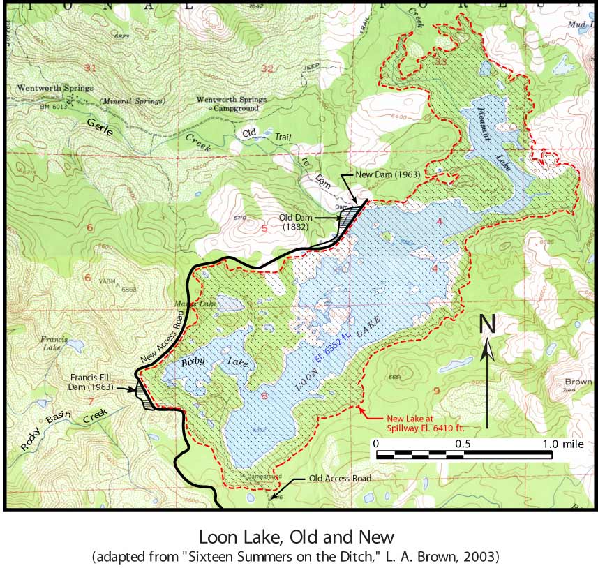
Fig-6-Loon-Lake1
ENF1916mapback

eldoradonfmap1916[1]

eldoradonfmap1916
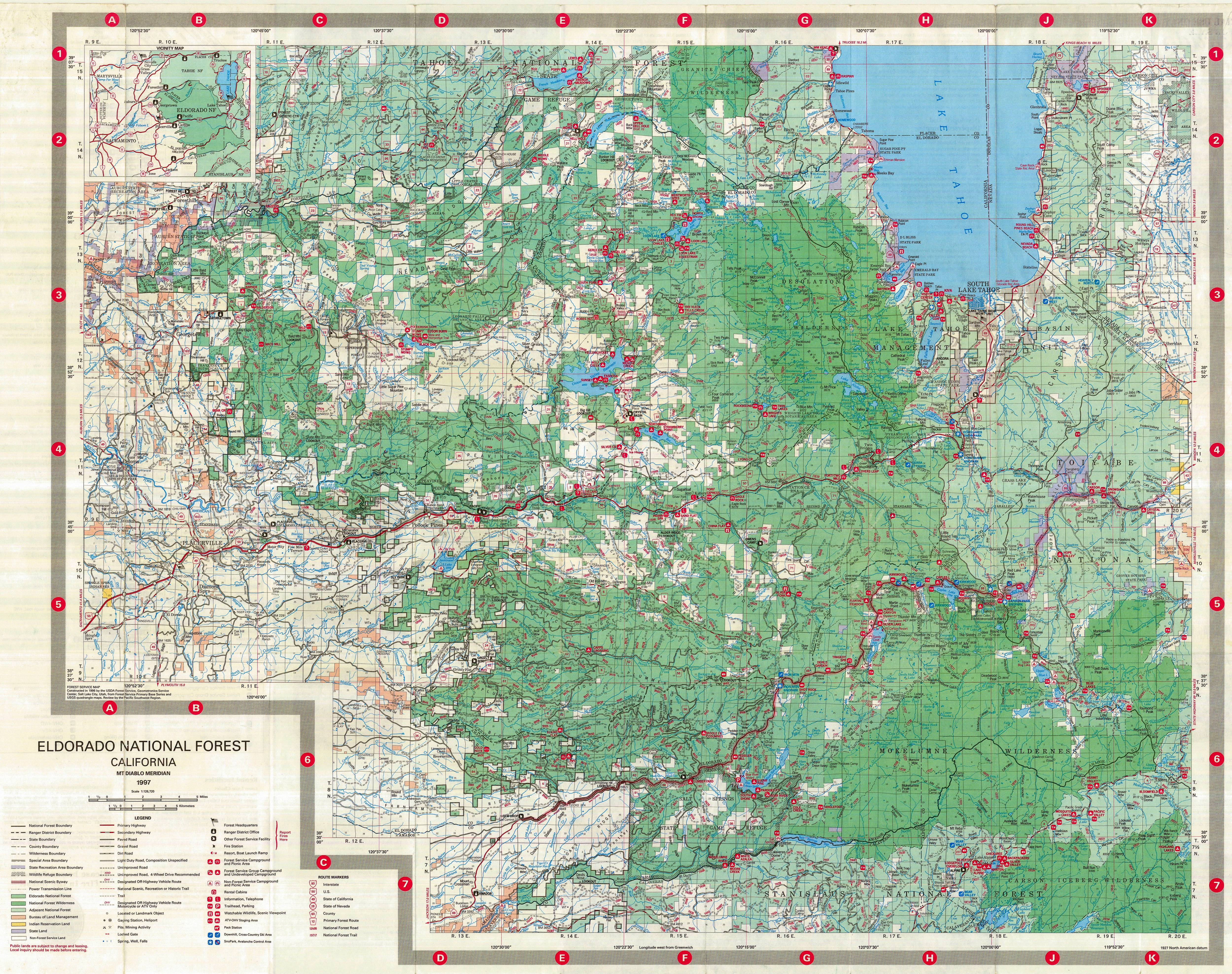
eldoradonf1997
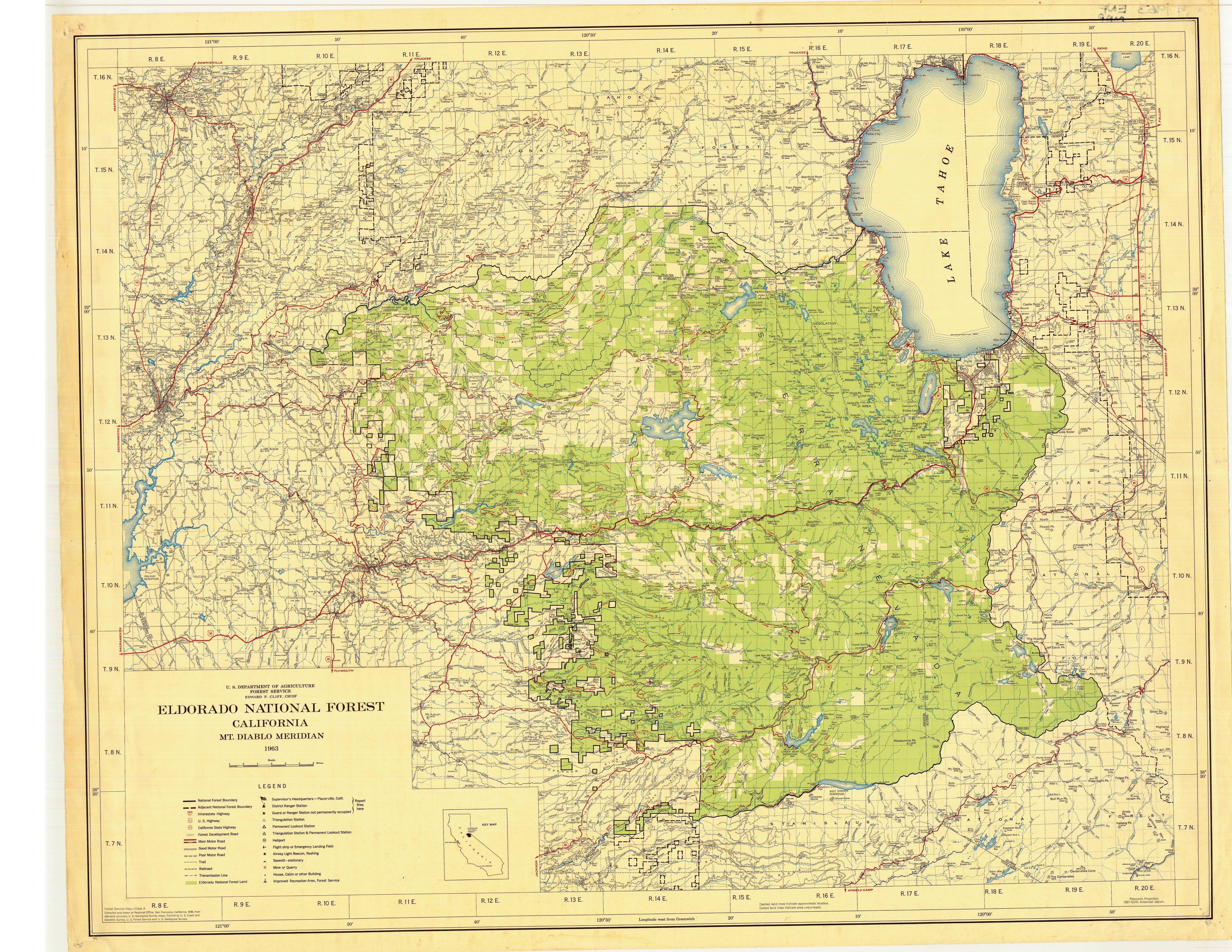
eldoradonf1963
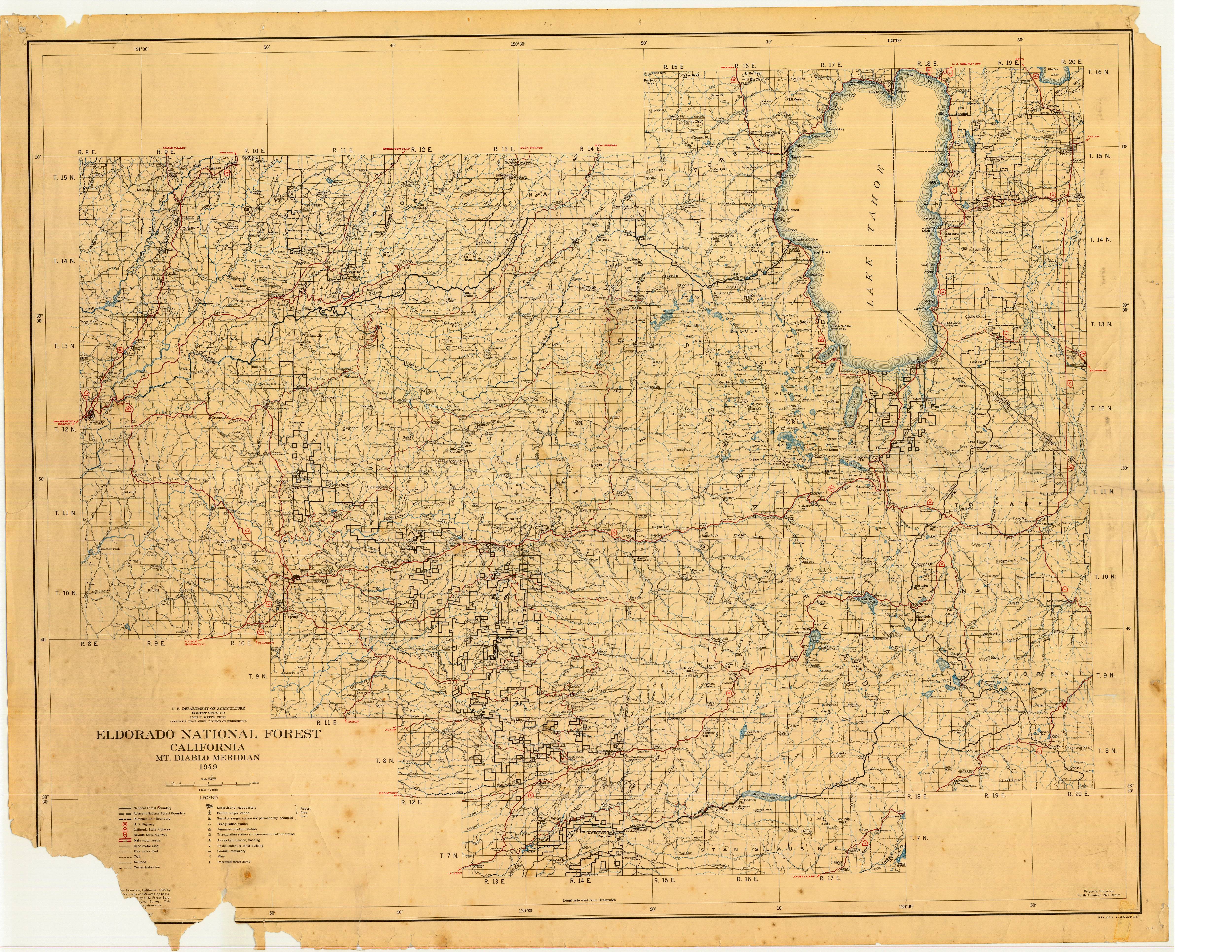
eldoradonf1949
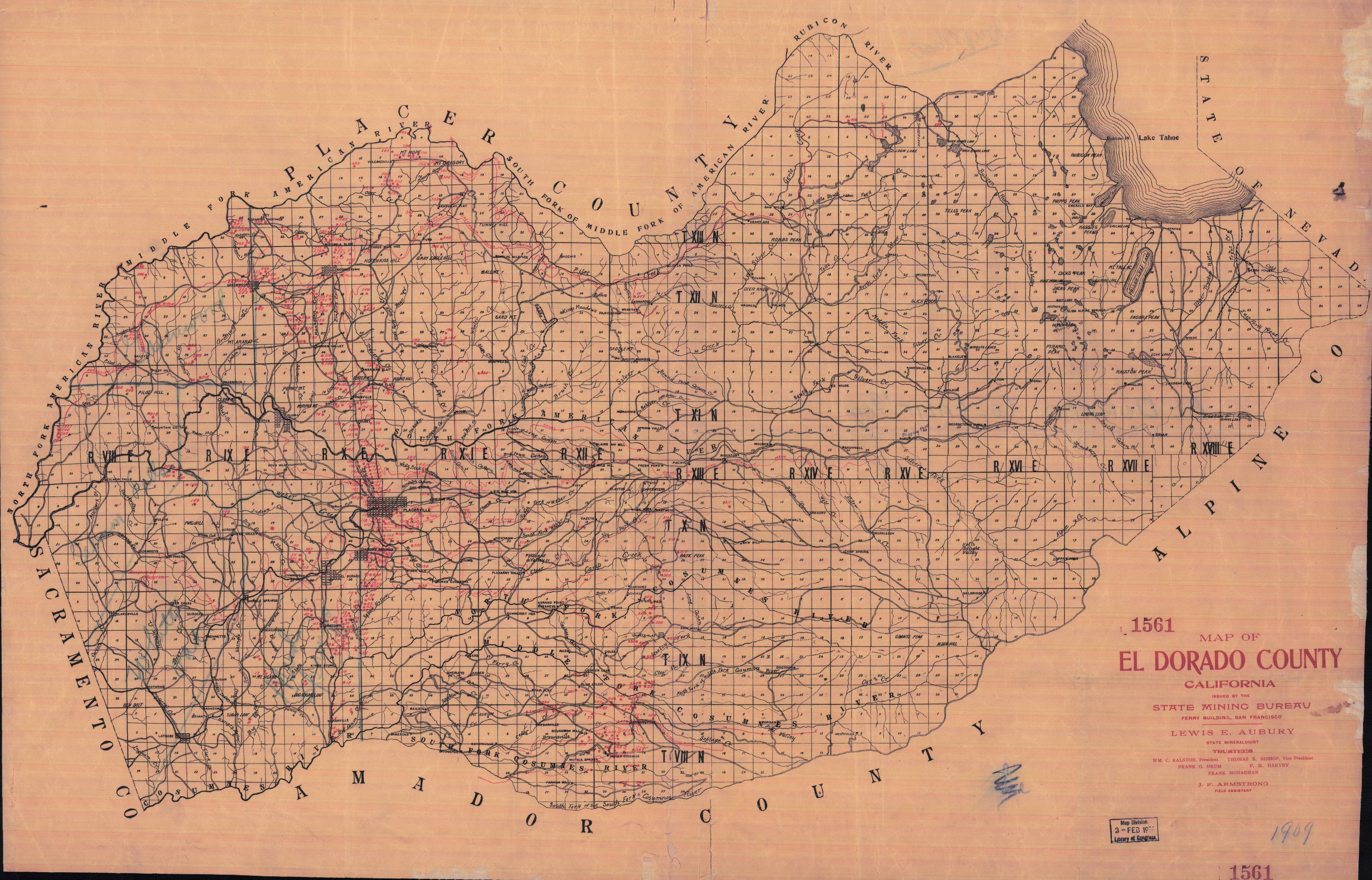
eldoradocountyminingmap1902afull

eldoradocountyminingmap1902a
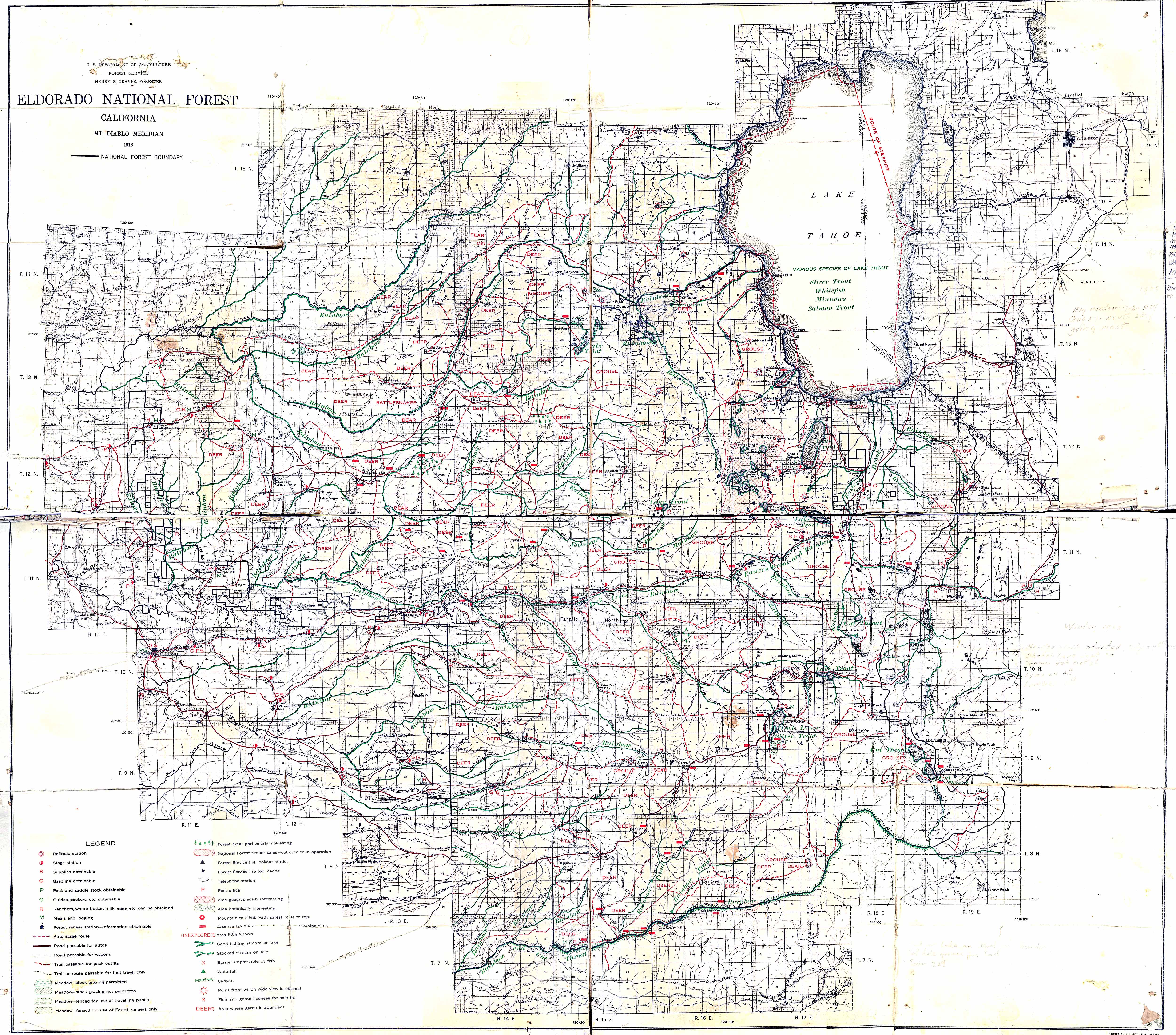
eldorado1916mapa
dumnamaps
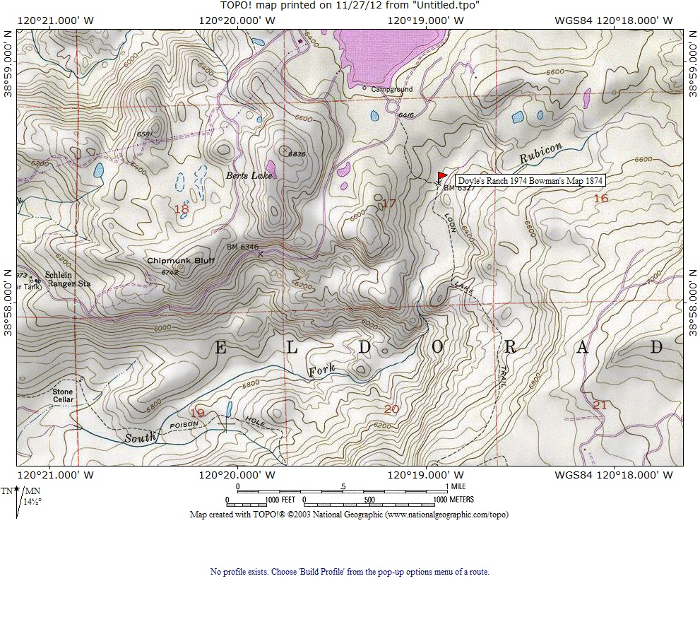
Doyles Ranch Loon Lake Area 1874

dividemap1915
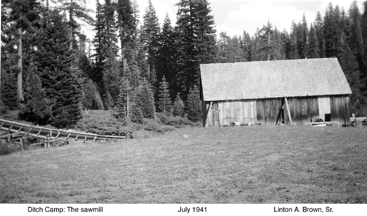
ditchcamp1941a[1]
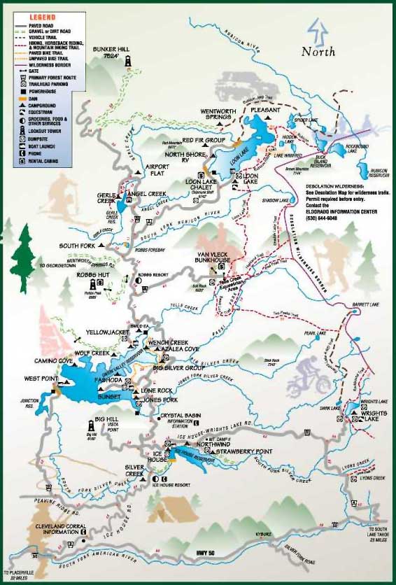
crystalbasin_map

CrashSitePerLAB[1]
ClausseniusPlaceSlabCreek
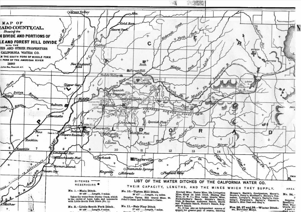
cawatercompmap1880
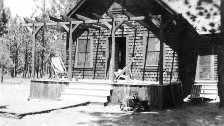
CampGerleMajortinkerhouseaug1932b
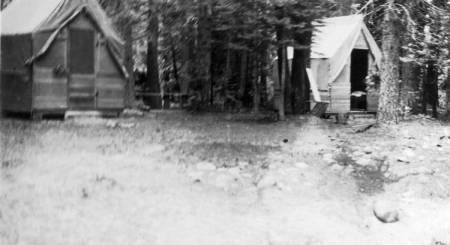
CampGerleaug1932b
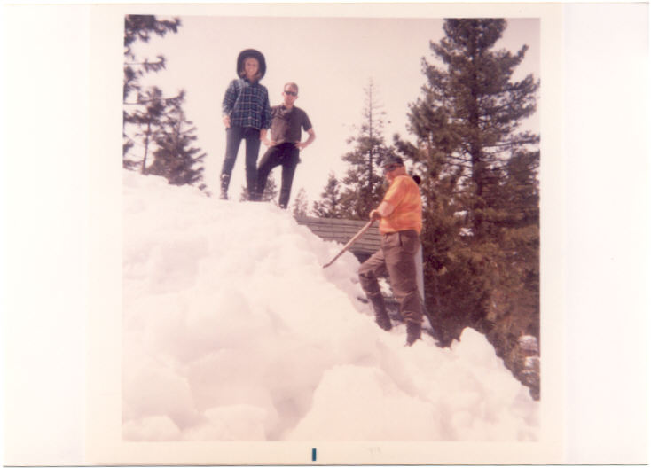
cabinsnow69e
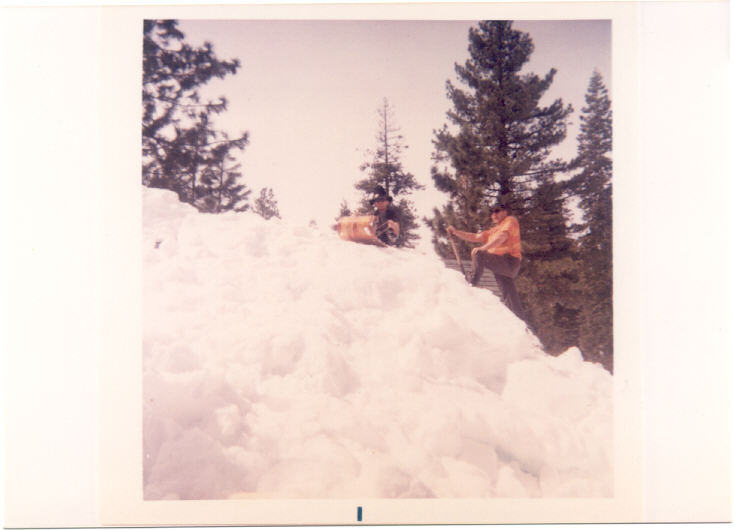
cabinsnow69d
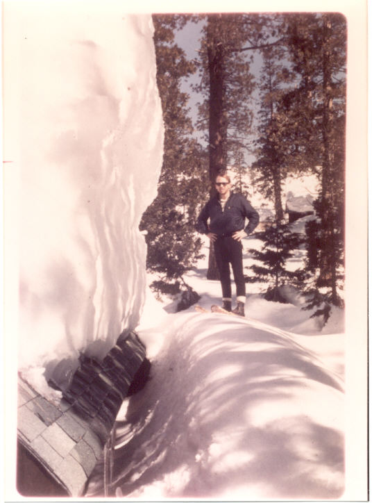
cabinsnow69c
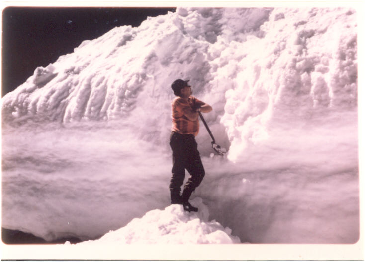
cabinsnow69b
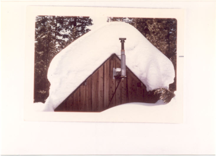
cabinsnow69a

bunkermap1880
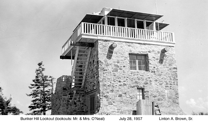
bunkerhilllo1957b[1]
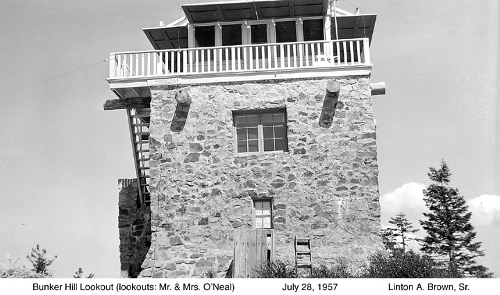
bunkerhilllo1957a
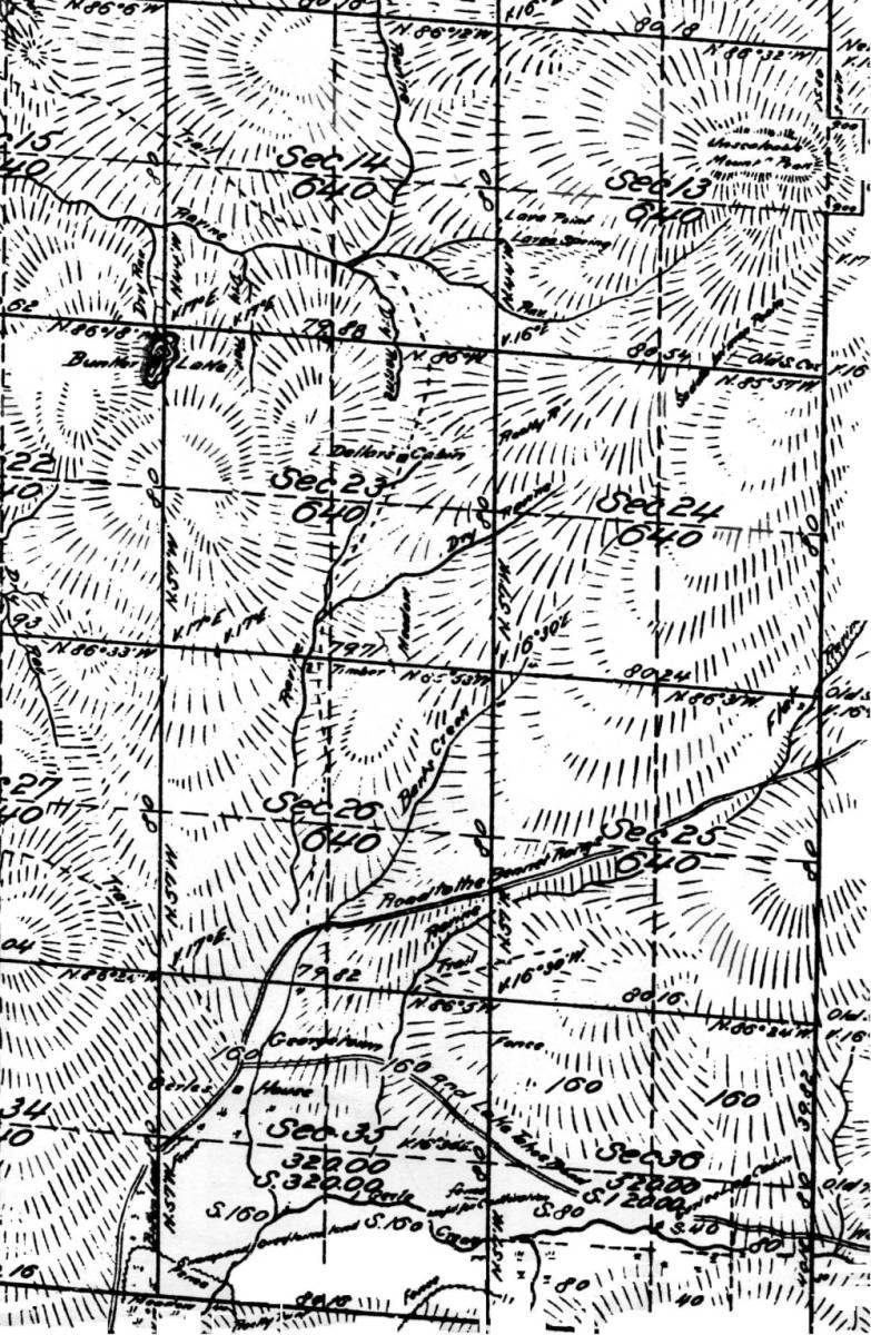
bunkergerle[1]

BuckIsland1953detail
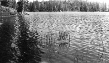
BuckIsland1953

Bridges – Gerle Creek_0002
Gerle Creek Wooden Bridge 1927 airport Flats
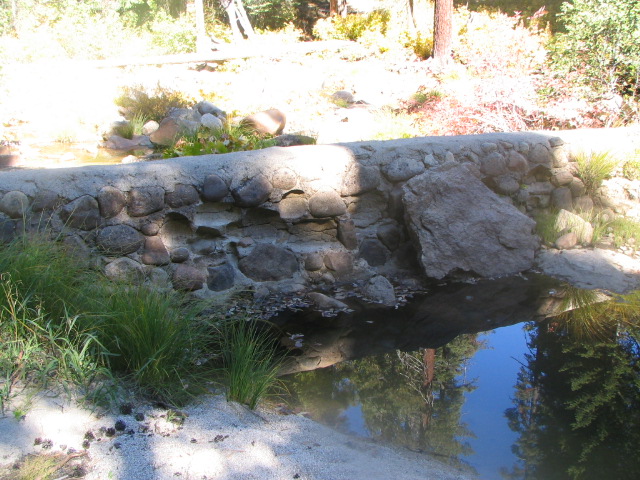
bigsilverdiversiondamoct122005008[1]
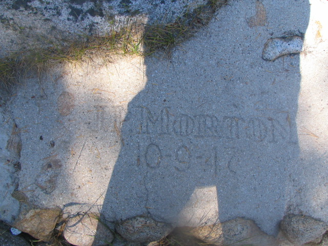
bigsilverdiversiondamoct122005007[1]
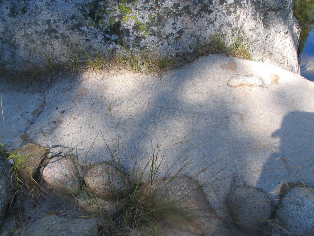
bigsilverdiversiondamoct122005005[1]
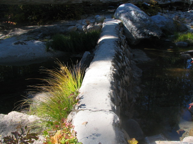
bigsilverdiversiondamoct122005004[1]
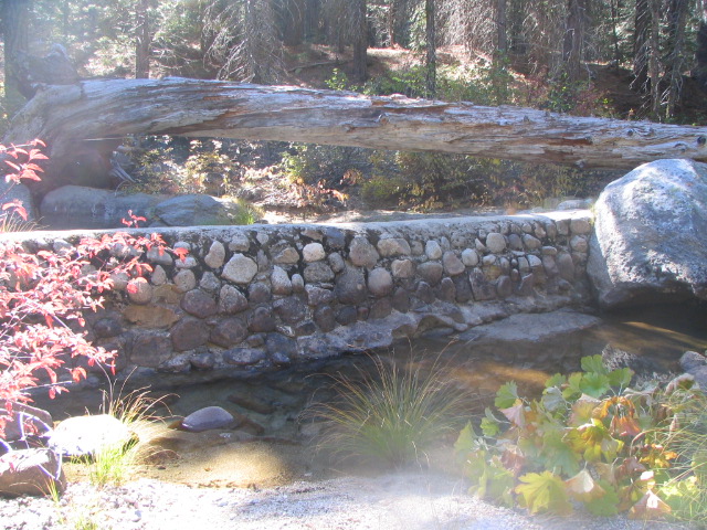
bigsilverdiversiondamoct122005003[1]
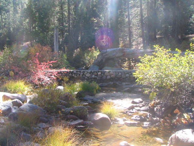
bigsilverdiversiondamoct122005002
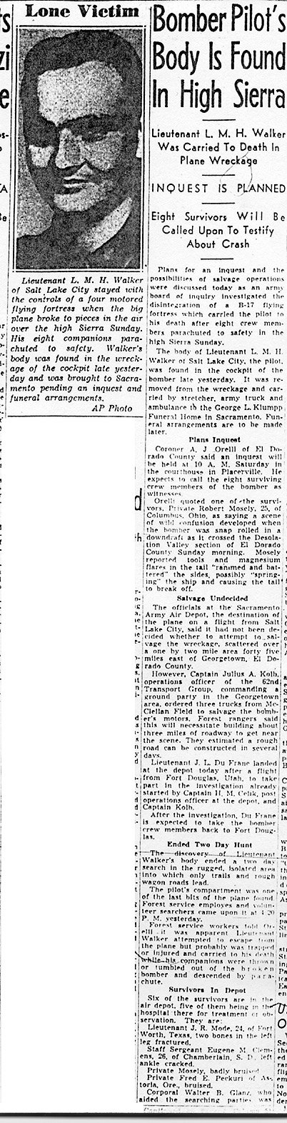
bee-clip
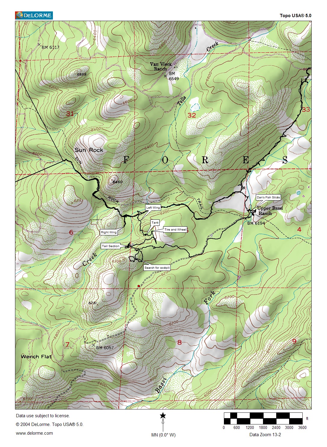
B-17 Hike Halsey and Dan 7-16-06
airportflatsbarracks1959
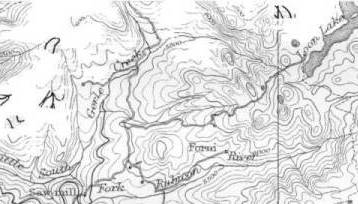
airportflats1895[1]

airportcamp1931c

airportcamp1931b
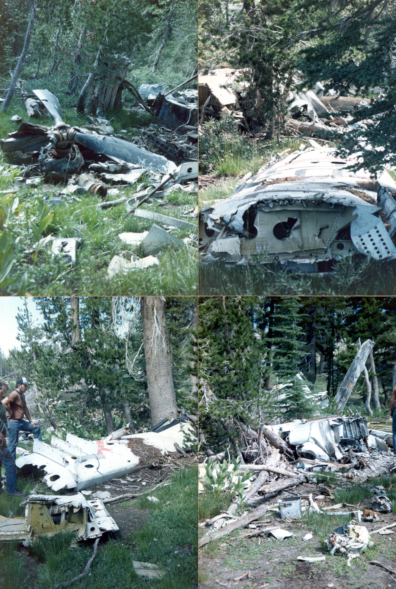
Airplane wreck
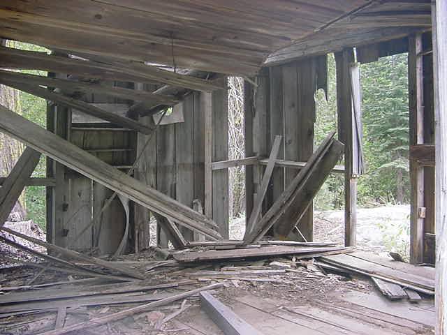
aebrownscabin3

aebrownscabin2

aebrownscabin1
aebrowns1895[1]

aebrowns1895

aafranciscowcamp[1]
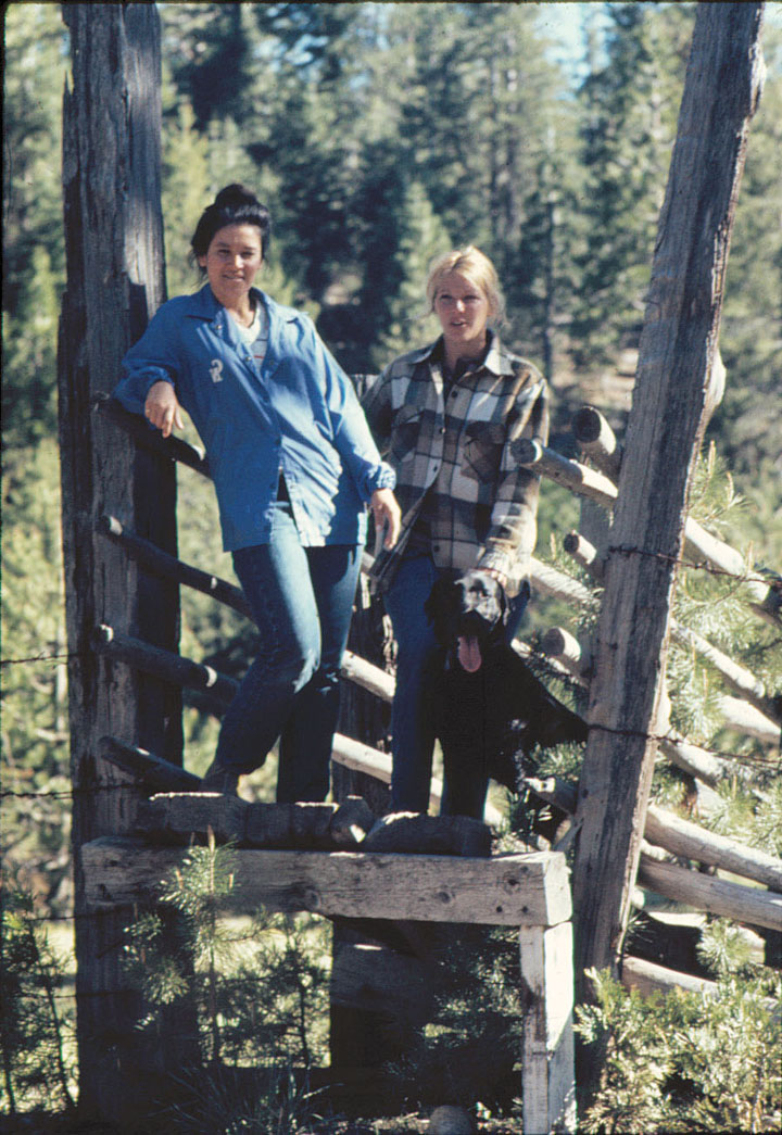
aafranciscabin3

aafranciscabin2

aafranciscabin1
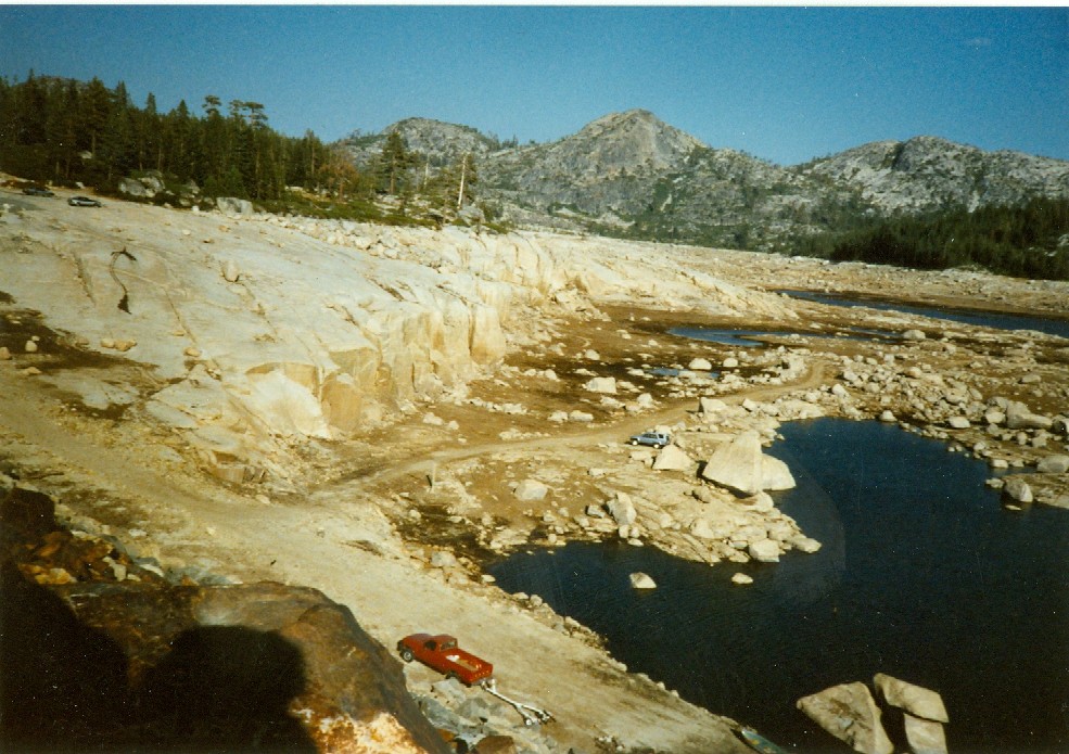
40 Extreme drought Loon Lk note cars upper left, red truck with trailer and blue suv in center down by spillway

10HartsgrandchildrenatGerleCrkford

4[1]

3[1]
Gerle Creek Concrete Bridge Airport Flats 1963

2[1]
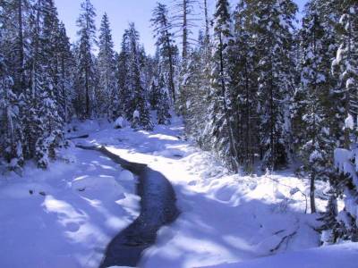
gerlecreekdec2002

loonlaketunnelearly1970s
Gordon Brattland, Center with hot early 1970s
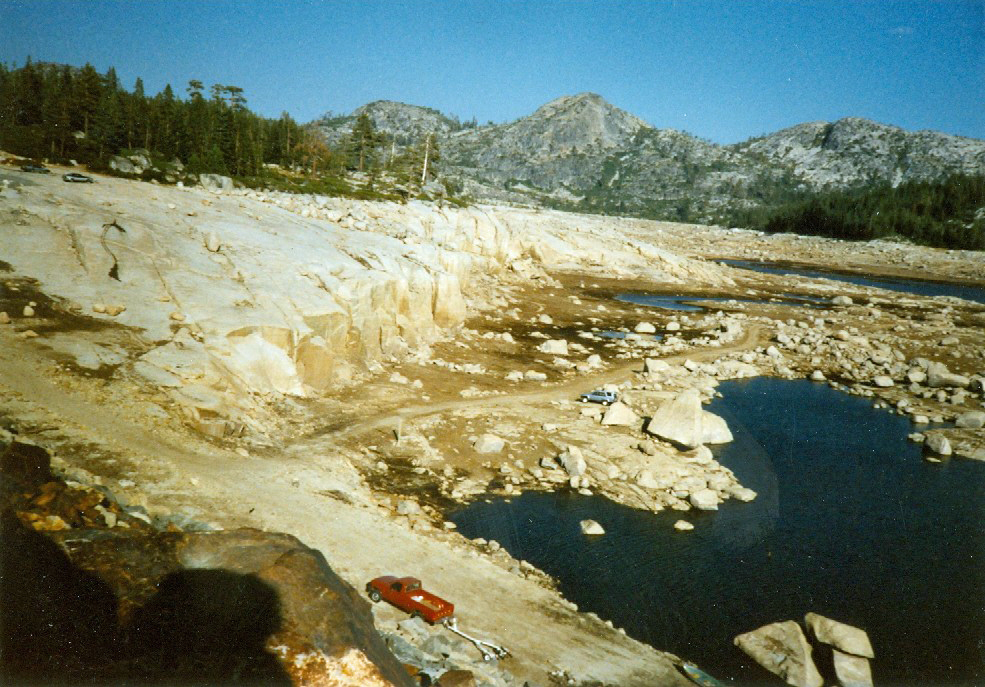
loonlakedamearly1990a